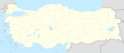
نڤشهر
نڤشهر
Nevşehir | |
|---|---|
District | |
| الإحداثيات: 38°37′35″N 34°42′50″E / 38.62639°N 34.71389°E | |
| البلد | |
| المنطقة | وسط الأناضول |
| المحافظة | نڤشهر |
| الحكومة | |
| • المحافظ | عبد الرحمن سواش |
| • العمدة | حسن أنور (AKP) |
| المساحة | |
| • District | 535 كم² (207 ميل²) |
| المنسوب | 1٬224 m (4٬016 ft) |
| التعداد (2009)[1] | |
| • District | 117٬327 |
| • الكثافة | 196٫41/km2 (508٫7/sq mi) |
| • Urban | 84٬631 |
| • الصيف (التوقيت الصيفي) | UTC+3 (EEST) |
| Postal code | 50xxx |
| مفتاح الهاتف | 0384 |
| Licence plate | 50 |
| الموقع الإلكتروني | www.nevsehir.gov.tr |
مدينة نڤشهر Nevşehir، وكان اسمها مشقرة (قد تكون المدينة القديمة نيسا، Νύσσα باليونانية القديمة)، هي عاصمة محافظة نڤشهر تقع في تركيا ويبلغ تعداد سكانها حوالي 67,864 نسمة.
التاريخ

نڤشهر اليوم
The city is located at a distance of 290 km (180 mi) from the capital Ankara, and is within the historical region of قپادوقيا.
The traditional main sources of income of the city, carpet weaving and viticulture, have been overtaken by tourism, because of its proximity to the underground shelters, the fairy chimneys, monasteries, caravanserais and the famous rock-hewn churches of Göreme.
المناخ
Nevşehir has a continental climate (Köppen climate classification: Dsa, Trewartha climate classification: Dc), with cold, snowy winters and warm, dry summers. Rainfall occurs throughout the year, with a slight peak in spring.
| Climate data for Nevşehir (1991–2020, extremes 1959–2020) | |||||||||||||
|---|---|---|---|---|---|---|---|---|---|---|---|---|---|
| Month | Jan | Feb | Mar | Apr | May | Jun | Jul | Aug | Sep | Oct | Nov | Dec | Year |
| Record high °C (°F) | 18.6 (65.5) |
19.6 (67.3) |
28.0 (82.4) |
31.6 (88.9) |
32.6 (90.7) |
35.0 (95.0) |
39.5 (103.1) |
38.2 (100.8) |
37.4 (99.3) |
32.0 (89.6) |
27.6 (81.7) |
23.0 (73.4) |
39.5 (103.1) |
| Mean daily maximum °C (°F) | 4.1 (39.4) |
6.0 (42.8) |
10.9 (51.6) |
16.3 (61.3) |
21.2 (70.2) |
25.6 (78.1) |
29.3 (84.7) |
29.4 (84.9) |
25.3 (77.5) |
19.1 (66.4) |
11.6 (52.9) |
6.2 (43.2) |
17.1 (62.8) |
| Daily mean °C (°F) | 0.0 (32.0) |
1.3 (34.3) |
5.5 (41.9) |
10.4 (50.7) |
15.0 (59.0) |
18.9 (66.0) |
22.2 (72.0) |
22.1 (71.8) |
18.1 (64.6) |
12.8 (55.0) |
6.3 (43.3) |
2.0 (35.6) |
11.2 (52.2) |
| Mean daily minimum °C (°F) | −3.5 (25.7) |
−2.6 (27.3) |
1.0 (33.8) |
5.2 (41.4) |
9.3 (48.7) |
12.3 (54.1) |
14.6 (58.3) |
14.5 (58.1) |
11.3 (52.3) |
7.4 (45.3) |
2.1 (35.8) |
−1.4 (29.5) |
5.9 (42.6) |
| Record low °C (°F) | −21.2 (−6.2) |
−23.6 (−10.5) |
−18.0 (−0.4) |
−12.5 (9.5) |
−2.3 (27.9) |
1.3 (34.3) |
3.8 (38.8) |
3.1 (37.6) |
−1.2 (29.8) |
−7.6 (18.3) |
−14.0 (6.8) |
−19.5 (−3.1) |
−23.6 (−10.5) |
| Average precipitation mm (inches) | 43.7 (1.72) |
41.8 (1.65) |
47.5 (1.87) |
45.7 (1.80) |
57.4 (2.26) |
37.5 (1.48) |
9.9 (0.39) |
9.6 (0.38) |
13.7 (0.54) |
29.4 (1.16) |
33.4 (1.31) |
48.4 (1.91) |
418.0 (16.46) |
| Average precipitation days | 8.80 | 7.83 | 10.27 | 11.33 | 13.40 | 8.40 | 2.40 | 2.37 | 3.83 | 6.93 | 7.10 | 9.30 | 92.0 |
| Mean monthly sunshine hours | 96.1 | 118.7 | 164.3 | 204.0 | 257.3 | 309.0 | 365.8 | 347.2 | 276.0 | 195.3 | 138.0 | 86.8 | 2٬558٫5 |
| Mean daily sunshine hours | 3.1 | 4.2 | 5.3 | 6.8 | 8.3 | 10.3 | 11.8 | 11.2 | 9.2 | 6.3 | 4.6 | 2.8 | 7.0 |
| Source: Turkish State Meteorological Service[2] | |||||||||||||
معرض
الهامش
- ^ خطأ استشهاد: وسم
<ref>غير صحيح؛ لا نص تم توفيره للمراجع المسماةdie - ^ "Resmi İstatistikler: İllerimize Ait Mevism Normalleri (1991–2020)" (in التركية). Turkish State Meteorological Service. Retrieved 6 July 2021.
- Pages using gadget WikiMiniAtlas
- CS1 التركية-language sources (tr)
- Short description is different from Wikidata
- Pages using multiple image with auto scaled images
- Coordinates on Wikidata
- Pages using infobox settlement with unknown parameters
- محافظة نڤشهر
- مدن تركيا
- منطقة وسط الأناضول
- نڤشهر
- Cities in Turkey
- Districts of Nevşehir Province
- Populated places in Nevşehir Province
- Archaeological sites in Central Anatolia
- Roman sites in Turkey
- Cappadocia
- قپادوقيا


