نهر سالنگ
| نهر سالنگ Salang river | |
|---|---|
 | |
| الاسم المحلي | سالنګ سيند (Pashto) |
| الموقع | |
| البلد | |
| الولاية | ولاية پروان |
| السمات الطبيعية | |
| المنبع | |
| ⁃ الإحداثيات | 35°04′N 69°14′E / 35.067°N 69.233°E |
| الطول | 238 كم |
 | |
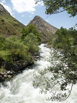
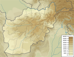
Salang is a 438-kilometre long river of Afghanistan, flowing through Parwan Province. It is a tributary of the Indus River and the Ghorband River and the Panjshir River and the Kabul River.
. . . . . . . . . . . . . . . . . . . . . . . . . . . . . . . . . . . . . . . . . . . . . . . . . . . . . . . . . . . . . . . . . . . . . . . . . . . . . . . . . . . . . . . . . . . . . . . . . . . . . . . . . . . . . . . . . . . . . . . . . . . . . . . . . . . . . . . . . . . . . . . . . . . . . . . . . . . . . . . . . . . . . . . .
الجغرافيا
The Salang River originates on the south side of the central Hindu Kush mountains in the north-east of Salang Pass, which links the region to Kabul with the northern part of the country.
Its valley and the Salang Pass form an important international waterway. It is north–south oriented. The Salang flows into the Ghorband River at Jabal Saraj in Parwan. In Jabal Saraj, the average annual flow module between 1961 and 1964 was about 763 millimeters per year, which is considered a high rate.[1]
References
- ^ UNESCO - Salang Station : Jabelusaraï Archived 2016-03-04 at the Wayback Machine
35°04′N 69°14′E / 35.067°N 69.233°E{{#coordinates:}}: لا يمكن أن يكون هناك أكثر من وسم أساسي واحد لكل صفحة
- Pages using gadget WikiMiniAtlas
- صفحات ذات وسوم إحداثيات غير صحيحة
- Short description is different from Wikidata
- Articles containing Pashto-language text
- Coordinates on Wikidata
- Infobox mapframe without OSM relation ID on Wikidata
- Pages using infobox river with unknown parameters
- Rivers of Afghanistan
- Landforms of Parwan Province
- صفحات مع الخرائط

