مقاطعة تاما، آيوا
Tama County | |
|---|---|
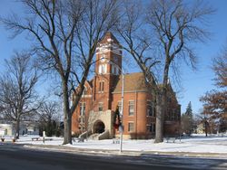
 Tama County Courthouse in Toledo | |
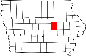
 الموقع ضمن ولاية Iowa | |
 موقع Iowa ضمن الولايات المتحدة | |
| الإحداثيات: 42°04′43″N 92°31′53″W / 42.07861°N 92.53139°W | |
| البلد | |
| State | |
| تأسست | 1843 |
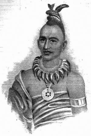
| السمِيْ | Taimah |
| Seat | Toledo |
| Largest city | Tama |
| المساحة | |
| • الإجمالي | 722 ميل² (1٬870 كم²) |
| • البر | 721 ميل² (1٬870 كم²) |
| • الماء | 1٫1 ميل² (3 كم²) 0.1% |
| التعداد (2010) | |
| • الإجمالي | 17٬767 |
| • Estimate (2018) | 16٬904 |
| • الكثافة | 25/sq mi (9٫5/km2) |
| منطقة التوقيت | UTC−6 (Central) |
| • الصيف (التوقيت الصيفي) | UTC−5 (CDT) |
| Congressional district | 1st |
| الموقع الإلكتروني | www |
مقاطعة تاما إنگليزية: Tama County هي إحدى مقاطعات ولاية آيوا في الولايات المتحدة الأمريكية.
. . . . . . . . . . . . . . . . . . . . . . . . . . . . . . . . . . . . . . . . . . . . . . . . . . . . . . . . . . . . . . . . . . . . . . . . . . . . . . . . . . . . . . . . . . . . . . . . . . . . . . . . . . . . . . . . . . . . . . . . . . . . . . . . . . . . . . . . . . . . . . . . . . . . . . . . . . . . . . . . . . . . . . . .
الطرق السريعة الرئيسية
المقاطعات المجاورة
- Grundy County (شمال غرب)
- Black Hawk County (شمال شرق)
- Benton County (شرق)
- Poweshiek County (جنوب)
- Marshall County (غرب)
- Iowa County (جنوب شرق)
- Jasper County (جنوب غرب)
الديمغرافيا
| التعداد التاريخي | |||
|---|---|---|---|
| التعداد | Pop. | %± | |
| 1850 | 8 | — | |
| 1860 | 5٬285 | 65٬962٫5% | |
| 1870 | 16٬131 | 205٫2% | |
| 1880 | 21٬585 | 33٫8% | |
| 1890 | 22٬052 | 2٫2% | |
| 1900 | 24٬585 | 11٫5% | |
| 1910 | 22٬156 | −9٫9% | |
| 1920 | 21٬861 | −1٫3% | |
| 1930 | 21٬987 | 0٫6% | |
| 1940 | 22٬428 | 2�0% | |
| 1950 | 21٬688 | −3٫3% | |
| 1960 | 21٬413 | −1٫3% | |
| 1970 | 20٬147 | −5٫9% | |
| 1980 | 19٬533 | −3�0% | |
| 1990 | 17٬419 | −10٫8% | |
| 2000 | 18٬103 | 3٫9% | |
| 2010 | 17٬767 | −1٫9% | |
| 2018 (تق.) | 16٬904 | [1] | −4٫9% |
| U.S. Decennial Census[2] 1790-1960[3] 1900-1990[4] 1990-2000[5] 2010-2018[6] | |||
التجمعات
المدن
Unincorporated communities
البلدات
Tama County is divided into twenty-one townships:
ترتيب التعداد
The population ranking of the following table is based on the 2010 census of Tama County.[7]
† county seat
| Rank | City/Town/etc. | Municipal type | Population (2010 Census) |
|---|---|---|---|
| 1 | Tama | City | 2,877 |
| 2 | † Toledo | City | 2,341 |
| 3 | Traer | City | 1,703 |
| 4 | Dysart | City | 1,379 |
| 5 | Sac and Fox/Meskwaki Settlement | AIAN | 1,062 |
| 6 | Gladbrook | City | 945 |
| 7 | Le Grand (mostly in Marshall County) | City | 938 |
| 8 | Garwin | City | 527 |
| 9 | Chelsea | City | 267 |
| 10 | Montour | City | 249 |
| 11 | Clutier | City | 213 |
| 12 | Elberon | City | 196 |
| 13 | Lincoln | City | 162 |
| 14 | Vining | City | 50 |
Notable people
- George R. Struble (1836–1918). Iowa judge and politician from Toledo. Speaker of the Iowa House of Representatives, 1881-1883. Ardent prohibitionist. Brother of John T. Struble of Johnson County, and Congressman Isaac S. Struble of Plymouth County. Biography in the Journal of the House, memorial resolution of 3/23/1921.
- Michael Emerson, born in Cedar Rapids and raised in Toledo, Emerson has been on Broadway and appeared on Lost.[8]
- Clifford Berry (1918-1963), born in Gladbrook, was a graduate student at Iowa State when he and John Vincent Atanasoff created the Atanasoff–Berry Computer (ABC), the first digital electronic computer, in 1939.
السياسة
| Year | Republican | Democratic | Third Parties |
|---|---|---|---|
| 2016 | 56.8% 4,971 | 36.5% 3,196 | 6.7% 585 |
| 2012 | 45.5% 4,098 | 52.9% 4,768 | 1.7% 151 |
| 2008 | 43.2% 3,820 | 55.3% 4,899 | 1.5% 133 |
| 2004 | 49.5% 4,456 | 49.9% 4,487 | 0.6% 58 |
| 2000 | 48.5% 4,034 | 48.7% 4,045 | 2.8% 236 |
| 1996 | 38.5% 2,986 | 51.5% 3,994 | 10.0% 772 |
| 1992 | 35.4% 2,948 | 42.9% 3,573 | 21.7% 1,809 |
| 1988 | 42.0% 3,362 | 57.2% 4,584 | 0.8% 66 |
| 1984 | 54.3% 4,882 | 45.2% 4,061 | 0.5% 47 |
| 1980 | 56.3% 4,840 | 35.5% 3,049 | 8.3% 713 |
| 1976 | 48.1% 4,379 | 50.3% 4,580 | 1.6% 148 |
| 1972 | 57.0% 5,058 | 41.6% 3,693 | 1.5% 129 |
| 1968 | 53.6% 4,955 | 40.7% 3,767 | 5.7% 531 |
| 1964 | 36.9% 3,543 | 63.0% 6,057 | 0.1% 8 |
| 1960 | 52.8% 5,535 | 47.2% 4,950 | 0.0% 1 |
| 1956 | 55.3% 5,952 | 44.5% 4,795 | 0.2% 26 |
| 1952 | 63.3% 7,061 | 36.5% 4,076 | 0.2% 17 |
| 1948 | 47.5% 4,763 | 51.0% 5,115 | 1.5% 150 |
| 1944 | 49.7% 5,249 | 50.0% 5,286 | 0.3% 32 |
| 1940 | 49.3% 5,865 | 50.4% 5,996 | 0.3% 32 |
| 1936 | 41.1% 4,737 | 57.5% 6,625 | 1.4% 160 |
| 1932 | 37.1% 4,051 | 61.4% 6,704 | 1.5% 165 |
| 1928 | 53.6% 5,589 | 46.0% 4,798 | 0.4% 45 |
| 1924 | 55.3% 5,177 | 23.3% 2,180 | 21.5% 2,010 |
| 1920 | 70.0% 6,352 | 28.1% 2,552 | 1.9% 169 |
| 1916 | 53.4% 3,061 | 44.9% 2,572 | 1.8% 102 |
| 1912 | 21.6% 1,179 | 44.8% 2,446 | 33.7% 1,840 |
| 1908 | 49.8% 2,774 | 45.8% 2,550 | 4.5% 248 |
| 1904 | 55.1% 3,127 | 41.6% 2,360 | 3.3% 186 |
| 1900 | 53.5% 3,290 | 44.5% 2,736 | 2.1% 129 |
| 1896 | 53.3% 3,054 | 45.3% 2,596 | 1.5% 83 |
. . . . . . . . . . . . . . . . . . . . . . . . . . . . . . . . . . . . . . . . . . . . . . . . . . . . . . . . . . . . . . . . . . . . . . . . . . . . . . . . . . . . . . . . . . . . . . . . . . . . . . . . . . . . . . . . . . . . . . . . . . . . . . . . . . . . . . . . . . . . . . . . . . . . . . . . . . . . . . . . . . . . . . . .
انظر أيضاً
الهامش
- ^ "Population and Housing Unit Estimates". Retrieved June 22, 2019.
- ^ "U.S. Decennial Census". United States Census Bureau. Retrieved July 20, 2014.
- ^ "Historical Census Browser". University of Virginia Library. Retrieved July 20, 2014.
- ^ "Population of Counties by Decennial Census: 1900 to 1990". United States Census Bureau. Retrieved July 20, 2014.
- ^ "Census 2000 PHC-T-4. Ranking Tables for Counties: 1990 and 2000" (PDF). United States Census Bureau. Retrieved July 20, 2014.
- ^ خطأ استشهاد: وسم
<ref>غير صحيح؛ لا نص تم توفيره للمراجع المسماةQF - ^ "Archived copy". Retrieved February 10, 2013.
- ^ "Michael Emerson". IMDb. Retrieved April 28, 2018.
- ^ Leip, David. "Dave Leip's Atlas of U.S. Presidential Elections". uselectionatlas.org. Retrieved April 11, 2018.
وصلات خارجية
- IAGenWeb History, Biographies, Records and more

|
Black Hawk County | Grundy County | 
| |
| Benton County | Marshall County | |||
| Iowa County | Poweshiek County |
- Pages using gadget WikiMiniAtlas
- Short description is different from Wikidata
- Coordinates on Wikidata
- مقاطعات Iowa
- Pages using infobox U.S. county with unknown parameters
- Articles containing إنگليزية-language text
- Pages using Lang-xx templates
- Pages using US Census population needing update
- Pages with empty portal template
- مقاطعة تاما، آيوا
- تأسيسات 1843 في الولايات المتحدة
- أماكن مأهولة تأسست في 1843


