مقاطعة ألكزاندر، كارولاينا الشمالية
Alexander County | |
|---|---|
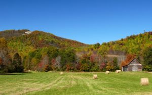
 The Brushy Mountains in Alexander County | |
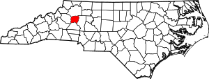
 الموقع ضمن ولاية North Carolina | |
 موقع North Carolina ضمن الولايات المتحدة | |
| الإحداثيات: 35°55′N 81°11′W / 35.92°N 81.18°W | |
| البلد | |
| State | |
| تأسست | 1847 |
| السمِيْ | William Julius Alexander |
| Seat | Taylorsville |
| Largest town | Taylorsville |
| المساحة | |
| • الإجمالي | 264 ميل² (680 كم²) |
| • البر | 260 ميل² (700 كم²) |
| • الماء | 3٫7 ميل² (10 كم²) 1.4%% |
| التعداد | |
| • Estimate (2018) | 37٬353 |
| • الكثافة | 143/sq mi (55/km2) |
| منطقة التوقيت | UTC−5 (Eastern) |
| • الصيف (التوقيت الصيفي) | UTC−4 (EDT) |
| Congressional district | 5th |
| الموقع الإلكتروني | alexandercountync |
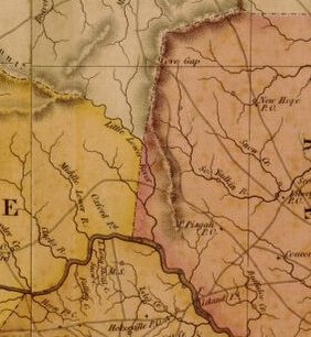
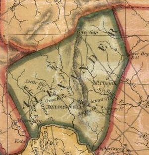
مقاطعة ألكزاندر إنگليزية: Alexander County هي إحدى مقاطعات ولاية كارولاينا الشمالية في الولايات المتحدة. مركز المقاطعة أو مقعدها هي مدينة تايلورزفيل. تأسست هذه المقاطعة سنة 1847.أصل هذه المقاطعة يأتي من: مقاطعة كالدويل, مقاطعة آيرديل, ومقاطعة ويلكس.
. . . . . . . . . . . . . . . . . . . . . . . . . . . . . . . . . . . . . . . . . . . . . . . . . . . . . . . . . . . . . . . . . . . . . . . . . . . . . . . . . . . . . . . . . . . . . . . . . . . . . . . . . . . . . . . . . . . . . . . . . . . . . . . . . . . . . . . . . . . . . . . . . . . . . . . . . . . . . . . . . . . . . . . .
التاريخ
الديمغرافيا
| التعداد التاريخي | |||
|---|---|---|---|
| التعداد | Pop. | %± | |
| 1850 | 5٬220 | — | |
| 1860 | 6٬022 | 15٫4% | |
| 1870 | 6٬868 | 14�0% | |
| 1880 | 8٬355 | 21٫7% | |
| 1890 | 9٬430 | 12٫9% | |
| 1900 | 10٬960 | 16٫2% | |
| 1910 | 11٬592 | 5٫8% | |
| 1920 | 12٬212 | 5٫3% | |
| 1930 | 12٬922 | 5٫8% | |
| 1940 | 13٬454 | 4٫1% | |
| 1950 | 14٬554 | 8٫2% | |
| 1960 | 15٬625 | 7٫4% | |
| 1970 | 19٬466 | 24٫6% | |
| 1980 | 24٬999 | 28٫4% | |
| 1990 | 27٬544 | 10٫2% | |
| 2000 | 33٬603 | 22�0% | |
| 2010 | 37٬198 | 10٫7% | |
| 2018 (تق.) | 37٬353 | [1] | 0٫4% |
| U.S. Decennial Census[2] 1790-1960[3] 1900-1990[4] 1990-2000[5] 2010-2014[6] | |||
ترتيب تعداد السكان
| Population Rank | City/Town/etc. | Municipal type | Population (2010 Census) |
|---|---|---|---|
| 1 | Bethlehem | CDP | 4,214 |
| 2 | Taylorsville (county seat) | Town | 2,098 |
| 3 | Stony Point (partially in Iredell County) | CDP | 1,317 |
| 4 | Hiddenite | CDP | 536 |
السياسة والقانون والحكم
Alexander is currently a powerfully Republican county in Presidential elections. The only Democrat to carry the county in the past nineteen Presidential contests has been Jimmy Carter in 1976, although Barry Goldwater won the county by a mere thirty-eight votes in 1964. In contrast, Hillary Clinton in 2016 obtained barely twenty percent of the county's vote. The county did vote mainly Democratic during the Third Party System, but Populist sentiments in the 1890s have meant the county has supported that party only five times since 1896.[بحاجة لمصدر]
| Year | Republican | Democratic | Third parties |
|---|---|---|---|
| 2016 | 76.0% 13,893 | 20.6% 3,767 | 3.3% 611 |
| 2012 | 71.3% 12,253 | 26.8% 4,611 | 1.9% 332 |
| 2008 | 68.3% 11,790 | 30.0% 5,167 | 1.7% 297 |
| 2004 | 70.1% 10,928 | 29.6% 4,618 | 0.4% 54 |
| 2000 | 68.5% 9,242 | 30.9% 4,166 | 0.6% 84 |
| 1996 | 57.5% 6,748 | 33.7% 3,955 | 8.8% 1,027 |
| 1992 | 49.6% 6,764 | 35.6% 4,849 | 14.8% 2,013 |
| 1988 | 65.6% 7,968 | 34.1% 4,148 | 0.3% 38 |
| 1984 | 70.2% 8,502 | 29.6% 3,581 | 0.2% 24 |
| 1980 | 57.4% 6,376 | 40.9% 4,546 | 1.7% 187 |
| 1976 | 46.7% 4,661 | 53.0% 5,287 | 0.3% 27 |
| 1972 | 69.0% 5,865 | 29.0% 2,468 | 2.0% 173 |
| 1968 | 52.0% 4,379 | 21.8% 1,834 | 26.2% 2,203 |
| 1964 | 50.3% 3,760 | 49.8% 3,722 | |
| 1960 | 51.4% 4,175 | 48.7% 3,956 | |
| 1956 | 58.2% 3,767 | 41.8% 2,710 | |
| 1952 | 57.4% 3,597 | 42.6% 2,665 | |
| 1948 | 48.0% 2,314 | 42.7% 2,057 | 9.4% 452 |
| 1944 | 56.6% 2,971 | 43.4% 2,282 | |
| 1940 | 44.7% 2,217 | 55.3% 2,739 | |
| 1936 | 42.9% 2,451 | 57.1% 3,262 | |
| 1932 | 39.6% 1,952 | 59.9% 2,953 | 0.6% 28 |
| 1928 | 60.2% 2,605 | 39.8% 1,722 | |
| 1924 | 51.3% 2,437 | 48.3% 2,291 | 0.4% 20 |
| 1920 | 56.4% 2,643 | 43.6% 2,045 | |
| 1916 | 55.4% 1,187 | 44.6% 954 | |
| 1912 | 27.9% 523 | 45.5% 852 | 26.6% 497 |
Alexander County is a member of the regional Western Piedmont Council of Governments.
النقل
الطرق السريعة الرئيسية
- Invalid type: US
- Invalid type: NC
- Invalid type: NC
- Invalid type: NC
. . . . . . . . . . . . . . . . . . . . . . . . . . . . . . . . . . . . . . . . . . . . . . . . . . . . . . . . . . . . . . . . . . . . . . . . . . . . . . . . . . . . . . . . . . . . . . . . . . . . . . . . . . . . . . . . . . . . . . . . . . . . . . . . . . . . . . . . . . . . . . . . . . . . . . . . . . . . . . . . . . . . . . . .
السكك الحديدية
The county is served by one railroad, the Alexander Railroad Company.
انظر أيضاً
- National Register of Historic Places listings in Alexander County, North Carolina
- Category:People from Alexander County, North Carolina
المراجع
- ^ "Population and Housing Unit Estimates". Retrieved July 22, 2019.
- ^ "U.S. Decennial Census". United States Census Bureau. Archived from the original on April 26, 2015. Retrieved January 11, 2015.
- ^ "Historical Census Browser". University of Virginia Library. Retrieved January 11, 2015.
- ^ Forstall, Richard L., ed. (March 27, 1995). "Population of Counties by Decennial Census: 1900 to 1990". United States Census Bureau. Retrieved January 11, 2015.
- ^ "Census 2000 PHC-T-4. Ranking Tables for Counties: 1990 and 2000" (PDF). United States Census Bureau. Retrieved January 11, 2015.
- ^ خطأ استشهاد: وسم
<ref>غير صحيح؛ لا نص تم توفيره للمراجع المسماةQF - ^ Leip, David. "Dave Leip's Atlas of U.S. Presidential Elections". uselectionatlas.org. Retrieved 2018-03-14.
- Powell, William S., ed. (2006). Alexander County. Encyclopedia of North Carolina (University of North Carolina Press: Chapel Hill, NC.
- Allen, Sara C. Allen, ed. (1985). The Heritage of Alexander County, North Carolina.
- Lewis, J.D. "Alexander County, North Carolina". The American Revolution in North Carolina. Retrieved June 3, 2019.
وصلات خارجية
- "County website". Retrieved August 7, 2019.

|
Wilkes County | 
| ||
| Iredell County | Caldwell County | |||
| Catawba County |
- Pages using gadget WikiMiniAtlas
- Short description is different from Wikidata
- Coordinates on Wikidata
- مقاطعات North Carolina
- Articles containing إنگليزية-language text
- Pages using Lang-xx templates
- Pages using US Census population needing update
- Articles with unsourced statements from July 2018
- Jct template errors
- Alexander County, North Carolina
- Charlotte metropolitan area


