يلوستون، المنتزه الوطني
| Yellowstone National Park | |
|---|---|
IUCN category II (national park) | |
 | |
| الموقع | United States |
| الإحداثيات | 44°36′N 110°30′W / 44.600°N 110.500°W |
| المساحة | 2,219,791 acres (8,983.18 km2)[1] |
| تأسست | 1 مارس 1872 |
| الزوار | 4,115,000 (in 2018)[2] |
| الهيئة الحاكمة | U.S. National Park Service |
| الموقع الإلكتروني | Official website |
| النوع | Natural |
| المعيار | vii, viii, ix, x |
| التوصيف | 1978 (2nd session) |
| الرقم المرجعي | 28[3] |
| Region | The Americas |
| Endangered | 1995–2003 |
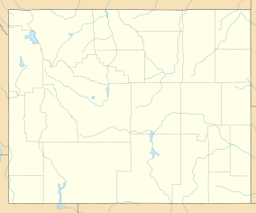
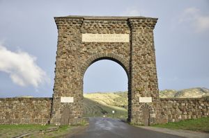
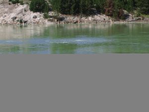
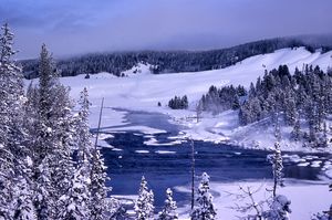
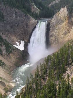
يلوستون حديقة أمريكية وطنية تقع في ولايات أيداهو, ومونتانا وويومنج. تعتبر أول وأقدم حديقة وطنية في العالم تغطي مساحة 3,470 ميل مربع, تشتهر بالحميات والينابيع الحارة والدببة البيضاء والذئاب والبيسون (ثور أمريكي) وتشتهر بثورة البراكين وسجلت فيها ثلاث ثورات ضخمة منذ 2.2 مليون سنة, سميت نسبة للصخور الصفراء فيها. اختير من قبل اليونسكو كأحد مواقع التراث الثقافي العالمي.
Native Americans have lived in the Yellowstone region for at least 11,000 years.[5] Aside from visits by mountain men during the early-to-mid-19th century, organized exploration did not begin until the late 1860s. Management and control of the park originally fell under the jurisdiction of the Secretary of the Interior, the first being Columbus Delano. However, the U.S. Army was subsequently commissioned to oversee management of Yellowstone for a 30-year period between 1886 and 1916.[6] In 1917, administration of the park was transferred to the National Park Service, which had been created the previous year. Hundreds of structures have been built and are protected for their architectural and historical significance, and researchers have examined more than a thousand archaeological sites.
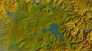
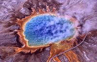
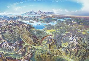
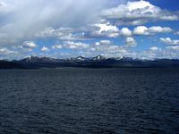
Yellowstone National Park spans an area of 3,468.4 square miles (8,983 km2),[1] comprising lakes, canyons, rivers and mountain ranges.[7] Yellowstone Lake is one of the largest high-elevation lakes in North America and is centered over the Yellowstone Caldera, the largest supervolcano on the continent. The caldera is considered a dormant volcano. It has erupted with tremendous force several times in the last two million years.[8] Half of the world's geysers[9][10] and hydrothermal features[11] are in Yellowstone, fueled by this ongoing volcanism. Lava flows and rocks from volcanic eruptions cover most of the land area of Yellowstone. The park is the centerpiece of the Greater Yellowstone Ecosystem, the largest remaining nearly-intact ecosystem in the Earth's northern temperate zone.[12] In 1978, Yellowstone was named a UNESCO World Heritage Site.
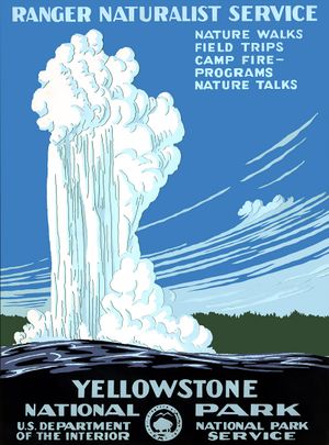
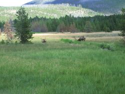
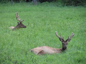
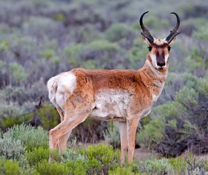
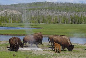
Hundreds of species of mammals, birds, fish, and reptiles have been documented, including several that are either endangered or threatened.[7] The vast forests and grasslands also include unique species of plants. Yellowstone Park is the largest and most famous megafauna location in the contiguous United States. Grizzly bears, wolves, and free-ranging herds of bison and elk live in this park. The Yellowstone Park bison herd is the oldest and largest public bison herd in the United States. Forest fires occur in the park each year; in the large forest fires of 1988, nearly one third of the park was burnt. Yellowstone has numerous recreational opportunities, including hiking, camping, boating, fishing and sightseeing. Paved roads provide close access to the major geothermal areas as well as some of the lakes and waterfalls. During the winter, visitors often access the park by way of guided tours that use either snow coaches or snowmobiles.
. . . . . . . . . . . . . . . . . . . . . . . . . . . . . . . . . . . . . . . . . . . . . . . . . . . . . . . . . . . . . . . . . . . . . . . . . . . . . . . . . . . . . . . . . . . . . . . . . . . . . . . . . . . . . . . . . . . . . . . . . . . . . . . . . . . . . . . . . . . . . . . . . . . . . . . . . . . . . . . . . . . . . . . .
التاريخ

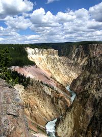
يقع المنتزه في منابع نهر يلوستون حيث تأخذ اسمها التاريخي. قرب نهاية القرن 18، الحطاب الفرنسي اسمه النهر الأصفر روك أو يلو ستون والتي من المحتمل ان يكون ترجمة لل مينوتوراسم "مي A-TSI دا تسي "(روك النهر الأصفر) .[13] في وقت لاحق، أصدر الصيادون الأمريكيون اسم فرنسي باللغة الإنجليزية باسم "ستون صفراء". على الرغم من الاعتقاد السائد أن كان اسمه نهر الصخور الصفراء لينظر في جراند كانيون من يلوستون ، مصدر الاسم الأميركي الأم غير معلوم.[14]
التاريخ الإنسانى للحديقة يبدأ على الأقل منذ 11،000 سنة مضت عندما بدأ الأميركيين الأصليين المطاردة و صيد الأسماك في المنطقة. وأثناء بناء مكتب البريد في غاردينر ، مونتانا ، مونتانا، في 1950، فإن نقطة قذيفة من الزجاج البركاني الأسود كلوفيس تم العثور على الأصل وتبين أنها مؤرخة من حوالي 11،000 سنة مضت.[15] هذه باليو-الهنود، من ثقافة كلوفيس،تم استخدام كميات كبيرة من سبج وجدت في الحديقة لجعل مثل أداة القطع و سلاح و السهم تم العثور علىها مصنوعة من الزجاج البركاني الأسود يلوستون بعيدة عن وادي المسيسيبي شرق أبعد مما يدل على أن التجارة العادية لحجر السج القائمة بين القبائل والعشائر المحلية.[16] بحلول الوقت البيضاء المستكشفين أولا دخلت المنطقة خلال [لويس] وكلارك]] في عام 1805، فإنها واجهت نيز بيرس ،قبائل كرو و شوشون . وبينما كانو يمرون من خلال مونتانا التى نعرفها في يومنا هذا، تم إبلاغ أعضاء البعثة عن منطقة يلوستون إلى الجنوب، لكن لم يمكنهم إستكشافها.[16]
في 1806، جون كولتر ، وهو عضو في بعثة لويس وكلارك ترك للانضمام إلى مجموعة من صيادى الفراء. بعد القسمة مع الصيادون الأخرون في عام 1807، 1807، مر كولتر إلى جزء من ما أصبح لاحقا المنتزه الوطنى، خلال فصل الشتاء من 1807-1808. لاحظ واحد على الأقل الطاقة الحرارية الأرضية منطقة في الجزء الشمالي الشرقي من الحديقة، بالقرب من برج الخريف.[17] بعد نجاته من جروح أصيب بها في معركة مع أعضاء الفريق وقبائل بلاكفوت في عام 1809، وقال انه قدم وصفا لمكان "النار والكبريت" الذي رفض من قبل معظم الناس الذين إعتبروه هذيانا. كان يلقب المكان بما يفترض أنه "جحيم كولتر ". خلال الأربعين سنة التى تلت ،فإن تقاريرا عديدة من الرجال عن جبال من الطين قال الصيادون أنه ثمة غليانا، تبخيرا للأنهار و أشجار تحجرت ، ولكن كان يعتقد أن معظم هذه التقارير في الوقت المناسب كانت أساطير.[18]
خلق المنتزه
التاريخ اللاحق
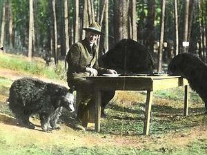
By 1915, 1,000 automobiles per year were entering the park, resulting in conflicts with horses and horse-drawn transportation. Horse travel on roads was eventually prohibited.[20]
الجغرافيا
الجيولوجيا


علم الأحياء والبيئة
النبيت
الوحيش
. . . . . . . . . . . . . . . . . . . . . . . . . . . . . . . . . . . . . . . . . . . . . . . . . . . . . . . . . . . . . . . . . . . . . . . . . . . . . . . . . . . . . . . . . . . . . . . . . . . . . . . . . . . . . . . . . . . . . . . . . . . . . . . . . . . . . . . . . . . . . . . . . . . . . . . . . . . . . . . . . . . . . . . .
الطقس
The climate at Yellowstone Lake is classified as subarctic (Dfc), according to Köppen-Geiger climate classification, while at the park headquarters the classification is humid continental (Dfb).
| Climate data for Yellowstone Lake, elev. 7,870 feet (2,399 m) | |||||||||||||
|---|---|---|---|---|---|---|---|---|---|---|---|---|---|
| Month | Jan | Feb | Mar | Apr | May | Jun | Jul | Aug | Sep | Oct | Nov | Dec | Year |
| Record high °F (°C) | 46 (8) |
56 (13) |
61 (16) |
65 (18) |
78 (26) |
83 (28) |
92 (33) |
91 (33) |
83 (28) |
72 (22) |
63 (17) |
48 (9) |
92 (33) |
| Mean daily maximum °F (°C) | 24.4 (−4.2) |
28.0 (−2.2) |
36.2 (2.3) |
43.3 (6.3) |
51.9 (11.1) |
61.6 (16.4) |
71.6 (22.0) |
71.4 (21.9) |
61.6 (16.4) |
47.8 (8.8) |
33.5 (0.8) |
24.3 (−4.3) |
46.4 (8.0) |
| Mean daily minimum °F (°C) | 1.2 (−17.1) |
1.2 (−17.1) |
9.2 (−12.7) |
18.0 (−7.8) |
28.0 (−2.2) |
35.4 (1.9) |
41.6 (5.3) |
39.9 (4.4) |
31.8 (−0.1) |
23.7 (−4.6) |
13.8 (−10.1) |
5.0 (−15.0) |
20.8 (−6.2) |
| Record low °F (°C) | −50 (−46) |
−50 (−46) |
−42 (−41) |
−26 (−32) |
−2 (−19) |
14 (−10) |
20 (−7) |
17 (−8) |
−5 (−21) |
−13 (−25) |
−30 (−34) |
−43 (−42) |
−50 (−46) |
| Average precipitation inches (mm) | 1.65 (42) |
1.61 (41) |
1.80 (46) |
1.78 (45) |
2.47 (63) |
2.25 (57) |
1.62 (41) |
1.60 (41) |
1.46 (37) |
1.18 (30) |
1.85 (47) |
1.63 (41) |
20.90 (531) |
| Average snowfall inches (cm) | 34.3 (87) |
30.4 (77) |
25.6 (65) |
21.4 (54) |
8.1 (21) |
1.3 (3.3) |
0 (0) |
0 (0) |
1.3 (3.3) |
9.9 (25) |
30.9 (78) |
30.5 (77) |
193.7 (492) |
| Average precipitation days (≥ 0.01 in) | 16.8 | 14.0 | 13.7 | 11.6 | 11.5 | 14.4 | 11.0 | 10.8 | 9.7 | 8.8 | 13.1 | 15.6 | 151 |
| Average snowy days (≥ 0.1 in) | 16.2 | 13.4 | 12.6 | 9.5 | 4.4 | 0.9 | 0 | 0 | 1.1 | 5.8 | 12.6 | 14.9 | 91.4 |
| Source 1: NOAA (normals, 1981–2010)[21] | |||||||||||||
| Source 2: The Weather Channel (Records)[22] | |||||||||||||
| Climate data for Yellowstone Park Headquarters, elev. 6,230 feet (1,899 m) | |||||||||||||
|---|---|---|---|---|---|---|---|---|---|---|---|---|---|
| Month | Jan | Feb | Mar | Apr | May | Jun | Jul | Aug | Sep | Oct | Nov | Dec | Year |
| Record high °F (°C) | 52 (11) |
56 (13) |
66 (19) |
78 (26) |
86 (30) |
92 (33) |
99 (37) |
97 (36) |
92 (33) |
82 (28) |
66 (19) |
52 (11) |
99 (37) |
| Mean daily maximum °F (°C) | 30.2 (−1.0) |
33.4 (0.8) |
40.8 (4.9) |
48.9 (9.4) |
59.0 (15.0) |
68.6 (20.3) |
79.3 (26.3) |
78.6 (25.9) |
67.4 (19.7) |
52.8 (11.6) |
37.7 (3.2) |
28.7 (−1.8) |
52.1 (11.2) |
| Mean daily minimum °F (°C) | 12.0 (−11.1) |
13.0 (−10.6) |
20.1 (−6.6) |
26.7 (−2.9) |
34.8 (1.6) |
42.3 (5.7) |
48.3 (9.1) |
46.7 (8.2) |
38.4 (3.6) |
29.4 (−1.4) |
19.8 (−6.8) |
11.3 (−11.5) |
28.6 (−1.9) |
| Record low °F (°C) | −36 (−38) |
−35 (−37) |
−25 (−32) |
−4 (−20) |
6 (−14) |
20 (−7) |
21 (−6) |
24 (−4) |
0 (−18) |
−8 (−22) |
−27 (−33) |
−35 (−37) |
−36 (−38) |
| Average precipitation inches (mm) | 0.73 (19) |
0.64 (16) |
0.95 (24) |
1.30 (33) |
2.06 (52) |
1.95 (50) |
1.46 (37) |
1.06 (27) |
1.14 (29) |
1.28 (33) |
1.03 (26) |
0.81 (21) |
14.41 (366) |
| Average snowfall inches (cm) | 11.1 (28) |
8.5 (22) |
10.4 (26) |
8.0 (20) |
2.2 (5.6) |
0.3 (0.76) |
0 (0) |
0 (0) |
0.3 (0.76) |
4.0 (10) |
9.4 (24) |
10.2 (26) |
64.4 (164) |
| Average precipitation days (≥ 0.01 in) | 9.8 | 9.0 | 9.1 | 9.7 | 12.8 | 13.3 | 9.9 | 8.9 | 8.2 | 8.4 | 9.8 | 10.2 | 119.1 |
| Average snowy days (≥ 0.1 in) | 8.0 | 7.1 | 6.4 | 4.8 | 1.2 | 0.1 | 0 | 0 | 0.2 | 2.6 | 7.2 | 8.3 | 45.9 |
| Source 1: NOAA (normals, 1981–2010)[23] | |||||||||||||
| Source 2: Western Regional Climate Center (extremes 1894–present)[24] | |||||||||||||
. . . . . . . . . . . . . . . . . . . . . . . . . . . . . . . . . . . . . . . . . . . . . . . . . . . . . . . . . . . . . . . . . . . . . . . . . . . . . . . . . . . . . . . . . . . . . . . . . . . . . . . . . . . . . . . . . . . . . . . . . . . . . . . . . . . . . . . . . . . . . . . . . . . . . . . . . . . . . . . . . . . . . . . .
انظر أيضاً
مرئيات
| معجزة ذئاب يلوستون. |
المصادر
- ^ أ ب "Listing of acreage as of December 31, 2011". Land Resource Division, National Park Service. Retrieved March 8, 2012.
- ^ قالب:NPS visitation
- ^ "Yellowstone National Park". UNESCO World Heritage Centre. Archived from the original on February 24, 2017. Retrieved March 24, 2012.
- ^ "Yellowstone in United States of America". protectedplanet.net. IUCN. Retrieved December 31, 2018.
- ^ "Yellowstone, History and Culture". National Park Service. Archived from the original on September 22, 2013. Retrieved May 8, 2011.
- ^ "eRecords of the National Park Service [NPS]". National Archives. Archived from the original on October 16, 2014. Retrieved January 9, 2016.
- ^ أ ب خطأ استشهاد: وسم
<ref>غير صحيح؛ لا نص تم توفيره للمراجع المسماةfacts - ^ "Questions About Yellowstone Volcanic History". United States Geological Survey, Yellowstone Volcano Observatory. Archived from the original on June 30, 2011. Retrieved May 6, 2011.
- ^ Bryan, T. Scott (2008). The Geysers of Yellowstone (Fourth ed.). University Press of Colorado. p. 9.
- ^ Johnson, JB; Anderson, JF; Anthony, RE; Sciotto, M (April 15, 2013). "Detecting geyser activity with infrasound". Journal of Volcanology and Geothermal Research. 256: 105–117. doi:10.1016/j.jvolgeores.2013.02.016.
- ^ "Yellowstone National Park". Encyclopedia Britannica. Retrieved August 5, 2018.
Yellowstone's principal attractions, however, are its some 10,000 hydrothermal features, which constitute roughly half of all those known in the world.
- ^ Schullery, Paul. "The Greater Yellowstone Ecosystem". Our Living Resources. U.S. Geological Survey. Archived from the original on September 25, 2006. Retrieved March 13, 2007.
- ^ Macdonald, James S., Jr. (December 27, 2006). "History of Yellowstone as a Place Name". Retrieved 2008-12-14.
{{cite web}}: CS1 maint: multiple names: authors list (link) - ^ "Yellowstone: A Brief History of the Park" (PDF). U.S. Department of the Interior. Archived from the original (PDF) on April 14, 2008.
- ^ Lahren, Larry (2006). Homeland: An archaeologist's view of Yellowstone Country's past. Cayuse Press. p. 161. ISBN 0-9789251-0-6.
- ^ أ ب Janetski, Joel C. (1987). Indians in Yellowstone National Park. Salt Lake City, Utah: University of Utah Press. ISBN 0-87480-724-7.
- ^ Haines, Aubrey L. (2000). "The Lewis and Clark Era (1805–1814)". Yellowstone National Park: Its Exploration and Establishment. U.S. Department of the Interior. Archived from the original on October 15, 2006. Retrieved 2006-11-14.
- ^ Haines, Aubrey L. (2000). "The Fur Trade Era (1818–42)". Yellowstone National Park: Its Exploration and Establishment. U.S. Department of the Interior. Archived from the original on October 15, 2006. Retrieved 2006-11-15.
- ^ Jordan Fisher Smith (June 7, 2016). Engineering Eden. Crown/Archetype. p. 37. ISBN 978-0307454263. Archived from the original on February 11, 2017.
- ^ "Yellowstone National Park's First 130 Years". Yellowstone History. National Park Service. Archived from the original on April 14, 2012. Retrieved April 1, 2007.
- ^ "WY Lake Yellowstone". National Oceanic and Atmospheric Administration. Retrieved June 19, 2013.
- ^ "Monthly Averages for Yellowstone Lake, Wyoming". The Weather Channel. Archived from the original on ديسمبر 1, 2013. Retrieved يناير 16, 2011.
- ^ "WY Yellowstone PK Mammoth". National Oceanic and Atmospheric Administration. Retrieved June 19, 2013.
- ^ "Yellowstone Park, Wyoming". Western Regional Climate Center. Archived from the original on يوليو 14, 2014. Retrieved يونيو 19, 2013.
قراءات إضافية
وصلات خارجية
- Yellowstone National Park Official site
- Greater Yellowstone Resource Guide
- يلوستون، المنتزه الوطني at the Open Directory Project
- Hi-resolution pictures of Yellowstone geyser basins
قالب:Protected Areas of Wyoming قالب:Protected Areas of Montana قالب:Protected Areas of Idaho
- Pages using gadget WikiMiniAtlas
- Articles with hatnote templates targeting a nonexistent page
- Missing redirects
- Short description is different from Wikidata
- IUCN Category II
- Coordinates on Wikidata
- Portal templates with default image
- مقالات مميزة
- تأسيسات 1872
- Geysers of Wyoming
- History of Wyoming
- National parks in Idaho
- مواقع التراث العالمي في الولايات المتحدة
- Biosphere reserves of the United States
- U.S. Route 20
- يلوستون
- متنزهات وطنية في مونتانا
- National parks in Wyoming
- Hot springs of Wyoming
- Federal lands in Wyoming
- Greater Yellowstone Ecosystem
- Regions of Wyoming
- Fremont County, Idaho
- Gallatin County, Montana
- Park County, Montana
- Park County, Wyoming
- Teton County, Wyoming
- Protected areas established in the 19th century
- Civilian Conservation Corps in Wyoming
- Civilian Conservation Corps in Montana
- Civilian Conservation Corps in Idaho
- حدائق وطنية في الولايات المتحدة الأمريكية
