لنكستر، پنسلڤانيا
Lancaster, Pennsylvania
Lengeschder | |
|---|---|
| City of Lancaster | |
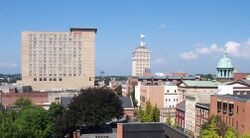
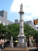
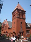
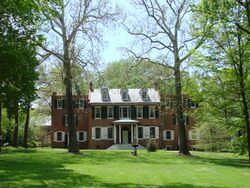
From top, left to right: Lancaster skyline, Soldiers and Sailors Monument, Central Market, Wheatland | |
| الكنية: The Red Rose City | |
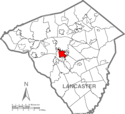 Location in Lancaster County | |
| الإحداثيات (Penn Square): 40°2′23″N 76°18′16″W / 40.03972°N 76.30444°W | |
| Country | United States |
| State | Pennsylvania |
| County | Lancaster |
| Founded | 1729 |
| Incorporated (borough) | 1742 |
| Incorporated (city) | 1818 |
| أسسها | James Hamilton |
| السمِيْ | Lancaster, Lancashire, England |
| Seat | Lancaster County |
| الحكومة | |
| • النوع | Strong mayor − council |
| • Mayor | Danene Sorace (D) |
| • City Council | |
| المساحة | |
| • City | 7٫35 ميل² (19٫03 كم²) |
| • البر | 7٫23 ميل² (18٫72 كم²) |
| • الماء | 0٫12 ميل² (0٫31 كم²) |
| • العمران | 802 ميل² (2٬080 كم²) |
| المنسوب | 368 ft (112 m) |
| التعداد (2010) | |
| • City | 59٬322 |
| • Estimate (2019)[3] | 59٬265 |
| • الترتيب | 10th in Pennsylvania |
| • الكثافة | 8٬200٫50/sq mi (3٬166٫09/km2) |
| • Urban | 402٬004 |
| • العمرانية | 507٬766 |
| صفة المواطن | Lancastrians |
| منطقة التوقيت | UTC−5 (EST) |
| • الصيف (التوقيت الصيفي) | UTC−4 (EDT) |
| ZIP Codes | 17573, 17601−17608, 17611, 17622, 17699 |
| مفتاح الهاتف | 717 and 223 |
| FIPS code | 42-41216 |
| الموقع الإلكتروني | cityoflancasterpa |
Lancaster ( /ˈlæŋkɪstər/ LANG-kə-stər; Pennsylvania German: Lengeschder) is a city in South Central Pennsylvania, that serves as the seat of Pennsylvania's Lancaster County and is one of the oldest inland towns in the United States.[4] With a population at the 2010 census of 59,322,[5] it ranks eighth in population among Pennsylvania's cities.[6] The Lancaster metropolitan area population is 507,766,[7] making it the 104th-largest metropolitan area in the U.S. and second-largest in the South Central Pennsylvania area.[7]
The city's primary industries include healthcare, tourism, public administration, manufacturing, and both professional and semi-professional services. Lancaster is best known for being the hub of Pennsylvania's Amish Country. Lancaster was home to James Buchanan, the nation's 15th president,[8] and to congressman and abolitionist Thaddeus Stevens.[9]
التاريخ
Originally called Hickory Town, the city was renamed after the English city of Lancaster by native John Wright. Its symbol, the red rose, is from the House of Lancaster.[10] Lancaster was part of the 1681 Penn's Woods Charter of William Penn, and was laid out by James Hamilton in 1734. It was incorporated as a borough in 1742 and incorporated as a city in 1818.[11]
Geography
Lancaster is located at 40°02'23" North, 76°18'16" West (40.039860, −76.304366),[12] and is 368 feet (112 m) above sea level. It is located in the piedmont region of Pennsylvania.
The city is located about 34 miles (55 km) southeast of Harrisburg, 70 miles (110 km) west of Philadelphia, 55 miles (89 km) north-northeast of Baltimore and 87 miles (140 km) northeast of Washington, D.C.
The nearest towns and boroughs are Millersville (4.0 miles), Willow Street (4.8 miles), East Petersburg (5.3 miles), Lititz (7.9 miles), Landisville (8.6 miles), Mountville (8.8 miles), Rothsville (8.9 miles), and Leola (8.9 miles).
According to the United States Census Bureau, the city has a total area of 7.4 square miles (19 km2), of which, 7.4 square miles (19 km2) of it is land and 0.14% is water.
Climate
Lancaster has a humid continental climate (Köppen climate classification Dfa) with hot or very warm summers. The hottest recorded temperature in the city was 103 °F (39 °C) on July 23, 2011 while the coldest recorded temperature was −16 °F (−27 °C) on January 22, 1984. On average, the city receives 42 inches of precipitation a year. September is the wettest month of the year and February the driest. The snowiest winter on record for Lancaster was the winter of 2009-10 when 72 inches of snow fell and the smallest amount of snow on record was when four inches fell during the winter of 1949–50. The highest recorded January temperature was 77 °F (25 °C) on January 26, 1950 and the coldest July temperature 42 °F (6 °C) on July 4, 1918.[بحاجة لمصدر]
On average, the city receives 203 days of sun a year. The shortest days of the year are between December 18 and December 25, when day length is nine hours and 19 minutes. The sun reaches its lowest point in the sky of 26° between December 11 and December 31. The longest days of the year are June 19 to June 23, reaching 15 hours and one minute. The sun reaches its highest point in the sky of 73° from June 10 to July 2.[بحاجة لمصدر]
| أخفClimate data for Lancaster, Pennsylvania (1981–2010 normals, extremes 1949–present) | |||||||||||||
|---|---|---|---|---|---|---|---|---|---|---|---|---|---|
| Month | Jan | Feb | Mar | Apr | May | Jun | Jul | Aug | Sep | Oct | Nov | Dec | Year |
| Record high °F (°C) | 70 (21) |
76 (24) |
88 (31) |
93 (34) |
99 (37) |
97 (36) |
103 (39) |
101 (38) |
99 (37) |
91 (33) |
86 (30) |
76 (24) |
103 (39) |
| Mean daily maximum °F (°C) | 38.1 (3.4) |
41.4 (5.2) |
51.0 (10.6) |
62.9 (17.2) |
72.6 (22.6) |
81.0 (27.2) |
85.2 (29.6) |
83.5 (28.6) |
76.0 (24.4) |
64.9 (18.3) |
53.8 (12.1) |
42.1 (5.6) |
62.8 (17.1) |
| Mean daily minimum °F (°C) | 22.0 (−5.6) |
23.8 (−4.6) |
31.1 (−0.5) |
40.5 (4.7) |
50.0 (10.0) |
59.7 (15.4) |
64.3 (17.9) |
62.6 (17.0) |
54.8 (12.7) |
43.2 (6.2) |
34.6 (1.4) |
26.3 (−3.2) |
42.8 (6.0) |
| Record low °F (°C) | −16 (−27) |
−9 (−23) |
−2 (−19) |
16 (−9) |
28 (−2) |
36 (2) |
46 (8) |
37 (3) |
34 (1) |
23 (−5) |
12 (−11) |
−3 (−19) |
−16 (−27) |
| Average precipitation inches (mm) | 2.88 (73) |
2.47 (63) |
3.27 (83) |
3.38 (86) |
3.89 (99) |
3.94 (100) |
4.50 (114) |
3.20 (81) |
4.56 (116) |
3.85 (98) |
3.60 (91) |
3.27 (83) |
42.81 (1٬087) |
| Average snowfall inches (cm) | 5.5 (14) |
7.5 (19) |
1.4 (3.6) |
0.2 (0.51) |
0 (0) |
0 (0) |
0 (0) |
0 (0) |
0 (0) |
0 (0) |
0.4 (1.0) |
3.3 (8.4) |
18.3 (46) |
| Average precipitation days (≥ 0.01 in) | 9.8 | 8.5 | 9.9 | 11.3 | 12.7 | 10.7 | 10.3 | 9.2 | 9.1 | 9.3 | 10.4 | 10.2 | 121.4 |
| Average snowy days (≥ 0.1 in) | 3.0 | 2.1 | 0.8 | 0.1 | 0 | 0 | 0 | 0 | 0 | 0 | 0.2 | 1.3 | 7.5 |
| Source: NOAA[13][14] | |||||||||||||
الديمغرافيا
| التعداد التاريخي | |||
|---|---|---|---|
| التعداد | Pop. | %± | |
| 1790 | 3٬762 | — | |
| 1800 | 4٬292 | 14٫1% | |
| 1810 | 5٬405 | 25٫9% | |
| 1820 | 6٬633 | 22٫7% | |
| 1830 | 7٬704 | 16٫1% | |
| 1840 | 8٬417 | 9٫3% | |
| 1850 | 12٬369 | 47�0% | |
| 1860 | 17٬603 | 42٫3% | |
| 1870 | 20٬233 | 14٫9% | |
| 1880 | 25٬769 | 27٫4% | |
| 1890 | 32٬011 | 24٫2% | |
| 1900 | 41٬459 | 29٫5% | |
| 1910 | 47٬227 | 13٫9% | |
| 1920 | 53٬150 | 12٫5% | |
| 1930 | 59٬949 | 12٫8% | |
| 1940 | 61٬345 | 2٫3% | |
| 1950 | 63٬774 | 4�0% | |
| 1960 | 61٬055 | −4٫3% | |
| 1970 | 57٬690 | −5٫5% | |
| 1980 | 54٬725 | −5٫1% | |
| 1990 | 55٬551 | 1٫5% | |
| 2000 | 56٬348 | 1٫4% | |
| 2010 | 59٬322 | 5٫3% | |
| 2019 (تق.) | 59٬265 | [3] | −0٫1% |
| Sources:[15][16][17] | |||
الجماعات العرقية
The largest ethnic groups in Lancaster as of recent estimates are:[18][19]
- Puerto Rican 29.2%
- German 21.2%
- African American 12.8%
- Irish 8.6%
- English 8.2%
- Italian 4.1%
- Dominican 3.2%
- Polish 2.0%
- Scottish 1.9%
- Mexican 1.8%
- Cuban 1.7%
- West Indian 1.0%
In 2010, 29.2% of Lancaster residents were of Puerto Rican ancestry. The city has the second highest concentration of Puerto Ricans in Pennsylvania after Reading. For this reason, it is sometimes referred to as the "Spanish Rose." Lancaster celebrates its Puerto Rican heritage once every year with the Puerto Rican Festival.[20]
الاقتصاد
Lancaster City has been in the process of recreating itself, particularly since 2005,[21] with a growth of specialty shops, boutiques, bars, clubs, and reinvestment in downtown institutions and locations. In 2005 the creation of "Gallery Row" solidified the status of Lancaster as an arts destination. The art community continues to thrive and expand.
There are also plans to convert an area of unused polluted industrial grounds (i.e., brownfields), which were once occupied by Armstrong World Industries, into playing fields for Franklin & Marshall College. This action is expected to take up most of the former industrial site. The Northwest Corridor will be developed with funds from Lancaster General Hospital. The hospital plans to create a mixed-use development which will add several city blocks to Lancaster's grid.
كبار أرباب العمل
According to Lancaster's 2018 Comprehensive Annual Financial Report,[22] the top employers in the city are:
| # | Employer | # of Employees |
|---|---|---|
| 1 | Lancaster General Hospital | 8,802 |
| 2 | Dart Container | 1,961 |
| 3 | County of Lancaster | 1,907 |
| 4 | Nordstrom, Inc. | Data Not Available |
| 5 | Masonic Villages | 1,685 |
| 6 | School District of Lancaster | 1,662 |
| 7 | LSC Communications (formerly RR Donnelley) | Data Not Available |
Media
- LNP, the county's predominant newspaper
- La Voz Hispana, the city's Spanish-language edition
- Sunday News, the county's weekly edition
- Fly Magazine, Lancaster City's Downtown Guide
- Fine Living Lancaster, a regional lifestyle magazine
TV
| TV stations | ||||
|---|---|---|---|---|
| Call letters | Channel | Network | Location | Owner |
| WGAL 8 | 8.1 | NBC | Lancaster | Hearst Corporation |
| WGAL–DT2 | 8.2 | MeTV | Lancaster | Hearst Corporation |
| TeleCentro TV | Comcast 949 | Public access | Lancaster | Spanish American Civic Association |
Lancaster is part of the Harrisburg-Lancaster-York market. In addition to WGAL and TeleCentro TV, the city is served by CBS/MyNetworkTV/CW affiliate WHP-TV 21, ABC affiliate WHTM-TV 27, PBS member station WITF-TV 33, and Fox affiliate WPMT 43. WPMT is based in York, while the other major stations are based in Harrisburg.
Nearby cities
See also
References
- ^ https://cityoflancasterpa.com/city-council/
- ^ "2019 U.S. Gazetteer Files". United States Census Bureau. Retrieved July 28, 2020.
- ^ أ ب "Population and Housing Unit Estimates". United States Census Bureau. May 24, 2020. Retrieved May 27, 2020.
- ^ "History of the City of Lancaster". City of Lancaster. Archived from the original on 18 March 2012. Retrieved 21 July 2011.
- ^ "The Most Populous Counties and the Most Populous Cities and Townships in 2010 in Pennsylvania". US Census Bureau. Archived from the original (xls) on 9 April 2011. Retrieved 5 April 2011.
- ^ "GCT-T1-R. Population Estimates (geographies ranked by estimate)". Pennsylvania – Place and County Subdivision. US Census Bureau. Archived from the original on 12 February 2020. Retrieved 31 March 2011.
- ^ أ ب "Annual Estimates of the Population of Metropolitan and Micropolitan Statistical Areas: April 1, 2000 to July 1, 2009". 2009 Population Estimates. United States Census Bureau, Population Division. March 23, 2010. Archived from the original (CSV) on October 13, 2013. Retrieved March 29, 2010.
- ^ "James Buchanan's Wheatland--Presidents: A Discover Our Shared Heritage Travel Itinerary". www.nps.gov. Retrieved 2015-12-28.
- ^ "Thaddeus Stevens". History Net: Where History Comes Alive - World & US History Online (in الإنجليزية الأمريكية). Retrieved 2015-12-28.
- ^ "A History of Lancaster, PA". Retrieved 1 July 2016.
- ^ "Lancaster County History". PHMC. Archived from the original on September 8, 2006. Retrieved August 1, 2006.
- ^ "US Gazetteer files: 2010, 2000, and 1990". United States Census Bureau. 2011-02-12. Retrieved 2011-04-23.
- ^ "NowData - NOAA Online Weather Data". National Oceanic and Atmospheric Administration. Retrieved 2015-07-27.
- ^ "Station Name: PA LANCASTER 2NE FLTR PLT". National Oceanic and Atmospheric Administration. Retrieved 2015-07-27.
- ^ "Census of Population and Housing". U.S. Census Bureau. Retrieved 11 December 2013.
- ^ "U.S. Census website". United States Census Bureau. Retrieved 2008-01-31.
- ^ "Incorporated Places and Minor Civil Divisions Datasets: Subcounty Resident Population Estimates: April 1, 2010 to July 1, 2012". Population Estimates. U.S. Census Bureau. Archived from the original on 11 June 2013. Retrieved 11 December 2013.
- ^ "population". Lancaster Online. Archived from the original on February 14, 2020. Retrieved September 18, 2006.
- ^ "population2". Lancaster Online. Archived from the original on February 14, 2020. Retrieved September 18, 2006.
- ^ "Puerto Rican Festival". Lancaster Online. Archived from the original on November 9, 2006. Retrieved September 18, 2006.
- ^ "Opinion | Where American Politics Can Still Work: From the Bottom Up" (in الإنجليزية). Retrieved 2018-07-04.
- ^ City of Lancaster CAFR
Further reading
- Alexander, Brian (2017). Glass House: The 1% Economy and the Shattering of the All-American Town. New York: St. Martin's Press. ISBN 9781250085801. OCLC 947146034.
- Interview with the author: "'Glass House' Chronicles the Sharp Decline of an All-American Factory Town". Fresh Air. NPR. February 6, 2017. Retrieved February 7, 2017.
- Lottie M. Bausman, A Bibliography of Lancaster County, Pennsylvania, 1745–1912. Philadelphia: Pennsylvania Federation of Historical Societies, 1917.
- Frank Ried Diffenderffer, The Early Settlement and Population of Lancaster County and City. Lancaster, PA: The New Era, 1905.
- H. M. J. Klein, Lancaster's Golden Century, 1821–1921: A Chronicle of Men and Women Who Planned and Toiled to Build a City Strong and Beautiful. Lancaster, PA: Hager and Brother, 1921.
- The Lancaster Farmer: A Monthly Newspaper. Vol. 1 (1869) | Vol. 2 (1870) | Vol. 3 (1871) | Vol. 4 (1872) | Vol. 5 (1873) | Vol. 6 (1874) | Vol. 7 (1875) | Vol. 8 (1876) | Vol. 9 (1877) | Vol. 10 (1878) | Vol. 11 (1879) | Vol. 12 (1880) | Vol. 13 (1881) | Vol. 14 (1882) | Vol. 15 (1883) | Vol. 16 (1885)
- Dave Pidgeon, "Battle Over City Project Moves to Courtroom", Intelligencer Journal (Lancaster, PA), July 13, 2006.
- William Riddle, One Hundred And Fifty Years of School History in Lancaster, Pennsylvania. Lancaster, PA: William Riddle, 1905.
- Israel Daniel Rupp, History of Lancaster and York Counties. n.c.: n.p., 1845.
External links
- Official website
- Official Lancaster city events website
- Official Tourism Bureau: Discover Lancaster website
- PA Dutch Country Welcome Center website
- لنكستر، پنسلڤانيا at Curlie
| سبقه Philadelphia |
Capital of the United States of America 1777 |
تبعه York |
| [[Image:|50px]] |
| ||||||
- Pages using gadget WikiMiniAtlas
- CS1 الإنجليزية الأمريكية-language sources (en-us)
- Short description is different from Wikidata
- Coordinates on Wikidata
- Articles with unsourced statements from August 2019
- Pages using US Census population needing update
- Articles with hatnote templates targeting a nonexistent page
- Articles with Curlie links
- Lancaster, Pennsylvania
- 1734 establishments in the Thirteen Colonies
- Cities in Lancaster County, Pennsylvania
- Cities in Pennsylvania
- County seats in Pennsylvania
- Former capitals of the United States
- Former state capitals in the United States
- Mayors of Lancaster, Pennsylvania
- Populated places established in 1734
- Populated places on the Underground Railroad
