صفط الحنا

قرية صفط الحنا هي إحدى القرى التابعة لمركز أبوحماد في محافظة الشرقية في جمهورية مصر العربية. حسب إحصاءات سنة 2006، بلغ إجمالي السكان في صفط الحنا 7598 نسمة، منهم 3861 رجل و3737 امرأة.[1]
الحفريات
| صفط الحنا بالهيروغليفية | |||||||||
|---|---|---|---|---|---|---|---|---|---|
Hut-nebes Ḥwt-nbs Ort des Christusdorns | |||||||||
Iat-nebes J3t-nbs Stätte des Christusdorns | |||||||||
Sebechet-net-pet Sbḫt-nt-pt Tor des Himmels | |||||||||
| اليونانية | Phakusa | ||||||||
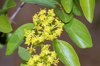
| Gelbe Blüte des Christusdorns | |||||||||
In December 1884 Swiss Egyptologist Édouard Naville was performing a survey in the Wadi Tumilat on behalf of the Egypt Exploration Fund. He went to Saft el-Hinna, a village of hinna farmers, and there he found traces of the ancient city under the modern settlement. He believed he had found the ancient city of Phacusa in the Biblical Land of Goshen, although it is nowadays assumed that Phacusa lies under the modern town of Faqus. Even though the archaeological site was threatened by urban development and the expansion of crops, Naville managed to discover several monuments of pharaoh Nectanebo I of the 30th Dynasty, the perimeter walls of a temple, and other attestations dating to the Ptolemaic and Roman periods. Unfortunately, he never published a comprehensive excavation report.[2][3]
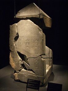
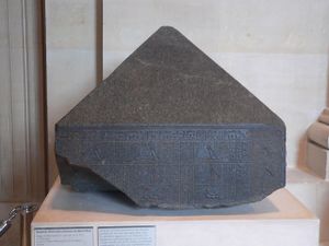
Among the findings dated to Nectanebo I, Naville found a naos dedicated to Sopdu. It was later discovered that the naos was one of four that were meant to be in the temple whose walls were found by Naville under Saft el-Hinna. The other three naoi were discovered as well, though in other places in the Delta and not in situ. One was dedicated to Shu; parts of it were found at Abukir and it is commonly called the "Naos of the Decades". Another was dedicated to Tefnut, and a poorly preserved one was discovered at Arish. All but the last one (due to its poor conservation) are thought to be attributable to Nectanebo I.[4]
In 1906 Flinders Petrie went to Saft el-Hinna to conduct an excavation aimed at discovering evidence of a Hebrew presence in ancient Egypt. He soon found that the condition of the site was even worse than at the time of Naville. He decided to dig in two undisturbed neighboring areas, Kafr Sheikh Zikr and Suwa, which turned out to be two ancient necropolises of Per-Sopdu. However, like Naville before him, Petrie never published a comprehensive report of these excavations.[5]
Saft el-Hinna was later involved in two surface surveys, the Wadi Tumilat Project begun in 1977, and the Liverpool University Delta Survey (1983–85). The latter was led by Steven Snape, who commented that of the ruins described by Naville a century earlier, almost nothing was left.[6]
By combining archaeological and philological evidence, it is now known that the sacred area of Per-Sopdu was divided into two parts, called Hut-nebes and Iat-nebes, which were connected by a dromos.[7]
التاريخ
ذكرها علي مبارك في كتابه الخطط التوفيقية باسم "سفط الحناء"، حيث ذكر أنها قرية في مديرية الشرقية بقسم بلبيس، وأن بها عدة مساجد وكتاتيب وعدة أضرحة ومقام يقال له "مقام بقرة بني إسرائيل"، ويكثر بها النخيل وجملة أراضيها 698 فدان، ويتكسّب أهلها من ثمر النخيل وبيع الحناء.[8]
طالع أيضا
المصادر
- ^
{{cite web}}: Empty citation (help) - ^ Tiribilli 2012, p. 129.
- ^ Tiribilli 2012, pp. 127–9.
- ^ Tiribilli 2012, p. 130.
- ^ Tiribilli 2012, p. 131.
- ^ Tiribilli 2012, pp. 135–6.
- ^ الخطط التوفيقية الجديدة لمصر - الجزء الثاني عشر (pdf).
{{cite book}}: Cite has empty unknown parameters:|lay-date=,|subscription=,|nopp=,|last-author-amp=,|name-list-format=,|lay-source=,|registration=, and|lay-summary=(help)


