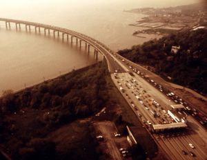
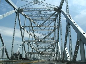
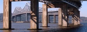
جسر تاپان زي (1955-2017)
جسر تاپان زي | |
|---|---|
 | |
| Coordinates | 41°04′12″N 73°53′28″W / 41.07000°N 73.89111°W |
| Carries | 7 حارات (3 northbound/westbound, 3 southbound/eastbound, 1 reversible) of Invalid type: I / Invalid type: I / Invalid type: NYST |
| Crosses | نهر هدسون وخط هدسون |
| Locale | Connecting جنوب نياك، مقاطعة روكلاند، نيويورك، وتاري تاون، وستشستر، في وادي نهر هدسون السفلي |
| Official name | جسر الحاكم مالكولم ولسون-تاپان زي |
| Maintained by | New York State Thruway Authority |
| Characteristics | |
| Design | Cantilever bridge |
| Total length | 16,013 feet (4,881 m) |
| Width | 90 feet (27 m) |
| Longest span | 1,212 feet (369 m) |
| Clearance below | 138 feet (42 m) |
| History | |
| Opened | 15 ديسمبر 1955 |
| أُغلِق | October 6, 2017 |
| Replaced by | جسر تاپان زي الجديد |
| Statistics | |
| Daily traffic | 134,947 (2010)[1] |
| رسم المرور | $4.75 (E-ZPass or Tolls by Mail)[2] (tolled eastbound/southbound only) |
| الموقع | |
 | |
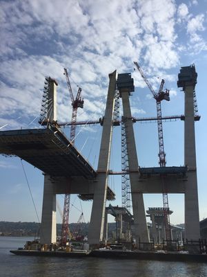
جسر الحاكم ملكولم ولسون-تاپان زي، شهرته جسر تاپان زي Tappan Zee Bridge، هو جسر كابولي في ولاية نيويورك الأمريكية، يعبر فوق نهر هدسون عند أحد أعرض نقاطه؛ تاپان زي المسماة على اسم إحدى القبائل الأمريكية-الهندية من المنطقة المسماة "تاپان"؛ وزي والتي تعني "البحر" باللغة الهولندية.[3] كطريق مدمج مع منطقة نيويورك الكبرى، يصل الجسر بين جنوب نياك في مقاطعة روكلاند بوادي هدسون السفلي. تقوم السلطات الفدرالية والولائية حالياً بإنشاء جسر بديل، جسر تاپان زي الجديد، والذي ستصل تكلفة إنشاءه إلى 4 بليون دولار على الأقل.[4]
. . . . . . . . . . . . . . . . . . . . . . . . . . . . . . . . . . . . . . . . . . . . . . . . . . . . . . . . . . . . . . . . . . . . . . . . . . . . . . . . . . . . . . . . . . . . . . . . . . . . . . . . . . . . . . . . . . . . . . . . . . . . . . . . . . . . . . . . . . . . . . . . . . . . . . . . . . . . . . . . . . . . . . . .
التاريخ
الجسر البديل

تجنب حدوث حالات إنتحار
انظر أيضاً
المصادر
- ^ "2010 Traffic Data Report for New York State" (PDF). New York State Department of Transportation. Appendix C. Retrieved 2010-02-27.
- ^ "Schedule of E-Zpass Tolls at Fixed Toll Barriers". New York State Thruway Authority. Retrieved 2016-04-16.
- ^ Melvin, Tessa (August 21, 1994). "If You're Thinking of Living In/Tarrytown; Rich History, Picturesque River Setting". The New York Times. Retrieved 2007-12-30.
The Dutch called this point, the river's widest, the Tappan Zee – Tappan probably for a group of Indians and Zee meaning "sea" in Dutch.
- ^ Khurram Saeed and Theresa Juva-Brown (2012-12-17). "It's official: State picks builder for new Tappan Zee Bridge". Copyright © 2012 www.lohud.com. All rights reserved. Retrieved 2012-12-19.
قراءات إضافية
- Plotch, Philip Mark (2015). Politics Across the Hudson - The Tappan Zee Megaproject. Rutgers University Press. ISBN 978-0-8135-7249-9. Archived from the original on 2017-07-17.
{{cite book}}: Unknown parameter|dead-url=ignored (|url-status=suggested) (help)
وصلات خارجية
- Tappan Zee Bridge at NYCRoads.com
- Tappan Zee Bridge in the Structurae database
- Tappan Zee Bridge/I-287 Environmental Review project site (archived March 15, 2016)
- Tappan Zee Bridge photos على Flickr
- Pages using gadget WikiMiniAtlas
- Short description is different from Wikidata
- Coordinates not on Wikidata
- Jct template errors
- Infobox mapframe without OSM relation ID on Wikidata
- Pages using infobox bridge with unknown parameters
- Articles with hatnote templates targeting a nonexistent page
- CS1 errors: unsupported parameter
- جسور على نهر هدسون
- جسور كابولية
- Toll bridges in New York (state)
- جسور اكتملت في 1955
- Tolled sections of Interstate Highways
- New York State Thruway Authority
- النقل في مقاطعة روكلاند، نيويورك
- النقل في مقاطعة وستشستر، نيويورك
- جسور طرق في نيويورك (ولاية)
- Roads with a reversible lane
- صفحات مع الخرائط


