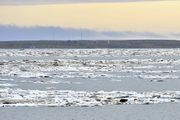
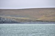
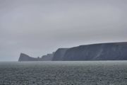
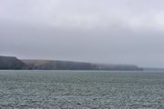
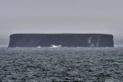
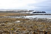
جزر سيبيريا الجديدة
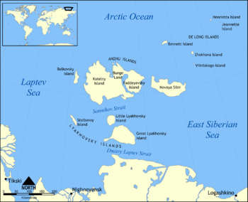 موقع جزر سيبيريا الجديدة | |
| الجغرافيا | |
| الموقع | بين بحر لاپتـِڤ و بحر سيبيريا الشرقي |
| الإحداثيات | 75°16′N 145°15′E / 75.267°N 145.250°E |
| الأرخبيل | جزر سيبيريا الجديدة |
| المساحة | 29,900 km2 (11,500 sq mi) |
| أعلى منسوب | 374 m (1٬227 ft) |
| أعلى نقطة | ملكاتن طاش |
| الإدارة | |
| الكيان الاتحادي | جمهورية ساخا |
| السكان | |
| التعداد | 2 (2017) على جزيرة كوتلني |
جزر سيبيريا الجديدة (روسية: Новосиби́рские острова, النطق Novosibirskiye Ostrova؛ بالياقوتية: Саҥа Сибиир арыылара؛ إنگليزية: New Siberian Islands) هي أرخبيل في أقصى شمال روسيا، إلى الشمال من ساحل شرق سيبيريا بين بحر لاپتـِڤ وبحر سيبيريا الشرقي، شمال جمهورية ساخا (ياقوتيا).
. . . . . . . . . . . . . . . . . . . . . . . . . . . . . . . . . . . . . . . . . . . . . . . . . . . . . . . . . . . . . . . . . . . . . . . . . . . . . . . . . . . . . . . . . . . . . . . . . . . . . . . . . . . . . . . . . . . . . . . . . . . . . . . . . . . . . . . . . . . . . . . . . . . . . . . . . . . . . . . . . . . . . . . .
التاريخ
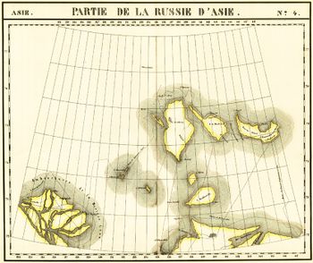
أول أخبار عن وجود جزر سيبيريا الجديدة جلبها القوزاق، ياكوڤ پرمياكوڤ، في مطلع القرن 18. ففي 1712، وصلت وحدة من القوزاق، بقيادة م. ڤاگن جزيرة لياخوڤسكي الكبرى.
المناخ
| Climate data for جزيرة كوتلني | |||||||||||||
|---|---|---|---|---|---|---|---|---|---|---|---|---|---|
| Month | Jan | Feb | Mar | Apr | May | Jun | Jul | Aug | Sep | Oct | Nov | Dec | Year |
| Record high °C (°F) | −7.2 (19.0) |
−3.3 (26.1) |
−4.8 (23.4) |
0.3 (32.5) |
6.2 (43.2) |
20.7 (69.3) |
25.1 (77.2) |
20.2 (68.4) |
11.8 (53.2) |
1.8 (35.2) |
−2.5 (27.5) |
−3.1 (26.4) |
25.1 (77.2) |
| Mean daily maximum °C (°F) | −26.1 (−15.0) |
−26.4 (−15.5) |
−24.2 (−11.6) |
−16.9 (1.6) |
−6.2 (20.8) |
1.4 (34.5) |
5.7 (42.3) |
4.3 (39.7) |
0.3 (32.5) |
−8.1 (17.4) |
−18.2 (−0.8) |
−23.8 (−10.8) |
−11.5 (11.3) |
| Daily mean °C (°F) | −29.3 (−20.7) |
−29.7 (−21.5) |
−27.5 (−17.5) |
−20.3 (−4.5) |
−8.6 (16.5) |
−0.4 (31.3) |
2.9 (37.2) |
2.1 (35.8) |
−1.2 (29.8) |
−10.7 (12.7) |
−21.5 (−6.7) |
−27.0 (−16.6) |
−14.3 (6.3) |
| Mean daily minimum °C (°F) | −32.6 (−26.7) |
−32.9 (−27.2) |
−30.9 (−23.6) |
−24.2 (−11.6) |
−11.4 (11.5) |
−2.1 (28.2) |
0.6 (33.1) |
0.2 (32.4) |
−3.0 (26.6) |
−13.7 (7.3) |
−24.8 (−12.6) |
−30.3 (−22.5) |
−17.1 (1.2) |
| Record low °C (°F) | −44.9 (−48.8) |
−49.9 (−57.8) |
−46.1 (−51.0) |
−46.2 (−51.2) |
−28.6 (−19.5) |
−14.9 (5.2) |
−6.0 (21.2) |
−9.2 (15.4) |
−18.6 (−1.5) |
−40.2 (−40.4) |
−40.2 (−40.4) |
−45.0 (−49.0) |
−49.9 (−57.8) |
| Average precipitation mm (inches) | 7 (0.3) |
5 (0.2) |
6 (0.2) |
8 (0.3) |
9 (0.4) |
17 (0.7) |
26 (1.0) |
23 (0.9) |
23 (0.9) |
16 (0.6) |
7 (0.3) |
7 (0.3) |
154 (6.1) |
| Average rainy days | 0 | 0 | 0 | 0.1 | 1 | 8 | 15 | 15 | 9 | 0.4 | 0 | 0 | 49 |
| Average snowy days | 15 | 16 | 16 | 15 | 22 | 16 | 8 | 11 | 22 | 26 | 18 | 16 | 201 |
| Average relative humidity (%) | 82 | 82 | 82 | 83 | 87 | 90 | 90 | 91 | 90 | 88 | 84 | 82 | 86 |
| Mean monthly sunshine hours | 0 | 7 | 147 | 283 | 197 | 178 | 168 | 100 | 44 | 14 | 0 | 0 | 1٬138 |
| Source 1: Pogoda.ru.net[1] | |||||||||||||
| Source 2: NOAA (sun 1961–1990)[2] | |||||||||||||
معرض صور
انظر أيضاً
المراجع
- ^ "Weather and Climate-The Climate of Kotelny Island" (in Russian). Weather and Climate (Погода и климат). Retrieved 27 February 2016.
{{cite web}}: CS1 maint: unrecognized language (link) - ^ "Kotel'nyj Island (Kotelny Island) Climate Normals 1961–1990". National Oceanic and Atmospheric Administration. Retrieved 27 February 2016.
للاستزادة
- Alfred Wegner institute (AWI) Publications, Berichte zur Polar- und Meeresforschung (Reports on polar and marine research) - free, downloadable research reports on the biology, geology, oceanography, hydrology, paleontology, paleoclimatology, fauna, flora, soils, cryology, and so forth of the New Siberian Islands, Laptev Sea, and other parts of the Arctic Circle.
- Andreev, A.A., and D.M. Peteet, 1999, Climate and Diet of Mammoths in the East Siberian Arctic . Science Briefs (August 1999). Goddard Institute for Space Studies, New York, New York. Last visited July 12, 2008.
- Babinski, E.T., nd, A Frozen Ninety Foot Tall Plum Tree. examination of reports of a 90-foot fossil plum tree being found in Great Lyakhovsky Island of the New Siberian Islands.
- Basilyan, A., and P.A. Nikolskiy, 2002, Quaternary Deposits of New Siberia Island (Russian Arctic). 32nd Annual Arctic Workshop Abstracts, March 14–16, 2002, INSTAAR, University of Colorado at Boulder.
- Espinoza, E.O., and M.-J. Mann, 1993, The history and significance of the Schreger Pattern in Proboscidean ivory characterization. Journal for the American Institute for Conservation. vol. 32, no. 3, Article 3, pp. 241–248.
- Kuznetsova, T.V., L.D. Sulerzhitsky, Ch. Siegert, 2001, New data on the "Mammoth" fauna of the Laptev Shelf Land (East Siberian Arctic), 144 KB PDF file, The World of Elephants - International Congress, Rome 2001. Consiglio Nazionale delle Ricerche, Centro di Studio per il Quaternario e l'Evoluzione Ambientale, Università di Roma, Roma, Italy.
. . . . . . . . . . . . . . . . . . . . . . . . . . . . . . . . . . . . . . . . . . . . . . . . . . . . . . . . . . . . . . . . . . . . . . . . . . . . . . . . . . . . . . . . . . . . . . . . . . . . . . . . . . . . . . . . . . . . . . . . . . . . . . . . . . . . . . . . . . . . . . . . . . . . . . . . . . . . . . . . . . . . . . . .
وصلات خارجية
- New Siberian Islands at the Wayback Machine (archived ديسمبر 23, 2010) - aerial photographs of these islands.
- Location of Nanosnyy
- Pages using gadget WikiMiniAtlas
- Articles containing روسية-language text
- Articles containing Yakut-language text
- Coordinates on Wikidata
- Articles containing إنگليزية-language text
- Pages using Lang-xx templates
- جزر سيبيريا الجديدة
- أرخبيلات بحر سيبيريا الشرقي
- أرخبيلات بحر لاپتيڤ
- أرخبيلات جمهورية ساخا
- جزر سيبيريا
- جزر روسيا غير المأهولة

