تيومين
{{ safesubst:#invoke:Unsubst||date=__DATE__|$B=
تيومين
Тюмень | |
|---|---|
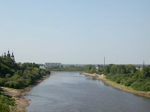
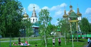
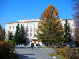
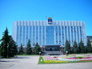
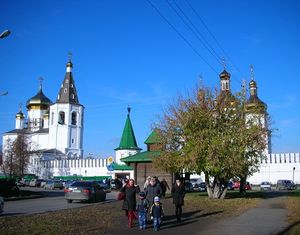
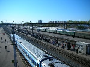
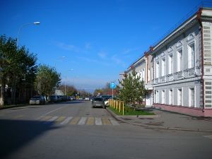
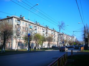
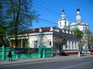
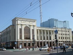
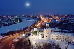 صورة لوسط مدينة تيومين. | |
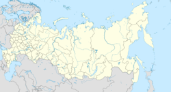
| الإحداثيات: 57°09′N 65°32′E / 57.150°N 65.533°E | |
| البلد | روسيا |
| الكيان الاتحادي | Tyumen Oblast[1] |
| Founded | 29 يوليو 1586[2] |
| الحكومة | |
| • رئيس الادارة[3] | ألكسندر مور[3] |
| المساحة | |
| • الإجمالي | 235 كم² (91 ميل²) |
| المنسوب | 102 m (335 ft) |
| التعداد | |
| • الإجمالي | 581٬907 |
| • الترتيب | 25 in 2010 |
| • الكثافة | 2٬500/km2 (6٬400/sq mi) |
| • Subordinated to | مدينة تيومين[1] |
| • Capital of | أبلاست تيومين[4], مقاطعة تيومينسكي[1] |
| • Urban okrug | أوكروگ تيومين الحضري[6] |
| • Capital of | أكروگ تيومين الحضري[6], مقاطعة تيومينسكي البلدية[6] |
| منطقة التوقيت | UTC+ ([7]) |
| Postal code(s)[8] | 625000–625010, 625013–625019, 625022, 625023, 625025–625039, 625041, 625043, 625046, 625048, 625049, 625051–625053, 625059, 625062, 625500, 625700, 625880, 625890, 625899, 625960, 625961–625965, 625970, 625991, 625992, 901163, 901165, 901167, 901169, 901171, 901205, 996000 |
| Dialing code(s) | +7 3452[9] |
| OKTMO ID | 71701000001 |
| مدينة Day | آخر أحد في يوليو.[2] |
| الموقع الإلكتروني | www |
تيومين (روسية: Тюмень; النطق الروسي: [tʲʉˈmʲenʲ] (![]() استمع))، هي أكبر مدينة والمركز الاداري لأبلاست تيومين، روسيا، وتقع على ضفاف نهر تورا، 2500 كم شرق موسكو. It is situated just east of the Ural Mountains, along the Tura River. Fueled by the Russian oil and gas industry, Tyumen has experienced rapid population growth in recent years, rising to a population of 847,488 at the 2021 Census.[10] Tyumen is among the largest cities of the Ural region and the Ural Federal District. Tyumen is often regarded as the first Siberian city, from the western direction.[11]
استمع))، هي أكبر مدينة والمركز الاداري لأبلاست تيومين، روسيا، وتقع على ضفاف نهر تورا، 2500 كم شرق موسكو. It is situated just east of the Ural Mountains, along the Tura River. Fueled by the Russian oil and gas industry, Tyumen has experienced rapid population growth in recent years, rising to a population of 847,488 at the 2021 Census.[10] Tyumen is among the largest cities of the Ural region and the Ural Federal District. Tyumen is often regarded as the first Siberian city, from the western direction.[11]
كانت تيومين أول مستوطنة روسية في سيبريا. تأسست عام 1586 لدعم التوسع الروسي شرقاً، ظلت المدينة واحدة من أهم المراكز الصناعية والاقتصادية شرق جبال الأورال. وتقع تيومين على تقاطع العديد من الطرق التجارية الهامة، ومع سهولة الوصول للممرات الصالحة للملاحة سرعان ما تطورت تيومين من مستوطنة عسكرية صغيرة إلى مدينة تجارية وصناعية كبيرة. الجزء الأوسط من تيومين القديمة لا يزال يحتفظ بالكثير من المباني التاريخية التي بنيت عبر تاريخ المدينة.
اليوم تعتبر تيومين مركز أعمال هام. تيومين هي مركز نقل والمركز الصناعي لاوبلاست تيومين-المنطقة الشاسعة الغنية بالنفط التي تمتد من الحدود القزخية حتى [[المحيط المتجمد الشمالي-فضلاً عن أنها موطن للكثير من الشركات الناشطة في صناعة النفط والغاز الروسية.
أصل الاسم
In Turkic and Mongolic languages, "Tümen/Түмэн" means a myriad, or ten thousand. Etymologically connected to the Tuman River that delineates sections of the borders between North Korea, Russia, and China.
الجغرافيا
Tyumen is located in Western Siberia, 1،700 km (1،100 mi) east of Moscow, 300 km (190 mi) east of Yekaterinburg, and 1،100 km (680 mi) west of Siberia's largest city, Novosibirsk. The city covers an area of 235 متر كيلومربع (91 sq mi).[4] Its primary geographical feature is the Tura River, which crosses the city from northwest to southeast. The river is navigable downstream of the city. The left bank of the Tura is a floodplain surrounded by gently rolling hills. The Tura is a shallow river with extensive marshlands.
The river floods during the snow melting season in the spring. The spring flood usually peaks in the second half of May,[12] when the river becomes 8–10 times wider than during the late-summer low water season. The city is protected from flooding by a dike which can withstand floods up to 8 متر (26 ft) high.[13] The highest ever flood water level in Tyumen was 9.15 متر (30.0 ft), recorded in 1979. More recently, in 2007, a water level of 7.76 was recorded.[14] In spring 2005, a flood higher than the critical 8 متر (26 ft) mark was expected,[15] but did not appear.
المناخ
Tyumen has a strongly humid continental climate (Köppen climate classification Dfb) with warm, somewhat humid summers and long, very cold (though average by Siberian standards) winters. The weather in the region is very changeable, and the temperature in town is always higher than in the surrounding area by a few degrees. The town area also attracts more precipitation. The average temperature in January is −16.7 °C (1.9 °F), with a record low of −50 °C (−58 °F) measured in February 1951. The average temperature in July is +18.6 °C (65.5 °F), with a record high of +38 °C (100 °F).
The average annual precipitation is 457 ميليمتر (18.0 in). The wettest year on record was 1943, with 581 ميليمتر (22.9 in), and the driest was 1917, with only 231 ميليمتر (9.1 in).[16]
| بيانات المناخ لـ تيومين | |||||||||||||
|---|---|---|---|---|---|---|---|---|---|---|---|---|---|
| الشهر | ينا | فب | مار | أبر | ماي | يون | يول | أغس | سبت | أكت | نوف | ديس | السنة |
| القصوى القياسية °س (°ف) | 5.6 (42.1) |
7.0 (44.6) |
17.1 (62.8) |
30.7 (87.3) |
34.9 (94.8) |
36.2 (97.2) |
37.5 (99.5) |
37.4 (99.3) |
31.2 (88.2) |
24.1 (75.4) |
12.8 (55.0) |
6.7 (44.1) |
37.5 (99.5) |
| متوسط القصوى اليومية °س (°ف) | −10.7 (12.7) |
−8.1 (17.4) |
0.1 (32.2) |
9.4 (48.9) |
17.7 (63.9) |
23.3 (73.9) |
24.5 (76.1) |
21.2 (70.2) |
14.7 (58.5) |
7.3 (45.1) |
−3.5 (25.7) |
−9.1 (15.6) |
7.2 (45.0) |
| المتوسط اليومي °س (°ف) | −15.0 (5.0) |
−13.3 (8.1) |
−5.3 (22.5) |
3.7 (38.7) |
11.3 (52.3) |
17.1 (62.8) |
18.8 (65.8) |
15.8 (60.4) |
9.6 (49.3) |
3.1 (37.6) |
−7.0 (19.4) |
−13.0 (8.6) |
2.2 (36.0) |
| متوسط الدنيا اليومية °س (°ف) | −19.2 (−2.6) |
−18.1 (−0.6) |
−10.4 (13.3) |
−1.3 (29.7) |
5.4 (41.7) |
11.3 (52.3) |
13.6 (56.5) |
11.1 (52.0) |
5.4 (41.7) |
−0.4 (31.3) |
−10.4 (13.3) |
−16.9 (1.6) |
−2.5 (27.5) |
| الصغرى القياسية °س (°ف) | −46.2 (−51.2) |
−43.7 (−46.7) |
−38.4 (−37.1) |
−29.5 (−21.1) |
−10.2 (13.6) |
−1.9 (28.6) |
0.7 (33.3) |
−2.7 (27.1) |
−8.6 (16.5) |
−26.7 (−16.1) |
−41.0 (−41.8) |
−49.2 (−56.6) |
−49.2 (−56.6) |
| متوسط تساقط الأمطار mm (inches) | 25 (1.0) |
15 (0.6) |
17 (0.7) |
23 (0.9) |
45 (1.8) |
55 (2.2) |
89 (3.5) |
60 (2.4) |
57 (2.2) |
38 (1.5) |
34 (1.3) |
27 (1.1) |
485 (19.1) |
| متوسط هطول الثلج cm (inches) | 32 (13) |
41 (16) |
40 (16) |
24 (9.4) |
7 (2.8) |
0 (0) |
0 (0) |
0 (0) |
4 (1.6) |
7 (2.8) |
11 (4.3) |
22 (8.7) |
188 (74.6) |
| Average rainy days | 0.4 | 0.2 | 2 | 9 | 16 | 17 | 17 | 19 | 19 | 13 | 4 | 0 | 117 |
| متوسط الرطوبة النسبية (%) | 80 | 76 | 70 | 62 | 58 | 65 | 72 | 77 | 77 | 77 | 80 | 80 | 73 |
| Mean monthly ساعات سطوع الشمس | 67.1 | 122.0 | 181.2 | 231.4 | 280.7 | 301.4 | 304.7 | 233.1 | 161.9 | 101.4 | 68.4 | 51.1 | 2٬104٫6 |
| [بحاجة لمصدر] | |||||||||||||
التاريخ

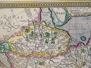
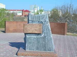
The Cossack ataman Yermak Timofeyevich conquered the Tyumen area, originally part of the Siberia Khanate, to the Tsardom of Russia in 1585. Both capitals of the Siberia Khanate, Sibir/Qashliq and Tyumen/Chimgi-Tura (the capital in the 15th century), were completely destroyed. Sibir was never rebuilt, though it gave its name to all concurrent and future lands in North Asia annexed by Russia, but Tyumen was later founded again. On July 29, 1586,[2] Tsar Feodor I ordered two regional commanders, Vasily Borisov-Sukin and Ivan Myasnoy, to construct a fortress on the site of the former Siberian Tatar town of Chingi-Tura ("city of Chingis"), also known as Tyumen, from the Turkic and Mongol word for "ten thousand"[19] – tumen.
Tyumen stood on the "Tyumen Portage", part of the historical trade route between Central Asia and the Volga region. Various South Siberian nomads had continuously contested control of the portage in the preceding centuries. As a result, Siberian Tatar and Kalmyk raiders often attacked early Russian settlers. The military situation meant that streltsy and Cossack garrisons stationed in the town predominated in the population of Tyumen until the mid-17th century. As the area became less restive, the town began to take on a less military character.
By the beginning of the 18th century, Tyumen had developed into an important center of trade between Siberia and China in the east and Central Russia in the west. Tyumen had also become an important industrial center, known for leatherworkers, blacksmiths, and other craftsmen. In 1763, 7,000 people were recorded[ممن؟] as living in the town.
In the 19th century, the town's development continued. In 1836, the first steam boat in Siberia was built in Tyumen. In 1862, the telegraph came to the town, and in 1864 the first water mains were laid. Further prosperity came to Tyumen after the construction, in 1885, of the Trans-Siberian Railway. For some years, Tyumen was Russia's easternmost railhead, and the site of transhipment of cargoes between the railway and the cargo boats plying the Tura, Tobol, Irtysh, and Ob Rivers.
By the end of the 19th century, Tyumen's population exceeded 30,000, surpassing that of its northern rival Tobolsk, and beginning a process whereby Tyumen gradually eclipsed the former regional capital. The growth of Tyumen culminated on August 14, 1944 when the city finally became the administrative center of the extensive Tyumen Oblast.
At the outbreak of the Russian Civil War in 1917, forces loyal to Admiral Alexander Kolchak and his Siberian White Army controlled Tyumen.[بحاجة لمصدر] However, the city fell to the Red Army on January 5, 1918.
During the 1930s, Tyumen became a major industrial center of the Soviet Union. By the onset of World War II, the city had several well-established industries, including shipbuilding, furniture manufacture, and the manufacture of fur and leather goods. World War II saw rapid growth and development in the city. In the winter of 1941, twenty-two major industrial enterprises evacuated to Tyumen from the European part of the Soviet Union.[20] These enterprises went into operation the following spring. Additionally, war-time Tyumen became a "hospital city", where thousands of wounded soldiers were treated. When it seemed that Moscow might fall to German forces during Operation Barbarossa, in 1941 Vladimir Lenin's body was secretly moved from his mausoleum in Moscow to a hidden tomb in what is now the Tyumen State Agriculture Academy.[21] Between 1941 and 1945, more than 20,000 Tyumen natives fought at the front, and some 6,000 were killed.[بحاجة لمصدر]
Rich oil- and gas-fields were discovered in the Tyumen Oblast in the 1960s. While most of these lay hundreds of kilometers away, near the towns of Surgut and Nizhnevartovsk, Tyumen was the nearest railway junction and so the city became their supply base while the railway was extended northwards.[22] As the result of this economic and population boom, with tens of thousands of skilled workers arriving from across the Soviet Union between 1963 and 1985, the rapid growth of the city also brought a host of problems. Its social infrastructure was limited and the lack of city planning has resulted in uneven development, with which Tyumen has continued to struggle.
الوضع الاداري والبلدي
Tyumen is the administrative center of the oblast and, within the framework of administrative divisions, it also serves as the administrative center of Tyumensky District, even though it is not a part of it.[1] As an administrative division, it is incorporated separately as the City of Tyumen—an administrative unit with the status equal to that of the districts.[1] As a municipal division, the City of Tyumen is incorporated as Tyumen Urban Okrug.[6]
تقسيمات المدينة
تنقسم تيومين إلى أربع أوكروگات اارية:
الحكومة
حكومة المدينة
حكومة الأبلاست
الديموغرافيا
الجماعات العرقية
While the population of Tyumen includes people from over a hundred different ethnicities, most belong to one of the following ethnicities:[23]
| Ethnicity (2010) | Population | Percentage |
|---|---|---|
| Russians | 448,186 | 84.4% |
| Siberian Tatars | 53,984 | 6.1% |
| Ukrainians | 9,312 | 1.7% |
| Azerbaijanis | 6,153 | 1.1% |
| Others | 36,788 | 6.7% |
الديانات
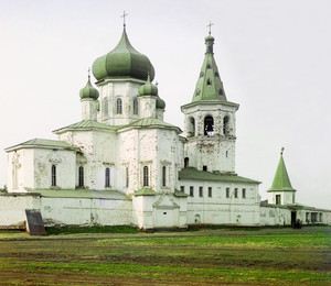
اعتبارا من 2009[تحديث], there are over ten operational Orthodox temples (both newly built and historical), two mosques (both newly built), one synagogue, and one Roman Catholic church in Tyumen (St. Joseph's Church).
الاقتصاد
Tyumen is an important service center for the gas and oil industries in Russia. Due to its advantageous location at the crossing of the motor, rail, water and air ways and its moderate climate Tyumen was an ideal base town for servicing the oil and gas industry of the West Siberia. As a result, today Tyumen is a center of industry, science, culture, education and medicine. Many large oil and gas companies such as Gazprom, LUKoil, Gazpromneft and Shell have their representative offices in Tyumen.
There are numerous factories, engineering companies, oil industry service companies (KCA DEUTAG and Schlumberger), design institutes, shipyard and other oil servicing companies located in Tyumen.
النقل
السكك الحديدية
النقل العام
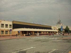
الجوي
البري
أفق المدينة
Historically, Tyumen occupied a small area on the high bank of the Tura River around the foundation site of the city. The city consisted of one and two-storey wooden buildings, surrounded by a number of villages. With time, the territory of the city was developed and extended by including the surrounding villages.
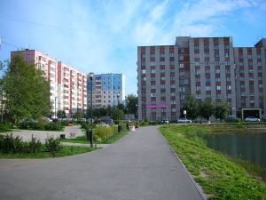
When viewed from above, present-day Tyumen appears to be a collection of low-rise towns with occasional clusters of tall buildings. Two areas of the city, Yamskaya Sloboda and Republic Street are noted for their historic character. These areas are dominated by old brick and wooden merchant houses and buildings, with the occasional intrusion of mid-century Soviet low-rise buildings.
العمارة
المنتزهات والحدائق
المجتمع والثقافة
التسلية والترفيه
الآداب والسينما
المتاحف والمعارض الفنية
الموسيقى
الرياضة
التعليم
المكتبات
العلاقات الدولية
مدن شقيقة
تيومين على توأمةمع:
 برن، سويسرا (2007)
 برست، بلارس (1999)
 كالگاري، ألبرتا، كندا
 Celle, ألمانيا (1994)[24]
 داتشينگ، الصين (1993)
 هيوستن، تكساس،[ [الولايات المتحدة]] (1995)
 Kaunas, لتوانيا
مشاهير المدينة
مواطنون أصليون
- Irving Berlin, musician
- Yevgeni Bushmanov, association football player and coach
- Sergey Fateev, journalist
- Yuri Aleksandrovich Gulyayev, opera singer
- Vladislav Krapivin, children's books writer
- Tamara Toumanova, ballerina and actress
- Anastasiya Kuzmina, Olympic biathlonist
- Viktor Leonenko, association football player
- Vladilen Mashkovtsev, writer
- Nikolay Pereverzev, futsal player
- Abraham Walkowitz, painter
- Ksenia Sukhinova, Miss World 2008
- Andrei Vasilevskiy, professional hockey player
آخرون
- Nikolai Chukmaldin, merchant and enlightener
- Georg Wilhelm Steller, German scientist
انظر أيضاً
المصادر
الهوامش
- ^ أ ب ت ث ج ح Law No. 53
- ^ أ ب ت "Charter of Tyumen (city proper) January 1, 2010. The Tyumen City Administration". Retrieved 2010-05-11.
- ^ أ ب "Head of Tyumen (city proper)January 1, 2010. The Tyumen City Administration". Retrieved 2010-05-11.
- ^ أ ب ت "Geography of Tyumen (city proper), January 1, 2010. The City Government of Tyumen". Archived from the original on يونيو 27, 2010. Retrieved مايو 11, 2010.
- ^ Russian Federal State Statistics Service (2011). "Всероссийская перепись населения 2010 года. Том 1". Всероссийская перепись населения 2010 года (2010 All-Russia Population Census) (in Russian). Federal State Statistics Service. Retrieved June 29, 2012.
{{cite web}}: Invalid|ref=harv(help); Unknown parameter|trans_title=ignored (|trans-title=suggested) (help)CS1 maint: unrecognized language (link) - ^ أ ب ت ث Law No. 263
- ^ "Об исчислении времени". Официальный интернет-портал правовой информации (in Russian). 3 June 2011. Retrieved 19 January 2019.
{{cite web}}: CS1 maint: unrecognized language (link) - ^ Почта России. Информационно-вычислительный центр ОАСУ РПО. (Russian Post). Поиск объектов почтовой связи (Postal Objects Search) (in روسية)
- ^ "Population of Tyumen (city proper)1 January 2010. The City Government of Tyumen". Retrieved 2010-05-11.
- ^ "Оценка численности постоянного населения по субъектам Российской Федерации". Federal State Statistics Service. Retrieved 1 September 2022.
- ^ "Tyumen the first Russian city in Siberia". Retrieved 2022-06-24.
- ^ В Тюмени готовятся к паводку (Tyumen is preparing for the spring flood) Archived يونيو 15, 2009 at the Wayback Machine
- ^ "Тюмени паводок не страшен (Flooding is no threat to Tyumen)". Archived from the original on 2012-09-08.
- ^ "Уровень воды в р. Тура не превышает паводкового значения (Тюмень) (Water level in the Tura River does not exceed the [normal] spring-flood mark)". Archived from the original on يناير 17, 2012.
... максимальный уровень паводковых вод в Тюмени составил 9,15 м в 1979 г., а в 2007 г. он составлял 7,76 м.
- ^ "Уровень воды в реке Тобол уже начал подниматься" [Water level in the Tobol has started to rise]. March 25, 2005. Archived from the original on May 14, 2013. Retrieved March 4, 2009.
Ожидается, что уровень воды в Туре превысит критический и достигнет восьми метров. (The water level in the Tura is expected to exceed the critical level and to reach 8 متر (26 ft)
- ^ http://slovari.yandex.ru/dict/bse%7CGreat[dead link] Soviet Encyclopedia
- ^ "Tyumen Climate" (in Russian). Weather and Climate (Погода и климат). Retrieved April 1, 2013.
{{cite web}}: CS1 maint: unrecognized language (link) - ^ "Weatherbase: Historical Weather for Tyumen, Russia". Weatherbase. Retrieved April 1, 2013.
- ^ E.M. Pospelov, Geograficheskie nazvaniya mira (Moscow: Russkie slovari, 1998), p. 427.
- ^ http://www.tyumen-city.ru/gorodtumeny/istoriigoroda/pg1/106/%7C Archived أبريل 16, 2016 at the Wayback Machine Official Site of Tyumen City History of the Town Section
- ^ http://www.tsaa.ru/index.php?option=com_content&view=frontpage&Itemid=28%7C Official Site of the Tyumen State Agriculture Academy Archived مارس 4, 2016 at the Wayback Machine
- ^ Eric Newby, The Big Red Train Ride, Penguin 1980, p.99
- ^ "Итоги::Тюменьстат". Archived from the original on 2019-03-07. Retrieved 2013-10-04.
- ^ "Stadt Celle". www.celle.de. Retrieved 2010-01-05.
المراجع
وصلات خارجية
- Pages using gadget WikiMiniAtlas
- CS1 errors: unsupported parameter
- Articles with روسية-language sources (ru)
- Articles with dead external links from July 2018
- Short description is different from Wikidata
- Coordinates on Wikidata
- Pages using infobox settlement with image map1 but not image map
- Articles containing روسية-language text
- Articles with unsourced statements from August 2010
- Articles with specifically marked weasel-worded phrases from September 2015
- Articles with unsourced statements from September 2015
- Articles with unsourced statements from October 2016
- مقالات فيها عبارات متقادمة منذ 2009
- جميع المقالات التي فيها عبارات متقادمة
- Articles with hatnote templates targeting a nonexistent page
- مدن وبلدات في أبلاست تيومين
- محافظة توبولسك
- أماكن مأهولة تأسست في 1586
- Ski areas and resorts in Russia
- Tyumensky Uyezd
- صفحات مع الخرائط


