نهر تورا
| Tura Dolgaya (روسية: Долгая) | |
|---|---|
 التورا، بالقرب من ڤرخوتوريى | |
 Tura watershed | |
| الاسم المحلي | Error {{native name}}: an IETF language tag as parameter {{{1}}} is required (help) |
| الموقع | |
| البلد | روسيا |
| المدن | Verkhnyaya Tura, Nizhnyaya Tura, ڤرخوتوريى, تورينسك، تيومين |
| السمات الطبيعية | |
| المنبع | جبال الأورال |
| ⁃ الموقع | Khrebet-Ural'skii, أبلاست سڤردلوڤسك |
| ⁃ الإحداثيات | 58°24′32″N 59°21′32″E / 58.409°N 59.359°E |
| ⁃ المنسوب | 405 متر |
| المصب | توبول |
- الموقع | تارخاني، أبلاست تيومين |
- الإحداثيات | 57°12′20″N 66°57′10″E / 57.2055°N 66.9529°E |
- المنسوب | 44 متر |
| الطول | 1،030 km (640 mi) |
| مساحة الحوض | 80،400 km2 (31،000 sq mi) |
| سمات الحوض | |
| السريان | قالب:RTobol |
| الروافد | |
| - اليسرى | Is |
| - اليمنى | Salda, Tagil, Nitsa, Pyshma |
 | |
تورا (روسية: Тура́؛ Tura)، ويُعرف أيضاً بإسم دلگايا ( Dolgaya ؛ النهر الطويل، روسية: Долгая) هو نهر سيبيري ذو أهمية تاريخية يسري شرقاً من وسط جبال الأورال إلى توبول، التي هي جزء من حوض أوب. البلدة الرئيسية عليه هي تيومين.
الوصف
From about 1600 to 1750 the Tura was the main entry point into Siberia. Most people and goods entering or leaving passed through the customs house at Verkhoturye. There are a number of mining towns in the upper Tura basin.
الجغرافيا
It is located in the Sverdlovsk Oblast and Tyumen Oblast in Russia. It is 1،030 كيلومتر (640 mi) long with a drainage basin of 80،400 متر كيلومربع (31،000 sq mi).[1] The Tura is navigable within 753 كيلومتر (468 mi) of its mouth. It freezes up in late October through November and stays under the ice until April or the first half of May.
The Tura basin is bounded on the west by the Ural Mountains with the city of Perm, on the north by the Tavda basin, on the east by the Tobol with the city of Tobolsk and on the south by the Iset basin with the city of Yekaterinburg.
The Tura flows north through Verkhnyaya Tura and Nizhnyaya Tura, receives an east-flowing river from the mining town of Kachkanar, flows east past Verkhoturye, turns east-southeast, receives the Tagil from the west, passes Turinsk, receives the east-flowing Nitsa, passes Tyumen, turns directly east, receives the east-flowing Pyshma from the south and joins the Tobol River southwest of Tobolsk.
The Tura basin is fan-shaped with the Tura on the north side and the Pyshma on the south.
معرض صور
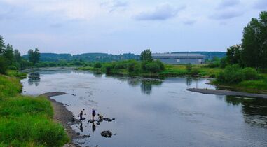
في تيومين
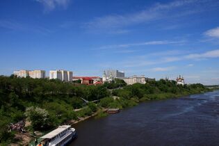
في تيومين
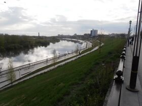
في تيومين
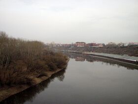
في ڤرخوتوريى
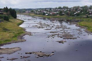
في ڤرخوتوريى
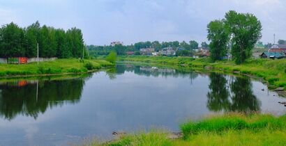
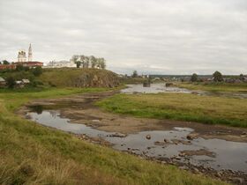
في Нижней Туре
في Нижней Туре
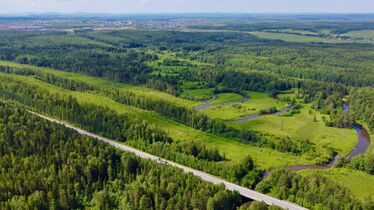
بالقرب من Верхней Туры, протекает под автодорогой Р352


.JPG&filetimestamp=20240728082313&)


المراجع
| Authority control databases: National |
|---|
قالب:SverdlovskOblast-geo-stub قالب:TyumenOblast-geo-stub قالب:Russia-river-stub
- Pages using gadget WikiMiniAtlas
- Short description is different from Wikidata
- Articles containing روسية-language text
- Pages using Lang-xx templates
- Native name template errors
- Coordinates on Wikidata
- Infobox mapframe without OSM relation ID on Wikidata
- أنهار أبلاست سڤردلوڤسك
- أنهار أبلاست تيومين
- جبال الأورال
- صفحات مع الخرائط