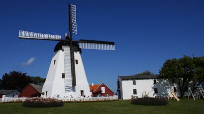
بورنهولم
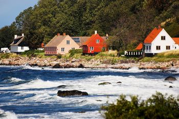 ساحل بورنهولم | |
 | |
| الجغرافيا | |
|---|---|
| الموقع | بحر البلطيق |
| الإحداثيات | 55°8′35″N 14°55′15″E / 55.14306°N 14.92083°E |
| المساحة | 588.36 km2 (227.17 sq mi) |
| أعلى منسوب | 162 m (531 ft) |
| أعلى نقطة | Rytterknægten |
| الإدارة | |
| المنطقة | منطقة العاصمة بالدنمارك |
| البلدية | بورنهولم |
| Largest settlement | رون (pop. 13.639) |
| السكان | |
| التعداد | 39.632 (1 يناير 2018) |
| الكثافة السكانية | 67٫36 /km2 (174٫46 /sq mi) |
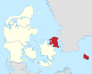
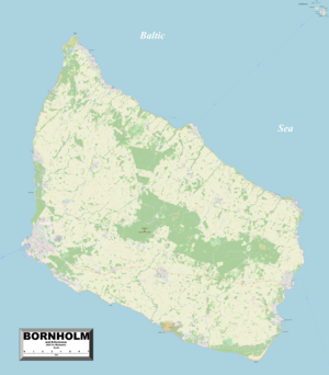
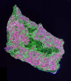
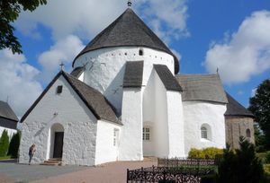
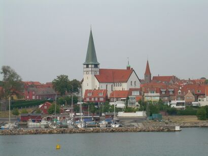
بورنهولم ( Bornholm ؛ الدنماركية: [bɒːnˈhʌlˀm]؛ نورسية القديمة: Burgundaholmr) هي جزيرة دنماركية في بحر البلطيق،إلى الشرق من بقية الدنمارك، وجنوب السويد، جنوب شرق ألمانيا وشمال أقصى غرب پولندا. الصناعات الرئيسية على الجزيرة تتضمن مزارع الألبان والفنون والصناعات اليدوية مثل إنتاج الزجاج والفخار باستخدام الطين المشغول محلياً. تعتبر السياحة من الأنشطة الهامة في فصل الصيف. يوجد بالجزيرة العديد من الكنائس المستديرة. تبلغ إجمالي مساحة الجزيرة 588.36 كم² (يناير 2016). ووصل تعداد السكان إلى 39.632 نسمة (1 يناير 2018).
وتسمى الجزيرة solskinsøen (جزيرة الشمس المشرقة) بسبب طقسها وklippeøen (جزيرة الصخرة) بسبب طبيعتها الجيولوجية، والتي تتألف من الگرانيت، باستثناء المنطقة الممتدة على طول الساحل الجنوبي. تختزن الحرارة الناجمة عن فصل الصيف في التشكيلات الصخرية ويظل الطقس حاراً حتى أكتوبر. نتيجة للمناخ، مجموعة الضفادع الشائعة، التي تعرف بجوهرة بورنهولم، تنمو محلياً فوق الجزيرة. تتألف طوبولوجيا الجزيرة من تشكيلات صخرية كبيرة في الشمال (على عكس بقية الدنمارك، والتي تتألف في الغالب من تلال مستديرة رقيقة) والتي تأخذ في الانحدار نحو غابات من الصنوبر والأشجار النفضية (المتأثرة بشكل كبير بالعواصف التي ضربت المنطقة في الخمسينيات)، المزارع في الوسط والشواطئ الرملية في الجنوب.[1]
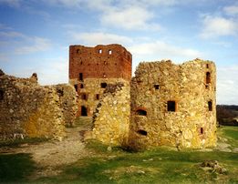
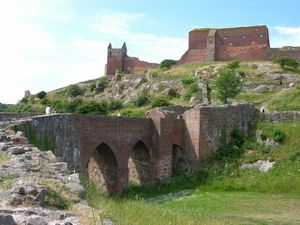
بحكم موقعها الاستراتيجي في بحر البلطيق، كانت بورنهولم محل نزاع لعدة قرون. كانت في الغالب تحت حكم الدنمارك، لكنها خضعت أيضاً لحكم لوبك، ألمانيا، والسويد. أطلال هامرزهوس، على الحافة الشمالية الغربية للجزيرة، تعتبر أكبر حصون العصور الوسطى في شمال أوروپا، والتي تشهد على أهمية موقعها.
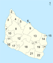
بلدية بورنهولم المحلية، والتي تأسست في يناير 2003 بدمج مقاطعة بورنهولم مع 5 بلديات، تغطي كامل الجزيرة. كانت بورنهولم واحدة من البلديات الدنماركية الثلاثة الأخيرة (دنماركية: (المفرد) kommune; kommuner (الجمع)) الغير تابعة لأي مقاطعة — والبلديتان الأخرتان هما كوپنهاگن وفردريكسبرگ. في 1 يناير 2007، فقدت البلدية مكانة المقاطعة التي حصلت عليها لوقت قصير (من 2003 حتى 2006) وأصبحت جزءاً من منطقة العاصمة الدنماركية.
تقع الجزيرة بين خطي عرض 54°59'11" و55°17'30" شمالاً وخطي طول 14°45' و15°11' شرقاً.
غرب بورنهولم مباشرة عبر بحر البلطيق، معظمها على جزيرة شلاند، توجدة عدة بلديات تابعة لمنطقة شلاند: Stevns, Faxe, Næstved (الجزء الذي استخدم كبلدية Fladså) وVordingborg، وتشمل Møn، والتي تقع على بعد 135 كيلومتر (84 ميل) عبر بحر البلطيق.
عادة ما يستغرق الوصول للجزيرة للركاب والبضائع من 2-3 ساعة: (العبّارة: 1 ساعة 21 دقيقة (67 كم)؛ القيادة: 1 ساعة (83 كم )) للسفر بين Rønne و كوبنهاگن عبر يستاد في السويد. هناك رحلة بالعبارة والتي تخصص في الغالب لنقل البضائع بين رون وKøge (مدة الرحلة 5½ ساعة (164 كم)). إذا كان هناك مكاناً على العبارة يمكن للمسافرين "العاديين" الصعود على متنها. كما توجد مسارات عبارات إلى Sassnitz وŚwinoujście. بين [[مطار بورنهولم] ومطار كوپنهاگ عن طريق الطائرة وتستغرق 25 دقيقة.
يقع أرخبيل Ertholmene على بعد 18 كم شمال شرق بورنهولم. هذه الجزر، والتي لا تتبع أي بلدية أو اقليم، تدار من قبل وزارة الدفاع.
اللغة
 مقالة مفصلة: لهجة بورنهولم
البلدية
| البلدية | نعم | لا | ||
|---|---|---|---|---|
| الأصوات | النسبة | الأصوات | النسبة | |
| Allinge-Gudhjem | 3590 | 74 | 1287 | 26 |
| Hasle | 2886 | 70 | 1219 | 30 |
| Nexø | 3218 | 59 | 2252 | 41 |
| Rønne | 7754 | 85 | 1366 | 15 |
| Aakirkeby | 3131 | 74 | 1118 | 26 |
| الإجمالي:27821 | 20579 | 74 | 7242 | 26 |

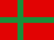
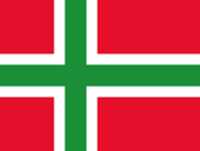
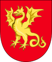
البلدات والقرى
|
|
|
الديمغرافيا
Population of parishes
Year: Beginning with 2007; 2018;
- 7552. Rønne 11,752; 11,539;
- 7553. Knudsker 2,821; 2,729;
- 7554. Vestermarie 1,460; 1,324;
- 7555. Nylarsker 924; 832;
- 7556. Nyker 1,737; 1,628;
- 7557. Hasle 1,887; 1,747;
- 7558. Rutsker 684; 570;
- 7559. Olsker 1,556; 1,266;
- 7560. Allinge-Sandvig 1,860; 1,527;
- 7561. Klemensker 1,737; 1,555;
- 7562. Rø 503; 418;
- 7563. Ibsker 1,322; 1,148;
- 7564. Svaneke 1,082; 981;
- 7565. Østerlarsker 997; 811;
- 7566. Gudhjem 752; 677;
- 7567. Østermarie 1,624; 1,458;
- 7568. Christiansø 95; 83;
- 7569. Aaker 3,479; 3,201;
- 7570. Bodilsker 981; 849;
- 7571. Nexø 3,884; 3,670;
- 7572. Poulsker 1,215; 1,061;
- 7573. Pedersker 715; 570;
Population numbers are from 1 January. Christiansø Parish (which encompasses Ertholmene) is not a part of Bornholm Regional Municipality. It is included because Danmarks Statistik includes it as parish number 7568. Bornholm has 21 parishes (2018) that before 1 April 1970 were parish (15) or market city (6) municipalities themselves. There are 2,158 parishes (2021) في كنيسة الدنمارك.
Source:Statistikbanken.dk/Befolkning og valg/(table)FODIE (births);FOD207 (deaths);BEV107 (births;deaths;birth surplus);KM1 (parishes).
| ||||||||||||||||||||||||||||||||||||||||||||||||||||||||||||
On 22 September 2014 population numbers showed fewer than 40,000 inhabitants on the island for the first time in over 100 years. The Folkeregister in the municipality could document 39,922 inhabitants in the municipality on that date.[3]
اللغة
Many inhabitants speak the Bornholmsk dialect, which is officially a dialect of Danish.[4] Bornholmsk retains three grammatical genders, like Faroese, Icelandic and most dialects of Norwegian, but unlike standard Danish. Its phonology includes archaisms (unstressed [a] and internal [d̥, ɡ̊], where other dialects have [ə] and [ð̞, ʊ / ɪ]) and innovations ([tɕ, dʝ] for [kʰ, ɡ̊] before and after front-tongue vowels). This makes the dialect difficult to understand for some Danish speakers. However, Swedish speakers often consider Bornholmian to be easier to understand than standard Danish. The intonation resembles the dialects spoken in nearby Scania, Blekinge and Halland the southernmost provinces of Sweden.
الدين
Most inhabitants are members of the Lutheran Church of Denmark (Folkekirken). Various Christian denominations have become established on the island, most during the 19th century.
- Folkekirken (State church) (1536)
- Baptist church (1843)
- The Church of Jesus Christ of Latter-day Saints (LDS Church) (1850)
- Methodist church (1895)
- Jehovah's Witnesses (1897)
- Roman Catholic Church (ca 1150–1536, 1849)
التاريخ
In Old Norse the island was known as Burgundaholmr, and in ancient Danish especially the island's name was Borghand or Borghund; these names were related to Old Norse borg 'height' and bjarg/berg 'mountain, rock' because it is an island that rises high from the sea.[5] Other names known for the island include Burgendaland (9th century), Hulmo / Holmus (Gesta Hammaburgensis ecclesiae pontificum), Burgundehulm (1145), and Borghandæholm (14th century).[6] The Old English translation of Orosius uses the form Burgenda land.[7] Some scholars[8] believe that the Burgundians are named after Bornholm. The Burgundians were Germanic peoples who moved west when the Western Roman Empire collapsed and occupied and named Burgundy in France.
Bornholm formed part of the historical Lands of Denmark when the nation united out of a series of petty chiefdoms. It was originally administratively part of the province of Scania and was administered by the Scanian Law after this was codified in the 13th century. Control over the island evolved into a long-raging dispute between the See of Lund and the Danish crown, culminating in several battles. The first fortress on the island was Gamleborg, which was replaced by Lilleborg built by the king in 1150. In 1149 the king accepted the transfer of three of the island's four herreder (districts) to the archbishop. In 1250, the archbishop constructed his own fortress, Hammershus. A campaign launched from it in 1259 conquered the remaining part of the island including Lilleborg. The island's status remained a matter of dispute for an additional 200 years.
العصر الحديث
Bornholm was pawned to Lübeck for 50 years starting in 1525. Its first militia, Bornholms Milits, was formed in 1624.
Swedish forces conquered the island in 1645, but returned the island to Denmark in the following peace settlement. After the war in 1658, Denmark ceded the island to Sweden under the Treaty of Roskilde along with the rest of the Skåneland, Bohuslän and Trøndelag, and it was occupied by Swedish forces.
A revolt broke out the same year, culminating in Villum Clausen's shooting of the Swedish commander Johan Printzensköld on 8 December 1658.[9] Following the revolt, a deputation of islanders presented the island as a gift to King Frederick III of Denmark on the condition that the island would never be ceded again. This status was confirmed in the Treaty of Copenhagen in 1660.
Swedes, notably from Småland and Scania, emigrated to the island during the 19th century, seeking work and better conditions. Most of the migrants did not remain.
Bornholm also attracted many famous artists at the beginning of the 20th century, forming a group now known as the Bornholm school of painters. In addition to Oluf Høst, they include Karl Isaksson (1878–1922) from Sweden, and the Danes Edvard Weie (1879–1943), Olaf Rude (1886–1957), Niels Lergaard (1893–1982), and Kræsten Iversen (1886–1955).[10]
الاحتلال الألماني (1940–1945)
Bornholm, as a part of Denmark, was captured by Nazi Germany on 10 April 1940, and served as a lookout post and listening station during the war, as it was a part of the Eastern Front. The island's perfect central position in the Baltic Sea meant that it was an important "natural fortress" between Germany and Sweden, effectively keeping submarines and destroyers away from Nazi-occupied waters. Several concrete coastal installations were built during the war, as well as several coastal batteries, which had tremendous range. However, none of them were ever used, and only a single test shot was fired during the occupation. These remnants of Nazi rule have since fallen into disrepair and are mostly regarded today as historical curiosities. Many tourists visit the ruins each year, however, providing supplemental income to the tourist industry.
On 22 August 1942 a V-1 flying bomb (numbered V83, probably launched from a Heinkel He 111) crashed on Bornholm during a test – the warhead was a dummy made of concrete. This was photographed or sketched by the Danish Naval Officer-in-Charge on Bornholm, Lieutenant Commander Hasager Christiansen. This was one of the first signs British Intelligence saw of Germany's aspirations to develop flying bombs and rockets which were to become known as V-1.[11][نشر ذاتي سطري?]
الاحتلال السوڤيتي (1945–1946)
تعرضت بورنهولم لقصف شديد من القوات الجوية السوڤيتية في مايو 1945. قائد الحامية الألمانية، كاپتن البحرية الألماني گرهارد فون كاپمتز (1902-1998)، رفض الاستسلام للسوڤيت، حيث كانت الأوامر الصادرة إليه التسليم للحلفاء الغربيين. أرسل الألمان العديد من البرقيات إلى كوپنهاگن تطلب نقل جندي بريطاني واحد على الأقل إلى بورنهولم، حتى يتسنى للألمان الاستسلام لقوات الحلفاء الغربيين بدلاً من السوڤيت. عندما فشل في فون كاپمتز في تقديم استسلام مكتوب كما طلب القادة السوڤيت، قصفت طائرة سوڤيتية ودمرت ما يزيد عن 800 من منازل المدنيين في ردون وNexø وتعرض أكثر من 3.000 منزل آخر لأضرار بالغة في 7-8 مايو 1945. قُتل 10 من السكان المحليين. كذلك قُتل وأصيب جنود. كان بعض دول البلطيق محالفين مع ألمانيا في قتال السوڤيت حتى يحافظون على استقلالهم.
أثناء القصف السوڤيتي للبلدتين الرئيسيتين في 7 و8 مايو، لم تسمع الإذاعة الدنماركية ببث الأخبار حيث كانت تعتقد أنها ستفسد احتفالات التحرير في الدنمارك.[12] في 9 مايو رست القوات السوڤيتية على الجزيرة، وبعد قتالاً قصيراً، استسلمت الحامية الألمانية (حوالي 12.000 فرد[13]).[14] غادرت القوات السوڤيتية الجزيرة في أبريل 1946.
بعد إجلاء قواتهم من بورنهولم، اتخذ السوڤييت الموضع الذي يجعل من عسكرة القوات الأجنبية على بورنهولم إعلاناً للحرب ضد الاتحاد السوڤيتي، وأن على الدنمارك إبقاء القوات على الجزيرة في جميع الأوقات لحمايتها من هذا العدوان الخارجي. ظلت هذه السياسة نافذة حتى بعد تشكيل الناتو، حيث كانت الدنمارك عضواً مؤسساً. قبل السوڤييت بعسكرة القوات الدنماركية هناك، والتي كانت جزءاً من الناتو لكنها كانت تعتبر من أدنى العناصر العسكرية في التحالف، ورفض السوڤييت بقوة وجود أي قوات أخرى من الناتو على بورنهولم، وخاصة القوات الأمريكية.[15]
المناظر والمعالم
التعداد
| السنة | تعداد | ±% |
|---|---|---|
| 1850 | 27٬927 | — |
| 1901 | 40٬677 | +45.7% |
| 1916 | 43٬445 | +6.8% |
| 1925 | 45٬550 | +4.8% |
| 1935 | 45٬819 | +0.6% |
| 1945 | 47٬185 | +3.0% |
| 1955 | 48٬475 | +2.7% |
| 1965 | 48٬620 | +0.3% |
| 1976 | 47٬242 | −2.8% |
| 1981 | 47٬370 | +0.3% |
| 1986 | 46٬919 | −1.0% |
| 1990 | 45٬784 | −2.4% |
| 1995 | 44٬823 | −2.1% |
| 2000 | 44٬238 | −1.3% |
| 2005 | 43٬347 | −2.0% |
| 2010 | 41٬802 | −3.6% |
| 2015 | 39٬842 | −4.7% |
| Source: statistikbanken.dk Statistical Yearbook 2009: Area and population. Regions and inhabited islands | ||
في 22 سبتمبر 2014، كانت أعداد السكان على الجزيرة أقل من 40.000 نسمة لأول مرة منذ أكثر من 100 عام. يوثق الفولكرجستر في البلدية تعداد 39،922 نسمة في ذلك التاريخ.[16]
المناخ
تتمتع بورنهولم بمناخ محيطي شبيه نسبياً بمناخ جنوب السويد والبر الرئيسي للدنمارك، الذي تخضع فيه درجات الحرارة القصوى صيفاً والصغرى شتاءاً للموقع البحري والمنعزل للجزيرة. على الرغم من أن الطقس الحار يعتبر نادراً، فإن المناخ يكون مشمسًا خلال فصل الصيف ويكون هطول الأمطار نادرًا جدًا لمثل هذه النوعية من المناخ. الشتاء (نوفمبر-ديسمبر) 2010 - (يناير-أبريل) 2011 كان متطرفاً بشكل استثنائي حيث وصل عمق الجليد فيه إلى 145 سنتيمتر على الأقل، أقل بوصتين عن 5 (أقدام الأعلى في شمال أوروپا. قام الجيش بالمساعدة. المعهد الدنماركي للأرصاد الجوية قدر وزن الجليد بـ100 مليون طن. كانت سنة 2013 الأكثر برودة، حيث لم تشهد طقساً دافئاً سوى في شهور يونيو، يوليو، وأغسطس.
| بيانات المناخ لـ بورنهولم (1971–2000) | |||||||||||||
|---|---|---|---|---|---|---|---|---|---|---|---|---|---|
| الشهر | ينا | فب | مار | أبر | ماي | يون | يول | أغس | سبت | أكت | نوف | ديس | السنة |
| القصوى القياسية °س (°ف) | 8.9 (48.0) |
9.7 (49.5) |
15.1 (59.2) |
26.6 (79.9) |
27.2 (81.0) |
31.7 (89.1) |
31.9 (89.4) |
32.0 (89.6) |
27.9 (82.2) |
20.2 (68.4) |
15.7 (60.3) |
11.0 (51.8) |
32.0 (89.6) |
| متوسط القصوى اليومية °س (°ف) | 2.7 (36.9) |
2.4 (36.3) |
4.5 (40.1) |
8.9 (48.0) |
14.5 (58.1) |
17.9 (64.2) |
20.1 (68.2) |
20.5 (68.9) |
16.4 (61.5) |
11.9 (53.4) |
7.3 (45.1) |
4.4 (39.9) |
10.9 (51.6) |
| المتوسط اليومي °س (°ف) | 0.9 (33.6) |
0.4 (32.7) |
2.1 (35.8) |
5.5 (41.9) |
10.5 (50.9) |
14.3 (57.7) |
16.8 (62.2) |
17.0 (62.6) |
13.4 (56.1) |
9.5 (49.1) |
5.4 (41.7) |
2.6 (36.7) |
8.2 (46.8) |
| متوسط الدنيا اليومية °س (°ف) | −1.1 (30.0) |
−1.7 (28.9) |
−0.4 (31.3) |
2.1 (35.8) |
6.6 (43.9) |
10.7 (51.3) |
13.3 (55.9) |
13.4 (56.1) |
10.5 (50.9) |
6.9 (44.4) |
3.2 (37.8) |
0.5 (32.9) |
5.3 (41.5) |
| الصغرى القياسية °س (°ف) | −15.7 (3.7) |
−17.7 (0.1) |
−16.1 (3.0) |
−7.0 (19.4) |
−3.0 (26.6) |
−0.2 (31.6) |
4.0 (39.2) |
5.4 (41.7) |
−0.2 (31.6) |
−5.7 (21.7) |
−10.1 (13.8) |
−14.1 (6.6) |
−17.7 (0.1) |
| متوسط تساقط الأمطار mm (inches) | 40.2 (1.58) |
22.8 (0.90) |
30.6 (1.20) |
30.2 (1.19) |
31.9 (1.26) |
44.2 (1.74) |
47.1 (1.85) |
41.4 (1.63) |
55.5 (2.19) |
50.2 (1.98) |
52.1 (2.05) |
42.4 (1.67) |
488.7 (19.24) |
| Average precipitation days (≥ 0.1 mm) | 16.5 | 12.9 | 13.7 | 11.2 | 10.0 | 11.0 | 10.6 | 10.8 | 13.2 | 14.5 | 16.7 | 16.1 | 157.3 |
| Mean monthly ساعات سطوع الشمس | 35 | 53 | 112 | 190 | 284 | 266 | 276 | 252 | 155 | 102 | 46 | 31 | 1٬809 |
| Source: Danish Meteorological Institute[17] | |||||||||||||
الرياضة
جغرافيا بورنهولم كجزيرة ومناخها المعتدل جعلها موقعاً مثالياً للملاحة الشراعية والرياضات المائية الأخرى.
انظر أيضاً
- مرض بورنهولم
- Dromaeosauroides bornholmensis، أول ديناصور يُعثر عليه في الدنمارك.
الهامش
أونلاين
- ^ Blecher, Lone Thygesen; George Blecher (August 2004). Swedish Folktales & Legends. University of Minnesota Press. pp. xvi. ISBN 978-0-8166-4575-6.
- ^ Svane, Erling (1994). Det danske Rigsvåben og Kongevåben. Odense Universitetsforlag. pp. 169–179.
- ^ خطأ استشهاد: وسم
<ref>غير صحيح؛ لا نص تم توفيره للمراجع المسماة40k - ^ Peter Skautrup, Det Danske Sprogs Historie, Gyldendal, 1968, vol. 4, p. 105ff. (Danish)
- ^ Mallory, J.P. and D.Q. Adams. Encyclopedia of Indo-European Culture. London: Fitzroy Dearborn Publishers, 1997: p. 269
- ^ Politikens Nudansk Ordborg (1993), 15th edition, entry "Bornholm" (in دنماركية)
- ^ King Alfred's Anglo-Saxon version of Orosius, London, 1859, edited by J. Bosworth
- ^ Essai sur l'histoire du peuple burgonde, de Bornholm (Burgundarholm) vers la Bourgogne et les Bourguignons, 1965, by Rene Guichard, published by A. et J. Picard et Cie.
- ^ أ ب "Bornholm Museum". Archived from the original on 21 February 2015. Retrieved 20 May 2015.
- ^ "Bornholm's culture and heritage" Archived 3 مايو 2013 at the Wayback Machine, Visit Denmark. Retrieved 13 November 2012.
- ^ Mindling, George; Bolton, Robert (2011). U.S. Air Force Tactical Missiles, 1949-1969: The Pioneers. Morrisville, NC, USA: Lulu.com. p. 4.قالب:Self-published source
- ^ En Ø i krig / An island at war by Børge Kure
- ^ "Soviet Information Bureau report". 11 May 1945. Retrieved 2007-09-17.
- ^ "Bornholm during World War II". Archived from the original on 28 September 2007. Retrieved 2007-09-06.
{{cite web}}: Unknown parameter|deadurl=ignored (|url-status=suggested) (help) - ^ Vojtech Mastny, "NATO in the Beholder’s Eye: Soviet Perceptions and Policies, 1949-56". Woodrow Wilson International Center for Scholars. Retrieved 10 November 2012.
- ^ [1] Retrieved 25 September 2014
- ^ "Danish Climatological Normals 1971–2000 for selected stations" (PDF). Danish Meteorological Institute. Retrieved 17 November 2015.
العامة
- The Island of Bornholm, a chapter in Selected Prose by Nikolai Mikhailovich Karamzin, 1969, Northwestern University Press.
- The Battle of Bornholm in The hidden folk: stories of fairies, dwarves, selkies, and other secret beings, by Lise Lunge-Larsen, 2004, Houghton Mifflin.
- The Templars' Secret Island: The Knights, the Priest, and the Treasure, 1992, by Erling Haagensen and Henry Lincoln
- Behind the Da Vinci Code, 2006 documentary by The History Channel
- Bornholm i krig 1940–1946 (Bornholm in War), Bornholm museum, 2001, ISBN 978-87-88179-49-1. Book of photos from World War II.
- Bent Jensen: Soviet Remote Control: the Island of Bornholm as a Relay Station in Soviet-Danish Relations, 1945–71, in Mechanisms of Power in the Soviet Union, Macmillan Press, 2000, ISBN 978-0-312-23089-0.
قراءات إضافية
- Lucazin, M (2010), Utkast till ortografi över skånska språket med morfologi och ordlista. Första revisionen, ISBN 978-91-977265-2-8, http://www.maniskor.se/isbn9789197726528.pdf Outlined scanian orthography including morphology and word index. First revision.
- Lucazin, M (2010), Utkast till ortografi över skånska språket med morfologi och ordlista, ISBN 978-91-977265-1-1, http://www.maniskor.se/isbn9789197726511cropmarked.pdf Outlined scanian orthography including morphology and word index.
وصلات خارجية
- Municipality's official website (Dansk+Deutsch+English)
- Turistguide Bornholm (Dansk+Deutsch+English)
- Bornholm in pictures
- Activities on Bornholm (Dansk+Deutsch+English)
- Krak searchable/printable municipality map(دنماركية)
- Bornholm Map and Web Index
- Bornholm's Museum (Dansk+Deutsch+English+Polski)
- Municipal statistics: NetBorger Kommunefakta, delivered from KMD a.k.a. Kommunedata (Municipal Data) (Danish)
- Bornholm (Polish)
- Frit Bårrijnhålm / Free Bornhom (Bornholmian+Danish+English)
- Pages using gadget WikiMiniAtlas
- Articles with دنماركية-language sources (da)
- CS1 errors: unsupported parameter
- Coordinates on Wikidata
- Articles containing نورسية القديمة-language text
- Pages using Lang-xx templates
- Articles containing دنماركية-language text
- Articles with hatnote templates targeting a nonexistent page
- Pages with plain IPA
- All articles with self-published sources
- Articles with self-published sources from February 2020
- بلديات في منطقة العاصمة بالدنمارك
- بلديات الدنمارك
- جزر دنماركية في البلطيق
- جزر الدنمارك
- بورنهولم
- أماكن مأهولة تأسست في 2003
