اللوار الأعلى (إقليم فرنسي)
Haute-Loire
Naut Léger (أوكسيتان) | |
|---|---|
|
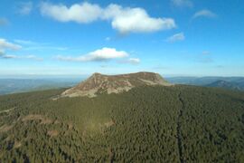
From top to bottom, left to right: Mont Mézenc, prefecture building in Le Puy-en-Velay, St Julien Basilica in Brioude and view of Boën-sur-Lignon | |
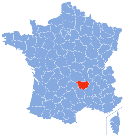
 Location of Haute-Loire in France | |
| الإحداثيات: 45°0′N 4°0′E / 45.000°N 4.000°E | |
| Country | France |
| Region | Auvergne-Rhône-Alpes |
| Prefecture | Le Puy-en-Velay |
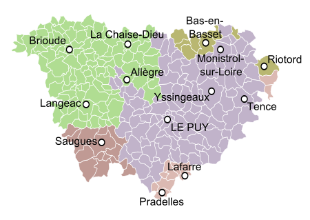
| Subprefectures | Brioude Yssingeaux |
| الحكومة | |
| • President of the Departmental Council | Marie-Agnès Petit[1] (LR) |
| المساحة | |
| • الإجمالي | 4٬977 كم² (1٬922 ميل²) |
| التعداد (يناير 2019) | |
| • الإجمالي | 227٬570 |
| • الترتيب | 87th |
| • الكثافة | 46/km2 (120/sq mi) |
| منطقة التوقيت | UTC+1 (CET) |
| • الصيف (التوقيت الصيفي) | UTC+2 (CEST) |
| Department number | 43 |
| Arrondissements | 3 |
| Cantons | 19 |
| Communes | 257 |
| ^1 French Land Register data, which exclude estuaries and lakes, ponds and glaciers larger than 1 km2 | |
اللوار الأعلى (بالفرنسية:Haute-Loire) هو إقليم فرنسي، يقع في جنوبي وسط فرنسا سمي باسم لورا الأعلى نسبة لنهر لوار.
التاريخ
يعتبر إقليم اللورا الأعلى واحد من الأقاليم الــ 83 التي تتشكل منها فرنسا، والتي أنشئت خلال الثورة الفرنسية يوم 4 مارس 1790، أنشئ الإقليم من أجزاء مناطق أوڤرن، لانگدوك، وليون السابقة.
الجغرافيا
يقع إقليم اللورا الأعلى في جزء من منطقة أوفيرني ويحيط بها كل من الإقليم التالية: لوار (بالفرنسية: Loire)، الأرديش (بالفرنسية: Ardèche)، لوزير (بالفرنسية: Lozère)، كانتال (بالفرنسية: Cantal)، وبوي دو دوم(بالفرنسية: Puy-de-Dôme).
يغطي إقليم اللورا الأعلى الروافد العليا لنهر لوار.
التعداد السكاني
ويطلق على سكان إقليم اللوار الأعلى اسم التيليغرينز (بالفرنسية: Altiligériens).
مشاهير المواطنين
السياحة
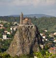
The department has attractive landscapes and is popular with tourists.[2] Le Puy-en-Velay has a historic cathedral at which pilgrims gather before starting their journey to Santiago de Compostela. The cathedral has been a UNESCO World Heritage Site since 1998, as part of the "Routes of Santiago de Compostela in France". Another site of pilgrimage is at Saint Michel d'Aiguilhe, a twelfth century chapel on top of a rocky pinnacle approached by a flight of 268 steps.[3]
انظر أيضاً
- Cantons of the Haute-Loire department
- Communes of the Haute-Loire department
- Arrondissements of the Haute-Loire department
المصادر
- ^ "Répertoire national des élus: les conseillers départementaux". data.gouv.fr, Plateforme ouverte des données publiques françaises (in الفرنسية). 4 May 2022.
- ^ خطأ استشهاد: وسم
<ref>غير صحيح؛ لا نص تم توفيره للمراجع المسماةAtchley - ^ "St. Michel d'Aiguilhe, Le Puy". Sacred destinations. Retrieved 1 October 2015.
وصلات خارجية
- (بالفرنسية) Prefecture website
- (بالفرنسية) Regional council website
- (إنگليزية) Haute-Loire at the Open Directory Project
- (إنگليزية) Tourist website
- (إنگليزية) The Haut-Allier Website concerned with the western half of the Haute Loire which follows the relatively unknown Allier valley and gorges
- (إنگليزية) (بالفرنسية) Regordane Info Independent portal for the Regordane Way or St Gilles Trail. (The Regordane Way crosses The Haute-Loire, commencing from Le Puy southwards)
- Pages using gadget WikiMiniAtlas
- CS1 الفرنسية-language sources (fr)
- Short description is different from Wikidata
- Articles containing أوكسيتان (بعد 1500)-language text
- Coordinates on Wikidata
- أقاليم فرنسا
- اللوار الأعلى
- Haute-Loire
- Massif Central
- 1790 establishments in France
- Departments of Auvergne-Rhône-Alpes
- States and territories established in 1790


