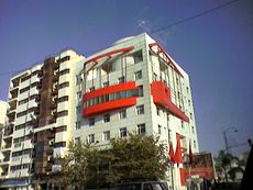
القنيطرة، المغرب
Kenitra
| |
|---|---|
Avenue Mohamed Diouri, Avenue Mohamed V, Kenitra | |
| الإحداثيات: 34°15′N 6°35′W / 34.250°N 6.583°W | |
| Country | |
| Region | Rabat-Salé-Kénitra |
| Province | Kenitra |
| Founded | 1912 |
| الحكومة | |
| • Mayor | Aziz Rabbah (PJD) (2009) |
| المساحة | |
| • الإجمالي | 112 كم² (43 ميل²) |
| المنسوب | 26 m (85 ft) |
| التعداد (2014)[1] | |
| • الإجمالي | 431٬282 |
| • الترتيب | 9th in Morocco |
| منطقة التوقيت | UTC+1 (CET) |
| الموقع الإلكتروني | http://www.alkenitra.com/ |
القنيطرة سادس أكبر مدينة مغربية، تطل على الساحل الأطلسي، على بعد 40 كم شمال العاصمة الرباط. يسكنها 800 ألف نسمة .مر منها الامريكيون والفرنسيون ،وفي حين بقيت بعض آثار الوجود الفرنسي ماثلة إلى اليوم بالمدينة، تلاشت بصمات الوجود الاميركي، إلا من بقايا يمكن تعقبها من خلال الروايات الشفاهية وبعض الصور في الحانات والنوادي التي كان يرتادها الاميركيون.
ومن بين ما تركه الأميركيون، ثمة مكان لا يكاد يعرفه حتى أبناء المدينة أنفسهم، يتعلق الأمر بقبر الجندي المجهول في مدخل قصبة المهدية، بجانب تمثال لسمكة وضعت شعارا لوجود المرسى البحري بالشاطئ، وسبب وجود هذا القبر، برأي محمد بلاط، أستاذ التاريخ ومهتم بأحداث القنيطرة، يكمن في المواجهات الضارية التي شهدتها قصبة المهدية بين الفرنسيين والأميركيين بداية الأربعينات من القرن الماضي.
. . . . . . . . . . . . . . . . . . . . . . . . . . . . . . . . . . . . . . . . . . . . . . . . . . . . . . . . . . . . . . . . . . . . . . . . . . . . . . . . . . . . . . . . . . . . . . . . . . . . . . . . . . . . . . . . . . . . . . . . . . . . . . . . . . . . . . . . . . . . . . . . . . . . . . . . . . . . . . . . . . . . . . . .
التاريخ
التاريخ القديم
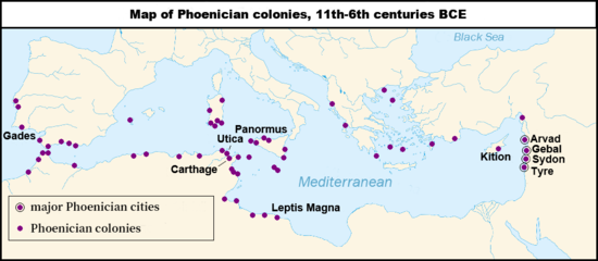
The history of the city begins with the foundation of a trading-post by the Carthaginian, known back then as Thamusida. Under the Antonine dynasty, a Venus temple was built there.[بحاجة لمصدر]
Before the French protectorate, the Kasbah Mahdiyya was the only construction in the area where the modern city can today be found.[بحاجة لمصدر]
التاريخ الاستعماري والحاضر
In March 1912 the French government and the Sultan of Morocco, Abd al-Hafid, signed the Treaty of Fez. Because of his growing unpopularity, the Sultan asked the French government for protection against the Berber rebel tribes surrounding Fez. France appointed Hubert Lyautey resident-general in Morocco.
General Lyautey restored peace and order to the country after crushing the tribal uprising. After safely moving the Sultan from Fez to the current capital city, Rabat, Lyautey began his task of civilian administration.
 كورنيش نهر سبو |
One of the first preoccupations of General Lyautey was to build ports along the inhabitable Atlantic coast where there were no natural harbors. He established Port Lyautey in 1912 as a French military fort and town. Its port, at the mouth of the Sebou river, was opened in 1913.[2] It soon became the best river port in Morocco.[3] Kenitra draws its name from a culvert built at Fouarat lake upstream of the kasbah. This culvert was destroyed in 1928. In 1933, the French officially named the locale "Port Lyautey".
It was renamed "Quneitra" in 1956 as Morocco gained its independence. The city has grown rapidly to be a shipping centre for agricultural produce (mainly fruit), fish, timber, and lead and zinc ores. The city's industrial area lies upstream of the port.
القاعدة البحرية الأمريكية
In November 1942, after Operation Torch, the Americans captured the Port Lyautey French fighter base as a military base, named Craw Field. For three months the 21st Engineer Aviation Regiment worked on the airfield. In February 1943 the Seabees of the 120th Naval Construction Battalion took over all construction activities.[4] The Navy ran the base until 1947, when the State Department negotiated reversion of control to France. In 1950, a $23,000,000 expansion was authorized, but then the Korean War diverted resources. In the 1950s, nearly 10,000 people were on the base making it the largest aggregation of Americans in any one overseas base outside Japan. Later, the base in Kenitra was expanded to become a U.S. Naval Air Station.[5]
The base was shared by both the US and Morocco through the Cold War. A small Navy communications out-station in Sidi Yahia closed in the late 1970s. The Air Station was closed in 1991.
وكان من نصيب القنيطرة أن تدخل قسرا من باب صفحة سوداء من تاريخ المغرب الحديث، حين انطلقت منها الطائرة التي قصفت الطائرة الملكية في سياق الانقلاب العسكري الفاشل عام 1972 الذي دبرته مجموعة من العسكريين كان على رأسهم الجنرال الدموي محمد أوفقير، الذي يحكي أبناء المدينة عنه أنه صال وجال في القنيطرة وعاقر الخمر في حاناتها وسهر الليالي في حي الحاج منصور على ايقاع أنغام «العيطة»، كما يسر بعض المولعين بنبش الماضي أن أوفقير ترك مقبرة كان يدفن بها عددا ممن عارضوا سياسته، في نفس المكان الذي كان يقيم به لياليه الحمراء. «لم تختر المدينة قدرها، بل هو من اختارها» يقول دارس تاريخ من أبناء القنيطرة
المناخ
Kenitra has a hot-summer Mediterranean climate (Köppen climate classification Csa).
| Climate data for Kenitra | |||||||||||||
|---|---|---|---|---|---|---|---|---|---|---|---|---|---|
| Month | Jan | Feb | Mar | Apr | May | Jun | Jul | Aug | Sep | Oct | Nov | Dec | Year |
| Mean daily maximum °C (°F) | 17.3 (63.1) |
18.1 (64.6) |
19.5 (67.1) |
20.6 (69.1) |
22.8 (73.0) |
24.8 (76.6) |
27.4 (81.3) |
27.9 (82.2) |
27.1 (80.8) |
24.7 (76.5) |
21.1 (70.0) |
18.0 (64.4) |
22.4 (72.3) |
| Daily mean °C (°F) | 12.3 (54.1) |
13.3 (55.9) |
14.4 (57.9) |
15.7 (60.3) |
18.1 (64.6) |
20.6 (69.1) |
23.0 (73.4) |
23.3 (73.9) |
22.2 (72.0) |
19.4 (66.9) |
15.9 (60.6) |
13.0 (55.4) |
17.6 (63.7) |
| Mean daily minimum °C (°F) | 7.2 (45.0) |
8.5 (47.3) |
9.3 (48.7) |
10.9 (51.6) |
13.4 (56.1) |
16.3 (61.3) |
18.6 (65.5) |
18.7 (65.7) |
17.4 (63.3) |
14.1 (57.4) |
10.7 (51.3) |
8.0 (46.4) |
12.8 (55.0) |
| Average precipitation mm (inches) | 97.6 (3.84) |
94.6 (3.72) |
74.9 (2.95) |
67.3 (2.65) |
37.8 (1.49) |
5.8 (0.23) |
0.4 (0.02) |
0.6 (0.02) |
10.7 (0.42) |
63.0 (2.48) |
130.0 (5.12) |
135.9 (5.35) |
718.6 (28.29) |
| Average precipitation days | 12.3 | 12.7 | 12.2 | 11.0 | 7.6 | 2.9 | 0.3 | 0.7 | 2.8 | 8.6 | 13.3 | 14.0 | 98.4 |
| Mean monthly sunshine hours | 165.0 | 170.4 | 229.8 | 255.8 | 296.7 | 302.9 | 326.5 | 312.8 | 263.8 | 227.2 | 174.6 | 161.4 | 2٬886٫9 |
| Source: NOAA[6] | |||||||||||||
التعداد
| 1982 | 1994 | 2004 | 2010 | 2014 |
|---|---|---|---|---|
| 187٬000 | 291٬000 | 358٬000 | 400٬000 | 430٬000 |
. . . . . . . . . . . . . . . . . . . . . . . . . . . . . . . . . . . . . . . . . . . . . . . . . . . . . . . . . . . . . . . . . . . . . . . . . . . . . . . . . . . . . . . . . . . . . . . . . . . . . . . . . . . . . . . . . . . . . . . . . . . . . . . . . . . . . . . . . . . . . . . . . . . . . . . . . . . . . . . . . . . . . . . .
أحياء المدينة
- المدينة القديمة
- الخبازات
- ساحة الشهداء
- المدينة الحديثة
- عرصة القاضي
- بـير الرامي الغربية
- بـير الرامي الشرقية
- ميموزا
- المدينة العليا
- أولاد أوجيه
- المنزه
- المغرب العربي
- الساكنية
- حي الفتح
- حي لارما
- وريدة
- للا مريم
- العلامة
- بام
- المنطقة المطهرة
- العصام
- الحاج منصور
- لاسيتي
- الصياد
- عين السبع
- عين عريس
- باب فاس
- الحي الصناعي
- الحوزية
الجامعات
تضم الجامعة الكليات و المعاهد التالية:
مشاهير القنيطرة
- محمد بندفعة
- الزجال : تقي الدين تاجي
- العداء : سعيد عويطة
- أمينة أيت حمو
- اللاعب الدولي يوسف شيبو
- الزجال:عبدالرحمان فهمي
- إسماعيل فروخي
- الهداف محمد البوساتي
- صلاح الدين فاضل
- زكرياء بوتخيل
- الديوري
- الجيلالي بناني
- الممثل العربي الساسي
- المطربة لطيفة رأفت
- خليفة العبد
- محمد دومو
- اللاعب الدولي يوسف شيبو
- الطاهر بن جلون
- الصحفي الرياضي محمد لحمر
- عبدالعزيز الرباح
- الصحفي :إدريس ولد القابلة
انظر أيضاً
الهامش
- ^ "POPULATION LÉGALE DES RÉGIONS, PROVINCES, PRÉFECTURES, MUNICIPALITÉS, ARRONDISSEMENTS ET COMMUNES DU ROYAUME D'APRÈS LES RÉSULTATS DU RGPH 2014" (in العربية and الفرنسية). High Commission for Planning, Morocco. 8 April 2015. Retrieved 29 September 2017.
- ^ Kénitra depuis 1912 Archived 2003-10-03 at the Wayback Machine (in فرنسية)
- ^ In Morocco by Edith Wharton, New York: Charles Scribner's Sons 1920
- ^ Port Lyautey, Chapter XX, The Mediterranean Area, Building the Navy's Bases in World War II, History of the Bureau of Yards and Docks and the Civil Engineer Corp, 1940-1946, Volume II, UNITED STATES GOVERNMENT PRINTING OFFICE, WASHINGTON, p. 80[1]
- ^ "History of Port Lyautey".
- ^ "Kenitra Climate Normals 1961–1990". National Oceanic and Atmospheric Administration. Retrieved March 16, 2015.
- ^ "Kenitra, Morocco Metro Area Population 1950-2020 – macrotrends.com". macrotrends.com.
وصلات خارجية
- CS1 الفرنسية-language sources (fr)
- Articles with فرنسية-language sources (fr)
- Pages using gadget WikiMiniAtlas
- Short description is different from Wikidata
- Articles with hatnote templates targeting a nonexistent page
- Articles containing explicitly cited عربية-language text
- Articles with unsourced statements from September 2020
- Coordinates on Wikidata
- القنيطرة، المغرب
- Port cities and towns on the Moroccan Atlantic Coast
- Populated places in Kénitra Province
- Municipalities of Morocco
- تأسيسات 1912 في المغرب
- Provincial capitals in Morocco
- مدن المغرب


