پلدشت
پلدشت
پلدشت Poldasht | |
|---|---|
مدينة | |
 | |
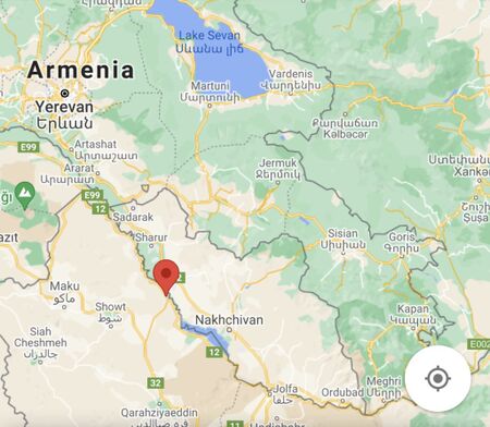
| الإحداثيات: 39°20′53″N 45°04′16″E / 39.34806°N 45.07111°E | |
| البلد | |
| المحافظة | أذربيجان الغربية |
| المقاطعة | پلدشت |
| بخش | Central |
| التعداد (2016 Census) | |
| • الإجمالي | 11٬472 [1] |
| منطقة التوقيت | UTC+3:30 (IRST) |
| • الصيف (التوقيت الصيفي) | UTC+4:30 (IRDT) |
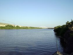
پلدشت (فارسية: پلدشت؛ Poldasht وتُرَوْمَن Pol Dasht, Pol’desht, Pol-e Dasht, and Pul Dasht; also known as Araplar)[2] is a city and capital of Poldasht County, West Azerbaijan Province, Iran. At the 2016 census, its population was 11,472, in 3,377 families.[3] The city lies on the western bank of the Aras River.
Poldasht is a Persian word meaning arable land by the bridge. The city is situated near the border crossing with the Nakhchivan Autonomous Republic of Azerbaijan. Across the Poldasht-Shah Takhti Bridge over the Aras is the Azerbaijani village of Şahtaxtı. It is one of the two Iran-Nakhchivan border crossings; the other is located near the city of Jolfa in East Azerbaijan Province. Also adjacent to Poldasht is the Aras River Dam.
الهامش
- ^ "Statistical Center of Iran > Home".
- ^ پلدشت can be found at GEOnet Names Server, at this link, by opening the Advanced Search box, entering "-3078448" in the "Unique Feature Id" form, and clicking on "Search Database".
- ^ "تعداد جمهورية إيران الإسلامية 1385 (2006)". جمهورية إيران الإسلامية. Archived from the original (Excel) on 2011-11-11.
{{cite web}}:|archive-date=/|archive-url=timestamp mismatch; 2011-09-20 suggested (help)


