شارلوت تاون
شارلوت تاون | |
|---|---|
مدينة | |
| City of Charlottetown | |
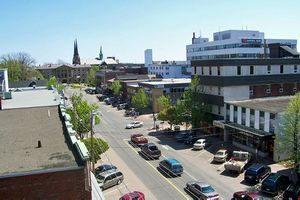
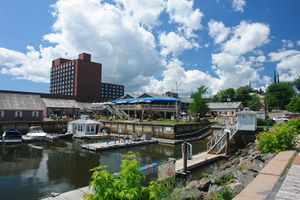
من أعلى لأسفل، من اليسار إلى اليمين: أفق شارلوت تاون من Fort Amherst, Water Street in Downtown Charlottetown, Charlottetown Harbour, Queen's Square | |
| الكنية: | |
| الشعار: | |
| الإحداثيات: 46°14′20″N 63°07′45″W / 46.23889°N 63.12917°W | |
| البلد | |
| المقاطعة | جزيرة الأمير إدوارد |
| County | Queens County |
| تأسست | 1764 |
| City | April 17, 1855[2] |
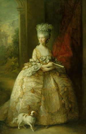
| السمِيْ | شارلوته من مكلنبورگ-شترلِتس |
| الحكومة | |
| • عمدة المدينة | Clifford J. Lee |
| • Governing body | Charlottetown City Council |
| المساحة | |
| • مدينة | 44٫33 كم² (17٫1 ميل²) |
| • الحضر | 57٫89 كم² (22٫35 ميل²) |
| • العمران | 798٫54 كم² (308٫32 ميل²) |
| المنسوب | Sea Level to 49 m (0 to 161 ft) |
| التعداد | |
| • مدينة | 36٬094 |
| • الكثافة | 779٫7/km2 (2٬019/sq mi) |
| • Urban | 42٬602 |
| • الكثافة الحضرية | 735٫9/km2 (1٬906/sq mi) |
| • العمرانية | 69٬325 |
| • الكثافة العمرانية | 80٫8/km2 (209/sq mi) |
| • Change (2011–16) | ▲5٫8% |
| • Dwellings | 16٬060 |
| صفة المواطن | Charlottetonian, Townie, From Town |
| منطقة التوقيت | UTC-4 (Atlantic (AST)) |
| • الصيف (التوقيت الصيفي) | UTC-3 (ADT) |
| Postal code | C1A — E |
| مفتاح الهاتف | 902 |
| NTS Map | 011L03 |
| GNBC Code | BAARG |
| الموقع الإلكتروني | city.charlottetown.pe.ca/ |
شارلوت تاون (Charlottetown ؛ /ˈʃɑːrləttaʊn/؛ النطق الفرنسي: [ʃaʁlɔt.tawn]؛ غالية اسكتلندية: Baile Sheàrlot) هي عاصمة وأكبر مدن المقاطعة الكندية جزيرة الأمير إدوارد، ومقر county seat of Queens County. مسماة على اسم شارلوته من مكلنبورگ-شترلِتس، الملكة القرينة للمملكة المتحدة، شارلوت تاون كانت في الأصل غير بلدة مُشهرة تحولت إلى مدينة في 1855.[2]
It was famously the site of the Charlottetown Conference in 1864, the first gathering of Canadian and Maritime statesmen to debate the proposed Maritime Union and the more persuasive British North American Union, now known as Canadian Confederation. From this, the city adopted as its motto "Cunabula Foederis" – "Birthplace of Confederation".
The population of Charlottetown in the 2016 census was 36,094;[7] this forms the centre of a census agglomeration of 69,325,[6] which is slightly less than half of the province's population (142,907[6]).
التاريخ
التاريخ المبكر (1720–1900)
أول مستوطنين أوروبيين في المنطقة كانوا فرنسيين؛ أفراد من حصن لويبورگ أسسوا مستوطنة في 1720 بإسم Port La Joye على الجانب الجنوبي الغربي للمرفأ مقابل المدينة الحالية. تلك المستوطنة كانت بقيادة ميشل هاشيه-گالان، الذي استخدم سفينته لنقل المستوطنين الأكاديين من لويبورگ.
أثناء حرب الملك جورج، استولى البريطانيون على الجزيرة. أرسل الضابط الفرنسي رامزاي 500 رجل لمهاجمة القوات البريطانية في Battle at Port-la-Joye. نجح الفرنسيون في قتل أو أسر أربعين من القوات البريطانية.[8]
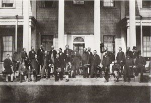
Between September 1–8, 1864, Charlottetown hosted what is now termed the Charlottetown Conference. Although many of the meetings and negotiations which would lead to Canadian Confederation were held in Province House, various social events spilled over into the surrounding community.
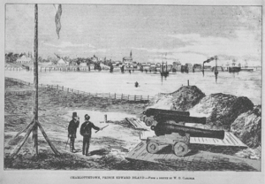
Prince Edward Island entered Confederation on July 1, 1873. Aside from being the seat of colonial government, the community came to be noted during the early nineteenth century for shipbuilding and its lumber industry as well as being a fishing port. The shipbuilding industry declined in the latter part of the nineteenth century.
الجغرافيا

Charlottetown is situated on its namesake harbour, which is formed by the confluence of three rivers in the central part of the island's south shore. The harbour opens onto the مضيق نورثمبرلاند. The city is roughly V-shaped (pointed to the south) and constrained by the North (Yorke) and the Hillsborough (East) Rivers to the west and east.
الطقس
| أخفClimate data for مطار شارلوت تاون, 1981–2010 normals, extremes 1872–present[أ] | |||||||||||||
|---|---|---|---|---|---|---|---|---|---|---|---|---|---|
| Month | Jan | Feb | Mar | Apr | May | Jun | Jul | Aug | Sep | Oct | Nov | Dec | Year |
| Record high °C (°F) | 15.1 (59.2) |
13.3 (55.9) |
24.5 (76.1) |
26.7 (80.1) |
31.7 (89.1) |
32.2 (90.0) |
33.9 (93.0) |
36.7 (98.1) |
31.5 (88.7) |
27.8 (82.0) |
21.3 (70.3) |
16.7 (62.1) |
36.7 (98.1) |
| Mean daily maximum °C (°F) | −3.4 (25.9) |
−2.9 (26.8) |
0.9 (33.6) |
7.2 (45.0) |
14.3 (57.7) |
19.4 (66.9) |
23.3 (73.9) |
22.8 (73.0) |
18.6 (65.5) |
12.3 (54.1) |
6.3 (43.3) |
0.5 (32.9) |
9.9 (49.8) |
| Daily mean °C (°F) | −7.7 (18.1) |
−7.3 (18.9) |
−3.1 (26.4) |
3.1 (37.6) |
9.2 (48.6) |
14.5 (58.1) |
18.7 (65.7) |
18.3 (64.9) |
14.1 (57.4) |
8.3 (46.9) |
2.9 (37.2) |
−3.3 (26.1) |
5.7 (42.3) |
| Mean daily minimum °C (°F) | −12.1 (10.2) |
−11.7 (10.9) |
−7.0 (19.4) |
−1.2 (29.8) |
4.1 (39.4) |
9.6 (49.3) |
14.1 (57.4) |
13.7 (56.7) |
9.6 (49.3) |
4.4 (39.9) |
−0.5 (31.1) |
−7.0 (19.4) |
1.3 (34.3) |
| Record low °C (°F) | −32.8 (−27.0) |
−30.6 (−23.1) |
−27.2 (−17.0) |
−16.1 (3.0) |
−6.7 (19.9) |
−1.1 (30.0) |
2.8 (37.0) |
2.0 (35.6) |
−0.6 (30.9) |
−6.7 (19.9) |
−17.2 (1.0) |
−28.1 (−18.6) |
−32.8 (−27.0) |
| Average precipitation mm (inches) | 101.0 (3.98) |
83.2 (3.28) |
86.3 (3.40) |
83.7 (3.30) |
91.0 (3.58) |
98.8 (3.89) |
79.9 (3.15) |
95.7 (3.77) |
95.9 (3.78) |
112.2 (4.42) |
112.5 (4.43) |
118.1 (4.65) |
1٬158٫2 (45.60) |
| Average rainfall mm (inches) | 34.1 (1.34) |
29.8 (1.17) |
44.1 (1.74) |
59.7 (2.35) |
87.2 (3.43) |
98.8 (3.89) |
79.9 (3.15) |
95.7 (3.77) |
95.9 (3.78) |
110.3 (4.34) |
93.0 (3.66) |
58.6 (2.31) |
887.1 (34.93) |
| Average snowfall cm (inches) | 73.3 (28.9) |
58.3 (23.0) |
44.1 (17.4) |
24.4 (9.6) |
3.7 (1.5) |
0.0 (0.0) |
0.0 (0.0) |
0.0 (0.0) |
0.0 (0.0) |
1.7 (0.7) |
19.2 (7.6) |
65.6 (25.8) |
290.4 (114.3) |
| Average precipitation days (≥ 0.2 mm) | 19.3 | 15.7 | 15.9 | 15.3 | 14.1 | 13.2 | 12.6 | 11.7 | 12.8 | 15.0 | 16.9 | 19.8 | 182.4 |
| Average rainy days (≥ 0.2 mm) | 6.3 | 5.0 | 7.5 | 11.6 | 13.8 | 13.2 | 12.6 | 11.7 | 12.8 | 14.6 | 13.0 | 8.6 | 130.8 |
| Average snowy days (≥ 0.2 cm) | 17.3 | 13.7 | 12.2 | 6.4 | 0.93 | 0.0 | 0.0 | 0.0 | 0.03 | 1.0 | 6.4 | 15.3 | 73.2 |
| Mean monthly sunshine hours | 108.9 | 109.1 | 141.3 | 148.2 | 197.1 | 219.8 | 253.6 | 219.0 | 181.0 | 123.9 | 62.9 | 75.8 | 1٬840٫5 |
| Percent possible sunshine | 38.8 | 37.6 | 38.3 | 36.5 | 42.5 | 46.6 | 53.2 | 49.9 | 47.9 | 36.5 | 22.1 | 28.1 | 39.8 |
| Source: Environment Canada[9][10][11][12][13] | |||||||||||||
أفق المدينة
الديمغرافيا
| Year | Pop. | ±% |
|---|---|---|
| 1851 | 4٬717 | — |
| 1861 | 6٬706 | +42.2% |
| 1871 | 7٬872 | +17.4% |
| 1881 | 10٬345 | +31.4% |
| 1891 | 10٬098 | −2.4% |
| 1901 | 10٬718 | +6.1% |
| 1911 | 9٬883 | −7.8% |
| 1921 | 10٬814 | +9.4% |
| 1931 | 12٬361 | +14.3% |
| 1941 | 14٬460 | +17.0% |
| 1951 | 15٬887 | +9.9% |
| 1961 | 18٬318 | +15.3% |
| 1971 | 19٬133 | +4.4% |
| 1981 | 15٬282 | −20.1% |
| 1991 | 15٬396 | +0.7% |
| 1996 | 32٬531 | +111.3% |
| 2001 | 32٬245 | −0.9% |
| 2006 | 32٬174 | −0.2% |
| 2011 | 34٬562 | +7.4% |
| [14] | ||
| Ethnic Origin | Population | Percent |
|---|---|---|
| Scottish | 24,345 | 42.2% |
| Canadian | 20,530 | 35.6% |
| English | 19,205 | 33.3% |
| Irish | 18,775 | 32.5% |
| French | 10,675 | 18.5% |
| German | 3,335 | 5.8% |
| Dutch | 2,000 | 3.5% |
| First Nations | 1,390 | 2.4% |
| Welsh | 1,310 | 2.3% |
| Acadian | 1,070 | 1.9% |
| Lebanese | 510 | 0.9% |
الاقتصاد
التعليم
English public schooling (gr. K-12) in Charlottetown is provided by the English Language School Board.[16] French public schooling (gr. K-12) in the city is provided by the Commission scolaire de langue française.
The city has two independent schools: Immanuel Christian School and Grace Christian School.
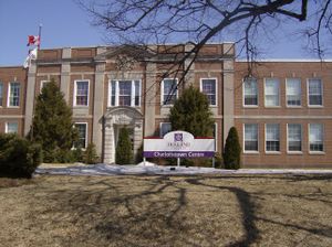
شارلوت تاون هي مقر جامعة جزيرة الأمير إدوارد، التي لديها برامج في الآداب والتعليم والعلوم والأعمال والتمريض. الجامعة الإقليمية تضم أيضاً الكلية البيطرية الأطلسية. ولجامعة UPEI عدد من الفرق الرياضية التي تنافس في الهوكي وكرة القدم والرجبي والسلة والطائرة. تلك الفرق الرياضية تسمى الفهود The Panthers.
الهامش
- ^ "City of Charlottetown: Welcome to the City of Charlottetown". City of Charlottetown. Retrieved October 9, 2013.
- ^ أ ب An Act to incorporate the town of Charlottetown
- ^ قالب:SCref
- ^ قالب:SCref
- ^ قالب:SCref
- ^ أ ب ت Statistics Canada. "Census Profile, 2016 Census". Retrieved 2018-02-13.
{{cite web}}: Cite has empty unknown parameter:|month=(help) - ^ أ ب http://www12.statcan.gc.ca/census-recensement/2016/dp-pd/prof/details/page.cfm?Lang=E&Geo1=CSD&Code1=1102075&Geo2=PR&Code2=11&Data=Count&SearchText=Charlottetown&SearchType=Begins&SearchPR=01&B1=All&TABID=1
- ^ Historical Biographies, Nova Scotia: Charles des Champs de BoishĂŠbert (1729–1797)
- ^ خطأ استشهاد: وسم
<ref>غير صحيح؛ لا نص تم توفيره للمراجع المسماةCCN - ^ "Charlottetown A". Canadian Climate Normals 1981–2010. Environment Canada. Retrieved 9 April 2016.
- ^ "Charlottetown". Canadian Climate Data. Environment Canada. Retrieved February 29, 2016.
- ^ "Charlottetown CDA". Canadian Climate Normals 1971–2000. Environment Canada. Retrieved 9 April 2016.
- ^ "March 2012". Canadian Climate Data. Environment Canada. Retrieved 9 June 2016.
- ^ [1], Censuses 1871-1941
- ^ Ethnocultural Portrait of Canada Highlight Tables: Charlottetown
- ^ "New School Board".
ملاحظات
- ^ Extreme high and low temperatures in the table below are from Charlottetown (April 1872 to December 1934), Charlottetown CDA (January 1935 to March 1943), and Charlottetown Airport (April 1943 to present).
وصلات خارجية
 Charlottetown travel guide from Wikivoyage
- City of Charlottetown – municipal website
- Prince Edward Island – Memories of WWII
- Pages using gadget WikiMiniAtlas
- Short description is different from Wikidata
- Pages using infobox settlement with possible motto list
- Coordinates on Wikidata
- صفحات تستخدم جدول مستوطنة بقائمة محتملة لصفات المواطن
- Articles containing غالية اسكتلندية-language text
- Pages using Lang-xx templates
- شارلوت تاون
- أماكن مأهولة تأسست في 1764
- أماكن ساحلية مأهولة في كندا
- عواصم استعمارية سابقة في كندا
- تأسيسات 1764 في الامبراطورية البريطانية


