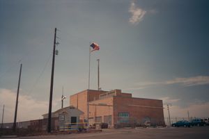
مقاطعة بيوت، أيداهو
Butte County | |
|---|---|
 | |
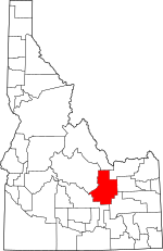
 الموقع ضمن ولاية Idaho | |
 موقع Idaho ضمن الولايات المتحدة | |
| الإحداثيات: خطأ لوا في وحدة:Coordinates على السطر 612: bad argument #1 to 'sub' (string expected, got nil). | |
| البلد | |
| State | |
| تأسست | February 6, 1917 |
| السمِيْ | Big Southern Butte |
| Seat | Arco |
| Largest city | Arco |
| المساحة | |
| • الإجمالي | 2٬234 ميل² (5٬790 كم²) |
| • البر | 2٬232 ميل² (5٬780 كم²) |
| • الماء | 2٫0 ميل² (5 كم²) 0.1%% |
| التعداد | |
| • Estimate (2017) | 2٬602 |
| • الكثافة | 1٫3/sq mi (0٫5/km2) |
| منطقة التوقيت | UTC−7 (Mountain) |
| • الصيف (التوقيت الصيفي) | UTC−6 (MDT) |
| Congressional district | 2nd |
مقاطعة بوتي إنگليزية: Butte County هي إحدى مقاطعات ولاية أيداهو في الولايات المتحدة الأمريكية.
. . . . . . . . . . . . . . . . . . . . . . . . . . . . . . . . . . . . . . . . . . . . . . . . . . . . . . . . . . . . . . . . . . . . . . . . . . . . . . . . . . . . . . . . . . . . . . . . . . . . . . . . . . . . . . . . . . . . . . . . . . . . . . . . . . . . . . . . . . . . . . . . . . . . . . . . . . . . . . . . . . . . . . . .
Demographics
| التعداد التاريخي | |||
|---|---|---|---|
| التعداد | Pop. | %± | |
| 1920 | 2٬940 | — | |
| 1930 | 1٬934 | −34٫2% | |
| 1940 | 1٬877 | −2٫9% | |
| 1950 | 2٬722 | 45�0% | |
| 1960 | 3٬498 | 28٫5% | |
| 1970 | 2٬925 | −16٫4% | |
| 1980 | 3٬342 | 14٫3% | |
| 1990 | 2٬918 | −12٫7% | |
| 2000 | 2٬899 | −0٫7% | |
| 2010 | 2٬891 | −0٫3% | |
| 2017 (تق.) | 2٬602 | [1] | −10�0% |
| U.S. Decennial Census[2] 1790-1960[3] 1900-1990[4] 1990-2000[5] 2010-2013[6] | |||
Politics
Presidential elections results
| Year | Republican | Democratic | Third parties |
|---|---|---|---|
| 2016 | 74.3% 914 | 13.0% 160 | 12.7% 156 |
| 2012 | 77.8% 1,001 | 20.1% 258 | 2.1% 27 |
| 2008 | 74.9% 1,056 | 22.6% 318 | 2.6% 36 |
| 2004 | 76.6% 1,077 | 22.8% 321 | 0.6% 8 |
| 2000 | 72.2% 1,054 | 24.3% 354 | 3.6% 52 |
| 1996 | 49.7% 741 | 34.0% 507 | 16.3% 243 |
| 1992 | 40.1% 602 | 28.8% 433 | 31.1% 468 |
| 1988 | 62.3% 899 | 36.1% 521 | 1.7% 24 |
| 1984 | 73.9% 1,245 | 25.5% 429 | 0.7% 11 |
| 1980 | 72.2% 1,275 | 24.0% 424 | 3.7% 66 |
| 1976 | 51.2% 751 | 45.2% 663 | 3.7% 54 |
| 1972 | 56.5% 788 | 27.7% 387 | 15.8% 221 |
| 1968 | 51.0% 691 | 38.4% 521 | 10.6% 144 |
| 1964 | 43.4% 649 | 56.7% 848 | |
| 1960 | 40.5% 680 | 59.6% 1,001 | |
| 1956 | 53.6% 774 | 46.4% 669 | |
| 1952 | 66.0% 916 | 34.1% 473 | |
| 1948 | 48.7% 412 | 50.4% 426 | 1.0% 8 |
| 1944 | 50.8% 431 | 49.0% 416 | 0.2% 2 |
| 1940 | 48.6% 423 | 51.4% 448 | |
| 1936 | 35.9% 312 | 62.8% 546 | 1.3% 11 |
| 1932 | 40.3% 396 | 59.2% 581 | 0.5% 5 |
| 1928 | 61.9% 493 | 37.8% 301 | 0.4% 3 |
| 1924 | 46.0% 409 | 32.0% 284 | 22.1% 196 |
| 1920 | 67.2% 646 | 32.9% 316 |
See also
References
- ^ "Population and Housing Unit Estimates". Retrieved Apr 7, 2018.
- ^ "U.S. Decennial Census". United States Census Bureau. Archived from the original on May 12, 2015. Retrieved June 28, 2014.
{{cite web}}: Unknown parameter|deadurl=ignored (|url-status=suggested) (help) - ^ "Historical Census Browser". University of Virginia Library. Retrieved June 28, 2014.
- ^ "Population of Counties by Decennial Census: 1900 to 1990". United States Census Bureau. Retrieved June 28, 2014.
- ^ "Census 2000 PHC-T-4. Ranking Tables for Counties: 1990 and 2000" (PDF). United States Census Bureau. Retrieved June 28, 2014.
- ^ خطأ استشهاد: وسم
<ref>غير صحيح؛ لا نص تم توفيره للمراجع المسماةQF - ^ Leip, David. "Dave Leip's Atlas of U.S. Presidential Elections". Uselectionatlas.org. Retrieved 2 January 2018.
وصلات خارجية

|
Clark County | Lemhi County and Custer County | 
| |
| Jefferson County | ||||
| Bingham County | Blaine County |
تصنيفات:
- CS1 errors: unsupported parameter
- Pages using gadget WikiMiniAtlas
- Short description is different from Wikidata
- مقاطعات Idaho
- Articles containing إنگليزية-language text
- Pages using Lang-xx templates
- Pages using US Census population needing update
- Coordinates on Wikidata
- مقاطعة بيوت، أيداهو
- 1917 establishments in Idaho
- Populated places established in 1917
- مقاطعات ولاية أيداهو الأمريكية
