مقاطعة جفرسون، آيداهو
Jefferson County | |
|---|---|
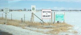
 الدخول إلى مقاطعة جفرسون في گرانت، آيداهو. | |
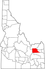
 الموقع ضمن ولاية Idaho | |
 موقع Idaho ضمن الولايات المتحدة | |
| الإحداثيات: 43°49′N 112°19′W / 43.82°N 112.31°W | |
| البلد | |
| State | |
| تأسست | February 18, 1913 |
| السمِيْ | توماس جفرسون |
| Seat | Rigby |
| Largest city | Rigby |
| المساحة | |
| • الإجمالي | 1٬106 ميل² (2٬860 كم²) |
| • البر | 1٬094 ميل² (2٬830 كم²) |
| • الماء | 12 ميل² (30 كم²) 1.1% |
| التعداد (2020) | |
| • الإجمالي | 30٬891 |
| • الكثافة | 28/sq mi (11/km2) |
| منطقة التوقيت | UTC−7 (Mountain) |
| • الصيف (التوقيت الصيفي) | UTC−6 (MDT) |
| Congressional district | 2nd |
| الموقع الإلكتروني | www |
مقاطعة جفرسون إنگليزية: Jefferson County هي إحدى مقاطعات ولاية أيداهو في الولايات المتحدة الأمريكية.
المقاطعات المجاورة
- Clark County - north
- Fremont County - northeast
- Madison County - east
- Bonneville County - south
- Bingham County - southwest
- Butte County - west
الطرق السريعة الرئيسية
المناطق المحمية الوطنية
الديمغرافيا
| التعداد التاريخي | |||
|---|---|---|---|
| التعداد | Pop. | %± | |
| 1920 | 9٬441 | — | |
| 1930 | 9٬171 | −2٫9% | |
| 1940 | 10٬762 | 17٫3% | |
| 1950 | 10٬495 | −2٫5% | |
| 1960 | 11٬672 | 11٫2% | |
| 1970 | 11٬619 | −0٫5% | |
| 1980 | 15٬304 | 31٫7% | |
| 1990 | 16٬543 | 8٫1% | |
| 2000 | 19٬155 | 15٫8% | |
| 2010 | 26٬140 | 36٫5% | |
| 2020 | 30٬891 | 18٫2% | |
| U.S. Decennial Census[1] 1790-1960[2] 1900-1990[3] 1990-2000[4] 2010-2020[5] 2020[6] | |||
السياسة
نتائج الانتخابات الرئاسية
| Year | Republican | Democratic | Third parties |
|---|---|---|---|
| 2020 | 85.3% 12,099 | 11.7% 1,661 | 3.0% 420 |
| 2016 | 73.5% 8,436 | 8.5% 976 | 18.0% 2,063 |
| 2012 | 86.9% 9,895 | 11.5% 1,303 | 1.6% 183 |
| 2008 | 81.8% 8,540 | 15.7% 1,641 | 2.5% 260 |
| 2004 | 86.5% 7,703 | 12.2% 1,084 | 1.3% 119 |
| 2000 | 82.7% 6,480 | 14.0% 1,100 | 3.3% 256 |
| 1996 | 66.5% 4,925 | 19.3% 1,427 | 14.2% 1,051 |
| 1992 | 48.8% 3,471 | 13.7% 978 | 37.5% 2,667 |
| 1988 | 79.6% 5,295 | 18.0% 1,198 | 2.4% 156 |
| 1984 | 87.9% 5,770 | 11.3% 743 | 0.8% 50 |
| 1980 | 84.5% 5,860 | 12.0% 833 | 3.5% 240 |
| 1976 | 65.1% 3,599 | 31.6% 1,745 | 3.3% 181 |
| 1972 | 58.4% 2,983 | 14.0% 715 | 27.6% 1,412 |
| 1968 | 61.5% 2,927 | 20.1% 955 | 18.5% 879 |
| 1964 | 57.1% 2,740 | 42.9% 2,061 | |
| 1960 | 52.5% 2,625 | 47.5% 2,374 | |
| 1956 | 60.1% 2,748 | 39.9% 1,823 | |
| 1952 | 66.8% 2,970 | 33.2% 1,474 | 0.0% 2 |
| 1948 | 41.8% 1,490 | 56.5% 2,017 | 1.7% 61 |
| 1944 | 39.8% 1,458 | 60.0% 2,198 | 0.3% 9 |
| 1940 | 39.3% 1,717 | 60.3% 2,631 | 0.4% 16 |
| 1936 | 26.8% 1,037 | 71.8% 2,776 | 1.3% 51 |
| 1932 | 31.5% 1,177 | 67.0% 2,501 | 1.5% 54 |
| 1928 | 55.2% 1,671 | 44.6% 1,350 | 0.2% 7 |
| 1924 | 50.1% 1,393 | 11.0% 305 | 39.0% 1,084 |
| 1920 | 70.8% 1,794 | 29.2% 741 | |
| 1916 | 36.4% 993 | 58.9% 1,606 | 4.6% 126 |
Communities
Cities
Unincorporated communities
Notable people
- Earl W. Bascom, rodeo pioneer, inventor, actor, cowboy artist, inductee of the Idaho Rodeo Hall of Fame.
- Philo Farnsworth, American inventor and television pioneer.
- Pat Friday, American singer.
See also
References
- ^ "U.S. Decennial Census". United States Census Bureau. Retrieved يونيو 30, 2014.
- ^ "Historical Census Browser". University of Virginia Library. Retrieved يونيو 30, 2014.
- ^ "Population of Counties by Decennial Census: 1900 to 1990". United States Census Bureau. Retrieved يونيو 30, 2014.
- ^ "Census 2000 PHC-T-4. Ranking Tables for Counties: 1990 and 2000" (PDF). United States Census Bureau. Retrieved يونيو 30, 2014.
- ^ خطأ استشهاد: وسم
<ref>غير صحيح؛ لا نص تم توفيره للمراجع المسماةQF - ^ 2020 Population and Housing State Data | Utah
- ^ "County Population Totals: 2010-2020". Retrieved يونيو 23, 2021.
- ^ Leip, David. "Dave Leip's Atlas of U.S. Presidential Elections". uselectionatlas.org. Retrieved أبريل 4, 2018.
External links

|
Fremont County | Clark County | 
| |
| Madison County | Butte County | |||
| Bonneville County | Bingham County |
تصنيفات:
- Pages using gadget WikiMiniAtlas
- Short description is different from Wikidata
- Use mdy dates from October 2021
- Coordinates on Wikidata
- مقاطعات Idaho
- Pages using infobox U.S. county with unknown parameters
- Articles containing إنگليزية-language text
- Pages using Lang-xx templates
- Jefferson County, Idaho
- مقاطعات أيداهو
- 1913 establishments in Idaho
- Populated places established in 1913
- Idaho Falls metropolitan area counties
