مقاطعة باري، مزوري
Barry County | |
|---|---|
 Barry County Courthouse in Cassville | |
 الموقع ضمن ولاية Missouri | |
 موقع Missouri ضمن الولايات المتحدة | |
| الإحداثيات: خطأ لوا في وحدة:Coordinates على السطر 612: bad argument #1 to 'sub' (string expected, got nil). | |
| البلد | |
| State | |
| تأسست | January 5, 1835 |
| السمِيْ | وليام تيلر باري |
| Seat | كاسڤل |
| Largest city | مونـِت |
| المساحة | |
| • الإجمالي | 791 ميل² (2٬050 كم²) |
| • البر | 778 ميل² (2٬020 كم²) |
| • الماء | 13 ميل² (30 كم²) 1.6%% |
| التعداد | |
| • Estimate (2015) | 35٬829 |
| • الكثافة | 46/sq mi (18/km2) |
| منطقة التوقيت | UTC−6 (Central) |
| • الصيف (التوقيت الصيفي) | UTC−5 (CDT) |
| Congressional district | 7th |
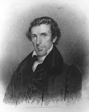
مقاطعة باري إنگليزية: Barry County هي إحدى المقاطعات في ولاية مزوري في الولايات المتحدة الأمريكية. ومقر المقاطعة هو كاسڤل.[1] المقاطعة أنشئت في 1835، وسميت على اسم وليام تيلر باري، مدير ادارة البريد الأمريكية من كنتكي.[2]
. . . . . . . . . . . . . . . . . . . . . . . . . . . . . . . . . . . . . . . . . . . . . . . . . . . . . . . . . . . . . . . . . . . . . . . . . . . . . . . . . . . . . . . . . . . . . . . . . . . . . . . . . . . . . . . . . . . . . . . . . . . . . . . . . . . . . . . . . . . . . . . . . . . . . . . . . . . . . . . . . . . . . . . .
التجمعات السكنية
المدن
القرى
Census-designated places
Other unincorporated communities
البلدات
Barry County is divided into 25 townships:
انظر أيضاً
الهامش
- ^ "Find a County". National Association of Counties. Archived from the original on 2012-07-12. Retrieved 2011-06-07.
{{cite web}}: Unknown parameter|deadurl=ignored (|url-status=suggested) (help) - ^ Eaton, David Wolfe (1916). How Missouri Counties, Towns and Streams Were Named. The State Historical Society of Missouri. p. 205.
وصلات خارجية
- Barry County Genealogy and History
- Digitized 1930 Plat Book of Barry County from University of Missouri Division of Special Collections, Archives, and Rare Books
- Barry County Sheriff's Office

|
Lawrence County | Newton County | 
| |
| Stone County | ||||
| Carroll County, Arkansas | Benton County, Arkansas | McDonald County |
الكلمات الدالة:
تصنيفات:
- CS1 errors: unsupported parameter
- Pages using gadget WikiMiniAtlas
- Short description is different from Wikidata
- مقاطعات Missouri
- Articles containing إنگليزية-language text
- Pages using Lang-xx templates
- Pages using div col with unknown parameters
- Portal-inline template with redlinked portals
- Pages with empty portal template
- Coordinates on Wikidata
- مقاطعة باري، مزوري
- مقاطعات المسيسپي
- 1835 establishments in Missouri
- Populated places established in 1835
- مقاطعات ولاية ميزوري الأمريكية

