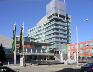
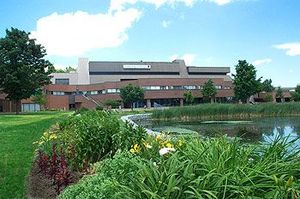
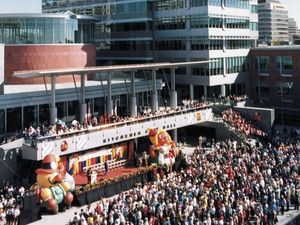
كتشنر، أونتاريو
43°27′N 80°29′W / 43.450°N 80.483°W
كـِتشنر
City of Kitchener | |
|---|---|
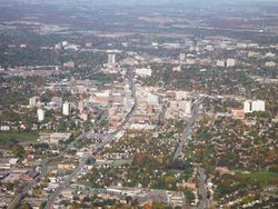 View of Downtown Kitchener | |
| الشعار: Ex industria prosperitas (لاتينية: الرخاء عبر التصنيع) | |
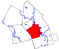 موقع كتشنر في منطقة واترلو | |
| الإحداثيات: 43°27′N 80°29′W / 43.450°N 80.483°W | |
| البلد | كندا |
| المقاطعة | اونتاريو |
| المنطقة | منطقة واترلو |
| تأسست | 1833 |
| أشهرت | 1853 |
| أشهرت كمدينة | 1912 |
| الحكومة | |
| • العمدة | كارل تسير |
| المساحة | |
| • مدينة (lower-tier) | 136٫89 كم² (52٫85 ميل²) |
| • البر | 136٫89 كم² (52٫85 ميل²) |
| التعداد (2006) | |
| • مدينة (lower-tier) | 204٬668 (Ranked 21st) |
| • الكثافة | 1٬495٫12/km2 (3٬872٫3/sq mi) |
| • العمرانية | 451٬235 (Ranked 11th) |
| source: Statistics Canada | |
| منطقة التوقيت | UTC−5 (EST) |
| • الصيف (التوقيت الصيفي) | UTC−4 (EDT) |
| الموقع الإلكتروني | http://www.kitchener.ca/ |
مدينة كتشنر City of Kitchener (تــُنطـَق /ˈkɪtʃɨnər/) هي مدينة في جنوب اونتاريو، كندا. وكان اسمها بلدة برلين Town of Berlin من 1854 حتى 1912 ثم مدينة برلين City of Berlin من 1912 حتى 1916. The city had a population of 204,668 in the Canada 2006 Census. The metropolitan area, which includes the neighbouring cities of Waterloo and Cambridge, has 451,235 people, making it the eleventh largest Census Metropolitan Area (CMA) in Canada and the fifth largest CMA in Ontario.[1] It is the seat of the Waterloo Regional Municipality, and is adjacent to the smaller cities of Cambridge to the south, and Waterloo to the north. Kitchener and Waterloo are often referred to jointly as "Kitchener-Waterloo" (K-W), although they have separate municipal governments. Including Cambridge, the three cities are known as "the tri-cities".
The City of Kitchener covers an area of 136.86 square kilometres. In 2004, the city celebrated its 150th anniversary.
. . . . . . . . . . . . . . . . . . . . . . . . . . . . . . . . . . . . . . . . . . . . . . . . . . . . . . . . . . . . . . . . . . . . . . . . . . . . . . . . . . . . . . . . . . . . . . . . . . . . . . . . . . . . . . . . . . . . . . . . . . . . . . . . . . . . . . . . . . . . . . . . . . . . . . . . . . . . . . . . . . . . . . . .
الجغرافيا
المناخ
| متوسطات الطقس لكتشنر | |||||||||||||
|---|---|---|---|---|---|---|---|---|---|---|---|---|---|
| شهر | يناير | فبراير | مارس | أبريل | مايو | يونيو | يوليو | أغسطس | سبتمبر | اكتوبر | نوفمبر | ديسمبر | السنة |
| العظمى القياسية °C (°F) | 17 (62) | 15 (59) | 26 (79) | 31 (87) | 34 (94) | 37 (99) | 39 (102) | 41 (106) | 37 (98) | 30 (86) | 24 (76) | 17 (62) | 41 (106) |
| متوسط العظمى °م (°ف) | -2 (28) | -2 (28) | 3 (37) | 11 (52) | 19 (66) | 23 (73) | 26 (79) | 25 (77) | 20 (68) | 13 (55) | 6 (43) | 0 (32) | 12 (53) |
| متوسط الصغرى °م (°ف) | -10 (14) | -10 (14) | -5 (23) | 0 (32) | 6 (43) | 11 (52) | 14 (57) | 13 (55) | 9 (48) | 3 (37) | 0 (32) | -7 (19) | 2 (36) |
| الصغرى القياسية °م (°F) | -32 (-26) | -33 (-27) | -28 (-19) | -17 (1) | -5 (23) | -1 (30) | 2 (35) | 1 (34) | -3 (26) | -10 (14) | -22 (-8) | -30 (-22) | −33 (−27) |
| هطول الأمطار cm (بوصة) | 10 (4) | 8 (3.5) | 7 (2.8) | 7 (2.9) | 7 (2.8) | 7 (3.1) | 8 (3.2) | 7 (2.8) | 7 (3.0) | 7 (2.9) | 9 (3.7) | 8 (3.5) | 82 (32٫3) |
| المصدر: Weatherbase[2] 2009-5-07 | |||||||||||||
التاريخ

الاقتصاد
الديمغرافيا
| الأصل العرقي | التعداد | النسبة |
|---|---|---|
| كنديون | 55,465 | 29.48% |
| German | 47,380 | 25.18% |
| English | 43,030 | 22.87% |
| Irish | 29,520 | 15.69% |
| Scottish | 29,320 | 15.58% |
| French | 17,620 | 9.36% |
| Polish | 10,515 | 5.59% |
| Dutch | 7,240 | 3.85% |
| Portuguese | 5,350 | 2.84% |
| Italian | 4,670 | 2.48% |
| Source: StatCan (includes multiple responses)[3] | ||
الحكومة
التعليم
الثقافة
. . . . . . . . . . . . . . . . . . . . . . . . . . . . . . . . . . . . . . . . . . . . . . . . . . . . . . . . . . . . . . . . . . . . . . . . . . . . . . . . . . . . . . . . . . . . . . . . . . . . . . . . . . . . . . . . . . . . . . . . . . . . . . . . . . . . . . . . . . . . . . . . . . . . . . . . . . . . . . . . . . . . . . . .
اكتوبرفست لكتشنر-واترلو
الهامش
- ^ [1]
- ^ "Weatherbase: Historical Weather for Kitchener, Ontario, Canada". Retrieved May 6, 2009.
{{cite web}}: Unknown parameter|dateformat=ignored (help) - ^ Selected Ethnic Origins, for Census Subdivisions (Municipalities) With 5,000-plus Population - 20% Sample Data on Kitchener, Ontario. StatCan, census year 2001, catalogue no. 97F0024XIE2001006, released January 21, 2003
وصلات خارجية
- مدينة كتشنر
- Kitchener Community Profile
- The Record Newspaper (Serving Waterloo Region)
- Grand River Transit (serving Waterloo, Kitchener and Cambridge)
- Kitchener-Waterloo Oktoberfest

|
Woolwich, Elora, Fergus | Waterloo, Woolwich via Conestoga Parkway |
Wellesley | 
|
| Woolwich, Guelph via Highway 7 |
Wilmot, Stratford via Conestoga Parkway | |||
| Cambridge via Highway 8 |
North Dumfries, Paris | Woodstock via Highway 401 |


