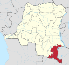
محافظة كاتانغا
محافظة كاتنگا
Province du Katanga | |
|---|---|
 | |
| الإحداثيات: 11°08′S 27°06′E / 11.133°S 27.100°E | |
| البلد | |
| العاصمة | لوبومباشي |
| أكبر مدينة | لوبومباشي |
| الحكومة | |
| • الحاكم | موسه كاتومبي چاپوه |
| المساحة | |
| • الإجمالي | 496٬871 كم² (191٬843 ميل²) |
| التعداد (2010 .) | |
| • الإجمالي | 5٬608٬683 |
| صفة المواطن | كاتنگاي |
| اللغة الرسمية | الفرنسية |
| اللغة الوطنية | سواحلية، تشيلومبا |
| الموقع الإلكتروني | katanga.cd |
كاتنگا Katanga، كانت احدى محافظات جمهورية الكونغو الديمقراطية. ما بين 1971 و1997 (أثناء حكم موبوتو سـِسه سـِكو عندما كانت الكونغو تعرف باسم زائير)، كان الاسم الرسمي لها محافظة شابا.
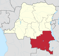
العاصمة الاقليمية لكاتنگا هي مدينة لوبومباشي. مساحتها 497,000 كم²، أكبر من كاليفورنيا وأكبر 16 مرة من مساحة بلجيكا. وتتم عمليات الزراعة وتربية الماشية خارج هضة كاتنگا. الجزء الشرقي من المحافظة هو اقليم غني بالنفط، حيث تتوفر فيه الكوبالت، النحاس، القصدير، الراديوم، اليورانيوم، والماس. العاصمة، مدينة لوبومباشي، هي ثاني أكبر مدينة في الكونغو.
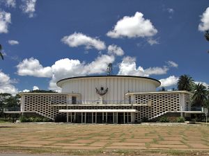 يقع مبنى المجلس المحلي لمحافظة كاتنگا في لوبومباشي. |
آخر حكام المحافظة كان رجل الأعمال موسه كاتومبي چاپوه. تولى المنصب في 24 فبراير 2007.[1]
. . . . . . . . . . . . . . . . . . . . . . . . . . . . . . . . . . . . . . . . . . . . . . . . . . . . . . . . . . . . . . . . . . . . . . . . . . . . . . . . . . . . . . . . . . . . . . . . . . . . . . . . . . . . . . . . . . . . . . . . . . . . . . . . . . . . . . . . . . . . . . . . . . . . . . . . . . . . . . . . . . . . . . . .
التاريخ
Copper mining in Katanga dates back over 1,000 years, and mines in the region were producing standard-sized ingots of copper for international transport by the end of the 10th century CE.[2]
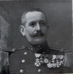
In the 1890s, the province was beleaguered from the south by Cecil Rhodes' Northern Rhodesia, and from the north by the Belgian Congo, the personal possession of King Leopold II of Belgium. Msiri, the King of Katanga, held out against both, but eventually Katanga was subsumed by the Belgian Congo.[3][صفحة مطلوبة]
After 1900, the Societe Generale de Belgique practically controlled all of the mining in the province through Union Minière du Haut Katanga (UMHK). This included uranium, radium, copper, cobalt, zinc, cadmium, germanium, manganese, silver, gold, and tin.
In 1915, a deposit of pitchblende and other uranium minerals of a higher grade than had ever been found before anywhere in the world and higher than any found since were discovered at Shinkolobwe. The discovery was kept secret by UMHK. After World War I ended a factory was built at Olen; the secrecy was lifted at the end of 1922 with the announcement of the production of the first gram of radium from the pitchblende.[4] By the start of World War II, the mining companies "constituted a state within the Belgian Congo". The Shinkolobwe mine near Jadotville (now Likasi) was at the centre of the Manhattan Project.[5]
كاتانغا المستقلة
 مقالة مفصلة: دولة كاتانغا
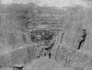
In 1960, after the Democratic Republic of the Congo (then called Republic of the Congo) gained independence from Belgium, the UMHK, Moise Tshombe and Godefroid Munongo supported the secession of Katanga province from the Congo. This was supported by Belgium but opposed by the Congolese Prime Minister Patrice Lumumba. This led to the assassination of Lumumba and the Katanga Crisis (or "Congo Crisis"), which lasted from 1960 to 1965. The breakaway State of Katanga existed from 1960 to 1963, then was reintegrated.[6]
In 2005, the new constitution specified that Katanga was to be split up into separately administered provinces.[7]
Militias such as Mai Mai Kata Katanga led by Gédéon Kyungu Mutanga fought for Katanga to secede, and his group briefly took over the provincial capital Lubumbashi in 2013.[6]
In 2015, Katanga Province was split into the constitutional provinces of Tanganyika, Haut-Lomami, Lualaba, and Haut-Katanga.[8][9]
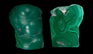 Malachite specimen, showing the original botryoidal form and a polished face of the opposite half of the specimen. Mines in the vicinity of Kolwezi supply much of the polishing-grade malachite in the world. |
 Another malachite specimen from Katanga, on display at the Royal Ontario Museum. |
الاقتصاد
يعتبر تعدين النحاس من أهم الموارد الاقتصادية في محافظة كاتنگا.
Copper mining is an important part of the economy of Katanga province.[10] Cobalt mining by individual contractors is also prevalent. A number of reasons have been advanced for the failure of the vast mineral wealth of the province to increase the overall standard of living. The local provincial budget was US$440 million in 2011.[11][12]
التعدين
Lubumbashi, the mining capital of the Democratic Republic of Congo, is a hub for many of the country's biggest mining companies. The Democratic Republic of Congo produces "more than 3 percent of the world’s copper and half its cobalt, most of which comes from Katanga".[13]
Major mining concessions include Tilwezembe and Kalukundi.
شركات التعدين
- Gécamines, (La Générale des Carrières et des Mines, the former UMHK), the state-owned copper-cobalt mining company, had monopoly concessions in the province.
- Katanga Mining Ltd TSX:KAT operates a major mining complex in Katanga province, producing refined copper and cobalt with the "potential of becoming Africa’s largest copper producer and the world’s largest cobalt producer".[14] Katanga Mining Ltd is majority-owned by Swiss commodity trader Glencore DCC.[15] A joint venture of Katanga Mining (75%) and Gécamines (25%) began mining Tilwezembe, an open-pit copper and cobalt mine, in 2007.[16]
الجغرافيا
تشكل المحافظة الحدود الكونغولية مع أنگولا وزامبيا. وتقع المحافظة أيضاً على الحدود مع تنزانيا، بالرغم من أن محافظة كاتانغا وتنزانيا لا يتشاركا حدود برية لكنها حدود بحرية حيث بحيرة تنجانيقا.
يوجد في المحافظة فصل مطير وفصل جاف. تسقط الأمطار بطول 49 بوصة سنوية (120 سم).[17]
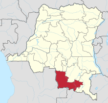
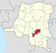
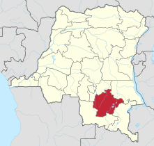
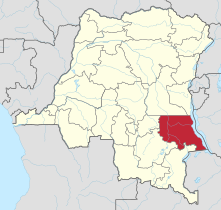
في 2015، انقسمت المحافظة إلى خمس محافظات، بناءً على المقاطعات التي كانت تؤلف المحافظة القديمة:
محافظة لومامي العليا
التعليم والرعاية الصحية
جامعة لوبومباشي هي أكبر جامعة في المحافظة وتعتبر أكبر جامعة في البلاد. وتقع الجامعة في الجزء الشمالي من مدينة لوبومباشي. الكلية الميثودية في كاتنگا، هي كلية ميثودية، تعتمد نظام الفصول الدراسية مع النظام الجامعي.
النقل
يخدم المحافظة خط سكك حديدية محدود مركزه حول لوبومباشي. ويوجد أيضا مطار لوانو الذي يقع شمال شرق لوبومباشي.
الإعلام
يوجد في المحافظة خدمات بث تلفزيوني. وتستقبل بث الراديو والتلفزيون الوطني الكونغولي عن طريق اشارة تستقبلها من كينشاسا. في 2005، بدأ البث الاذاعي لراديو موانگازا في لوبومباشي.
مشاهير أبناء كاتنگا
- لوران كابيلا رئيس جمهورية الكونغو الديمقراطية السابق
- مويز تشومبه رئيس سابق لدولة كاتنگا
- باربارا كانام مغني موسيقى أفريقيا شهير
انظر أيضاً
. . . . . . . . . . . . . . . . . . . . . . . . . . . . . . . . . . . . . . . . . . . . . . . . . . . . . . . . . . . . . . . . . . . . . . . . . . . . . . . . . . . . . . . . . . . . . . . . . . . . . . . . . . . . . . . . . . . . . . . . . . . . . . . . . . . . . . . . . . . . . . . . . . . . . . . . . . . . . . . . . . . . . . . .
المصادر
- ^ Provinces of Congo (Kinshasa)
- ^ McKenna, Amy, ed. (2011). The History of Central and Eastern Africa. Britannica Guide to Africa. Rosen Education Service. p. 9. ISBN 978-1615303229.
- ^ Crawford, Daniel (1912). Thinking Black: 22 Years Without a Break in the Long Grass of Central Africa. New York: George H. Doran.
- ^ Uranium's scientific history - Part 2
- ^ Williams, Susan (2016). Spies in the Congo. New York: Public Affairs. pp. 76–77, 289. ISBN 9781610396547.
- ^ أ ب Jullien, Maud (2013-08-12). "Fighting for DR Congo's cash cow to secede". BBC Africa (in الإنجليزية البريطانية). Archived from the original on 8 January 2015. Retrieved 2019-01-16.
- ^ "Constitution de la République démocratique du Congo: Article 2". Wikisource. Archived from the original on 25 October 2011. Retrieved 24 May 2016.
- ^ The National Assembly adopts the laws regarding the limits of the provinces in the Democratic Republic of the Congo Archived 27 يناير 2015 at the Wayback Machine, National Assembly of the Democratic Republic of the Congo, 10 January 2015. (in فرنسية)
- ^ Election of governors: definite results expected on 18 April Archived 28 مارس 2016 at the Wayback Machine, Radio Okapi, 27 March 2016. (in فرنسية)
- ^ "COPPER". congo-pages.org. Archived from the original on 3 March 2016. Retrieved 23 October 2015.
- ^ "Katanga: le budget 2011 s'élève à 396 milliards de Francs congolais". Radio Okapi. 21 September 2010. Archived from the original on 23 July 2012.
- ^ The State vs. the People: Governance, mining and the transitional regime in the Democratic Republic of Congo. Amsterdam: Netherlands Institute for Southern Africa. 2006. ISBN 90-78028-04-1. Archived from the original. You must specify the date the archive was made using the
|archivedate=parameter. http://friendsofthecongo.org/pdf/fataltransactions.pdf. Retrieved on 25 March 2013. - ^ Kavanagh, Michael J. (23 March 2013). "Congolese Militia Seizes UN Compound in Katanga's Lubumbashi". Archived from the original on 25 March 2013. Retrieved 23 March 2013.
- ^ "History: dead link". Katanga Mining. Archived from the original on 10 November 2011. Retrieved 16 November 2011.
- ^ Katanga Mining. Archived from the original. You must specify the date the archive was made using the
|archivedate=parameter. http://www.glencore.com/katanga-mining.html. Retrieved on 25 March 2013. - ^ "An Independent Technical Report on the Material Assets of Katanga Mining Limited..." (PDF). SRK Consulting. 17 March 2009. Archived from the original (PDF) on 6 May 2012. Retrieved 6 November 2011.
- ^ Katanga, or Shaba (province, Democratic Republic of the Congo) - Britannica Online Encyclopedia
وصلات خارجية
- Pages using gadget WikiMiniAtlas
- CS1 الإنجليزية البريطانية-language sources (en-gb)
- Articles with فرنسية-language sources (fr)
- Short description is different from Wikidata
- Coordinates on Wikidata
- Articles with hatnote templates targeting a nonexistent page
- مقالات بالمعرفة بحاجة لذكر رقم الصفحة بالمصدر from January 2019
- Pages with empty portal template
- محافظة كاتنگا
- محافظات جمهورية الكونغو الديمقراطية

