قسم جمو
قسم جمو
Jammu Division | |
|---|---|
Administrative Division | |
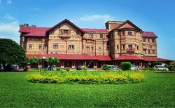 View of Hari Niwas palace | |
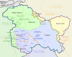 جمو (بحدود برتقالية) تقع ضمن كشمير تحت الادارة الهندية | |
| الإحداثيات: 32°44′N 74°52′E / 32.73°N 74.87°E | |
| البلد | |
| الولاية | جمو وكشمير |
| Headquarters | جمو |
| المساحة | |
| • الإجمالي | 26٬293 كم² (10٬152 ميل²) |
| التعداد | |
| • الإجمالي | 5٬350٬811 |
| • الكثافة | 200/km2 (530/sq mi) |
| اللغات | |
| • الرسمية | أردو |
| • Secondary | الإنگليزية |
| • Spoken | Dogri, Hindi, Gojri, Kashmiri, Pahadi, Punjabi |
| منطقة التوقيت | UTC+5:30 (IST) |
قسم جـَمـّو (Jammu Division؛ /ˈdʒɑːmuː/) هو قسم اداري within Jammu and Kashmir, the northernmost region of India. It consists of the districts of Jammu, Doda, Kathua, Ramban, Reasi, Kishtwar, Poonch, Rajouri, Udhampur and Samba. Most of the land is hilly or mountainous, including the Pir Panjal Range which separates it from the Kashmir Valley and part of the Great Himalayas in the eastern districts of Doda and Kishtwar. Its principal river is the Chenab. Chenab Valley is another important division in Jammu region.[1][2]
Jammu city is the largest city in Jammu and the winter capital of Jammu and Kashmir. It is also known as "City of Temples" as it has many temples and shrines, with glittering shikhars soaring into the sky, which dot the city’s skyline, creating the ambiance of a holy and peaceful city.
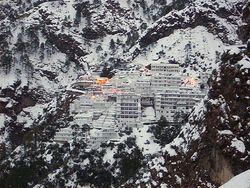
Home to some of India's most popular Hindu shrines, such as Vaishno Devi, Jammu is a major pilgrimage centre for Hindus. A majority of Jammu's population practices Hinduism,[3] while Islam and Sikhism enjoy a strong cultural heritage in the region. Due to relatively better infrastructure, Jammu has emerged as the main economic centre of Jammu and Kashmir.[4]
الأضلع
As of 2012, the Jammu Division consists of ten districts:
| Name of district | Headquarters | Area (km2) | Population (2001) |
Population (2011) |
|---|---|---|---|---|
| Kathua | Kathua | 2٬651 | 550٬084 | 615٬711 |
| Jammu | Jammu | 3٬097 | 1٬343٬756 | 1٬526٬406 |
| Samba | Samba | 245٬016 | 318٬611 | |
| Udhampur | Udhampur | 4٬550 | 475٬068 | 555٬357 |
| Reasi | Reasi | 268٬441 | 314٬714 | |
| Rajouri | Rajouri | 2٬630 | 483٬284 | 619٬266 |
| Poonch | Poonch | 1٬674 | 372٬613 | 476٬820 |
| Doda | Doda | 11٬691 | 320٬256 | 409٬576 |
| Ramban | Ramban | 180٬830 | 283٬313 | |
| Kishtwar | Kishtwar | 190٬843 | 231٬037 |
During the Maharaja's time before the Independence and Partition of India (and of Jammu and Kashmir), the following districts were also part of Jammu region: Bhimber, Kotli, Mirpur, Poonch (Western parts), Haveli, Bagh and Sudhnati. Today these districts are a part of Pakistan-controlled Azad Jammu and Kashmir but are claimed by India.
المعالم
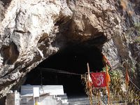
معبد ڤايشنو دڤي
Mansar Lake
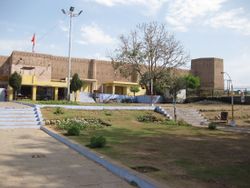
Bahu Fort
Shivkhori
انظر أيضاً
- List of topics on the land and the people of “Jammu and Kashmir”
- Roman Catholic Diocese of Jammu–Srinagar
- Dogri
- Dogra
- Prakash Singh Chib
المراجع
وصلات خارجية
- The Official Website of Jammu and Kashmir Government, India
- Official Website of District Jammu, India
 قسم جمو travel guide from Wikivoyage
- Shri Mata Vaishno Devi Shrine Board – Shrines in Jammu
- Bhaderwah – Website about Bhaderwah
- Brief history of Jammu Rulers with their Coinage details
- Mata Pingla
Bahu Fort
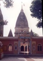
Raghunath Temple
