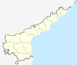
سري هاريكوتا
سري هاريكوتا
Sriharikota | |
|---|---|
بلدة | |
| الإحداثيات: 13°43′04″N 80°12′00″E / 13.7178°N 80.2000°E | |
| State | أندرا پرادش |
| District | ضلع نلورى |
| المنسوب | 1 m (3 ft) |
| اللغات | |
| • الرسمية | تلوگو |
| PIN | 524124 |
| لوحة السيارة | AP |
سري هاريكوتا (بالتلوگو: శ్రీహరికోట, أيضا Sriharikote) هي جزيرة حاجزة للشاطئ الجنوبي ولاية أندرا پرادش في الهند. وهي مركز لإطلاق المسبار الفضائي، چاندرايان-1، إلى القمر من مركز فضاء ساتيش ضوان، الذي هو أحد مركزين لإطلاق السواتل في الهند (الآخر هو Thumba Equatorial Rocket Launching Station في ثيروڤاننثاپورام). هيئة أبحاث الفضاء الهندية (ISRO) launches satellites using multistage rockets such as the Polar Satellite Launch Vehicle and the Geosynchronous Satellite Launch Vehicle from Sriharikota.[1]
الموقع
Sriharikota is partly located in Sullurpeta mandal and partly located in Tada mandal in Nellore district in Andhra Pradesh and separates Pulicat Lake from the Bay of Bengal[2] The nearest town and railway station is Sullurpeta which is 16 km west of Sriharikota. A 16 km elevated road connects Sriharikota to the mainland. It is about 70 km north of Chennai city. It has elevation of 1 meter
المناخ
The climate of Sriharikota is tropical wet and dry (Aw; bordering on As) in the Köppen–Geiger climate classification system. Sriharikota has hot summers and mild winters. Summers can reach up to 38 degrees Celsius, while winters can reach down to 20 degrees Celsius. Since Sriharikota is only 105 km north of Chennai, its climate is similar to that of Chennai.
| بيانات المناخ لـ Sriharikota | |||||||||||||
|---|---|---|---|---|---|---|---|---|---|---|---|---|---|
| الشهر | ينا | فب | مار | أبر | ماي | يون | يول | أغس | سبت | أكت | نوف | ديس | السنة |
| متوسط القصوى اليومية °س (°ف) | 29.6 (85.3) |
31.5 (88.7) |
33.6 (92.5) |
36 (97) |
38.8 (101.8) |
38 (100) |
35.6 (96.1) |
35.2 (95.4) |
34.5 (94.1) |
32.3 (90.1) |
29.6 (85.3) |
28.8 (83.8) |
33.6 (92.5) |
| المتوسط اليومي °س (°ف) | 24.6 (76.3) |
26 (79) |
28.1 (82.6) |
30.9 (87.6) |
33.4 (92.1) |
32.8 (91.0) |
31 (88) |
30.7 (87.3) |
30 (86) |
28.3 (82.9) |
26 (79) |
24.6 (76.3) |
28.9 (84.0) |
| متوسط الدنيا اليومية °س (°ف) | 19.7 (67.5) |
20.6 (69.1) |
22.7 (72.9) |
25.8 (78.4) |
28 (82) |
27.9 (82.2) |
26.5 (79.7) |
26.2 (79.2) |
25.6 (78.1) |
24.4 (75.9) |
22.4 (72.3) |
20.2 (68.4) |
24.2 (75.5) |
| متوسط تساقط الأمطار mm (inches) | 25 (1.0) |
11 (0.4) |
5 (0.2) |
15 (0.6) |
58 (2.3) |
95 (3.7) |
137 (5.4) |
182 (7.2) |
197 (7.8) |
274 (10.8) |
325 (12.8) |
179 (7.0) |
1٬503 (59.2) |
| Source: Climate-Data.org, altitude: 1m[3] | |||||||||||||
المراجع
- ^ [1] Srīharikota Island. (2011). In Encyclopædia Britannica. Retrieved from Encyclopædia Britannica. Encyclopædia Britannica Online.
- ^ [2] Pincode and Map Location of SRIHARIKOTA RANGE, NELLORE District, ANDHRA PRADESH State-Source Pincode locator
- ^ "Climate: Sriharikota - Climate graph, Temperature graph, Climate table". Climate-Data.org. Retrieved 31 October 2013.
وصلات خارجية
- Pages using gadget WikiMiniAtlas
- Short description is different from Wikidata
- Coordinates on Wikidata
- Pages using infobox settlement with unknown parameters
- Pages using infobox settlement with missing country
- Articles containing تلوگو-language text
- جزر حاجزة
- برنامج الفضاء الهندي
- جزر أندرا پرادش
- جزر خليج البنغال
- صفحات مع الخرائط


