سان ميگل دى ألندى
San Miguel de Allende | |
|---|---|
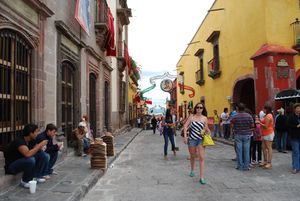
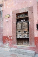
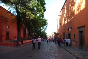
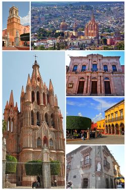 Montage of San Miguel de Allende | |
| الكنية: El Corazón de México[1] | |
| الشعار: Hic Natus Ubique Notus | |
| الإحداثيات: 20°54′51″N 100°44′37″W / 20.91417°N 100.74361°W | |
| Country | |
| State | |
| Founded | Pre-1541 |
| Municipal Status | 1811 |
| الحكومة | |
| • Municipal President | Luis Alberto Villarreal |
| المنسوب (of seat) | 1٬900 m (6٬200 ft) |
| التعداد (2005) Municipality | |
| • Municipality | 139٬297 |
| • | 62٬034 |
| منطقة التوقيت | UTC−06:00 (Central (US Central)) |
| • الصيف (التوقيت الصيفي) | UTC−05:00 (Central) |
| Postal code (of seat) | 37700 |
| مفتاح الهاتف | 415 |
| Demonym | sanmiguelense[2] |
| الموقع الإلكتروني | (in إسپانية) [1] |
| الاسم الرسمي | Protective town of San Miguel de Allende and Sanctuary of Jesús Nazareno de Atotonilco |
| النوع | Cultural |
| المعيار | ii, iv |
| التوصيف | 2008 (32nd session) |
| الرقم المرجعي | 1274 |
| State Party | |
| Region | Latin America and the Caribbean |
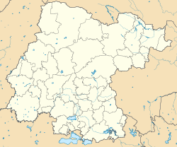
San Miguel de Allende (النطق الإسپاني: [san mi'ɣel de a'ʎende]) is the principal city in the municipality of San Miguel de Allende, located in the far eastern part of Guanajuato, Mexico. A part of the Bajío region,[3] the city lies 274 km (170 mi) from Mexico City, 86 km (53 mi) from Querétaro, and 97 km (60 mi) from the state capital of Guanajuato.[4] The city's name derives from two persons: 16th-century friar Juan de San Miguel, and a martyr of Mexican Independence, Ignacio Allende, who was born in a house facing the city's central plaza. San Miguel de Allende was also a critical epicenter during the historic Chichimeca War (1540–1590) where the Chichimeca Confederation defeated the Spanish Empire in the initial colonization war. Today, an old section of the town is part of a proclaimed World Heritage Site, attracting thousands of tourists and new residents from abroad every year.
At the beginning of the 20th century, the town was in danger of becoming a ghost town after an influenza pandemic. Gradually, its Baroque/Neoclassical colonial structures were "discovered" by foreign artists who moved in and began art and cultural institutes such as the Instituto Allende and the Escuela de Bellas Artes. This gave the town a reputation, attracting artists such as David Alfaro Siqueiros, who taught painting.
This attracted foreign art students, especially former U.S. soldiers studying on the G.I. Bill after the Second World War. Since then, the town has attracted a significant number of foreign retirees, artists, writers and tourists, which has shifted the area's economy from agriculture and industry to commerce catering to outside visitors and residents.
The United Nations Educational, Scientific and Cultural Organization (UNESCO) designated the Protective town of San Miguel and the Sanctuary of Jesús Nazareno de Atotonilco as a World Heritage Site in 2008. The area of designation includes part of the town San Miguel de Allende and part of the town of Atotonilco, which are about 14 kilometers apart.[5] The World Heritage Site is highlighted by a core zone of 43 hectares[6] in San Miguel de Allende's well-preserved historic center, filled with buildings from the 17th and 18th centuries. The other part of the World Heritage Site fourteen kilometers north, at the Sanctuary of Atotonilco, has a core zone of .75 hectares surrounded by a buffer zone of about 4.5 hectares.[6]
. . . . . . . . . . . . . . . . . . . . . . . . . . . . . . . . . . . . . . . . . . . . . . . . . . . . . . . . . . . . . . . . . . . . . . . . . . . . . . . . . . . . . . . . . . . . . . . . . . . . . . . . . . . . . . . . . . . . . . . . . . . . . . . . . . . . . . . . . . . . . . . . . . . . . . . . . . . . . . . . . . . . . . . .
الديمغرافيا
Landmarks
Historic core zone
الجغرافيا
المناخ
| Climate data for سان ميگل دى ألندى (1951–2010) | |||||||||||||
|---|---|---|---|---|---|---|---|---|---|---|---|---|---|
| Month | Jan | Feb | Mar | Apr | May | Jun | Jul | Aug | Sep | Oct | Nov | Dec | Year |
| Record high °C (°F) | 34.5 (94.1) |
35.5 (95.9) |
38.0 (100.4) |
39.0 (102.2) |
39.6 (103.3) |
39.0 (102.2) |
36.8 (98.2) |
36.0 (96.8) |
37.0 (98.6) |
37.0 (98.6) |
34.5 (94.1) |
32.5 (90.5) |
39.6 (103.3) |
| Mean daily maximum °C (°F) | 23.0 (73.4) |
25.2 (77.4) |
28.5 (83.3) |
30.2 (86.4) |
30.7 (87.3) |
29.1 (84.4) |
27.2 (81.0) |
27.2 (81.0) |
26.3 (79.3) |
25.5 (77.9) |
24.6 (76.3) |
23.2 (73.8) |
26.7 (80.1) |
| Daily mean °C (°F) | 14.5 (58.1) |
16.2 (61.2) |
19.3 (66.7) |
21.3 (70.3) |
22.2 (72.0) |
21.7 (71.1) |
20.5 (68.9) |
20.5 (68.9) |
19.9 (67.8) |
18.3 (64.9) |
16.5 (61.7) |
14.8 (58.6) |
18.8 (65.8) |
| Mean daily minimum °C (°F) | 6.0 (42.8) |
7.3 (45.1) |
10.0 (50.0) |
12.4 (54.3) |
13.8 (56.8) |
14.4 (57.9) |
13.9 (57.0) |
13.7 (56.7) |
13.5 (56.3) |
11.1 (52.0) |
8.4 (47.1) |
6.4 (43.5) |
10.9 (51.6) |
| Record low °C (°F) | −3 (27) |
−8 (18) |
−1 (30) |
1.5 (34.7) |
6.0 (42.8) |
8.0 (46.4) |
6.5 (43.7) |
7.0 (44.6) |
4.0 (39.2) |
−2 (28) |
−6 (21) |
−5 (23) |
−8 (18) |
| Average precipitation mm (inches) | 13.7 (0.54) |
7.2 (0.28) |
6.0 (0.24) |
18.9 (0.74) |
42.2 (1.66) |
100.1 (3.94) |
128.7 (5.07) |
94.4 (3.72) |
94.2 (3.71) |
41.5 (1.63) |
12.7 (0.50) |
6.5 (0.26) |
566.1 (22.29) |
| Average precipitation days (≥ 0.1 mm) | 2.1 | 1.1 | 0.9 | 2.6 | 5.2 | 9.4 | 11.8 | 8.3 | 8.6 | 4.5 | 1.8 | 1.7 | 58.0 |
| Source: Servicio Meteorologico Nacional[7] | |||||||||||||
| سان ميگل دى ألندى | ||||||||||||||||||||||||||||||||||||||||||||||||||||||||||||
|---|---|---|---|---|---|---|---|---|---|---|---|---|---|---|---|---|---|---|---|---|---|---|---|---|---|---|---|---|---|---|---|---|---|---|---|---|---|---|---|---|---|---|---|---|---|---|---|---|---|---|---|---|---|---|---|---|---|---|---|---|
| جدول طقس (التفسير) | ||||||||||||||||||||||||||||||||||||||||||||||||||||||||||||
| ||||||||||||||||||||||||||||||||||||||||||||||||||||||||||||
| ||||||||||||||||||||||||||||||||||||||||||||||||||||||||||||
. . . . . . . . . . . . . . . . . . . . . . . . . . . . . . . . . . . . . . . . . . . . . . . . . . . . . . . . . . . . . . . . . . . . . . . . . . . . . . . . . . . . . . . . . . . . . . . . . . . . . . . . . . . . . . . . . . . . . . . . . . . . . . . . . . . . . . . . . . . . . . . . . . . . . . . . . . . . . . . . . . . . . . . .
الثقافة
الاقتصاد
السياحة
الزراعة
البلدات التوأم – المدن الشقيقة
سان ميگل دى ألندى متوأمة مع:[بحاجة لمصدر]
 Acquaviva delle Fonti، إيطاليا]
 La Habra, California، الولايات المتحدة
 Laredo, Texas، الولايات المتحدة
 Redlands, California، الولايات المتحدة
 Santa Fe, New Mexico، الولايات المتحدة
 St. Augustine, Florida، الولايات المتحدة
 Tyler, Texas، الولايات المتحدة[8]
 أوشوايا، الأرجنتين
 West Palm Beach, Florida، الولايات المتحدة
الهامش
- ^ Covert (2017), p. xviii.
- ^ Covert (2017), p. xx.
- ^ Cruz, Osiel (6 August 2013). "BAJÍO, EL NUEVO MILAGRO MEXICANO". T21MX (in الإسبانية). Retrieved 8 November 2018.
- ^ "Estado de Guanajuato - Allende" [State of Guanajuato - Allende]. Enciclopedia de los Municipios de México (in Spanish). Mexico: Instituto Nacional para el Federalismo y el Desarrollo Municipal. 2005. Archived from the original on 18 May 2011. Retrieved 20 October 2010.
{{cite web}}: CS1 maint: unrecognized language (link) - ^ "Protective town of San Miguel and the Sanctuary of Jesús Nazareno de Atotonilco: Description". UNESCO. Retrieved 8 November 2018.
- ^ أ ب "Protective town of San Miguel and the Sanctuary of Jesús Nazareno de Atotonilco: Maps". UNESCO. Retrieved 8 November 2018.
- ^ أ ب
"Normales climatológicas 1951–2010" (in Spanish). National Meteorological Service of Mexico. Archived from the original on 13 April 2013. Retrieved 26 February 2013.
{{cite web}}: CS1 maint: unrecognized language (link) - ^ "Interactive City Directory". Sister Cities International. Archived from the original on 2016-03-04. Retrieved 2016-02-20.
للاستزادة
- Covert, Lisa Pinley (2010) "Colonial Outpost to Artists' Mecca: Conflict and Collaboration in the Development of San Miguel de Allende's Tourism Industry", in Holiday in Mexico: Critical Reflections on Tourism and Tourist Encounters ISBN 978-0-8223-4571-8
- Covert, Lisa Pinley (2017) San Miguel de Allende: Mexicans, Foreigners, and the Making of a World Heritage Site. Lincoln: University of Nebraska Press.
- Spiegel, Mamie (2005) San Miguel and the War of Independence
وصلات خارجية
- Official website (in Spanish)
- Pages using gadget WikiMiniAtlas
- CS1 الإسبانية-language sources (es)
- Short description is different from Wikidata
- Coordinates on Wikidata
- Articles with إسپانية-language sources (es)
- Articles with hatnote templates targeting a nonexistent page
- Articles with unsourced statements from October 2020
- مواقع التراث العالمي في المكسيك
- American diaspora in Mexico
- أماكن مأهولة في گواناخواتو
- Populated places established in 1542
- الحزام البركاني عبر المكسيك
- تأسيسات 1542 في اسبانيا الجديدة

