ريڤرينا
| Riverina نيو ساوث ويلز | |||||||||||||||
|---|---|---|---|---|---|---|---|---|---|---|---|---|---|---|---|
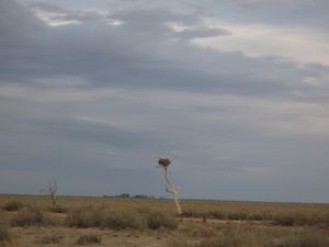
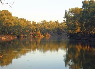 The Murrumbidgee River at Wagga Wagga | |||||||||||||||
| Coordinates | 35°S 146°E / 35°S 146°E | ||||||||||||||
| Population | 255,881 (2001)[1] | ||||||||||||||
| LGA(s) | Various | ||||||||||||||
| State electorate(s) | |||||||||||||||
| Federal Division(s) | |||||||||||||||
| |||||||||||||||
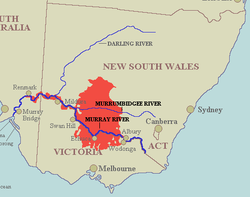
The Riverina /rɪvəˈriːnə/[2] is an agricultural region of South-Western New South Wales (NSW), Australia. The Riverina is distinguished from other Australian regions by the combination of flat plains, warm to hot climate and an ample supply of water for irrigation. This combination has allowed the Riverina to develop into one of the most productive and agriculturally diverse areas of Australia. Bordered on the south by the state of Victoria and on the east by the Great Dividing Range, the Riverina covers those areas of New South Wales in the Murray and Murrumbidgee drainage zones to their confluence in the west.
Home to Aboriginal groups for over 40,000 years, the Riverina was originally colonised by Europeans in the mid-19th century as a pastoral region providing beef and wool to markets in Australia and beyond. In the 20th century, the development of major irrigation areas in the Murray and Murrumbidgee valleys has led to the introduction of crops such as rice and wine grapes. The Riverina has strong cultural ties to Victoria, and the region was the source of much of the impetus behind the federation of Australian colonies.
Major population and service centres in the Riverina include the cities of Wagga Wagga, Leeton and Griffith. Wagga Wagga is home to a campus of Charles Sturt University, the only local provider of higher education for the region. Wagga Wagga is home to two major Australian Defence Force establishments.
. . . . . . . . . . . . . . . . . . . . . . . . . . . . . . . . . . . . . . . . . . . . . . . . . . . . . . . . . . . . . . . . . . . . . . . . . . . . . . . . . . . . . . . . . . . . . . . . . . . . . . . . . . . . . . . . . . . . . . . . . . . . . . . . . . . . . . . . . . . . . . . . . . . . . . . . . . . . . . . . . . . . . . . .
Geography
Landform and hydrology
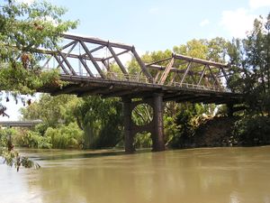
The geology of the Riverina comprises several troughs and sedimentary basins.
Riverina bioregion
التاريخ
Exploration and pastoral settlement
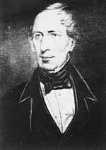
The first European explorer in the Riverina was John Oxley in 1817 following the Lachlan River to what is now the town of Booligal.[3]
Riverboats and railways
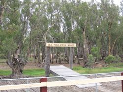
Riverina and Federation
Irrigation and closer settlement
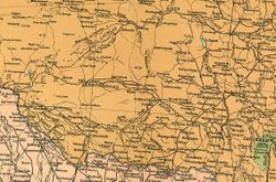
Culture
References
- ^ خطأ استشهاد: وسم
<ref>غير صحيح؛ لا نص تم توفيره للمراجع المسماةMurrayMurrumbidgeeABSStats - ^ Macquarie Dictionary, Fourth Edition (2005). Melbourne, The Macquarie Library Pty Ltd. ISBN 1-876429-14-3
- ^ خطأ استشهاد: وسم
<ref>غير صحيح؛ لا نص تم توفيره للمراجع المسماةNSWPWSRiverinaBioregionHistory - ^ "Moulamein Wharf". Council of the Shire of Wakool. Archived from the original on 26 نوفمبر 2014. Retrieved 3 فبراير 2007.
{{cite web}}: Unknown parameter|deadurl=ignored (|url-status=suggested) (help)
وصلات خارجية
 Media related to Riverina at Wikimedia Commons
قالب:Riverina قالب:Local Government Areas of the Riverina قالب:Regions of New South Wales
- Pages using gadget WikiMiniAtlas
- CS1 errors: unsupported parameter
- Short description is different from Wikidata
- Coordinates on Wikidata
- Pages using infobox Australian place with an explicitly-suppressed location map
- Articles with hatnote templates targeting a nonexistent page
- مقالات مميزة
- IBRA regions
- Newell Highway
- Regions of New South Wales
- Riverina
- Biogeography of New South Wales
