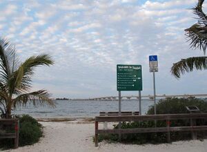
سانيبل، فلوريدا
Sanibel, Florida | |
|---|---|
| City of Sanibel | |
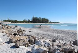 A view looking across to the northern tip of Sanibel from the Captiva side of Blind Pass. The bridge connecting the two islands is visible on the extreme left. | |
| الشعار: "A Barrier Island Sanctuary"[1] | |
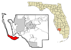 Location in Lee County, Florida | |
| الإحداثيات: 26°26′23″N 82°4′50″W / 26.43972°N 82.08056°W | |
| Country | United States |
| State | |
| County | Lee County, Florida |
| Settled | 1884 |
| Incorporated (city) | 1974[1] |
| الحكومة | |
| • النوع | Council-Manager |
| • Mayor | Kevin Ruane (R) |
| • City Manager | Judie Zimomra (I) |
| المساحة | |
| • الإجمالي | 33٫21 ميل² (86٫01 كم²) |
| • البر | 16٫18 ميل² (41٫90 كم²) |
| • الماء | 17٫03 ميل² (44٫10 كم²) 48.13% |
| المنسوب | 3 ft (0٫9 m) |
| التعداد | |
| • الإجمالي | 6٬469 |
| • Estimate (2019)[4] | 7٬401 |
| • الكثافة | 457٫42/sq mi (176٫61/km2) |
| منطقة التوقيت | UTC-5 (Eastern (EST)) |
| • الصيف (التوقيت الصيفي) | UTC-4 (EDT) |
| ZIP code | 33957 |
| مفتاح الهاتف | 239 |
| FIPS code | 12-63700 |
| GNIS feature ID | 0290637[5] |
| الموقع الإلكتروني | City of Sanibel Florida Website |
سانيبل Sanibel هي جزيرة ومدينة في مقاطعة لي، فلوريدا، الولايات المتحدة. The population was 6,469 at the 2010 census, with an estimated 2018 population of 7,402. It is part of the Cape Coral-Fort Myers, Florida Metropolitan Statistical Area. The island, also known as Sanibel Island, constitutes the entire city. It is a barrier island – a collection of sand on the leeward side of the more solid coral-rock of Pine Island.
Most of the city proper is at the east end of the island. After the Sanibel causeway was built to replace the ferry in May 1963, the city was incorporated in 1974 and the residents asserted control over development by establishing the Sanibel Comprehensive Land Use Plan, helping to maintain a balance between development and preservation of the island's ecology.[6]
Due to easy causeway access, Sanibel is a popular tourist destination known for its shell beaches and wildlife refuges. More than half of the island is made up of wildlife refuges, the largest being J. N. "Ding" Darling National Wildlife Refuge. The Island hosts the Sanibel Historical Village and a variety of other museums including the Bailey-Matthews National Shell Museum and theaters, as well as many non-profit organizations such as the Sanibel-Captiva Conservation Foundation, the Clinic for the Rehabilitation of Wildlife, and the Sanibel Sea School.
. . . . . . . . . . . . . . . . . . . . . . . . . . . . . . . . . . . . . . . . . . . . . . . . . . . . . . . . . . . . . . . . . . . . . . . . . . . . . . . . . . . . . . . . . . . . . . . . . . . . . . . . . . . . . . . . . . . . . . . . . . . . . . . . . . . . . . . . . . . . . . . . . . . . . . . . . . . . . . . . . . . . . . . .
التاريخ
Sanibel and Captiva formed as one island about 6,000 years ago. The first known humans in the area were the Calusa, who arrived about 2,500 years ago.[7] The Calusa were a powerful Indian nation who came to dominate most of Southwest Florida through trade via their elaborate system of canals and waterways. Sanibel remained an important Calusa settlement until the collapse of their empire, soon after the arrival of the Europeans.
الجغرافيا
Sanibel is located at 26°26′23″N 82°4′50″W / 26.43972°N 82.08056°W (26.439608, -82.080456).[8] According to the United States Census Bureau, the city has a total area of 33.16 square miles (85.9 km2), of which 17.21 square miles (44.6 km2) is land and 15.96 square miles (41.3 km2) (48.13%) is water.
الديمغرافيا
| التعداد التاريخي | |||
|---|---|---|---|
| التعداد | Pop. | %± | |
| 1980 | 3٬363 | — | |
| 1990 | 5٬468 | 62٫6% | |
| 2000 | 6٬064 | 10٫9% | |
| 2010 | 6٬469 | 6٫7% | |
| 2019 (تق.) | 7٬401 | [4] | 14٫4% |
| U.S. Decennial Census[9] | |||
البيئة
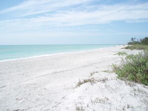
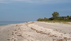
The island's curved shrimp-like shape forms Tarpon Bay on the north side of the island. It is linked to the mainland by the Sanibel Causeway, which runs across two small manmade islets and the Intracoastal Waterway. A short bridge links Sanibel Island to Captiva Island over Blind Pass. The Bailey-Matthews Shell Museum on Sanibel is the only museum in the world dedicated entirely to the study of shells. The Gulf-side beaches are excellent on both Sanibel and Captiva, and are world-renowned for their variety of seashells, which include coquinas, scallops, whelks, sand dollars, and many other species of both shallow-water and deeper-water mollusks, primarily bivalves and gastropods. Sanibel Island is home to a significant variety of birds, including the roseate spoonbill and several nesting pairs of bald eagles. Birds can be seen on the beaches, the causeway islands, and the reserves, including J. N. "Ding" Darling National Wildlife Refuge. Common sights include pelicans, herons, egrets, and anhingas, as well as the more common birds like terns, sandpipers, and seagulls.
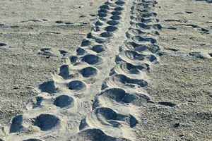
There is a population of American alligators on Sanibel Island. A lone rare American crocodile had been seen at the Wildlife Refuge for over 30 years, but she died in 2010 of unseasonably cold winters or old age.[10] A memorial was set up at J.N. "Ding" Darling National Wildlife Refuge honoring "Wilma", as she was known by the residents.[10] A new crocodile was introduced in May 2010 when she was found on a private property and relocated to J.N. "Ding" Darling National Wildlife Refuge.[11] Plants on the island include the native sea grape, sea oats, mangroves, and several types of palm trees. The Australian pine is an introduced species that has spread throughout the island, to some extent overpowering native vegetation and trees. Once mature, the pine blocks sunlight and drops a thick bed of pine needles that affect the soil's pH and prevents new native growth. The ground is very soft under these pines.
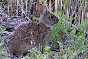
The local form of the marsh rice rat has been recognized in some classifications as a separate subspecies, Oryzomys palustris sanibeli.[12]
ملاجئ الحياة البرية
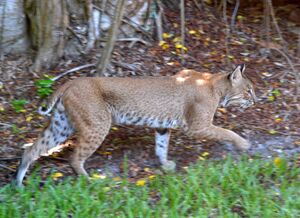
Preserving the island's natural ecology has always been important to its citizens and visitors alike. A driving force in the preservation of the island is the Sanibel-Captiva Conservation Foundation which was founded in 1967 with a mission to "preserve natural resources and wildlife habitat on and around the islands of Sanibel and Captiva."[13] 1,300 acres (5.3 km2) of land on Sanibel are under the supervision of the Foundation; included in this land there is a "Marine Laboratory which actively conducts research in areas including seagrasses, mangroves, harmful algal blooms, fish populations and shellfish restoration."[14] Sanibel Captiva Conservation Foundation also has a project called RECON (River, Estuary and Coastal Observing Network) which includes a "network of eight in-water sensors that provide real-time, hourly readings of key water quality parameters."[14] The foundation also serves to protect the wildlife on the island and has a variety of education programs designed to instruct people about the island's unique ecology.
الشواطئ والقواقع
البنية التحتية
Night Moves was filmed on the Island in 1975, directed by Arthur Penn. It stars Gene Hackman, Jennifer Warren, Susan Clark and features early career appearances by James Woods and Melanie Griffith.
الهامش
- ^ أ ب "City of Sanibel Florida Website". City of Sanibel Florida Website. Retrieved September 21, 2012.
- ^ "2019 U.S. Gazetteer Files". United States Census Bureau. Retrieved July 2, 2020.
- ^ "Annual Estimates of the population for the Incorporated Places of Florida". U.S. Census Bureau. Archived from the original on 2013-10-19. Retrieved 2014-02-24.
- ^ أ ب "Population and Housing Unit Estimates". United States Census Bureau. May 24, 2020. Retrieved May 27, 2020.
- ^ "US Board on Geographic Names". United States Geological Survey. 2007-10-25. Retrieved 2008-01-31.
- ^ "Sanibel Captiva Conservation Foundation History". Archived from the original on 2009-07-05. Retrieved 2009-07-09.
{{cite web}}: CS1 maint: bot: original URL status unknown (link) - ^ "Sanibel and Captiva Islands Information". Archived from the original on 2009-04-11. Retrieved 2009-07-13.
- ^ "US Gazetteer files: 2010, 2000, and 1990". United States Census Bureau. 2011-02-12. Retrieved 2011-04-23.
- ^ "Census of Population and Housing". Census.gov. Retrieved June 4, 2015.
- ^ أ ب "Old age or cold snap to blame for crocodile's death on Sanibel Island". Retrieved 2012-03-01.
- ^ "'Ding' Darling receives new female crocodile". Retrieved 2012-03-01.
- ^ Wolfe, J.L. 1982. Oryzomys palustris. Mammalian Species 176:1–5.
- ^ "Sanibel-Captiva Conservation Foundation". Archived from the original on 2009-07-05. Retrieved 2009-07-13.
- ^ أ ب "Sanibel Captiva Conservation Foundation". Retrieved 2009-07-15.
. . . . . . . . . . . . . . . . . . . . . . . . . . . . . . . . . . . . . . . . . . . . . . . . . . . . . . . . . . . . . . . . . . . . . . . . . . . . . . . . . . . . . . . . . . . . . . . . . . . . . . . . . . . . . . . . . . . . . . . . . . . . . . . . . . . . . . . . . . . . . . . . . . . . . . . . . . . . . . . . . . . . . . . .
وصلات خارجية
- Sanibel-Captiva Chamber of Commerce Official website for businesses on Sanibel Island and Captiva Island
- City of Sanibel Florida Website Portal style website, Government, Business, Library, Recreation and more
- Lee County Visitor & Convention Bureau Information regarding travel and tourism to and around Sanibel Island
- Pages using gadget WikiMiniAtlas
- CS1 maint: bot: original URL status unknown
- Short description is different from Wikidata
- Coordinates on Wikidata
- Pages using US Census population needing update
- سانيبل، فلوريدا
- Seaside resorts in Florida
- Populated coastal places in Florida on the Gulf of Mexico
- Cities in Florida
- Islands of Lee County, Florida
- Gulf Coast barrier islands of Florida
