بيشاپور
in Persian: بیشاپور | |
 أطلال بیشاپور | |
| الاسم البديل | Bishâpûr |
|---|---|
| المكان | كازرون، محافظة فارس، إيران |
| الإحداثيات | 29°46′40″N 51°34′15″E / 29.77778°N 51.57083°E |
| النوع | Settlement |
| التاريخ | |
| الباني | شاپور الأول |
| تأسس | 226 م |
| الثقافات | الفارسية (الفترة الساسانية) |
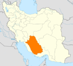
بیشاپور (الفارسية الوسيطة: Bay-Šāpūr؛ فارسية: بیشاپور، Bishâpûr) كانت مدينة قديمة في فارس الساسانية (إيران الحالية) على الطريق القديم بين پرسيس و عيلام. الطريق كان يربط العواصم الساسانية اصطخر (القريبة جداً من پرسيپوليس) و قطسيفون (المدائن). وتقع جنوب بلدة Faliyan الحالية في شهرستان كازرون في محافظة فارس، إيران.
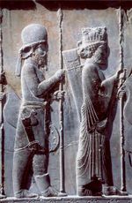
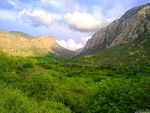
بـُنيت بیشاپور بالقرب من معبر نهري، وفي نفس الموقع يوجد حصن فيه خزانات ماء منحوتة في الصخر، ووادي نهري فيه ست نقوش صخرية بارزة من العصر الساساني.
أهم نقطة عن هذه المدينة، هي جمعها بين الفن والعمارة الفارسية والفن والعمارة الرومانية بشكل لم يُشاهد قبل بناء بیشاپور. فقبل بناء بیشاپور، كانت معظم المدن الرئيسية في فارس/إيران لها شكل دائرة، مثل المدينة القديمة في فيروزآباد أو داراب. بیشاپور كانت أول مدينة بشوارع رأسية وأفقية. كما نشاهد في التصميم الداخلي أعمال فسيفساء مأخوذة من الفن الروماني
التاريخ

اسم بیشاپور مشتق من باي-شاپور، التي تعني السيد شاپور.[1]
وحسب نقش، فإن المدينة نفسها تأسست في عام 266م على يد شاپور الأول (241-272)، الذي كان ثاني ملك ساساني وألحق هزيمة ثلاثية بالرومان، إذ قتل گورديان الثالث، وأسر ڤالريان وأجبر فيليپ العربي على الاستسلام. وفي مسقط رأسه محافظة فارس، فقد شيد عاصمة جديدة تناسب طموحاته: بیشاپور، مدينة شاپور. وخارج المدينة، زيّن شاپور جانبي خندق نهر بیشاپور بنقوش بارزة عملاقة تخلـّد انتصاره الثلاثي على روما. أحد تلك النقوش، على شكل نصف دائرة، has rows of registers with files of soldiers and horses, in a deliberate imitation of the narrative scenes on the Trajan column in Rome.
At Bishapur the king also inaugurated the Sassanid imagery of the king's investiture, which would be copied by his successors: the king and the god are face to face, often on horseback, and the god - usually Ahura Mazda - is holding the royal diadem out to the sovereign.
The city, has the remarkable dam bridge in Shushtar, built by Roman soldiers who had been captured after هزيمة ڤالريان في 260. However, it was not a completely new settlement: وقد عثر علماء الآثار على بقايا من العصرين الپارثي و العيلامي.
The city remained important until the Arab conquest of Persia the rise of Islam in the second quarter of the 7th century AD. There were still people living there in the 10th century.
The city has a rectangular plan with a grid pattern of regular intra urban streets, resembling Roman city design. This design was never repeated in the architecture of Iran.[2]
الحفريات والأبحاث
الموقع قام بتطهيره عالم الآثار الروسي-الفرنسي Roman Ghirshman in the 1930s. The British archaeologist Georgina Herrmann has also written a book about the Sasanian rock reliefs in Bishapur which was published in 1980.[3]
الزخارف

The main part of the excavations took place in the royal sector, in the east of the city. A water temple, interpreted as a Anahita temple , was erected near the palace. In the center there is a cross-shaped space with eight large square exedrae decorated with 64 alcoves. The French excavators believed it had been covered with a dome roof, but this reconstruction has been rejected. To the west lies a courtyard decorated with mosaics; to the east, a square iwan used as a reception room. Its walls must have been covered with small stucco ornaments: rows of medallions, bands of foliage, and topped with merlons inherited from Achaemenid architecture. All these decorative techniques were still used after the الفتح الإسلامي لفارس.
The floor was paved with black marble slabs, with a mosaic border. Along the walls runs a narrow band featuring a series of heads and masks, in a frontal or profile view, on a white background. At the top of each alcove there was a picture of women naked under their transparent veils: courtesans, musicians, dancers, women twisting garlands, together with a few richly attired noble ladies.
انظر أيضاً
الهامش
- ^ http://www.iranicaonline.org/articles/bisapur-town
- ^ Salma, K. Jayyusi; Holod, Renata; Petruccioli, Attilio; André, Raymond (2008). The City in the Islamic World. Leiden: Brill. p. 174. ISBN 9789004162402.
- ^ http://www.worldcat.org/title/sasanian-rock-reliefs-at-bishapur-part-1-bishapur-iii-triumph-attributed-to-shapur-i/oclc/59815517&referer=brief_results
وصلات خارجية
- Bishapur; Photos
- Bishapur, Photos from Iran, Livius.
- City of Bishapur (Video)
- Pages using gadget WikiMiniAtlas
- Coordinates on Wikidata
- Articles containing فارسية-language text
- Buildings and structures completed in the 3rd century
- العمارة الإيرانية
- فن الامبراطورية الرومانية
- Ancient Roman architecture
- مدن ساسانية
- مباني ومنشآت في محافظة فارس
- Former populated places in Iran
- شهرستان كازرون
- جغرافيا محافظة فارس
- معالم سياحية في محافظة فارس
- Stone buildings
- شاپور الأول


