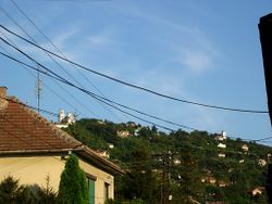
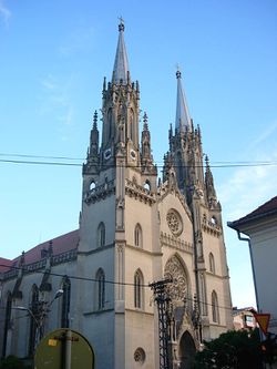
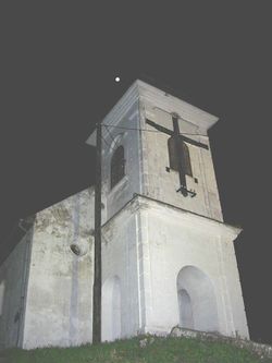
ڤرشاتس
(تم التحويل من Vršac)
ڤرشاتس | |
|---|---|
Municipality and Town | |
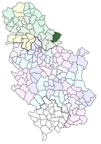 Location of the municipality of Vršac within Serbia | |
| البلد | صربيا |
| المنطقة | South Banat |
| المستوطنات | 24 |
| الحكومة | |
| • العمدة | Čedomir Živković |
| المساحة | |
| • Municipality | 1٬324 كم² (511 ميل²) |
| التعداد (2002 census)[3] | |
| • Town | 40٬000[2] |
| • Municipality | 54٬369 |
| منطقة التوقيت | UTC+1 (CET) |
| • الصيف (التوقيت الصيفي) | UTC+2 (CEST) |
| Postal code | 26300 |
| مفتاح الهاتف | +381 13 |
| Car plates | VŠ |
| الموقع الإلكتروني | www.vrsac.com |
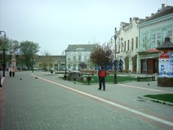
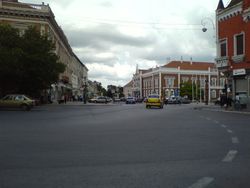
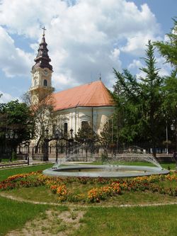
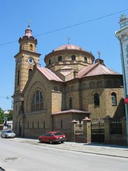
ڤرشاتس (سيريلية صربية: Вршац, تـُنطق [ʋr̩̂ʃat͡s], مجرية: Versec, Versecz, ألمانية: Werschetz, رومانية: Vârşeţ, تركية: Virşac) هي مدينة في بنات في مقاطعة ڤويڤودينا في صربيا.
يبلغ عدد سكانها حوالي 35935 نسمة.
التعداد التاريخي
- 1838: 18,481
- 1857: 19,087
- 1869: 21,095
- 1880: 22,329
- 1890: 21,859
- 1900: 24,770
- 1910: 26,941
- 1921: 27,011
- 1931: 29,411
- 1948: 23,038
- 1953: 26,110
- 1961: 31,620
- 1971: 34,256
- 1981: 37,513
- 1991: 36,885
- 2002: 36,623
العلاقات الدولية
بلدات شقيقة
Vršac is twinned with:
المراجع
- Dušan Belča, Mala istorija Vršca, Vršac, 1997.
- Dr. Dušan J. Popović, Srbi u Vojvodini, knjige 1-3, Novi Sad, 1990.
- Slobodan Ćurčić, Broj stanovnika Vojvodine, Novi Sad, 1996.
- Györffy György, Az Árpád-kori Magyarország történeti földrajza, 1987 (third edition). (Geographia historica Hungariae tempore stripis Arpadianae.)
الهامش
- ^ "Municipalities of Serbia, 2006". Statistical Office of the Republic of Serbia.
- ^ http://www.vrsac.org.rs/active/sr-latin/home/aktuelno/o_vrscu/dobrodosli.html
- ^ Popis stanovništva, domaćinstava i Stanova 2002. Knjiga 1: Nacionalna ili etnička pripadnost po naseljima (in Serbian). Statistical Office of the Republic of Serbia. 2003. ISBN 86-84443-00-09.
{{cite book}}: Check|isbn=value: length (help)CS1 maint: unrecognized language (link)
وصلات خارجية
تصنيفات:
- CS1 errors: ISBN
- Short description is different from Wikidata
- Pages using infobox settlement with unknown parameters
- Pages using infobox settlement with no coordinates
- Articles containing صربية-language text
- Articles containing مجرية-language text
- Pages using Lang-xx templates
- Articles containing ألمانية-language text
- Articles containing رومانية-language text
- Articles with hatnote templates targeting a nonexistent page
- ڤرشاتس
- أماكن في بنات الصربية
- أماكن مأهولة في ڤويڤودينا
- بلديات ڤويڤودينا
- مناطق النبيذ في صربيا
- مدن صربيا

