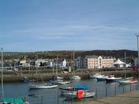
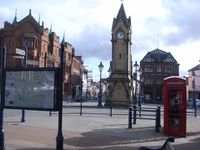
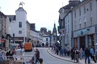
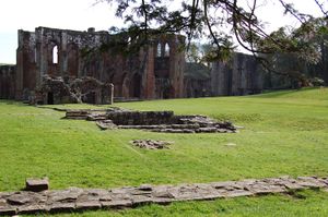
كمبريا
كمبريا
Cumbria | |||||||||||||||||||||||||||
|---|---|---|---|---|---|---|---|---|---|---|---|---|---|---|---|---|---|---|---|---|---|---|---|---|---|---|---|
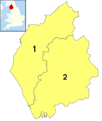
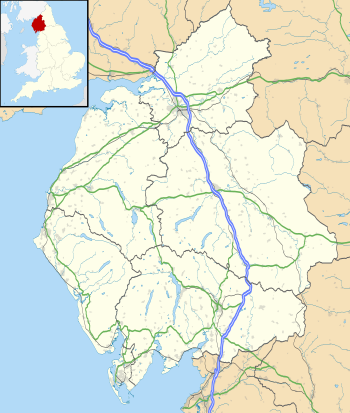
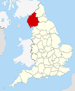 Location of Cumbria within England | |||||||||||||||||||||||||||
| الإحداثيات: 54°30′N 3°15′W / 54.500°N 3.250°W | |||||||||||||||||||||||||||
| البلد | المملكة المتحدة | ||||||||||||||||||||||||||
| المقاطعة | إنگلترة | ||||||||||||||||||||||||||
| المنطقة | North West England | ||||||||||||||||||||||||||
| التأسيس | 1 April 1974 | ||||||||||||||||||||||||||
| أسسها | Local Government Act 1972 | ||||||||||||||||||||||||||
| منطقة التوقيت | UTC±00:00 (توقيت گرينتش المتوسط) | ||||||||||||||||||||||||||
| • الصيف (التوقيت الصيفي) | UTC+01:00 (توقيت بريطانيا الصيفي) | ||||||||||||||||||||||||||
| أعضاء البرلمان | 6 MPs | ||||||||||||||||||||||||||
| الشرطة | Cumbria Constabulary | ||||||||||||||||||||||||||
| |||||||||||||||||||||||||||
كمبريا Cumbria (بالإنگليزيةالنطق: /ˈkʌmbriə/ KUM-bree-ə; locally [ˈkʊmbɾiə] KUUM-bree-ə)، هي مقاطعة صغرى في شمال غرب إنگلترة. مجلس مقاطعة كمبريا يمثل السلطة المحلية فيها، تأسست عام 1974 بعد التصديق على قانون الحكومة المحلية 1972. أكبر مستوطنة وبلدة المقاطعة هي كارلايل والمنطقة الحضرية الكبرى الوحيدة فيها هي بارو-إن-فرنس على الطرف الجنوبي الغربي للمقاطعة والتي يقل عدد سكنها قليلاً عن كارلايل.
The county is predominantly rural, with an area of 6,769 km2 (2,614 sq mi) and a population of 500,012; this makes it the third largest ceremonial county in England by area but the eighth-smallest by population. After Carlisle (74,281), the largest settlements are Barrow-in-Furness (56,745), Kendal (29,593), and Whitehaven (23,986). The county contains two districts, Westmorland and Furness and Cumberland, which are both unitary areas.[3]
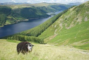
Cumbria is well-known for its natural beauty and much of its landscape is protected; the county contains the Lake District National Park and Solway Coast AONB, and parts of the Yorkshire Dales National Park, Arnside and Silverdale AONB, and North Pennines AONB. Together these protect the county's mountains, lakes, and coastline, including Scafell Pike, at 3,209 feet (978 m) England's highest mountain, and Windermere, its largest lake by volume.
The county contains several Neolithic monuments, such as Mayburgh Henge. The region was on the border of Roman Britain, and Hadrian's Wall runs through the north of the county. In the Early Middle Ages parts of the region successively belonged to Rheged, Northumbria, and Strathclyde, and there was also a Viking presence. It became the border between England and Scotland, and was unsettled until the Union of the Crowns in 1603. During the Industrial Revolution mining took place on the Cumberland coalfield and Barrow-in-Furness became a shipbuilding centre, but the county was not heavily industrialised and the Lake District became valued for its sublime and picturesque qualities, notably by the Lake Poets.
In 1974 Cumbria was created from the historic counties of Cumberland, Westmorland, the Furness area of Lancashire, and a small part of Yorkshire, and was a non-metropolitan county (with a county council) until 31 March 2023, when governance was taken up by Cumberland and Westmorland and Furness.
Name
The place names Cumbria and Cumberland both mean "land of the Cumbrians" and are names derived from the term that had been used by the inhabitants of the area to describe themselves. In the period ح. 400, it is likely that any group of people living in Britain who identified as ‘Britons’ called themselves by a name similar to ‘Cum-ri’ which means "fellow countrymen" (and has also survived in the Welsh name for Wales which is Cymru).[4] The first datable record of the place name as Cumberland is from an entry in the Anglo Saxon Chronicle for the year AD 945.[5] This record refers to a kingdom known to the Anglo Saxons as Cumberland (often also known as Strathclyde) which in the 10th century may have stretched from Loch Lomond to Leeds.[6] The first king to be unequivocally described as king of the Cumbrians is Owain ap Dyfnwal who ruled from ح. 915.[7]
التاريخ

Cumbria was created in April 1974 through an amalgamation of the administrative counties of Cumberland and Westmorland, to which parts of Lancashire (the area known as Lancashire North of the Sands) and of the West Riding of Yorkshire were added.[8]
During the Neolithic period the area contained an important centre of stone axe production (the so-called Langdale axe factory), products of which have been found across Great Britain.[9] During this period stone circles and henges were built across the county and today 'Cumbria has one of the largest number of preserved field monuments in England'.[10]
While not part of the region conquered in the Romans' initial conquest of Britain in AD 43, most of modern-day Cumbria was later conquered in response to a revolt deposing the Roman-aligned ruler of the Brigantes in AD 69.[11] The Romans built a number of fortifications in the area during their occupation, the most famous being UNESCO World Heritage Site Hadrian's Wall which passes through northern Cumbria.[12]
At the end of the period of British history known as Roman Britain (ح. AD 410) the inhabitants of Cumbria were Cumbric-speaking native Romano-Britons who were probably descendants of the Brigantes and Carvetii (sometimes considered to be a sub-tribe of the Brigantes) that the Roman Empire had conquered in about AD 85.[بحاجة لمصدر] Based on inscriptional evidence from the area, the Roman civitas of the Carvetii seems to have covered portions of Cumbria. The names Cumbria, Cymru (the native Welsh name for Wales), Cambria, and Cumberland are derived from the name these people gave themselves, *kombroges in Common Brittonic, which originally meant "compatriots".[13][14]
Although Cumbria was previously believed to have formed the core of the Early Middle Ages Brittonic kingdom of Rheged, more recent discoveries near Galloway appear to contradict this.[15] For the rest of the first millennium, Cumbria was contested by several entities who warred over the area, including the Brythonic Celtic Kingdom of Strathclyde and the Anglian kingdom of Northumbria. Most of modern-day Cumbria was a principality in the Kingdom of Scotland at the time of the Norman conquest of England in 1066 and thus was excluded from the Domesday Book survey of 1086. In 1092 the region was invaded by William II and incorporated into England.[16] Nevertheless, the region was dominated by the many Anglo-Scottish Wars of the latter Middle Ages and early modern period and the associated Border Reivers who exploited the dynamic political situation of the region.[17] There were at least three sieges of Carlisle fought between England and Scotland, and two further sieges during the Jacobite risings.
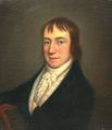
After the Jacobite Risings of the 18th century, Cumbria became a more stable place and, as in the rest of Northern England, the Industrial Revolution caused a large growth in urban populations. In particular, the west coast towns of Workington, Millom and Barrow-in-Furness saw large iron and steel mills develop, with Barrow also developing a significant shipbuilding industry.[18] Kendal, Keswick and Carlisle all became mill towns, with textiles, pencils and biscuits among the products manufactured in the region. The early 19th century saw the county gain fame when the Lake Poets and other artists of the Romantic movement, such as William Wordsworth and Samuel Taylor Coleridge, lived among, and were inspired by, the lakes and mountains of the region. Later, the children's writer Beatrix Potter also wrote in the region and became a major landowner, granting much of her property to the National Trust on her death.[19] In turn, the large amount of land owned by the National Trust assisted in the formation in 1951 of the Lake District National Park,[بحاجة لمصدر] which remains the largest National Park in England and has come to dominate the identity and economy of the county.
The Windscale fire of 10 October 1957 was the worst nuclear accident in Great Britain's history.[20]
Cumbria was created in 1974 from the traditional counties of Cumberland and Westmorland, the Cumberland County Borough of Carlisle, along with the North Lonsdale or Furness part of Lancashire, usually referred to as "Lancashire North of the Sands", (including the county borough of Barrow-in-Furness) and, from the West Riding of Yorkshire, the Sedbergh Rural District.[8] Between 1974 and 2023 it was governed by Cumbria County Council but in 2023 the county council was abolished and replaced by Cumberland and Westmorland and Furness.
On 2 June 2010, taxi driver Derrick Bird killed 12 people and injured 11 others in a shooting spree that spanned over 24 kilometres (15 mi) along the Cumbrian coastline.[21]
Local newspapers The Westmorland Gazette and Cumberland and Westmorland Herald continue to use the name of their historic counties. Other publications, such as local government promotional material, describe the area as "Cumbria", as does the Lake District National Park Authority.
الجغرافيا
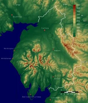
Cumbria is the most northwesterly ceremonial county of England. Most of Cumbria is mountainous, with the majority of the county being situated in the Lake District while the Pennines, consisting of the Yorkshire Dales and the North Pennines, lie at the eastern and south-east areas of the county. At 978 metres (3,209 ft) Scafell Pike is the highest point in Cumbria and in England. Windermere is the largest natural lake in England.
The Lancaster Canal runs from Preston into southern Cumbria and is partly in use. The Ulverston Canal which once reached to Morecambe Bay is maintained although it was closed in 1945. The Solway Coast and Arnside and Silverdale AONB's lie in the lowland areas of the county, to the north and south respectively.
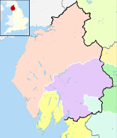
الحدود والتقسيمات
يحدها المقاطعات الإنگليزية؛ نورث ثمبرلاند، مقاطعة دِرَم، شمال يوركشاير، لانكشير ومناطق المجالس المحلية الاسكتلندية دمفريز وگالواي والحدود الاسكتلندية.
الاقتصاد

Many large companies and organisations are based in Cumbria. The county council itself employs around 17,000 individuals, while the largest private employer in Cumbria, the Sellafield nuclear processing site, has a workforce of 10,000.[22] Below is a list of some of the county's largest companies and employers (excluding services such as Cumbria Constabulary, Cumbria Fire and Rescue and the NHS in Cumbria), categorised by district.
السياحة
|
|
المردود الاقتصادي
| Year | Regional Gross Value Added[23] | الزراعة[24] | الصناعة[25] | الخدمات[26] |
|---|---|---|---|---|
| 1995 | 2,679 | 148 | 902 | 1,629 |
| 2000 | 2,843 | 120 | 809 | 1,914 |
| 2003 | 3,388 | 129 | 924 | 2,335 |
| السنة | القيمة الإجمالية المحلية المضافة [23] | الزراعة[24] | Industry[25] | الخدمات[26] |
|---|---|---|---|---|
| 1995 | 2,246 | 63 | 1,294 | 888 |
| 2000 | 2,415 | 53 | 1,212 | 1,150 |
| 2003 | 2,870 | 60 | 1,420 | 1,390 |
السياسة
| الدائرة الانتخابية | 1983 | 1987 | 1992 | 1997 | 2001 | 2005 | 2010 |
|---|---|---|---|---|---|---|---|
| بارو وفرنس | CON Cecil Franks | LAB John Hutton | LAB John Woodcock | ||||
| كارلايل | LAB Ronald Lewis | LAB Eric Martlew | CON John Stevenson | ||||
| كوپلاند | LAB Jack Cunningham | LAB Jamie Reed | |||||
| پنرث والحدود | CON David Maclean | CON Rory Stewart | |||||
| وستمورلاند و لونزديل | CON Michael Jopling | CON Tim Collins | LD Tim Farron | ||||
| وركنگتون | LAB Dale Campbell-Savours | LAB Tony Cunningham | |||||
| الانتخابات العامة 2010: كمبريا | |||||||||
|---|---|---|---|---|---|---|---|---|---|
| المحافظون | العمل | الديمقراطيون الليبراليون | BNP | UKIP | الخضر | الديمقراطيون الإنگليز | الاتحاد التجاري والاشتراكي | آخرون | الإقبال |
| 88,372 +8,328 |
60,292 −6,068 |
59,986 +9,664 |
5,149 N/A |
4,899 +197 |
1,003 N/A |
414 −248 |
376 N/A |
263 −780 |
220,754 +17,621 |
| إجمالي عدد المقاطع في 2010 | |||||||||
|---|---|---|---|---|---|---|---|---|---|
| العمل | المحافظون | الديمقراطيون الليبراليون | BNP | UKIP | الخضر | الديمقراطيون الإنگليز | الاتحاد التجاري والاشتراكي | آخرون | |
| 3 | 2 | 1 | 0 | 0 | 0 | 0 | 0 | 0 | |
التعليم
 مقالة مفصلة: قائمة مدارس كمبريا
النقل
الديموغرافيا
|
|
|
|
| إجمالي سكان كمبريا | |||||||
|---|---|---|---|---|---|---|---|
| السنة | السكان | السنة | السكان | السنة | السكان | ||
| 1801 | 173,017 | 1871 | 365,556 | 1941 | 456,833 | ||
| 1811 | 193,139 | 1881 | 410,856 | 1951 | 471,897 | ||
| 1821 | 225,555 | 1891 | 434,867 | 1961 | 473,706 | ||
| 1831 | 242,320 | 1901 | 437,364 | 1971 | 475,669 | ||
| 1841 | 255,603 | 1911 | 440,485 | 1981 | 471,693 | ||
| 1851 | 274,957 | 1921 | 441,483 | 1991 | 489,191 | ||
| 1861 | 320,257 | 1931 | 442,693 | 2001 | 487,607 | ||
| Pre-1974 statistics were gathered from local government areas that now comprise Cumbria Source: Great Britain Historical GIS.[27] | |||||||
المستوطنات
مدن شقيقة
| المستوطنة | المقاطعة | المدينة الشقيقة |
|---|---|---|
| كارلايل | كارلايل | |
| Cockermouth | Allerdale | |
| Dalton-in-Furness | Barrow-in-Furness | |
| Kendal | South Lakeland | |
| Penrith | إيدن | |
| Sedbergh | South Lakeland | |
| Ulverston | South Lakeland | |
| Whitehaven | Copeland | |
| Windermere | South Lakeland | |
| Workington | Allerdale |
الرموز والشعارات
الرياضة
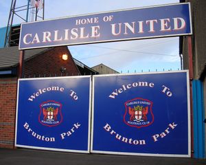
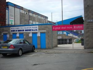
أشهر الأماكن
| المفتاح | |
| كنيسة/كاتدرائية | |
| منطقة مفتوحة للمعاقين | |
| منتزه ترفيهي/حديقة ملاهي | |
| قلعة | |
| منتزه المقاطعة | |
| تراث إنگليزي | |
| هيئة الغابات | |
| سكك حديدية تراثية | |
| بيت تاريخي | |
| متحف (مجاني/غير مجاني) | |
| صندوق وطني | |
| مسرح | |
| حديقة حيوان | |
مشاهير المقاطعة
انظر أيضاً
- موضوعات عن إنگلترة
- قائمة الموضوعات المتعلقة بكمبريا
- الحدود الإنگليزية الإسكتلندية
- مجلس مقاطعة كمبريا
- اللهجة الكمبرية
- اللغة الكمبرية
- تسمية أسمء الأماكن الكمبرية
- Cumbrian toponymy
- List of High Sheriffs of Cumbria
- List of Lord Lieutenants of Cumbria
المصادر
- ^ "No. 62943". The London Gazette. 13 March 2020. p. 5161.
- ^ قالب:NOMIS2021
- ^ "Names for two controversial Cumbria councils revealed". BBC News. 5 November 2021. Archived from the original on 24 November 2021. Retrieved 24 November 2021.
- ^ Tim (30 July 2011). "Terminology topics 5: Cumbria". Senchus (in الإنجليزية). Retrieved 5 January 2022.
- ^ "Cumberland :: Survey of English Place-Names". epns.nottingham.ac.uk. Retrieved 5 January 2022.
- ^ Molyneaux, George (2015). The Formation of the English Kingdom in the Tenth Century (First ed.). Oxford, United Kingdom: Oxford University Press. ISBN 978-0-19-871791-1. OCLC 898531165.
- ^ Phythian-Adams, Charles (1996). Land of the Cumbrians : a study in British provincial origins, A.D. 400-1120. Aldershot, England: Scolar Press. ISBN 1-85928-327-6. OCLC 35012254.
- ^ أ ب "Local Government Act 1972". www.legislation.gov.uk. Archived from the original on 1 July 2018. Retrieved 16 August 2018.
- ^ Castleden, Rodney (1992). Neolithic Britain: New Stone Age Sites of England, Scotland, and Wales. Routledge. ISBN 9780415058452. Archived from the original on 20 August 2018. Retrieved 20 August 2018.
- ^ Barrowclough (2010), p. 105.
- ^ Shotter (2014), p.5
- ^ "Frontiers of the Roman Empire". whc.unesco.org. UNESCO World Heritage Centre. Archived from the original on 20 August 2018. Retrieved 20 August 2018.
- ^ "Cymric". Online Etymological Dictionary. Archived from the original on 27 April 2010. Retrieved 25 September 2010.
- ^ Davies, John (2007) [1990]. A History of Wales. Penguin Books. pp. 68–69.
- ^ Ronan, Toolis (31 January 2017). The lost Dark Age kingdom of Rheged : the discovery of a royal stronghold at Trusty's Hill, Galloway. Bowles, Christopher R. Oxford. ISBN 9781785703126. OCLC 967457029.
{{cite book}}: CS1 maint: location missing publisher (link) - ^ Sharpe, Richard (2006). Norman rule in Cumbria, 1092-1136. Cumberland and Westmorland Antiquarian and Archaeological Society. ISBN 978-1873124437. OCLC 122952827.
- ^ Tuck, J.A. (January 1986). "The Emergence of a Northern Nobility, 1250–1400". Northern History. 22 (1): 1–17. doi:10.1179/007817286790616516. ISSN 0078-172X.
- ^ Gill, Jepson (15 November 2017). Barrow-in-Furness at Work : People and Industries Through the Years. Stroud: Amberley Publishing. ISBN 9781445670041. OCLC 1019605931.
- ^ Sarah, Gristwood (9 June 2016). The Story of Beatrix Potter. London: Pavilion Books. ISBN 9781909881808. OCLC 951610299.
- ^ Richard Black (18 March 2011). "Fukushima - disaster or distraction?". BBC. Archived from the original on 11 April 2020. Retrieved 23 August 2019.
- ^ Fresco, Adam (2 June 2010). "Police identify man wanted over drive-by shootings in Cumbria". The Times. London. Archived from the original on 14 December 2021. Retrieved 2 June 2010.
- ^ "Cumbrian employers supporting staff after multiple shooting". Personneltoday. 3 June 2010. Archived from the original on 24 December 2013. Retrieved 15 July 2010.
- ^ أ ب المكونات قد تكون غير مضافة للإجمالي لأنها مقربة
- ^ أ ب تشمل الصيد والغابات
- ^ أ ب تشمل الطاقة والإنشاءات
- ^ أ ب تشمل خدمات الوساطة المالية المقاسة بطريقة غير مباشرة
- ^ A Vision of Britain through time, Cumbria Modern (post 1974) County: Total Population, http://www.visionofbritain.org.uk/data_cube_page.jsp?data_theme=T_POP&data_cube=N_TOT_POP&u_id=10105833&c_id=10001043&add=N, retrieved on 10 January 2010
- ^ http://www.kozloduy.bg/proekti/pobratimeni-gradove_en
وصلات خارجية
- Visit Cumbria Tourism Guide to Cumbria with over 1,000 information pages.
- Pages using gadget WikiMiniAtlas
- CS1 maint: location missing publisher
- Short description is different from Wikidata
- Articles with hatnote templates targeting a nonexistent page
- Pages using multiple image with auto scaled images
- Coordinates on Wikidata
- Convert errors
- Articles with unsourced statements from September 2018
- Articles containing لاتينية-language text
- Articles containing ويلزية-language text
- Articles with unsourced statements from October 2021
- كمبريا
- مقاطعات صغرى
- شمال شرق إنگلترة
- أقاليم التصنيف الثاني في المملكة المتحدة


