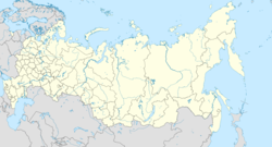
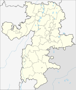
باكال
Bakal
Бакал | |
|---|---|
| الإحداثيات: 54°56′N 58°49′E / 54.933°N 58.817°E | |
| البلد | روسيا |
| الكيان الاتحادي | Chelyabinsk Oblast[1] |
| Administrative district | Satkinsky District[1] |
| Town | Bakal[1] |
| Founded | 1757 |
| Town status since | October 25, 1951 |
| المنسوب | 597 m (1٬959 ft) |
| التعداد | |
| • الإجمالي | 20٬940 |
| • Capital of | Town of Bakal[1] |
| • Municipal district | Satkinsky Municipal District[1] |
| • Urban settlement | Bakalskoye Urban Settlement[1] |
| • Capital of | Bakalskoye Urban Settlement[3] |
| منطقة التوقيت | UTC+ ([4]) |
| Postal code(s)[5] | 456900, 456901, 456903 |
| OKTMO ID | 75649103001 |
| الموقع الإلكتروني | admbakal |
Bakal (روسية: Бака́л) is a town in Satkinsky District of Chelyabinsk Oblast, Russia, located on the western slopes of the Ural Mountains on the Chelyabinsk–Ufa railway branch, 264 kilometers (164 mi) west from Chelyabinsk, the administrative center of the oblast. Population: 20,940 (تعداد 2010);[2] 22,314 (تعداد 2002);[6] 24,101 (تعداد 1989).[7]
. . . . . . . . . . . . . . . . . . . . . . . . . . . . . . . . . . . . . . . . . . . . . . . . . . . . . . . . . . . . . . . . . . . . . . . . . . . . . . . . . . . . . . . . . . . . . . . . . . . . . . . . . . . . . . . . . . . . . . . . . . . . . . . . . . . . . . . . . . . . . . . . . . . . . . . . . . . . . . . . . . . . . . . .
التاريخ
It was founded in 1757 as a settlement of serfs resettled to man new Bakal iron ore mines owned by the association of Ivan and Yakov Tverdyshev and Ivan Myasnikov.[بحاجة لمصدر]
During 1941–1943, a gulag labor camp existed in the area known as Bakal ITL ("Bakal Corrective Labor Camp"), Bakallag (Бакаллаг, abbr. for "Bakal camp") or Bakalstroy of NKVD (Бакалстрой, abbr. for "Bakal construction"), with headquarters in Chelyabinsk. Its main occupations were the construction of a metallurgic, coke, and other plants, logging, and mining. Its peak inmate count was about 4,200. In addition, Bakalstroy was manned by Germans (with the peak count of over 27,000 as of January 1942).
Town status was granted to Bakal on October 25, 1951.[بحاجة لمصدر]
الوضع الإداري والبلدي
Within the framework of administrative divisions, it is, together with four rural localities, incorporated within Satkinsky District as the Town of Bakal.[1] As a municipal division, the Town of Bakal is incorporated within Satkinsky Municipal District as Bakalskoye Urban Settlement.[1]
الاقتصاد
The town's main enterprise is public company "Bakal Mining Administration" (ОАО "Бакальское рудоуправление", Bakalskoye rudoupravleniye, commonly referred by its abbreviation "БРУ", BRU). The bureaucratic-style name is inherited from the Soviet times.
مرئيات
| Hidden inside a Maya Pyramid. |
المصادر
ملاحظات
- ^ أ ب ت ث ج ح خ د ذ Resolution #161
- ^ أ ب Russian Federal State Statistics Service (2011). "Всероссийская перепись населения 2010 года. Том 1". Всероссийская перепись населения 2010 года (2010 All-Russia Population Census) (in Russian). Federal State Statistics Service. Retrieved June 29, 2012.
{{cite web}}: Invalid|ref=harv(help); Unknown parameter|trans_title=ignored (|trans-title=suggested) (help)CS1 maint: unrecognized language (link) - ^ قالب:OKTMO reference
- ^ "Об исчислении времени". Официальный интернет-портал правовой информации (in Russian). 3 June 2011. Retrieved 19 January 2019.
{{cite web}}: CS1 maint: unrecognized language (link) - ^ Почта России. Информационно-вычислительный центр ОАСУ РПО. (Russian Post). Поиск объектов почтовой связи (Postal Objects Search) (in روسية)
- ^ Федеральная служба государственной статистики (Federal State Statistics Service) (2004-05-21). "Численность населения России, субъектов Российской Федерации в составе федеральных округов, районов, городских поселений, сельских населённых пунктов – районных центров и сельских населённых пунктов с населением 3 тысячи и более человек[[Category:Articles containing روسية-language text]] (Population of Russia, its federal districts, federal subjects, districts, urban localities, rural localities—administrative centers, and rural localities with population of over 3,000)". Всероссийская перепись населения 2002 года (All-Russia Population Census of 2002) (in Russian). Federal State Statistics Service. Retrieved 2008-07-25.
{{cite web}}: URL–wikilink conflict (help)CS1 maint: unrecognized language (link) - ^ "Всесоюзная перепись населения 1989 г. Численность наличного населения союзных и автономных республик, автономных областей и округов, краёв, областей, районов, городских поселений и сёл-райцентров.[[Category:Articles containing روسية-language text]] (All Union Population Census of 1989. Present population of union and autonomous republics, autonomous oblasts and okrugs, krais, oblasts, districts, urban settlements, and villages serving as district administrative centers.)". Всесоюзная перепись населения 1989 года (All-Union Population Census of 1989) (in Russian). Demoscope Weekly (website of the Institute of Demographics of the State University—Higher School of Economics. 1989. Retrieved 2007-12-13.
{{cite web}}: Italic or bold markup not allowed in:|publisher=(help); URL–wikilink conflict (help)CS1 maint: unrecognized language (link)
Sources
وصلات خارجية
- Memorial. Bakal ITL
- Official website of Bakal Archived سبتمبر 20, 2019 at the Wayback Machine (in روسية)
- Directory of organizations in Bakal (in روسية)
خطأ لوا في وحدة:Authority_control على السطر 278: attempt to call field '_showMessage' (a nil value).
- Pages using gadget WikiMiniAtlas
- CS1 errors: unsupported parameter
- Articles with روسية-language sources (ru)
- Articles containing روسية-language text
- CS1 errors: URL–wikilink conflict
- CS1 errors: markup
- Short description is different from Wikidata
- Infobox mapframe without OSM relation ID on Wikidata
- Coordinates on Wikidata
- Pages using infobox settlement with image map1 but not image map
- Articles with unsourced statements from September 2014
- Cities and towns in Chelyabinsk Oblast
- Populated places established in 1757
- Geography of Gulag
- صفحات مع الخرائط


