ڤليكو ترنوڤو
ڤليكو ترنوڤو
Велико Търново Veliko Tarnovo | |
|---|---|
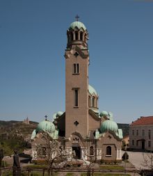
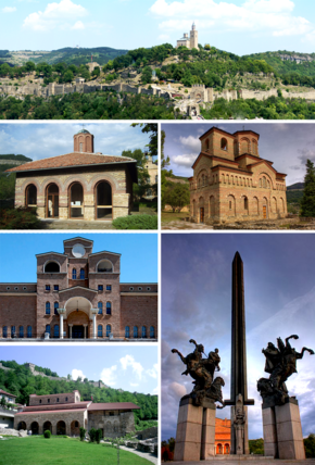 أعلى: View of Tsarevets Fortress، وسط اليسار: Saint Peter and Paul Church, Middle right:Saint Demetrius church, Bottom upper left:Boris Denev Art Gallery، أسفل اليسار: Saint Forty Martyrs bChurch, أسفل اليمين: The monument of the Assens | |
| الإحداثيات: 43°05′N 25°39′E / 43.083°N 25.650°E | |
| البلد | بلغاريا |
| المحافظة (أوبلاست) | ڤليكو ترنوڤو |
| الحكومة | |
| • العمدة | Daniel Panov |
| المساحة | |
| • الإجمالي | 30٫379 كم² (11٫729 ميل²) |
| المنسوب | 220 m (720 ft) |
| التعداد (Census February 2011).[1] | 200٬292 Metro |
| منطقة التوقيت | UTC+2 (EET) |
| • الصيف (التوقيت الصيفي) | UTC+3 (EEST) |
| Postal code | 5000 |
| Area code | 062 |
| الموقع الإلكتروني | Official website |
ڤليكو تورنوڤو (بالبلغارية: Велико Търново، تـُنطـَق [vɛˈliko ˈtɤrnovo]؛ "ترنوڤو الكبرى") هي مدينة في محافظة ڤليكو ترنوڤو في شمال وسط بلغاريا.
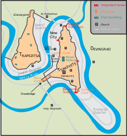
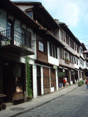
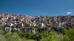
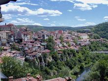
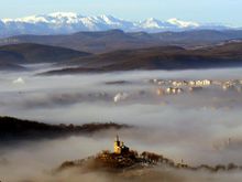
وكثيراً ما يشار إليها بلقب "مدينة القياصرة"، تقع ڤليكو ترنوڤو على نهر يانترا and is famously known as the historical capital of the Second Bulgarian Empire, attracting many tourists with its unique architecture. The old part of the town is situated on three hills, Tsarevets, Trapezitsa, and Sveta Gora, rising amidst the meanders of the Yantra. On Tsarevets are the palaces of the Bulgarian emperors and the Patriarchate, the Patriarchal Cathedral, and also a number of administrative and residential edifices surrounded by thick walls.
Trapezitsa is known for its many churches and as the former main residence of the nobility. في العصور الوسطى، كانت البلدة ضمن المراكز الأوروبية الرئيسية للثقافة وأعطت اسمها لـ عمارة مدرسة ترنوڤو الفنية ورسم مدرسة ترنوڤو الفنية والأدب. Veliko Tarnovo is an important administrative, economic, educational, and cultural centre of شمال بلغاريا.
. . . . . . . . . . . . . . . . . . . . . . . . . . . . . . . . . . . . . . . . . . . . . . . . . . . . . . . . . . . . . . . . . . . . . . . . . . . . . . . . . . . . . . . . . . . . . . . . . . . . . . . . . . . . . . . . . . . . . . . . . . . . . . . . . . . . . . . . . . . . . . . . . . . . . . . . . . . . . . . . . . . . . . . .
التاريخ
الحكم العثماني
المناخ
| Climate data for ڤليكو تورنوڤو، بلغاريا (سجلات 1961-1990، 1926-1970) | |||||||||||||
|---|---|---|---|---|---|---|---|---|---|---|---|---|---|
| Month | Jan | Feb | Mar | Apr | May | Jun | Jul | Aug | Sep | Oct | Nov | Dec | Year |
| Record high °C (°F) | 20.4 (68.7) |
23.3 (73.9) |
29.7 (85.5) |
32.2 (90.0) |
36.1 (97.0) |
38.4 (101.1) |
40 (104) |
41.1 (106.0) |
40.6 (105.1) |
33.8 (92.8) |
29.8 (85.6) |
21.8 (71.2) |
41.1 (106.0) |
| Mean daily maximum °C (°F) | 2.1 (35.8) |
5.7 (42.3) |
11.4 (52.5) |
18.6 (65.5) |
23.4 (74.1) |
27 (81) |
29.6 (85.3) |
29.8 (85.6) |
26 (79) |
19.4 (66.9) |
12.4 (54.3) |
5.1 (41.2) |
17.5 (63.5) |
| Daily mean °C (°F) | −2.3 (27.9) |
0.7 (33.3) |
5.5 (41.9) |
12.1 (53.8) |
17.2 (63.0) |
20.7 (69.3) |
22.9 (73.2) |
22.4 (72.3) |
18.1 (64.6) |
12.4 (54.3) |
6.9 (44.4) |
0.9 (33.6) |
11.5 (52.7) |
| Mean daily minimum °C (°F) | −6.8 (19.8) |
−4.3 (24.3) |
−0.2 (31.6) |
5.3 (41.5) |
10 (50) |
13.5 (56.3) |
15.2 (59.4) |
14.5 (58.1) |
10.7 (51.3) |
6.1 (43.0) |
2.4 (36.3) |
−3.1 (26.4) |
5.3 (41.5) |
| Record low °C (°F) | −20.8 (−5.4) |
−28.1 (−18.6) |
−16.7 (1.9) |
−2.5 (27.5) |
2 (36) |
— | 9.8 (49.6) |
9.2 (48.6) |
−0.8 (30.6) |
−2.6 (27.3) |
−9.8 (14.4) |
−18.4 (−1.1) |
−28.1 (−18.6) |
| Average precipitation mm (inches) | 48 (1.9) |
44 (1.7) |
43 (1.7) |
63 (2.5) |
88 (3.5) |
86 (3.4) |
65 (2.6) |
56 (2.2) |
41 (1.6) |
45 (1.8) |
51 (2.0) |
50 (2.0) |
680 (26.8) |
| Source: Stringmeteo.com[2] | |||||||||||||
التعداد
| Veliko Tarnovo | |||||||||||||
|---|---|---|---|---|---|---|---|---|---|---|---|---|---|
| السنة | 1887 | 1910 | 1934 | 1946 | 1956 | 1965 | 1975 | 1985 | 1992 | 2001 | 2005 | 2009 | 2011 |
| السكان | 11,314 | 12,469 | 13,963 | 16,223 | 24,648 | 37,337 | 56,664 | 69,173 | 77,644 | 86,897 | 86,145 | 97,099 | 100,783 |
| أعلى رقم 100,783 في 1985 | |||||||||||||
| Sources: National Statistical Institute,[1][3][4] „citypopulation.de“,[5] „pop-stat.mashke.org“,[6] Bulgarian Academy of Sciences[7] | |||||||||||||
الأعراق
- Bulgarians: 59,649 (95.5%)
- Turks: 2,225 (3.6%)
- الغجر: 123 (0.2%)
- Others: 258 (0.4%)
- Indefinable: 198 (0.3%)
- Romanians: 2
- Undeclared: 6,330 (9.2%)
الإجمالي: 100,783
العلاقات الدولية
. . . . . . . . . . . . . . . . . . . . . . . . . . . . . . . . . . . . . . . . . . . . . . . . . . . . . . . . . . . . . . . . . . . . . . . . . . . . . . . . . . . . . . . . . . . . . . . . . . . . . . . . . . . . . . . . . . . . . . . . . . . . . . . . . . . . . . . . . . . . . . . . . . . . . . . . . . . . . . . . . . . . . . . .
المدن الشقيقة
Veliko Tarnovo is متوأمة مع the following cities:[8]
 ڤغرشاپت، أرمينيا
 نخجوان، أذربيجان
 شيآن، الصين
 أستي، إيطاليا
 فـِرارا، إيطاليا
 بايون، فرنسا
 بيتولا، شمال مقدونيا
 تستينيه، الجبل الأسود
 Colonia Tovar، ڤنزويلا
 ياشي، رومانيا
 كراكوڤ، پولندا
 نيش، صربيا
 أوخريد، شمال مقدونيا
 Maebashi، اليابان
 پولتاڤا، أوكرانيا
 سيرس، اليونان
 Tarxien، مالطا
 زادار، كرواتيا
 Opava، جمهورية التشيك
 طليطلة، اسبانيا
 تڤر، روسيا
 الكرك، Jordan[9]
الهامش
- ^ أ ب خطأ استشهاد: وسم
<ref>غير صحيح؛ لا نص تم توفيره للمراجع المسماةnsi.bg - ^ http://www.stringmeteo.com/synop/bg_climate.php#15530
- ^ (بلغارية) National Statistical Institute – Towns population 1956–1992
- ^ (إنگليزية) Bulgarian National Statistical Institute – towns in 2009
- ^ (إنگليزية) „WorldCityPopulation“
- ^ „pop-stat.mashke.org“
- ^ (بلغارية) Bulgarian Academy of Sciences
- ^ [1]
- ^ НАЦИОНАЛНО СДРУЖЕНИЕ НА ОБЩИНИТЕ В РЕПУБЛИКА БЪЛГАРИЯ namrb.org
وصلات خارجية
- Pages using gadget WikiMiniAtlas
- Short description with empty Wikidata description
- Coordinates not on Wikidata
- Pages using infobox settlement with unknown parameters
- Articles containing بلغارية-language text
- Articles with hatnote templates targeting a nonexistent page
- Veliko Tarnovo
- عواصم سابقة لبلغاريا
- Populated places in Veliko Tarnovo Province
- مدن بلغاريا


