وحدة:Location map/data/USSR
| الاسم | USSR | ||
|---|---|---|---|
| x | sin((($2<0)*360+$2)/70.032-1.4993)*(115.34-1.2134*$1)+58.71 | ||
| y | cos((($2<0)*360+$2)/70.032-1.4993)*(186.47-1.9618*$1)-11.25 | ||
| الصورة | Soviet Union location map.svg | ||

| |||
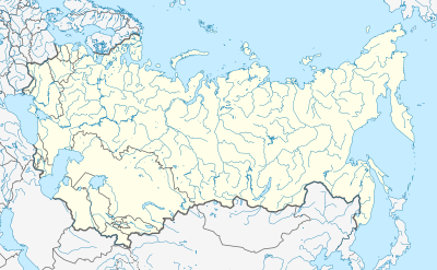
وحدة:Location map/data/USSR is a location map definition used to overlay markers and labels on an equirectangular projection map of USSR. The markers are placed by latitude and longitude coordinates on the default map or a similar map image.
Usage
These definitions are used by the following templates when invoked with parameter "USSR":
{{Location map | USSR | ...}}{{Location map many | USSR | ...}}{{Location map+ | USSR | ...}}{{Location map~ | USSR | ...}}
Map definition
- name = USSR
- Name used in the default map caption
- image = Soviet Union location map.svg
- The default map image, without "Image:" or "File:"
- x = sin((($2<0)*360+$2)/70.032-1.4993)*(115.34-1.2134*$1)+58.71
- An expression to calculate a location on the map via its longitude; evaluates as 0 along the left edge and 100 along the right edge
- y = cos((($2<0)*360+$2)/70.032-1.4993)*(186.47-1.9618*$1)-11.25
- An expression to calculate a location on the map via its latitude; evaluates as 0 along the top edge and 100 along the bottom edge
Examples using location map templates
Location map: Eastern hemisphere, Deg/Min/Sec coordinates
Location of Moscow in the Soviet Union
{{Location map | USSR
| width = 300
| float = right
| caption = Location of [[Moscow]] in the Soviet Union
| label = Moscow
| background = lightblue
| position = right
| lat_deg= 55 | lat_min=45 | lat_sec=06 | lat_dir=N
| lon_deg=037 | lon_min=37 | lon_sec=04 | lon_dir=E
}}
Location map: Eastern hemisphere, Decimal coordinates
Location of Moscow in the Soviet Union
{{Location map | USSR
| width = 300
| float = right
| caption = Location of [[Moscow]] in the Soviet Union
| label = Moscow
| background = lightblue
| position = right
| lat = 55.75167
| long = 37.61778
}}
Location map many: Deg/Min/Sec coordinates, alternative map
{{Location map many | USSR
| AlternativeMap = Soviet Union location map (provinces).svg
| width = 300
| float = right
| caption = [[Moscow]] and [[Egvekinot]] in the Soviet Union
| label1 = Moscow | label_size = 90
| bg1 = lightblue | pos = right
| lat1_deg= 55 | lat1_min=45 | lat1_sec=06 | lat1_dir=N
| lon1_deg=037 | lon1_min=37 | lon1_sec=04 | lon1_dir=E
| label2 = Egvekinot | label2_size = 90
| bg2 = lightgreen | pos2 = left
| lat2_deg= 66 | lat2_min=19 | lat2_sec=06 | lat2_dir=N
| lon2_deg=179 | lon2_min=07 | lon2_sec=24 | lon2_dir=W
}}
See also
- Location map templates
- Template:Location map, to display one mark and label using latitude and longitude
- Template:Location map many, to display up to nine marks and labels
- Template:Location map+, to display an unlimited number of marks and labels
- Infobox templates incorporating (passing values to) the Location map template
أظهر
List
