وحدة:Location map/data/France Burgundy/شرح
هذه صفحة توثيق لوحدة:Location map/data/France Burgundy
خطأ لوا في package.lua على السطر 80: module 'وحدة:Location map/data/France Burgundy/شرح' not found.
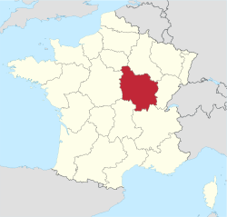
وحدة:Location map/data/France Burgundy is a location map definition used to overlay markers and labels on an equirectangular projection map of Burgundy. The markers are placed by latitude and longitude coordinates on the default map or a similar map image.
Usage
These definitions are used by the following templates when invoked with parameter "France Burgundy":
{{Location map | France Burgundy | ...}}{{Location map many | France Burgundy | ...}}{{Location map+ | France Burgundy | ...}}{{Location map~ | France Burgundy | ...}}
Map definition
- name = Burgundy
- Name used in the default map caption
- image = 4-Région-fr-Bourgogne-carte-A.svg
- The default map image, without "Image:" or "File:"
- image1 = 4-Région-fr-Bourgogne-carte-R.jpg
- An alternative map image, usually a relief map, can be displayed via the relief or AlternativeMap parameters
- top = 48.5
- Latitude at top edge of map, in decimal degrees
- bottom = 46
- Latitude at bottom edge of map, in decimal degrees
- left = 2.45
- Longitude at left edge of map, in decimal degrees
- right = 5.7
- Longitude at right edge of map, in decimal degrees
Alternative map
The map defined as image1 (4-Région-fr-Bourgogne-carte-R.jpg) can be displayed by using the relief or AlternativeMap parameters in {{Location map}}, {{Location map many}} and {{Location map+}}. The use of these two parameters is shown in the examples below. Additional examples can be found at:
- Template:Location map#Relief parameter
- Template:Location map#AlternativeMap parameter
- Template:Location map+/relief
- Template:Location map+/AlternativeMap
Precision
Longitude: from West to East this map definition covers 3 degrees.
- At an image width of 200 pixels, that is 0.015 degrees per pixel.
- At an image width of 1000 pixels, that is 0.003 degrees per pixel.
Latitude: from North to South this map definition covers 2.5 degrees.
- At an image height of 200 pixels, that is 0.0125 degrees per pixel.
- At an image height of 1000 pixels, that is 0.0025 degrees per pixel.
Examples using location map templates
Location map, using default map (image)
{{Location map | France Burgundy
| width   = 250
| lat_deg = 47.291
| lon_deg = 5.043
| label   = Dijon
}}
Location map many, using relief map (image1)
{{Location map many | France Burgundy
| relief   = yes
| width    = 250
| caption  = Locations in the Burgundy region
| lat1_deg = 47.291
| lon1_deg = 5.043
| label1   = Dijon
| lat2_deg = 47.799
| lon2_deg = 3.567
| label2   = Auxerre
}}
Location map+, using AlternativeMap
{{Location map+ | France Burgundy
| AlternativeMap = 4-Région-fr-Bourgogne-carte-R.jpg
| width   = 250
| caption = Locations in the Burgundy region
| places  =
  {{Location map~ | France Burgundy
  | lat_deg = 47.291
  | lon_deg = 5.043
  | label   = Dijon
  }}
  {{Location map~ | France Burgundy
  | lat_deg = 47.799
  | lon_deg = 3.567
  | label   = Auxerre
  }}
}}
See also
- Module:Location map/data/France
- Template:Location map France Bourgogne, uses different maps with different edge coordinates
- Location map templates
- Template:Location map, to display one mark and label using latitude and longitude
- Template:Location map many, to display up to nine marks and labels
- Template:Location map+, to display an unlimited number of marks and labels
- Infobox templates incorporating (passing values to) the Location map template
- Template:Infobox airport — alternative map support: relief (via pushpin_relief) and AlternativeMap (via pushpin_image)
- Template:Infobox ancient site — alternative map support: relief
- Template:Infobox artwork
- Template:Infobox building — alternative map support: relief
- Template:Infobox casino
- Template:Infobox castrum — alternative map support: relief (via map_relief)
- Template:Infobox cave (via Infobox map) — alternative map support: relief
- Template:Infobox cemetery
- Template:Infobox civil conflict
- Template:Infobox climbing route (via Infobox map) — alternative map support: relief
- Template:Infobox church — alternative map support: relief
- Template:Infobox concentration camp
- Template:Infobox dam — alternative map support: relief
- Template:Infobox dava
- Template:Infobox forest (via Infobox map) — alternative map support: relief
- Template:Infobox glacier (via Infobox map) — alternative map support: relief (displays relief image unless map_relief=0)
- Template:Infobox golf facility — alternative map support: relief
- Template:Infobox historic site — alternative map support: relief (via map_relief)
- Template:Infobox hospital — alternative map support: relief
- Template:Infobox hot spring (via Infobox map) — alternative map support: relief
- Template:Infobox hotel
- Template:Infobox hut — alternative map support: relief
- Template:Infobox lighthouse — alternative map support: relief
- Template:Infobox map (used by other infoboxes) — alternative map support: relief
- Template:Infobox military conflict — alternative map support: relief (via map_relief)
- Template:Infobox military conflict timeline
- Template:Infobox military installation — alternative map support: relief (via map_relief)
- Template:Infobox monastery
- Template:Infobox mountain (via Infobox map) — alternative map support: relief (displays relief image unless map_relief=0)
- Template:Infobox mountain pass (via Infobox map) — alternative map support: relief (displays relief image unless map_relief=0)
- Template:Infobox mountain range (via Infobox map) — alternative map support: relief (displays relief image unless map_relief=0)
- Template:Infobox museum — alternative map support: relief (via map_relief)
- Template:Infobox oil field — alternative map support: relief
- Template:Infobox oil refinery — alternative map support: relief
- Template:Infobox operational plan
- Template:Infobox park (via Infobox map) — alternative map support: relief
- Template:Infobox power station — alternative map support: relief
- Template:Infobox protected area (via Infobox map) — alternative map support: relief
- Template:Infobox reactor
- Template:Infobox religious building — alternative map support: relief
- Template:Infobox restaurant
- Template:Infobox settlement — alternative map support: relief (via pushpin_relief) and AlternativeMap (via pushpin_image)
- Template:Infobox temple
- Template:Infobox terrestrial impact site
- Template:Infobox valley (via Infobox map) — alternative map support: relief
- Template:Infobox waterfall (via Infobox map) — alternative map support: relief
- Template:Infobox World Heritage Site — alternative map support: relief
