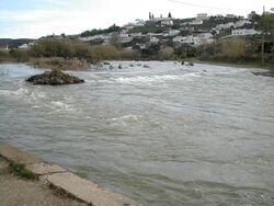
نهر أوديليتي
| Odeleite River "نهر التنين الأزرق" | |
|---|---|
 | |
 Steve Richards' picture of the river which gave it the name "نهر التنين الأزرق" فليكر | |
| الموقع | |
| البلد | البرتغال |
| المنطقة | الغرب |
| السمات الطبيعية | |
| المنبع | Serra do Caldeirao |
| التدفق | نهر يانة |
 | |
Odeleite is a river located in the municipality of Castro Marim, الغرب، في البرتغال. It originates in the mountains of the Serra do Caldeirao and flows through the municipalities Sao Bras de Alportel, Tavira, Alcoutim, Castro Marim في مقاطعة فارو. Also, there is a water reservoir of the same name because of the dam created on the path of the river. Odeleite is a right tributary of the نهر يانة.
كما يُعرف النهر بإسم "نهر التنين الأزرق" because of its dark blue color and unusual curvy shape.
. . . . . . . . . . . . . . . . . . . . . . . . . . . . . . . . . . . . . . . . . . . . . . . . . . . . . . . . . . . . . . . . . . . . . . . . . . . . . . . . . . . . . . . . . . . . . . . . . . . . . . . . . . . . . . . . . . . . . . . . . . . . . . . . . . . . . . . . . . . . . . . . . . . . . . . . . . . . . . . . . . . . . . . .