ملف:Middle Creek Battlefield.jpg

حجم هذه المعاينة: 800 × 532 بكسل. البعدان الآخران: 2٬560 × 1٬702 بكسل | 6٬016 × 4٬000 بكسل.
الملف الأصلي (6٬016 × 4٬000 بكسل حجم الملف: 6٫22 ميجابايت، نوع MIME: image/jpeg)
| موضوعات | |
|---|---|
| قوائم حسب الولاية |
|
| قائمة الأراضي | |
| قوائم حسب الولايات المرتبطة | |
| أخرى | |
37°39′4″N 82°48′44″W / 37.65111°N 82.81222°W
| ⧼wm-license-information-description⧽ |
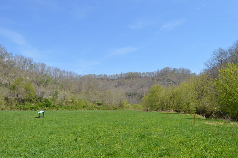
English: Looking northeast in the eastern section of the Middle Creek Battlefield, located west of Prestonsburg in Floyd County, Kentucky, United States. The hill in the distance was Union Colonel James Garfield's command post, while the Confederate position was on the hillside and hilltop barely visible to the far right. Fought here in early 1862, Middle Creek was one of the most decisive battles of the Civil War in eastern Kentucky. The site has been designated a National Historic Landmark.
|
||
| ⧼wm-license-information-date⧽ | قالب:Taken on | ||
| ⧼wm-license-information-source⧽ | ⧼Wm-license-own-work⧽ | ||
| ⧼wm-license-information-author⧽ | Nyttend | ||
| ⧼wm-license-information-permission⧽ (⧼wm-license-information-permission-reusing-text⧽) |
|
تاريخ الملف
اضغط على زمن/تاريخ لرؤية الملف كما بدا في هذا الزمن.
| زمن/تاريخ | صورة مصغرة | الأبعاد | مستخدم | تعليق | |
|---|---|---|---|---|---|
| حالي | ★ مراجعة معتمدة 22:45، 13 أكتوبر 2023 | | 6٬016 × 4٬000 (6٫22 ميجابايت) | Pastakhov (نقاش | مساهمات) | Upload https://upload.wikimedia.org/wikipedia/commons/0/03/Middle_Creek_Battlefield.jpg |
لا يمكنك استبدال هذا الملف.
وصلات
لا يوجد صفحات تصل لهذه الصورة.