مقاطعة باستروپ، تكساس
(تم التحويل من مقاطعة Bastrop، تكساس)
Bastrop County | |
|---|---|
 الموقع ضمن ولاية Texas | |
 موقع Texas ضمن الولايات المتحدة | |
| الإحداثيات: 30°06′N 97°19′W / 30.1°N 97.31°W | |
| البلد | |
| State | |
| تأسست | 1836 |
| السمِيْ | Felipe Enrique Neri, Baron de Bastrop |
| Seat | Bastrop |
| المساحة | |
| • الإجمالي | 896 ميل² (2٬320 كم²) |
| • البر | 888 ميل² (2٬301 كم²) |
| • الماء | 8 ميل² (20 كم²) 0.84%% |
| التعداد (2000) | |
| • الإجمالي | 57٬733 |
| • الكثافة | 65/sq mi (25/km2) |
| منطقة التوقيت | UTC−6 (Central) |
| • الصيف (التوقيت الصيفي) | UTC−5 (CDT) |

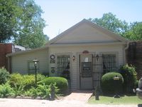
The Bastrop County Courthouse in Bastrop is designed in classical revival style. Built in 1883, the Courthouse and Jail Complex were listed in the National Register of Historic Places on November 20, 1975.

Closeup view of the Bastrop County Courthouse, located across from the Roman Catholic Church in Bastrop

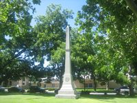
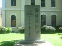
Obelisk commemorating Bastrop County soldiers in the army of the Confederate States of America is located on the courthouse grounds.
مقاطعة باستروب إنگليزية: Bastrop County هي إحدى المقاطعات في ولاية تكساس، الولايات المتحدة الأمريكية.
. . . . . . . . . . . . . . . . . . . . . . . . . . . . . . . . . . . . . . . . . . . . . . . . . . . . . . . . . . . . . . . . . . . . . . . . . . . . . . . . . . . . . . . . . . . . . . . . . . . . . . . . . . . . . . . . . . . . . . . . . . . . . . . . . . . . . . . . . . . . . . . . . . . . . . . . . . . . . . . . . . . . . . . .
المصادر
وصلات خارجية
- Bastrop County website
- Bastrop County from the Handbook of Texas Online

|
Lee County | Williamson County | Travis County | 
|
| Fayette County | Caldwell County |
تصنيفات:
- Pages using gadget WikiMiniAtlas
- Short description is different from Wikidata
- مقاطعات Texas
- U.S. Counties Missing Ex Image
- Articles containing إنگليزية-language text
- Pages using Lang-xx templates
- مقاطعات ولاية تكساس الأمريكية
- Coordinates on Wikidata
- مقاطعات تكساس
- Bastrop County, Texas
- Austin-Round Rock metropolitan area


