مقاطعة هيكمان، كنتكي
Hickman County | |
|---|---|
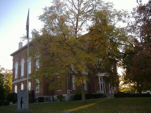
 Hickman County Courthouse in Clinton | |
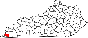
 الموقع ضمن ولاية Kentucky | |
 موقع Kentucky ضمن الولايات المتحدة | |
| الإحداثيات: 36°41′N 88°59′W / 36.68°N 88.98°W | |
| البلد | |
| State | |
| تأسست | 1821 |
| السمِيْ | Paschal Hickman |
| Seat | Clinton |
| Largest city | Clinton |
| المساحة | |
| • الإجمالي | 253 ميل² (660 كم²) |
| • البر | 242 ميل² (630 كم²) |
| • الماء | 11 ميل² (30 كم²) 4.3%% |
| التعداد (2020) | |
| • الإجمالي | 4٬521 |
| منطقة التوقيت | UTC−6 (Central) |
| • الصيف (التوقيت الصيفي) | UTC−5 (CDT) |
| Congressional district | 1st |
| الموقع الإلكتروني | hickmancounty |
مقاطعة هيكمان إنگليزية: Hickman County هي إحدى المقاطعات في ولاية كنتاكي في الولايات المتحدة الأمريكية.
. . . . . . . . . . . . . . . . . . . . . . . . . . . . . . . . . . . . . . . . . . . . . . . . . . . . . . . . . . . . . . . . . . . . . . . . . . . . . . . . . . . . . . . . . . . . . . . . . . . . . . . . . . . . . . . . . . . . . . . . . . . . . . . . . . . . . . . . . . . . . . . . . . . . . . . . . . . . . . . . . . . . . . . .
الجغرافيا
المقاطعات المجاورة
- Carlisle County (north)
- Graves County (east)
- Weakley County, Tennessee (southeast)
- Obion County, Tennessee (south)
- Fulton County (جنوب)
- مقاطعة مسيسپي، مزوري (غرب)
السكان
| التعداد التاريخي | |||
|---|---|---|---|
| التعداد | Pop. | %± | |
| 1830 | 5٬198 | — | |
| 1840 | 8٬968 | 72٫5% | |
| 1850 | 4٬791 | −46٫6% | |
| 1860 | 7٬008 | 46٫3% | |
| 1870 | 8٬453 | 20٫6% | |
| 1880 | 10٬651 | 26�0% | |
| 1890 | 11٬637 | 9٫3% | |
| 1900 | 11٬745 | 0٫9% | |
| 1910 | 11٬750 | 0�0% | |
| 1920 | 10٬244 | −12٫8% | |
| 1930 | 8٬725 | −14٫8% | |
| 1940 | 9٬142 | 4٫8% | |
| 1950 | 7٬778 | −14٫9% | |
| 1960 | 6٬747 | −13٫3% | |
| 1970 | 6٬264 | −7٫2% | |
| 1980 | 6٬065 | −3٫2% | |
| 1990 | 5٬566 | −8٫2% | |
| 2000 | 5٬262 | −5٫5% | |
| 2010 | 4٬902 | −6٫8% | |
| 2020 | 4٬521 | −7٫8% | |
| 2021 (تق.) | 4٬424 | −2٫1% | |
| U.S. Decennial Census[1] 1790-1960[2] 1900-1990[3] 1990-2000[4] 2010-2021[5] | |||
التجمعات
السياسة
| السنة | الجمهوري | الديمقراطي | حزب ثالث | |||
|---|---|---|---|---|---|---|
| رقم. | % | رقم. | % | رقم. | % | |
| 2020 | 1,714 | 77٫94% | 458 | 20٫83% | 27 | 1٫23% |
| 2016 | 1,657 | 76٫82% | 449 | 20٫82% | 51 | 2٫36% |
| 2012 | 1,431 | 66٫90% | 686 | 32٫07% | 22 | 1٫03% |
| 2008 | 1,406 | 62٫49% | 812 | 36٫09% | 32 | 1٫42% |
| 2004 | 1,395 | 59٫56% | 926 | 39٫54% | 21 | 0٫90% |
| 2000 | 1,151 | 54٫19% | 940 | 44٫26% | 33 | 1٫55% |
| 1996 | 695 | 31٫98% | 1,220 | 56٫14% | 258 | 11٫87% |
| 1992 | 861 | 35٫04% | 1,296 | 52٫75% | 300 | 12٫21% |
| 1988 | 1,142 | 49٫33% | 1,158 | 50٫02% | 15 | 0٫65% |
| 1984 | 1,380 | 56٫63% | 1,049 | 43٫04% | 8 | 0٫33% |
| 1980 | 1,143 | 42٫84% | 1,456 | 54٫57% | 69 | 2٫59% |
| 1976 | 585 | 21٫54% | 2,035 | 74٫93% | 96 | 3٫53% |
| 1972 | 1,430 | 56٫66% | 976 | 38٫67% | 118 | 4٫68% |
| 1968 | 623 | 23٫19% | 880 | 32٫76% | 1,183 | 44٫04% |
| 1964 | 613 | 22٫10% | 2,149 | 77٫47% | 12 | 0٫43% |
| 1960 | 968 | 30٫79% | 2,176 | 69٫21% | 0 | 0�00% |
| 1956 | 785 | 24٫82% | 2,367 | 74٫83% | 11 | 0٫35% |
| 1952 | 871 | 30٫40% | 1,988 | 69٫39% | 6 | 0٫21% |
| 1948 | 326 | 12٫26% | 2,143 | 80٫59% | 190 | 7٫15% |
| 1944 | 588 | 22٫60% | 2,005 | 77٫06% | 9 | 0٫35% |
| 1940 | 490 | 15٫05% | 2,758 | 84٫73% | 7 | 0٫22% |
| 1936 | 385 | 13٫04% | 2,548 | 86٫31% | 19 | 0٫64% |
| 1932 | 446 | 11٫77% | 3,327 | 87٫81% | 16 | 0٫42% |
| 1928 | 767 | 26٫12% | 2,163 | 73٫67% | 6 | 0٫20% |
| 1924 | 618 | 21٫27% | 2,270 | 78٫14% | 17 | 0٫59% |
| 1920 | 866 | 22٫01% | 3,045 | 77٫40% | 23 | 0٫58% |
| 1916 | 539 | 21٫05% | 1,982 | 77٫42% | 39 | 1٫52% |
| 1912 | 365 | 17٫66% | 1,540 | 74٫50% | 162 | 7٫84% |
. . . . . . . . . . . . . . . . . . . . . . . . . . . . . . . . . . . . . . . . . . . . . . . . . . . . . . . . . . . . . . . . . . . . . . . . . . . . . . . . . . . . . . . . . . . . . . . . . . . . . . . . . . . . . . . . . . . . . . . . . . . . . . . . . . . . . . . . . . . . . . . . . . . . . . . . . . . . . . . . . . . . . . . .
انظر أيضاً
- Murphy's Pond
- Dry counties
- National Register of Historic Places listings in Hickman County, Kentucky
المراجع
- ^ "U.S. Decennial Census". United States Census Bureau. Retrieved August 16, 2014.
- ^ "Historical Census Browser". University of Virginia Library. Retrieved August 16, 2014.
- ^ "Population of Counties by Decennial Census: 1900 to 1990". United States Census Bureau. Retrieved August 16, 2014.
- ^ "Census 2000 PHC-T-4. Ranking Tables for Counties: 1990 and 2000" (PDF). United States Census Bureau. Retrieved August 16, 2014.
- ^ خطأ استشهاد: وسم
<ref>غير صحيح؛ لا نص تم توفيره للمراجع المسماةQF - ^ Leip, David. "Dave Leip's Atlas of U.S. Presidential Elections". uselectionatlas.org. Retrieved 2018-07-02.
- Pages using gadget WikiMiniAtlas
- Short description is different from Wikidata
- Articles with hatnote templates targeting a nonexistent page
- Coordinates on Wikidata
- مقاطعات Kentucky
- Articles containing إنگليزية-language text
- Pages using Lang-xx templates
- مقاطعة هيكمان، كنتكي
- مقاطعات كنتكي
- مقاطعات كنتكي على نهر المسيسپي
- تأسيسات 1821 في كنتكي
- أماكن مأهولة تأسست في 1821
