مقاطعة فرديس
Fardis County
فارسية: شهرستان فردیس | |
|---|---|
 | |
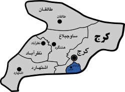
 Location of Fardis County in Alborz province (bottom, pink) | |
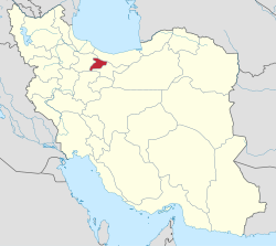
 Location of Alborz province in Iran | |
| الإحداثيات: 35°44′47″N 50°58′27″E / 35.74639°N 50.97417°E[1] | |
| Country | |
| المحافظة | Alborz |
| العاصمة | فرديس |
| Districts | Central، Meshkin Dasht |
| التعداد (2016)[2] | |
| • الإجمالي | 271٬829 |
| منطقة التوقيت | UTC+3:30 (IRST) |
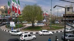
Fardis County (فارسية: شهرستان فردیس) is in Alborz province, Iran. Its capital is the city of Fardis.[3]
التاريخ
In August 2010, Karaj, Nazarabad, and Savojbolagh Counties were separated from Tehran province in the establishment of Alborz province.[4]
In July 2013, the city of Meshkin Dasht and some villages were separated from Karaj County in the establishment of Fardis County, which was divided into two districts of two rural districts each, with Fardis as its capital.[3]
السكان
Population
At the time of the 2016 National Census, the county's population was 271,829 in 86,619 households.[2]
Administrative divisions
Fardis County's population and administrative structure are shown in the following table.
| Administrative Divisions | 2016[2] |
|---|---|
| Central District | 188,129 |
| Fardis RD | 3,338 |
| Vahdat RD | 3,617 |
| Fardis (city) | 181,174 |
| Meshkin Dasht District | 83,700 |
| Farrokhabad RD | 5,407 |
| Meshkinabad RD | 16,288 |
| Meshkin Dasht (city) | 62,005 |
| Total | 271,829 |
| RD = Rural District | |
See also
 وسائط متعلقة بـمقاطعة فرديس من مشاع المعرفة.
References
- ^ OpenStreetMap contributors (25 March 2023). "Fardis County" (Map). OpenStreetMap (in الفارسية). Retrieved 25 March 2023.
- ^ أ ب ت "Census of the Islamic Republic of Iran, 1395 (2016)". AMAR (in الفارسية). The Statistical Center of Iran. p. 30. Archived from the original (Excel) on 28 January 2020. Retrieved 19 December 2022.
- ^ أ ب Rahimi, Mohammad Reza (7 July 2013). "With the approval of the government board: The counties of Fardis, Badreh and Balaveh were added to the map of country divisions". Mehr News (in الفارسية). Ministry of Interior, Board of Ministers. Archived from the original on 24 March 2023. Retrieved 11 November 2023.
- ^ Larijani, Ali (16 April 1389). "Alborz province establishment law". Lamtakam (in الفارسية). Guardian Council. Archived from the original on 16 December 2023. Retrieved 16 December 2023.
This article may include material from Wikimedia licensed under CC BY-SA 4.0. Please comply with the license terms.
تصنيفات:
- Pages using gadget WikiMiniAtlas
- CS1 الفارسية-language sources (fa)
- Short description matches Wikidata
- Articles with hatnote templates targeting a nonexistent page
- Short description is different from Wikidata
- Articles containing فارسية-language text
- Coordinates on Wikidata
- Portal-inline template with redlinked portals
- Pages with empty portal template
- Fardis County
- Counties of Alborz province

