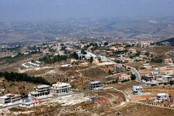
مركبا
مركبا
Markaba | |
|---|---|
قرية | |
 | |
| الإحداثيات: 33°14′0″N 35°31′0″E / 33.23333°N 35.51667°E | |
| موقع الجريدة | 197/293 PAL |
| البلد | |
| المحافظة | محافظة النبطية |
| القضاء | قضاء مرجعيون |
| المنسوب | 700 m (2٬300 ft) |
| منطقة التوقيت | UTC+2 (EET) |
| • الصيف (التوقيت الصيفي) | UTC+3 (EEST) |
| Dialing code | +961 |
مركبا هي قرية لبنانية من قرى قضاء مرجعيون في محافظة النبطية وتبلغ مساحتها 808 هكتار (3.12 ميل مربع).[1]
التسمية
كتب إدوارد هنري بالمر أن اسم مركبا جاء من فعل "الركوب" امتطاء شيء لآخر.[2] ومركبا، تلفظ بشكل شبه مطابق للاسم "مركبة"
التاريخ
في عام 1596، ذكرت قرية مركبا دفتر الضرائب العثماني كناحية تتبع لواء صفد، ويبلغ عدد سكانها خمسة عشر أسرة وعزاب واحد، جميعهم مسلمون. في ذلك العام دفع أهالي القرية ضريبة ثابتة قدرها 25% على المنتجات الزراعية مثل القمح والشعير وأشجار الفاكهة والماعز وخلايا النحل، بالإضافة إلى "العائدات العرضية"؛ ما مجموعه 5,110 آقچه.[3][4]
وفي عام 1875 ذكر فيكتور غيران أن عدد سكانها مركبا يبلغ 150 متوالي.[5]وأضاف: "يوجد فيها مسجد بني مكان حرم أو معبد أو كنيسة أقدم، واستخدم ببنائه أجزاء من أعمدة متناسفة، وحجارة جيدة منحوتة منتشرة في القرية، وفيها حاولي عشرين خزان أرضي وناووس محفورة بالصخور، بما يشر أن المكان كان له قدر من الأهمية سابقاً."[6]
في 1881، وصفها مسح فلسطين الغربية التابع لـصندوق استكشاف فلسطين بأنها: "قرية مبنية من الحجر تحتوي على حوالي 400 متوالي، وتقع على رأس التلة، ومحاطة بأشجار التين والزيتون والأراضي الصالحة للزراعة، وبقربها بركة وخزانات أرضية وعين."[7]
كما أشار المسح إلى أن "قرية تضم بقايا كنيسة من الفترة المسيحية المبكرة؛ وتاجين عامود من الطراز الكورنثياني، وعدة أعمدة مكسورة بأحجام مختلفة، عليها وعتبات وبعض الحجارة الكبيرة المزخرفة المنتشرة في جميع أنحاء القرية، كما يوجد نقوش يونانية على أحد الحجارة، وصليب على حجر آخر، وهناك معصرة نبيذ، وخزانات أرضية منحوتة في الصخر، ودلمن بالقرب من القرية."[8]
المناخ
تقع مركبا على ارتفاعحوالي 950 مترًا (3120 قدماً) عن مستوى سطح البحر، لذا فهي جافة صيفاً ورطبة في الشتاء. في أشهر الشتاء (ديسمبر ويناير وفبراير) ينخفض متوسط درجات الحرارة إلى أقل من 0 درجة مئوية،. أما في فصل الربيع يكون الطقس معتدلاً، ويكون الصيف جافاً ويمكن أن تصل الحرارة إلى حوالي 35 درجة مئوية خلال النهار. وتتركز معظم الهطولات المطرية في أشهر الشتاء والربيع.
النشاط الاقتصادي
تعتمد القرية بالأساس على الزراعة وقطاع الأعمال والتحويلات خارجية من المغتربين. وتوفر الكهرباء من قبل الحكومة ومولدات خاصة في القرية. ويزرع معظم المزارعين المحليين الزيتون والقمح والتبغ.
السكان
يبلغ عدد السكان حوالي 3250 شخصا يعيشون في القرية. ولكن خلال العطلات وفي موسم الصيف، يصل عدد سكان القري لحوالي 10.000 شخص.
الدين
معظم سكان القرية من المسلمين الشيعة. وتضم القرية ثلاثة مساجد وحسينية واحدة. المسجد الأول يقع في الجزء الشرقي من القرية في حالة جيدة. أما المسجد الثاني، في وسط القرية، والذي تعرض لأضرار خلال حرب 2006، لكن أعيد إعماره وهو الآن مفتوح.
العوائل
تُعد عائلات وسويد، وحمود، وعطوي، وزراقط، وشحيمي، وشمس الدين، وحيدر، ويونس، ونور الدين، ومبارك، وشهلا، وبيضون، وصالح، وعواضة، وفهدة، وكرياني، والخليل، بورجي، وخميس، ومراد، ورغدة، والحسني، وكشمر، والأشقر ورضا ودقيق ونور الدين والمسلماني، من أبرز العائلات في القرية.
المصادر
- ^ "Markaba". localiban.org. Retrieved 2 May 2018.
- ^ Palmer, 1881, p. 30
- ^ Hütteroth and Abdulfattah, 1977, p. 182
- ^ Note that Rhode, 1979, p. 6 Archived 2016-10-10 at the Wayback Machine writes that the register that Hütteroth and Abdulfattah studied was not from 1595/6, but from 1548/9
- ^ Guerin, 1880, p. 383
- ^ Guerin, 1880, p. 383; given in Conder and Kitchener, 1881, SWP I, p. 136
- ^ Conder and Kitchener, 1881, SWP I, p. 89
- ^ Conder and Kitchener, 1881, SWP I, p. 136
الفهرس
- Conder, C.R.; Kitchener, H.H. (1881). The Survey of Western Palestine: Memoirs of the Topography, Orography, Hydrography, and Archaeology. Vol. 1. London: Committee of the Palestine Exploration Fund.
- Guérin, V. (1880). Description Géographique Historique et Archéologique de la Palestine (in French). Vol. 3: Galilee, pt. 2. Paris: L'Imprimerie Nationale.
{{cite book}}: CS1 maint: unrecognized language (link) - Hütteroth, Wolf-Dieter; Abdulfattah, Kamal (1977). Historical Geography of Palestine, Transjordan and Southern Syria in the Late 16th Century. Erlanger Geographische Arbeiten, Sonderband 5. Erlangen, Germany: Vorstand der Fränkischen Geographischen Gesellschaft. ISBN 3-920405-41-2.
- Palmer, E.H. (1881). The Survey of Western Palestine: Arabic and English Name Lists Collected During the Survey by Lieutenants Conder and Kitchener, R. E. Transliterated and Explained by E.H. Palmer. Committee of the Palestine Exploration Fund.
- Rhode, H. (1979). Administration and Population of the Sancak of Safed in the Sixteenth Century. Columbia University. Archived from the original on 2016-10-10. Retrieved 2017-12-04.
وصلات خارجية
- Survey of Western Palestine, Map 2: IAA, Wikimedia commons
- Markaba, Localiban
