محافظة سايتاما
| محافظة سايتاما | |||||||||
| |||||||||
 35°57′N 139°33′E / 35.950°N 139.550°E | |||||||||
| العاصمة | سايتاما | ||||||||
| المنطقة | كانتو | ||||||||
| الجزيرة | هونشو | ||||||||
| الحاكم | Kiyoshi Ueda | ||||||||
| المساحة (الترتيب) | 3,798.08 كم² (39th) | ||||||||
| - % المياه | 0.5% | ||||||||
| التعداد (March 1, 2018) | |||||||||
| - التعداد | 7,308,198 (5th) | ||||||||
| - الكثافة | 1,924.18 /كم² | ||||||||
| المقاطعات | 8 | ||||||||
| البلديات | 63 | ||||||||
| ISO 3166-2 | JP-11 | ||||||||
| الموقع الإلكتروني | www | ||||||||
| رموز المحافظة | |||||||||
| - الزهرة | Primrose (Primula sieboldii) | ||||||||
| - الشجرة | Keyaki (Zelkova serrata) | ||||||||
| - الطائر | Eurasian collared dove (Streptopelia decaocto) | ||||||||
 رمز محافظة سايتاما | |||||||||
| القالب ■ النقاش ■ المتغيرات ■ معرفة اليابان | |||||||||
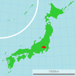
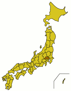
Saitama Prefecture (埼玉県, Saitama-ken) is a prefecture of Japan located in the Kantō region.[1] The capital is the city of Saitama.[2]
This prefecture is part of the Greater Tokyo Area, and most of Saitama's cities can be described as suburbs of Tokyo, to which a large number of residents commute each day.[بحاجة لمصدر]
. . . . . . . . . . . . . . . . . . . . . . . . . . . . . . . . . . . . . . . . . . . . . . . . . . . . . . . . . . . . . . . . . . . . . . . . . . . . . . . . . . . . . . . . . . . . . . . . . . . . . . . . . . . . . . . . . . . . . . . . . . . . . . . . . . . . . . . . . . . . . . . . . . . . . . . . . . . . . . . . . . . . . . . .
الجغرافيا
المدن
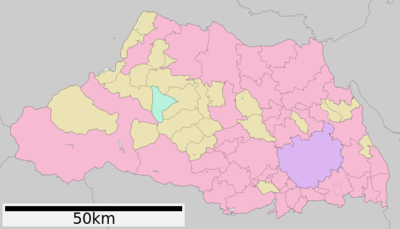
أربعون مدينة تقع في محافظة سايتاما:
|
|
البلدات والقرى
These are the towns and villages in each district:
|
|
Mergers
النقل
Radial transportation to and from Tokyo dominates transportation in the prefecture. Circular routes were constructed as bypasses to avoid congestion in central Tokyo.
الطرق
The Jōban, Kan-etsu, Shuto, Tōhoku, and Tokyo-Gaikan expressways form parts of the nationwide expressway network. National highway Routes 4, 16, and 17 are important routes in Kantō region.
السكك الحديدية
Ōmiya Station in Saitama City forms East Japan Railway Company's northern hub station in the Greater Tokyo Area, offering transfers to and from Shinkansen high-speed lines. The Musashino serves as a freight bypass line as well as a passenger line. Chichibu Railway the northwestern, Seibu Railway the southwestern, Tobu Railway the midwestern and the eastern, the New Shuttle and Saitama Railway the southeastern parts of the prefecture respectively. The Tsukuba Express line crosses the southeastern corner of the prefecture.
- East Japan Railway Company
- Tobu
- Seibu
- Tokyo Metro
- Tsukuba Express
- Saitama Rapid Railway Line
- Chichibu Railway
- Chichibu Mainline
- Mikajiri Line
People movers
- Saitama New Urban Transit (New Shuttle)
- Seibu Yamaguchi Line (Leo Liner)
Culture
Mass media
See Mass media in Saitama Prefecture.
Sister relationships
Saitama Prefecture has a number of sister city relationships with states and a province as listed below (in chronological order).[3]
 Mexico State, Mexico, affiliated on October 2, 1979
 Shanxi province,China, affiliated on October 27, 1982
 Queensland, Australia, affiliated on October 27, 1984
 Ohio, United States, affiliated on October 22, 1990
 Brandenburg, Germany, affiliated on August 26, 1998
See also
- Saitama Bank
- Saitama gubernational election, 2007
- Sayama Tea, a tea variety grown in Saitama prefecture
- Thirteen Buddhas of Chichibu
. . . . . . . . . . . . . . . . . . . . . . . . . . . . . . . . . . . . . . . . . . . . . . . . . . . . . . . . . . . . . . . . . . . . . . . . . . . . . . . . . . . . . . . . . . . . . . . . . . . . . . . . . . . . . . . . . . . . . . . . . . . . . . . . . . . . . . . . . . . . . . . . . . . . . . . . . . . . . . . . . . . . . . . .
References
Citations
- ^ Nussbaum, Louis-Frédéric. (2005). "Saitama prefecture" in Japan Encyclopedia, p. 808, p. 808, في كتب گوگل; "Kantō" in p. 479, p. 479, في كتب گوگل.
- ^ Saitama City Profile, overview
- ^ "Sister States and Provinces of Saitama Prefecture". Saitama Prefecture. 1 July 2011. Archived from the original on 19 December 2012. Retrieved 17 June 2012.
{{cite web}}: Unknown parameter|deadurl=ignored (|url-status=suggested) (help)
Sources
- Nussbaum, Louis-Frédéric and Käthe Roth. (2005). Japan encyclopedia. Cambridge: Harvard University Press. ISBN 978-0-674-01753-5; OCLC 58053128
External links
- Saitama Prefecture Official Website (Japanese)
- Saitama Prefecture Official Website (إنگليزية)


