ماياگويز
ماياگويز
Mayagüez | |
|---|---|
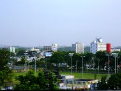
 منظر وسط ماياگويز من حرم جامعة پورتوريكو. | |
| الكنية: "La Sultana del Oeste", "La Ciudad de las Aguas Puras", "El Pueblo del Mangó" | |
| النشيد: "Mi patria es un oasis" | |
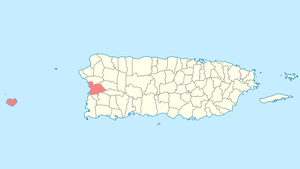
 Location of Mayagüez in Puerto Rico | |
| الإحداثيات: 18°12′04″N 67°08′23″W / 18.20111°N 67.13972°W | |
| Country | |
| Territory | |
| تأسست | September 18, 1760 |
| أسسها | Faustino Martínez de Matos Juan de Silva Juan de Aponte |
| الحكومة | |
| • Mayor | José Guillermo Rodríguez (PPD) |
| • Senatorial dist. | Mayagüez |
| • Representative dist. | 18 and 19 |
| المساحة | |
| • مدينة وبلدية | 274٫09 ميل² (709٫89 كم²) |
| • البر | 77٫63 ميل² (201٫07 كم²) |
| • الماء | 196٫46 ميل² (508٫82 كم²) |
| أعلى منسوب | 1٬577 ft (480٫6 m) |
| أوطى منسوب | 0 ft (0 m) |
| التعداد (2010) | |
| • مدينة وبلدية | 89٬080 |
| • الكثافة | 330/sq mi (130/km2) |
| • العمرانية | 115٬048 |
| • CSA | 251٬260 |
| صفة المواطن | Mayagüezanos |
| منطقة التوقيت | UTC-4 (AST) |
| ZIP codes | 00680, 00681, 00682 |
| Area code | 787, 939 |
| FIPS code | 72-52431[1] |
| GNIS feature ID | 1611495[2] |
| الموقع الإلكتروني | www |
ماياگويز (Mayagüez ؛ النطق الإسپاني: [maʝaˈɣwes]) هي ثامن أكبر[3] بلدية في پورتوريكو. Originally founded as "Nuestra Señora de la Candelaria" it is also known as "La Sultana del Oeste" (The Sultaness of the West), "Ciudad de las Aguas Puras" (City of Pure Waters), or "Ciudad del Mangó" (City of the Mango). On April 6, 1894, the Spanish crown gave it the formal title of "Excelente Ciudad de Mayagüez" (Excellent City of Mayaquez).[4][5] Mayagüez is located in the center of the western coast on the island of Puerto Rico. It is both a principal city of the Mayagüez Metropolitan Statistical Area and the Mayagüez–San Germán–Cabo Rojo Combined Statistical Area.
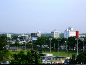
أفق المدينة

Mayagüez seen from UPRM campus
المناخ
| أخفClimate data for Mayagüez, Puerto Rico | |||||||||||||
|---|---|---|---|---|---|---|---|---|---|---|---|---|---|
| Month | Jan | Feb | Mar | Apr | May | Jun | Jul | Aug | Sep | Oct | Nov | Dec | Year |
| Record high °F (°C) | 95 (35) |
96 (36) |
97 (36) |
98 (37) |
98 (37) |
98 (37) |
99 (37) |
99 (37) |
99 (37) |
99 (37) |
98 (37) |
97 (36) |
99 (37) |
| Mean daily maximum °F (°C) | 84 (29) |
86 (30) |
87 (31) |
88 (31) |
89 (32) |
91 (33) |
91 (33) |
91 (33) |
91 (33) |
90 (32) |
89 (32) |
87 (31) |
89 (32) |
| Mean daily minimum °F (°C) | 64 (18) |
64 (18) |
66 (19) |
68 (20) |
70 (21) |
71 (22) |
72 (22) |
71 (22) |
71 (22) |
71 (22) |
70 (21) |
68 (20) |
69 (21) |
| Record low °F (°C) | 51 (11) |
43 (6) |
50 (10) |
57 (14) |
57 (14) |
60 (16) |
58 (14) |
58 (14) |
59 (15) |
61 (16) |
47 (8) |
55 (13) |
43 (6) |
| Average precipitation inches (mm) | 1.1 (28) |
2.0 (52) |
1.5 (39) |
4.8 (123) |
10.7 (271) |
5.2 (131) |
6.6 (168) |
11.8 (299) |
12.6 (321) |
7.4 (189) |
7.8 (198) |
4.8 (123) |
67.4 (1٬713) |
| Source: The Weather Channel[6] | |||||||||||||
References
- ^ "American FactFinder". United States Census Bureau. Retrieved 2008-01-31.
- ^ "Mayagüez – Populated Place". Geographic Names Information System. USGS. Retrieved 2008-05-14.
- ^ "Puerto Rico – Municipio". U.S. Census Bureau. Retrieved March 24, 2006.
- ^ Aguilo Ramos, Silvia (1984). Mayaguez: Notas para su Historia. San Juan, Puerto Rico: Model Offset Printing. p. 46.
{{cite book}}: Cite has empty unknown parameter:|coauthors=(help) - ^ Loida Figueroa, "Escudo de Mayagüez" Anuario de las Fiestas Patronales, 1977
- ^ "Average Weather for Mayaguez, PR - Temperature and Precipitation". Weather.com. Retrieved 2012-06-07.
وصلات خارجية
Wikivoyage has a travel guide for Mayagüez.
- website about the history and cultural life of Mayagüez
- Mayaguez, Puerto Rico
- Mayaguez 2010 Central American and Caribbean Games
- 1888 Map of Mayaguez (Library of Congress)
- Earthquake of 1918
- Karl Stephen Hermann's memoir of the occupation of the city by United States troops, written in 1907 (Library of Congress)
- Current weather in Mayagüez from: Weather Underground
- Peter van der Krogt's page about the Columbus monument at Mayagüez's Plaza de Colón
- Historic Places in Puerto Rico and the Virgin Islands, a National Park Service Discover Our Shared Heritage Travel Itinerary
تصنيفات:
- Articles with hatnote templates targeting a nonexistent page
- Missing redirects
- Short description is different from Wikidata
- Pages using infobox settlement with possible nickname list
- Pages using gadget WikiMiniAtlas
- Pages using infobox settlement with unknown parameters
- Populated places established in 1760
- Mayagüez, Puerto Rico
- Port cities in Puerto Rico
- Mayagüez metropolitan area
- موانئ في الكاريبي

