لا پاز
لاپــاز
Choqueyapu Nuestra Señora de La Paz | |
|---|---|
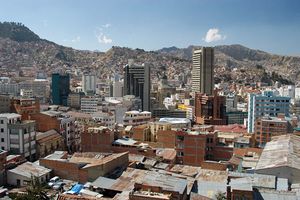
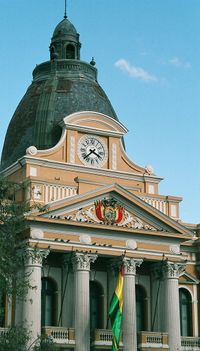
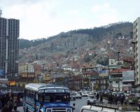
 Top to Bottom, Left to Right: La Paz Skyline with Mount Illimani in the background, Palace of the Plurinational Legislative Assembly, San Francisco Church, Mariscal Santa Cruz Avenue, Red Line of the La Paz-El Alto cable car transit system, Downtown La Paz. | |
| الشعار: [1] Los discordes en concordia, en paz y amor se juntaron y pueblo de paz fundaron para perpetua memoria (The dissenters in harmony gathered together in peace and love, and a town of peace they founded, for perpetual memory.) | |
| الإحداثيات: 16°30′S 68°09′W / 16.500°S 68.150°W | |
| البلد | بوليڤيا |
| القسم | قسم لاپار (بوليڤيا) |
| المقاطعة | مقاطعة پدرو دومينگو موريو |
| تأسست | 20 اكتوبر 1548 |
| اُشهـِرت (El Alto) | القرن العشرون |
| الحكومة | |
| • العمدة | خوان دل گرانادو |
| المساحة | |
| • الإجمالي | 470 كم² (180 ميل²) |
| المنسوب | 3٬640 m (11٬940 ft) |
| التعداد (2008[2]) | |
| • الإجمالي | 877٬363 |
| • الكثافة | 6٬275٫16/km2 (16٬252٫6/sq mi) |
| منطقة التوقيت | UTC-4 |
| مفتاح الهاتف | 2 |
| الموقع الإلكتروني | www.ci-lapaz.gov.bo/ |
لاپاز Nuestra Señora de La Paz، هي عاصمة بوليفيا. وفقا لإحصائيات 2001 وصل عدد سكان المدينة 789,585[3], ومع المدن المجاورة إل ألتو و ڤياتشا, تشكل اكبر منطقة حضرية في بوليڤيا, بتعداد سكان يتعدى 1.6 مليون نسمة (Instituto Nacional de Estadisticas - Bolivia). وتقع العاصمة البوليفية بالقرب من نهر لاباز على ارتفاع يقدر بحوالي 3600 م.
وتـُعرف أيضاً باسم چوكوياگو ماركا Chuquiago Marka أوچوكيياپو Chuqiyapu من لغة الأيمارا: "چوكي" = ذهب, "ياپو" = مزرعة.
التاريخ
أسس ألونزو دي مندوسا المدينة عام 1548 م ألونزو دي مندوزا على أطلال قرية للسكان الأصليين تسمى تشوكوياگو وسميت المدينة في بادئ الأمر (Nuestra Señora de La Paz) والتي تعني سيدتنا (مريم العذراء) للسلام. ازدهرت المدينة بفضل موقعها الاستراتيجي على الطرق التجارية للامبراطورية الاستعمارية الإسبانية. وفي عام 1825 م بعد انتصار الديموقراطيين على قوات الجيش الأسباني في أياتشو أثناء حرب الاستقلال غير اسمها لـ(La Paz de Ayacucho) والتي تعني سلام أياتشو. ،اصبحت لاباز عاصمة بوليفيا الإدارية سنة 1898.
خط زمني لتاريخ لاپاز
| السنة | الحدث |
|---|---|
| 1548 | The city of La Paz was founded by Spanish settlers on the pre- existing site of Choqueyapu, an ancient Aymara village. It was founded as Nuestra Senora de La Paz (Our Lady of Peace) by Alonso de Mendoza, commissioned by Pedro de la Gasca, to commemorate the "pacification" of Peru. It was started as a commercial city, lying on the main gold and silver route to the coast. The Spaniards came for the Bolivian gold found in the Choqueapu River that runs through present-day La Paz. The Spaniards took the gold mines away from Aymara people and made them work as slaves. The primarily male Spanish population soon mixed with the indigenous people, creating a largely mestizo, or mixed, population. |
| 1549 | In November of this year, Juan Gutierrez was given the task of designing an urban plan, in keeping with the Code of the Indies (regulations on Spanish Colonial Cities from Spain). As such, he was to lay out plazas and public lands and designate sites for public buildings. The Plaza Murillo (pictured below) was later selected as the site for the city Cathedral, elite homes, and government buildings. |
| 1600 | As the gold slowly diminished, the city's location between Potosi (the primary silver mining town) and Lima grew in importance, as La Paz became a main stop on the trade route. Soon La Paz was the most flourishing town in the Altiplano area of the Andes, although it was not as wealthy as Potosi. |
| 1800 | La Paz emerges as the largest city of Upper Peru (the early name for Bolivia) in the late eighteenth century, acting as the center for the population and agricultural production zone. The heavily populated Altiplano hinterland above La Paz fed its growth. Many large estate land holders, known as haciendados, lived in La Paz throughout most of the year while they maintained a small community of indigenous people to live and work on their haciendas (landed estates). |
| 1825 | Bolivia gained independence, which sparked even more growth in the city. Simon Bolivar was the first president of the Republic. The country was divided in 5 departments: La Paz, Cochabamba, Potosí, Charkas and Santa Cruz de la Sierra. |
| 1800 | La Paz emerged as the capital of the Intendencia, the home of a thriving commercial community, and the center of an important network of interregional and international trade routes. The majority of the absentee landed elite resided in La Paz, creating the commerce and royal treasury from which more wealth could be generated for investment in the rural zones of the Intendencia. At that time in history, the capital and its provincial hinterland were one of the wealthiest tax-producing areas in all of the Andes. This early beginning, as the home of the rich land-lords of the haciendas, is still evident in the structure of the city today, as the finest example of old Spanish Colonial Architecture seen in houses is located close to the central plazas and offices of the city. |
| 1840 | Bolivia started exporting more than it imported, allowing the government to engage in infrastructural investments with the surplus funds. This led to a growth of La Paz as the financial, commercial, and political capital of the area. "With new urban classes emerging, and new capital to spend, there was both increased demands for foodstuffs production and an aggressive class of urban-based capitalists willing to engage in agricultural production"(Klien 1993 134). However, at this time La Paz was virtually isolated from the rest of the world due to the poor roads and lack of rail lines leading over the harsh Altiplano to ports in Peru and Chile. Contact between La Paz and the eastern part of the country, surrounded by rainforest, was even more difficult. |
| 1879 | The Pacific War with Chile. The Chileans entered the country at the coast for the salitre and the guano(Nitrate-rich bird dung). The result of this brutal war was the loss of Bolivia's coast land to Chile. |
| 1898 | La Paz becomes Bolivia's administrative capital and the seat of the government(thus starting the process of development into the large city it is today. |
| 1900 | Construction began on the international railroad network linking La Paz to the Pacific and Atlantic coasts, thus solidifying the future role of La Paz as a primate city. |
| 1921 | The first oil company came to Bolivia. Bolivia was found to have great reservoirs of oil, in addition to all the precious minerals. |
| 1952 | The great national revolution when the revolutionaries won the rights for the indigenous people. Their biggest accomplishment was agrarian land reform, which allowed peasants to have freedom from the obligations of working on the elite-owned land, diffusing the long-established hacienda system. This in turn sparked a great growth spurt in the city, as many working-class and poor migrated to urban areas. |
| 1963 | Playing at home, Bolivia wins South American football (soccer) championships. |
| 1964 | Military revolution, with the help of the United States, that established the dictatorial rule that would remain until 1980. The last dictator was General Hugo Banzer. He held elections in 1980, although, suspiciously, Banzer's candidate won and was president until the year 1982. |
الجغرافيا والمناخ
الموقع الجغرافي
تقع المدينة شمال غربي بوليڤيا في فج عميق من الأرض، يسلكه نهر ريو دي لا باز Rio de La paz، وذلك ضمن هضبة جبلية عالية (2000- 3000م) تعرف بهضبة ألتيبلانو Altiplano التي تشرف عليها وعلى المدينة جبال الآنديز Andes الشامخة (5500 - 6500م) الموشاة قممها بالثلوج، وتعدّ لا باز أعلى مدن العالم قاطبة (3810م).
تطورت لاباز في وادي شوكياگو ماركا الذي يحيط به جبلا هوينا بوتوسي (6094 م) ونيڤادو إليماني (6460م) على مقربة من بحيرة تيتيكاكا. تقع في محافظة لاباز في إقليم موريو.
لاباز أعلى عاصمة في العالم يقع مركزها 3600 متر فوق سطح البحر. يؤوي أعلى حي فيها (ال آلتو - 4000 م فوق سطح البحر) الطبقات المحرومة بينما يقطن المترفون أحياء فلوريدا ولا ريكونادا وآتشوماني وأرنخواس.
المناخ
يتسم مناخها بالقسوة لانخفاض حرارته (5-12 درجة وسطياً) وبسبب خلخلة الهواء نتيجة للارتفاع الكبير (صعوبة تنفس الغرباء خاصة).[4]
| لا پاز | ||||||||||||||||||||||||||||||||||||||||||||||||||||||||||||
|---|---|---|---|---|---|---|---|---|---|---|---|---|---|---|---|---|---|---|---|---|---|---|---|---|---|---|---|---|---|---|---|---|---|---|---|---|---|---|---|---|---|---|---|---|---|---|---|---|---|---|---|---|---|---|---|---|---|---|---|---|
| جدول طقس (التفسير) | ||||||||||||||||||||||||||||||||||||||||||||||||||||||||||||
| ||||||||||||||||||||||||||||||||||||||||||||||||||||||||||||
| ||||||||||||||||||||||||||||||||||||||||||||||||||||||||||||
الديموغرافيا
تسكن المدينة أعراق شتى، ولعل أهمهـا قبائل أيمارا الهندية التي تشغل نصف سكّان المدينة عدداً، ويعيش جلّهم - والفقراء منهم خاصة - فوق مصاطب النهر العالية، وذلك في أكواخ وبيوت متواضعة تميزت بأسقفها القرميدية وبواجهاتها وأبوابها الموشاة بالحديد المطلي والمزخرف؛ الحاملة معاني دينية وفنية قديمة غالباً، إلا أنه بالنزول نحو المصاطب الدنيا للنهر وإلى قاعه، يشاهد أن اللوحة البنائية والحضارية قد تبدلت، إذ تتسابق ناطحات السحاب صعوداً حافلة بكثير من المباني الحكومية ذات الطابع الهندي والإسباني، وأبرز أحيائها هو بلازا موريللو Plaza Murillo؛ حيث الحدائق الغناء الفائقة الجمال، وبين أحضانها أرسي بنيان القصر الرئاسي ومجلس الكونغرس الوطني وأبرز الكاتدرائيات والمتاحف والعديد من إدارات الدولة المهمة.
يعيش في الأحياء هذه أغنياء الأوربيين ووجهاء الهنود والسكان من ذوي الأرومة الإسبانية والخلاسيون، وتعاني المدينة بطالة شديدة، وتضجّ بنشاطها الدائب والدائم الاقتصادي والتجاري، فهي سوق كبيرة للمنتجات الهندية الأمريكية الجنوبية: (الملابس الهندية التقليدية المزركشة والموشاة بصور ورموز هندية دينية وغير دينية قديمة؛ وبزخارف جميلة للشال والدثار (البطانيّات) الذي يعلو أكتافهم وقاية من مناخها القارس، ومما يميز المدينة صغر المؤسسات الاقتصادية والمصانع، وقليلها كبير، ومن صناعاتها الصناعات التقليدية الهندية اليدوية وسواها وبعض مصانع البيرة والكحوليّات، وصناعات تعليب الفواكه والخضر وصناعة الإسمنت والزجاج وشيء من الصناعات النسيجية.
إن تنامي المدينة السريع في بضعة قرون من بلدة متواضعة إلى مدينة كبيرة؛ سببه موقعها القريب من مناجم الفضّة ووقوعها على طريق نقل هذا الخام إلى سواحل المحيط الهادئ.
معرض الصور
بحيرة تيتيكاكا، في لا پاز وفي الخلفية جبال الإنديز
كنيسة كوپاكابانا
المصادر
- ^ "Bolivia.com - Turismo : La Paz".
- ^ World Gazetteer
- ^ Observatorio Bolivia Democrática
- ^ شاهر جمال آغا. "لا باز وسوكره". الموسوعة العربية. Retrieved 2012-08-02.
المراجع
- سلسلة شعوب العالم، المجلد الرابع (موسكو1970) (باللغة الروسية).
- عدد من المؤلفين، دول أمريكا اللاتينية (موسكو 1975) (باللغة الروسية).


