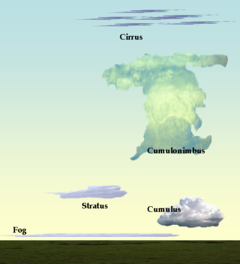
قائمة أنواع السحب
تتكون السحب عندما تتبخر المياه من المحيطات، البحيرات، والبرك وترتفع إلى الغلاف الجوي.
. . . . . . . . . . . . . . . . . . . . . . . . . . . . . . . . . . . . . . . . . . . . . . . . . . . . . . . . . . . . . . . . . . . . . . . . . . . . . . . . . . . . . . . . . . . . . . . . . . . . . . . . . . . . . . . . . . . . . . . . . . . . . . . . . . . . . . . . . . . . . . . . . . . . . . . . . . . . . . . . . . . . . . . .
السحب المرتفعة High-level clouds
القزع Cirrus
الاختصار: Ci
Cirrus clouds form above 23,000 feet (about 7,000m), in the cold region of the troposphere. They are denoted by the prefix cirro- or cirrus. At this altitude water almost always freezes so clouds are composed of ice crystals. The clouds tend to be wispy, and are often transparent. Isolated cirrus clouds often do not bring precipitation, however, large amounts of cirrus clouds can indicate an approaching storm system and cool and fair weather.
There are several variations of cirrus cloud:
- A series of dense lumps, or "towers" of cirrus, connected by a thinner base.
- Sheets of cirrus at different layers of the atmosphere, which may be connected at one or more points.
- Cirrus clouds having the traditional "mare's tail" appearance. These clouds are long, fibrous, and curved, with no tufts or curls at the ends.
- Cirrus with elements which take on a rounded appearance on the top, with the lower part appearing ragged.
- Cirrus clouds whose filaments are irregularly curved or tangled.
- Horizontal, cirriform spiral, indicative of severe turbulence at that layer of the atmosphere.
- Large area of cirrus displaying horizontal banding.
الركامية المرتفعة Cirrocumulus
Abbreviation: Cc[1]
Cirrocumulus clouds form when moist air at a high altitude reaches saturation, creating ice crystals. Instability at the cloud level gives the cloud its cumuliform appearance.[2]
- cirrocumulus with "towers", or turrets.
- lenticular, or lens-shaped cirrocumulus.
- extensive cirrocumulus.
- undulating cirrocumulus.
- cirrocumulus with large clear holes.
الطباقية المرتفعة Cirrostratus
الاختصار: Cs[1]
Cirrostratus clouds consist of a continuous, wide layer of cirrus that covers a large area of the sky. It is formed when moist air cools to saturation at a high altitude, forming ice crystals.[4]
- featureless,uniform cirrostratus
خط نفاث Contrail
Aircraft engines emit water vapor into the atmosphere, and this vapor is then frozen into ice crystals. These are known as condensation trails (contrails) or cirrus aviaticus.
السحب المتوسطة Medium-level clouds
الطباقية المتوسطة Altostratus
الاختصار: As
- altostratus duplicatus
- altostratus lenticularis
- altostratus mammatus
- altostratus opacus
- altostratus praecipitatio
- altostratus radiatus
- altostratus translucidus
- altostratus undulatus
الركامية المتوسطة Altocumulus
الاختصار: Ac
السحب المنخفضة Low-level clouds
الركامية الطباقية Stratocumulus
Abbreviation: Sc
Stratocumulus clouds are lumpy, layered clouds often following a cold front, and they can produce rain or drizzle.
- Layer of stratocumulus clouds with tower-like formation protruding upwards.
- stratocumulus duplicatus
- stratocumulus floccus
- stratocumulus lacunosus
- stratocumulus lenticularis
- stratocumulus mammatus
- Stratocumulus with bubble-like protrusions on the underside.
- Stratocumulus clouds covering entire sky without break.
- Stratocumulus clouds covering entire sky, but having a few small breaks.
- Stratocumulus clouds which precipitation reaches ground.
- Stratocumulus clouds arranged in parallel waves
- Separate masses of stratocumulus clouds with large breaks inbetween.
الطباقية المنبسطة الخفيضة (الرهج) Stratus
Abbreviation: St
Stratus clouds are horizontal layer like clouds having a uniform base,which is associated with widespread precipitation or ocean air, and often produce drizzle.
- Ragged shreds of stratus clouds.
- Dark ragged clouds under base of precipitation clouds.
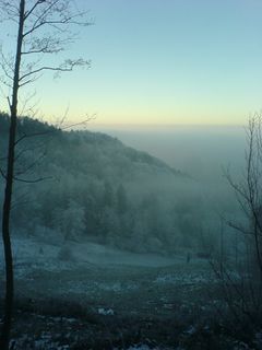
- Uniform fog-like low clouds.
المزن الطباقية Nimbostratus
الاختصار: Ns
Nimbostratus clouds tend to bring constant precipitation and low visibility.
- nimbostratus floccus
- nimbostratus opacus
- nimbostratus pannus
- nimbostratus praecipitatio
- nimbostratus virga
. . . . . . . . . . . . . . . . . . . . . . . . . . . . . . . . . . . . . . . . . . . . . . . . . . . . . . . . . . . . . . . . . . . . . . . . . . . . . . . . . . . . . . . . . . . . . . . . . . . . . . . . . . . . . . . . . . . . . . . . . . . . . . . . . . . . . . . . . . . . . . . . . . . . . . . . . . . . . . . . . . . . . . . .
الركامية المنخفضة Stratocumulus
الاختصار: Cu
Cumulus clouds are sometimes called fair weather clouds but can grow into more storm-condition clouds (cumulonimbus, for example), and continued upward growth suggests showers later in the day.
- arcus (including roll and shelf clouds)
- Low, horizontal cloud formation associated with the leading edge of thunderstorm outflow.
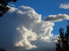
- Tall and large cumulus clouds
- Ragged shreds of cumulus clouds.
- "Fair weather clouds" that are wider than taller
- Cumulus clouds slightly taller than cumulus humilis
- Cumulus clouds with tall tower-like formations protruding upwards.
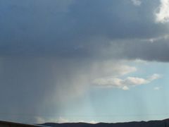
- Cumulus clouds which precipitation reaches ground
- Cumulus clouds arranged in parallel lines
- Clouds formed by air rising at windward slopes of hills and mountains.
- Mass of fractus clouds below cumulus cloud.
- Small cap-like cloud over parent cumulonimbus cloud
- Column hanging from the bottom of cumulus
- velum
- Sail-shaped clouds
السحب العمودية Vertically developed clouds
Cumulonimbus
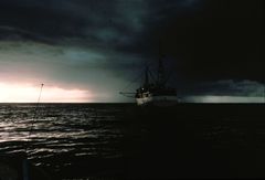
Abbreviation: Cb Cumulonimbus is the cloud of storms and rain or showers.
- Cumulonimbus cloud with cirriform top.
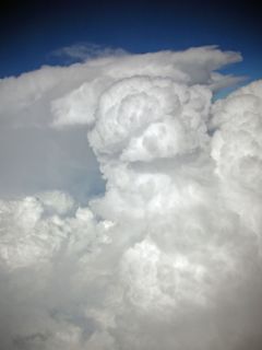
- Cumulonimbus with puffy rounded top.
- Cumulonimbus with flat anvil-like top
- Small cap-like cloud over parent cumulonimbus cloud
- Cumulonimbus with bubble-like protrusions on the underside.
- Low, horizontal cloud formation associated with the leading edge of thunderstorm outflow.
- Cumulonimbus clouds which precipitation reaches ground
- Column hanging from the bottom of cumulonimbus cloud
- Mass of fractus clouds below cumulonimbus cloud.
- Is a tropical cumulonimbus cloud that penetrates the tropopause.
سحب أخرى
- Nacreous cloud (mother of pearl) – A thin cloud seen most often between sunset and sunrise and is between 12 to 18 miles (19 to 29 km) high
- Noctilucent cloud – A thin cloud seen most often between sunset and sunrise and is between 32 to 35 miles (51 to 56 km) high
- Ice cloud
- Salt storm – A cloud of airborne salt that hovers over salt flats
معنى أسماء السحب
Main cloud components
- Alto – high
- Cirrus – thin and wispy
- Cumulus – puffy, from Latin for stack
- Nimbus – precipitation-bearing (Latin for "raincloud")
- Stratus – layer (Latin for "spread out")
الأنواع الرئيسية للسحب
- Altocumulus – altus and cumulus – high heap
- Altostratus – altus and stratus – high layer
- Cirrocumulus – cirrus and cumulus – thin and wispy and puffy
- Cirrostratus – cirrus and stratus – thin and wispy and spreadout
- Cirrus – thin and wispy
- Cumulonimbus – cumulus and nimbus – rain-bearing heap
- Cumulus – puffy
- Nimbostratus - nimbus and stratus - rain-bearing layer
- Stratocumulus - stratus and cumulus - layer and heap
- Stratus - layer
Main sub-cloud types
- Castellanus – castle-like with a series of turret shapes – indicates lateral decrease and vertical increase in movement.
- Congestus – moderate development and heaped into cauliflower shapes – indicates moist ground and upcurrent.
- Fibratus – thin filament type clouds, can be straight or slightly curved
- Floccus – looking like a tuft of wool, small congestus – indicates dry air
- Fractus – irregular shredded appearance – indicates usually gusts
- Humilis – small, low, flattened cumulus – indicates relatively dry ground
- Lenticular cloud – having a lens-like appearance – formed by standing waves of wind passing mountains or hills
- Mediocris – medium size cumulus with small bulges at the top – indicates moderate updrafts
- Nebulosus – indistinct cloud without features – indicates stable wind if any and static air layers
- Spissatus – thick cirrus with a grey appearance – indicates upper troposphere vertical movement
- Stratiformis – horizontal cloud sheet – rains
- Uncinus – cirrus with a hook shape at the top – indicates a nearby backside
- Uniformis – no notable difference in shapes of clouds used with cumulus – indicates stable wind (if any) and static air layers
أنواع سحب أخرى
- Arcus – arch or a bow – mostly attached to cumulus, thick with ragged edges
- Cumulogenitus – formed by the spreading out of cumulus clouds
- Cumulonimbogenitus – formed by the spreading out of cumulonimbus clouds
- Duplicatus – double – partly merged layers of cloud
- Incus – anvil – top part of Cb cloud, anvil shaped
- Intortus – twisted – curved and tangled cirrus
- Mammatus – breast cloud – round pouches on surface of cloud
- Lacunosus – full of holes – thin cloud distinguished by holes and ragged edges
- Opacus – thick and shadowy – an opaque sheet of cloud
- Pannus – shredded cloth – shredded sections attached to main cloud
- Perlucidus – translucent – sheet of cloud with small spaces among itself
- Pileus – capped – hood shaped cumulus type cloud
- Praecipitatio – falling – cloud whose precipitation reaches the ground
- Fallstreak hole or hole punch cloud - the layer of cirrocumulus that develops a perfect circular hole.
- Pyrocumulus - generated by quickly generated ground heat; including forest fires, volcanic eruptions and low level nuclear detonation
- Radiatus – radiant – parallel lines converging at a central point, often cirrus
- Tuba – like a trumpet – column hanging from the bottom of cumulus
- Translucidus – transparent – translucent patch or sheet
- Undulatus – wavy – cloud displaying an undulating pattern
- Velum – a ship’s sail – sail-like in appearance
- Vertebratus – skeletal and bone like – cirrus arranged to look like bones or skeleton or calcium.
. . . . . . . . . . . . . . . . . . . . . . . . . . . . . . . . . . . . . . . . . . . . . . . . . . . . . . . . . . . . . . . . . . . . . . . . . . . . . . . . . . . . . . . . . . . . . . . . . . . . . . . . . . . . . . . . . . . . . . . . . . . . . . . . . . . . . . . . . . . . . . . . . . . . . . . . . . . . . . . . . . . . . . . .
سحب عاصفة
Clouds associated with the development and duration of storms:
- Accessory cloud – cloud that is attached to and develops on body of main cloud
- Anvil – the top flatter part of a cumulonimbus cloud
- Anvil dome – the overshooting top on a Cb that is often present on a supercell
- Anvil rollover – (slang) circular protrusion attached to underside of anvil
- Arcus cloud – arch or a bow shape, attached to cumulus, thick with ragged edges
- Backsheared anvil – (slang) anvil that spreads upwind, indicative of extreme weather
- Clear slot (or dry slot) - an evaporation of clouds as a rear flank downdraft descends and dries out cloud and occludes around a mesocyclone
- Cloud tags – ragged detached portions of cloud
- Collar cloud – rare ring shape surrounding upper part of wall cloud
- Condensation funnel - the cloud of a funnel cloud aloft or a tornado
- Cumulus – heaped clouds
- Cumulus congestus – moderate development and heaped into cauliflower shapes
- Cumulus fractus – ragged detached portions of cumulus cloud
- Cumulus humilis - small, low, flattened cumulus, early development
- Cumulus mediocris - medium-sized cumulus with small bulges at the top
- Cumulus pannus - shredded sections attached to main cumulus cloud
- Cumulus pileus - capped – hood shaped cumulus cloud
- Cumulus praecipitatio - cumulus whose precipitation reaches the ground
- Cumulus radiatus – cumulus arranged in parallel lines
- Cumulus tuba - column hanging from the bottom of cumulus
- Cumulus velum - cumulus displaying an undulating pattern
- Cumulonimbus – heaped towering rain-bearing clouds that stretch to the upper levels
- Cumulonimbus calvus – cumulonimbus whose upper parts have lost their shape
- Cumulonimbus capillatus - Cb whose upper parts have taken on a cirrus-like form
- Cumulonimbus incus – Cb with anvil aloft
- Cumulonimbus mammutus - pouch-like protrusions that hang from under an anvil
- Cumulonimbus pannus - shredded sections attached to main Cb cloud
- Cumulonimbus pileus - capped – hood shaped cumulonimbus cloud
- Cumulonimbus praecipitatio - Cb whose precipitation reaches the ground
- Cumulonimbus spissatus - cumulonimbus with a thick grey appearance
- Cumulonimbus tuba - column hanging from the bottom of cumulonimbus
- Cumulonimbus velum - cumulonimbus displaying an undulating pattern
- Debris cloud – rotating ‘cloud’ of debris found at base of tornado
- Hail fog - a shallow surface layer of fog that sometimes forms in vicinity of deep hail accumulation, can be very dense
- Inflow band - a laminar band marking inflow to a Cb, can occur at lower or mid levels of tower
- Inverted cumulus - cumulus which has transferred momentum from an exceptionally intense Cb tower and is convectively growing on the underside of an anvil
- Fractonimbus - dark ragged clouds under base of precipitation cloud.
- Funnel cloud – rotating funnel of cloud hanging from under Cb, not making contact with ground
- Knuckles – lumpy protrusion that hangs from edge or underside of anvil
- Roll cloud – elongated, low-level, tube shaped, horizontal cloud
- Rope – (slang) narrow, sometimes twisted funnel type cloud seen after tornado dissipates
- Rope cloud – A very narrow, long, sometimes meandering, cumulus cloud formation that is frequently visible in satellite imagery
- Scud cloud – ragged detached portions of cloud
- Shelf cloud – wedge shaped cloud often attached to the underside of Cb
- Stratus fractus – ragged detached portions of stratus cloud
- Striations - a groove or band of clouds encircling an updraft tower, indicative of rotation
- Tail cloud - an area of condensation consisting of laminar band and cloud tags extending from a wall cloud towards a precipitation core
- Towering cumulus (TCu) - a large cumulus cloud with great vertical development, usually with a cauliflower-like appearance, but lacking the characteristic anvil of a Cb
- Wall cloud – distinctive fairly large lowering of the rain free base of a Cb, often rotating
- Earthquake cloud
الهوامش والمصادر
- ^ أ ب Dunlop, Storm (2003-6-1). The Weather Identification Handbook, p.9. The Lyons Press; 1st edition, Guilford, CT. ISBN 1585748479.
- ^ Burroughs, William James; Crowder, Bob (January 2007). Weather, p.216. Fog City Press, San Francisco. ISBN 9781740895798.
- ^ أ ب ت ث ج ح Dunlop, Storm (2003-6-1). The Weather Identification Handbook, p.66-67. The Lyons Press; 1st edition, Guilford, CT. ISBN 1585748479.
- ^ Burroughs, William James; Crowder, Bob (January 2007). Weather, p.215. Fog City Press, San Francisco. ISBN 9781740895798.
- ^ أ ب ت ث Dunlop, Storm (2003-6-1). The Weather Identification Handbook, p.62-63. The Lyons Press; 1st edition, Guilford, CT. ISBN 1585748479.


