عجمان
عجمان | |
|---|---|
مدينة | |
Clockwise from top: Aerial view of Ajman, Corniche Mosque, Ajman beach, Street in Ajman, Ajman Fort Museum | |
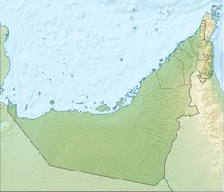
| الإحداثيات: 25°24′49″N 55°26′44″E / 25.41361°N 55.44556°E | |
| Country | United Arab Emirates |
| Emirate | Emirate of Ajman |
| Founded | 1750 |
| الحكومة | |
| • النوع | Monarchy |
| • Emir | Sheikh Humaid bin Rashid Al Nuaimi III |
| المساحة | |
| • البر | 148 كم² (57 ميل²) |
| التعداد (2017) | |
| • الإجمالي | 490٬035 [1] |
| منطقة التوقيت | UTC+4 (UAE Standard Time) |
| الموقع الإلكتروني | www |
عجمان، is the capital of the emirate of Ajman in the United Arab Emirates. It is the fifth-largest city in UAE after Dubai, Abu Dhabi, Sharjah and Al Ain. Located along the Persian Gulf, it is engulfed by the larger emirate of Sharjah in territory.
التاريخ
Al Bu Kharaiban Nuaimi rule in Ajman started in 1816, when Sheikh Rashid bin Humaid Al Nuaimi and fifty of his followers took the coastal settlement of Ajman from members of the Al Bu Shamis Nuaimi tribe in a short conflict.[2] It wasn't until 1816 or 1817, however, that the Ajman fort finally fell to Rashid's followers and his rule was endorsed by the powerful Sheikh of neighbouring Sharjah and Ras Al Khaimah, Sheikh Sultan bin Saqr Al Qasimi.[3]
On 8 January 1820, following the sack of Ras Al Khaimah by a British force led by Sir W.G. Keir, Sultan bin Saqr signed the General Maritime Treaty with the United Kingdom on 4 February 1820, followed on 15 March by Rashid bin Humaid[4] at Falaya Fort.
An 1822 British maritime survey noted that Ajman had one of the best backwaters on the coast and was a small town with a single fortified building, the ruler's house. In common with many other coastal towns on what became the Trucial Coast, the population was mobile depending on the season – there were as many as 1,400 to 1,700 men of the 'Mahamee' tribe living there during the pearl hunting season (April–September), many of whom would migrate to Al Buraimi in the date season. The survey notes that Ajman's ruler Rashid bin Ahmed considered his dominion independent of Emirate of Sharjah, but that Sharjah did not maintain that view even though it had no power over Ajman.[5] The survey noted that the inhabitants of Ajman were 'mostly strict Wahhabis' and recorded the presence of the ruined village of Fasht down the shore from Ajman town, which is today the Fisht suburb of Sharjah city.
In 1831, the Sheikh of Ajman accepted a subsidy from the Imam of Muscat to join with Sultan bin Saqr of Sharjah against Sohar, but following Sultan's defeat declared for Sohar.[مطلوب توضيح] In his absence, a part of Bani Yas from Abu Dhabi sacked Ajman town and its date groves.[6] In retaliation, the forces of Ajman committed 'daring depredations' upon the cities of Sohar and Muscat. When called upon to provide redress for the actions of his 'subject', Sultan bin Saqr disavowed any authority over Ajman and in 1832 a British naval force was sent to Ajman to obtain redress for the raids on the East Coast cities.[7] Ending a conflict between Sharjah, Ajman and Dubai on the one hand and Abu Dhabi on the other, Ajman (together with the other parties) signed the 1835 Maritime Treaty in its own right.[7]
In 1840, Humaid bin Obeid bin Subt of Al Heera invaded Ajman supported by a body of the Bani Naeem. Although initially reluctant to assist Humeid bin Rashid, Sultan bin Suggur of Sharjah sent his son Suggur who, together with Maktoum of Dubai, ejected the invaders and sacked Al Heera in reprisal.
In 1843 a further Maritime Treaty was signed between the Trucial Sheikhs and the British and then, on 4 May 1853, 'A Perpetual Treaty of Peace' was entered into by the coastal Sheikhs, including Ajman. A copy of this treaty is on display in Ajman Museum. A further treaty of 1892 bound the Trucial States to Britain.
By the 20th century, J. G. Lorimer's survey of the coast of the Trucial States showed Ajman to be a small town of some 750 inhabitants (in comparison, the population of Dubai at the time numbered over 10,000).[8] On 2 December 1971, Ajman, under Sheikh Rashid bin Humayd Al Nuaimi, joined the United Arab Emirates.
الديموغرافيا
The city has more than 90% of the population of the emirate. The area runs directly into the city of Sharjah along the coast to the south-west, which in turn is adjacent to Dubai, forming a continuous urban area.
الاقتصاد
Ajman is home to the Ruler's office, companies, commercial markets, and about 50 international and local retail shops. Banking interests include: Emirates National Bank of Dubai, Ajman Bank, Arab Bank PLC, Bank Saderat Iran, and Commercial Bank of Dubai. Ajman is also home to fishing industry & Seafood Importers/Exporters in UAE. Shopping malls include Ajman China Mall and City Centre Ajman.
منطقة عجمان الحرة
With capacity to accommodate 1500 companies and serving over 1,000 vessels a year, Ajman Port and Ajman Free Zone are major contributors to the emirate's economy. Exporting to over 65 countries, the Free Zone's companies make up approximately 20% of the UAE's overall industrial units, with some 256 industrial companies operating from the zone.[9]
السياحة
Ajman is continuing the development stalled by the financial crisis of 2007–2008 and once again undergoing a period of growth. It has immensely grown throughout the years, with recent investments from foreign companies and installations and renovations of its tourist attractions, hotels and commercial sites. Tourist attractions in the emirate are growing rapidly. They include the Ajman Beach, Ajman National Museum situated at Ajman Fort, the Red Fort and the museum in the inland enclave of Manama. City Centre Ajman, the Emirate’s biggest mall, is a big attraction as well for its unique architectural experience and variety of shops and confectionaries.
Ajman's corniche is a popular evening and weekend destination for families and features a number of fast food outlets, coffee shops and stalls. It is home to the 'Outside Inn', a popular watering hole with expatriates, as well as to a number of hotels, including the Ramada, Ajman Palace, Ajman Hotel, the Ajman Saray and Fairmont Ajman.
Ajman's newly developed Al Zorah area is also getting a lot of tourist attention. It has multiple activities for all ages ranging from bouncy castles to kayaking in the mangroves.[10]
النقل
The natural port (or khor) of Ajman is located along a natural creek which penetrates the town.[11] Ajman is also home to Arab Heavy Industries, one of the world's largest ship manufacturing firms.[12][مطلوب مصدر أفضل]
For international air travel, residents of Ajman can also use the Sharjah International Airport, which is only a few kilometers away.
التعليم
- Ajman University, founded in 1988
- City University College of Ajman (CUCA)
- Gulf Medical University
مشاهير عجمان
- كلثم بن مسعود (born 1957), Emirati journalist, writer, poet and businesswoman
انظر أيضاً
المصادر
- ^ "190320BR_Ajman Statistic Report_V16_For Print".
- ^ Wilson, Graeme (2010). Rashid: Portrait of a Ruler. UK: Media Prima. p. 21. ISBN 9789948152880.
- ^ Wilson, Graeme (2010). Rashid, portrait of a ruler. London. p. 21. ISBN 9789948152880. OCLC 843954755.
{{cite book}}: CS1 maint: location missing publisher (link) - ^ General Maritime Treaty, 1820
- ^ Schofield, R (1990). Islands and Maritime Boundaries of the Gulf 1798–1960. UK: Archive Editions. p. 543. ISBN 9781852072759.
- ^ Schofield, R (1990). Islands and Maritime Boundaries of the Gulf 1798–1960. UK: Archive Editions. p. 133. ISBN 9781852072759.
- ^ أ ب Schofield, R (1990). Islands and Maritime Boundaries of the Gulf 1798–1960. UK: Archive Editions. pp. 134–135. ISBN 9781852072759.
- ^ Lorimer, John G (1908). Gazetteer of the Persian Gulf Oman & Central Arabia. Bombay: Government of India. pp. 1433–1451.
- ^ "Ajman Free Zone". UAEFreeZones.com. Retrieved 30 November 2014.
- ^ "Al Zorah Nature Reserve | Ajman". ajman.travel. Retrieved 2019-06-13.
- ^ Ajman Free Zone Archived أبريل 18, 2008 at the Wayback Machine
- ^ "Ajman travel guide". www.world66.com (in الإنجليزية). Archived from the original on 2010-01-24. Retrieved 31 July 2016.
- Pages using gadget WikiMiniAtlas
- CS1 maint: location missing publisher
- Short description is different from Wikidata
- Coordinates on Wikidata
- جميع الصفحات التي تحتاج تنظيف
- مقالات بالمعرفة تحتاج توضيح from January 2016
- Articles with hatnote templates targeting a nonexistent page
- كل المقالات بدون مراجع موثوقة
- كل المقالات بدون مراجع موثوقة from July 2016
- مدن الإمارات العربية المتحدة
- أماكن ساحلية مأهولة في الإمارات العربية المتحدة
- أماكن مأهولة في عجمان


