سلهط
سلهط
সিলেট ꠍꠤꠟꠐ Sylhet | |
|---|---|
|
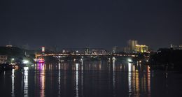
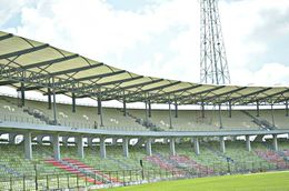
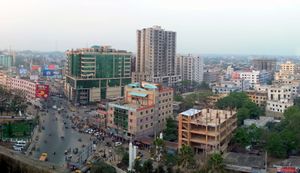
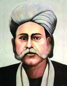
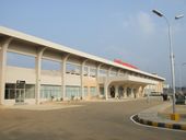
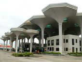
From the top:Sylhet Skyline with Keane Bridge, Osmani International Airport, Sylhet railway station, Sylhet Circuit House, Shah Jalal, Sylhet International Cricket Stadium. | |
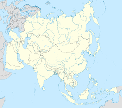
| الإحداثيات: 24°54′N 91°52′E / 24.900°N 91.867°E | |
| البلد | |
| Division | Sylhet Division |
| القسم | سلهط |
| Municipal Board | 1867 |
| Sylhet City Corporation | 9 أبريل 2001 |
| Metropolitan city | 31 March 2009[2] |
| الحكومة | |
| • النوع | Mayor–Council |
| • الكيان | Sylhet City Corporation |
| • العمدة | عارف الحق شودري (BNP) |
| المساحة | |
| • الحضر | 26٫5 كم² (10٫2 ميل²) |
| • العمران | 518٫43 كم² (200٫17 ميل²) |
| المنسوب | 35 m (115 ft) |
| التعداد (2011) | |
| • Metropolis | 526٬412[1] metro−800٬000 |
| • الكثافة | 19٬865/km2 (51٬450/sq mi) |
| صفة المواطن | Sylheti |
| منطقة التوقيت | UTC+6 (BST) |
| Postal code | 3100 |
| Police | Sylhet Metropolitan Police (SMP)[3] |
| International airport | Osmani International Airport |
| Regional Calling code | +880821 |
| الموقع الإلكتروني | scc |
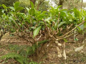
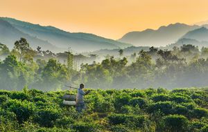
سلهط (Sylhet ، بالبنغالي: সিলেট)، هي مدينة عمرانية في شمال شرق بنگلادش. It is the administrative seat of Sylhet Division. The city is located on the right bank of the Surma River in northeastern Bengal. It has a subtropical climate and lush highland terrain. The city has a population of more than half a million.[1] Sylhet is one of Bangladesh's most important spiritual and cultural centres. It is one of the most important cities of Bangladesh, after Dhaka and Chittagong due to its importance to the country's economy. Sylhet produces the highest amount of tea and gas in the country.
The name of Sylhet is the anglicized form of the ancient Indo-Aryan term Srihatta.[4] In 1303, the Sultan of Lakhnauti Shamsuddin Firoz Shah conquered Sylhet by defeating Gour Govinda.[5] Sylhet was a realm of the Bengal Sultanate. In the 16th-century, Sylhet was controlled by the Baro-Bhuyan zamindars and later became a sarkar (district) of the Mughal Empire.[6] Sylhet emerged as the Mughals' most significant imperial outpost in the east and its importance remained as such throughout the seventeenth century.[7] British rule began in the 18th century under the administration of the East India Company. With its ancient seafaring tradition, Sylhet became a key source of lascars in the British Empire. The Sylhet municipal board was established in 1867.[8] Originally part of the Bengal Presidency and later Eastern Bengal and Assam; the town was part of Colonial Assam between 1874 and 1947, when following a referendum and the partition of British India, it became part of East Bengal.[5] The Sylhet City Corporation was constituted in 2001. The Government of Bangladesh designated Sylhet a metropolitan area in 2009.[9]
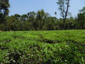
The hinterland of the Sylhet valley is the largest oil and gas-producing region in Bangladesh. It is also the largest hub of tea production in Bangladesh. It is notable for its high-quality cane and agarwood.[4][10] The city is served by the Osmani International Airport which is named after General M A G Osmani, the Commander of the Bangladesh Liberation Forces. People from Sylhet form a significant portion of the Bangladeshi diaspora, particularly in the United Kingdom and the United States, as well as other countries in the Middle East.
أصل الاسم
The name Sylhet is anglicized from Srihatta. In Indo-Aryan languages, Sri means prestige or beauty. Hatta (Haat) is a term for a marketplace. The name of the region was changed to Jalalabad during the Sultanate period, but the actual town of Srihatta kept its name. In the Mughal Empire's records, Srihatta was used as the name for the city in the Bengal Subah.[11] In British India, Srihatta became known as Sylhet in English.
التاريخ
In 1995, the Government of Bangladesh declared Sylhet as the sixth divisional headquarters of the country.[12] Sylhet has played a vital role in the Bangladeshi economy. Several of Bangladesh's finance ministers have been Members of Parliament from the city of Sylhet. Badar Uddin Ahmed Kamran was a longtime mayor of Sylhet. Humayun Rashid Choudhury, a diplomat from Sylhet, served as President of the UN General Assembly and Speaker of the Bangladesh National Parliament.
In 2001, the municipality was upgraded to the Sylhet City Corporation. It was made a metropolitan city in 2009.[9]
الجغرافيا والطقس
Sylhet is located at 24°53′30″N 91°53′00″E / 24.8917°N 91.8833°E, in the north eastern region of Bangladesh within the Sylhet Division, within the Sylhet District and Sylhet Sadar Upazila. Sylhet has a typical Bangladesh tropical monsoon climate (Köppen Am) bordering on a humid subtropical climate (Cwa) at higher elevations. The rainy season from April to October is hot and humid with very heavy showers and thunderstorms almost every day, whilst the short dry season from November to February is very warm and fairly clear. Nearly 80% of the annual average rainfall of 4,200 millimetres (170 in) occurs between May and September.[13]
The city is located within the region where there are hills and basins which constitute one of the most distinctive regions in Bangladesh. The physiography of Sylhet consists mainly of hill soils, encompassing a few large depressions known locally as "beels" which can be mainly classified as oxbow lakes, caused by tectonic subsidence primarily during the earthquake of 1762.
Geologically, the region is complex having diverse sacrificial geomorphology; high topography of Plio-Miocene age. Available limestone deposits in different parts of the region suggest that the whole area was under the ocean in the Oligo-Miocene. In the last 150 years three major earthquakes hit the city, at a magnitude of at least 7.5 on the Richter Scale, the last one took place in 1918, although many people are unaware that Sylhet lies on an earthquake prone zone.[14]
| أخفClimate data for سلهط، بنگلادش | |||||||||||||
|---|---|---|---|---|---|---|---|---|---|---|---|---|---|
| Month | Jan | Feb | Mar | Apr | May | Jun | Jul | Aug | Sep | Oct | Nov | Dec | Year |
| Mean daily maximum °C (°F) | 25.2 (77.4) |
27.1 (80.8) |
30.4 (86.7) |
30.8 (87.4) |
30.8 (87.4) |
30.9 (87.6) |
30.9 (87.6) |
31.6 (88.9) |
31.2 (88.2) |
30.9 (87.6) |
29.2 (84.6) |
26.3 (79.3) |
29.6 (85.3) |
| Mean daily minimum °C (°F) | 12.9 (55.2) |
14.2 (57.6) |
18.1 (64.6) |
20.8 (69.4) |
22.6 (72.7) |
24.4 (75.9) |
24.9 (76.8) |
25.0 (77.0) |
24.3 (75.7) |
22.5 (72.5) |
18.4 (65.1) |
14.0 (57.2) |
20.2 (68.3) |
| Average rainfall mm (inches) | 8 (0.3) |
31 (1.2) |
146 (5.7) |
372 (14.6) |
569 (22.4) |
796 (31.3) |
834 (32.8) |
621 (24.4) |
548 (21.6) |
232 (9.1) |
30 (1.2) |
13 (0.5) |
4٬200 (165.1) |
| Source: WMO[15] | |||||||||||||
الادارة
Sylhet is divided into 6 metropolitan thanas(police station) and consists of 27 wards and 224 mahallas. The thanas are:
- Bimanbandar Thana
- Kotwali Thana Google Maps
- Jalalabad Thana Google Maps
- Dakshin Surma Thana Google Maps
- Mogla Bazar Thana Google Maps
- Shah Paran Thana
الديمغرافيا
According to the 2011 Bangladesh census, the city had a population of 531,663.[1] The population growth rate of the city is 1.73%, which has reduced from 1.93% in 1991.[16]
الشتات
الاقتصاد
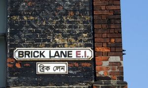
The Sylhet Metropolitan Area is one of Bangladesh's main business centers. Sylhet's economy is closely linked with the Bangladeshi diaspora, especially the British Bangladeshi community. The city receives a significant portion of the country's annual remittances, which have driven growth in real estate and construction.[17]
الثقافة
Transport
Rail
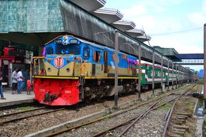
The Sylhet Railway Station is the main railway station providing trains on national routes operated by the state-run Bangladesh Railway. Some important train that origins/terminates :
Towards Dhaka
| Train No. | Train Name | Train Type | Departures |
|---|---|---|---|
| 710 | Parabat Express | Intercity | Daily (except Tue) |
| 718 | Jayantika Express | Intercity | Daily |
| 740 | Upaban Express | Intercity | Daily |
| 774 | Kalni Express | Intercity | Daily (except Fri) |
| 10 | Surma Mail | Daily |
باتجاه Chittagong
| Train No. | Train Name | Train Type | Departures |
|---|---|---|---|
| 724 | Udayan Express | Intercity | Daily (except Fri) |
| 720 | Paharika Express | Intercity | Daily (except Fri) |
| 14 | Jalalabad Express | Daily |
باتجاه أكاهورا
| Train No. | Train Name | Train Type | Departures |
|---|---|---|---|
| 18 | Kushiara Express | Daily |
التعليم
أشخاص بارزون
البلدات التوأم والمدن الشقيقة
سلهط متوأمة مع:
|
انظر أيضاً
المراجع
- ^ أ ب ت "National Volume-3: Urban Area Report" (PDF). Population and Housing Census 2011. Bangladesh Bureau of Statistics. August 2014. pp. 25, 48. Archived from the original (PDF) on 2015-05-18.
- ^ "Bangladesh clamps down on beggars". BBC News. 2 April 2009. Retrieved 2 April 2009.
- ^ "Sylhet Metropolitan Police". sylhetmetropolitanpolice.com.
- ^ أ ب https://www.britannica.com/place/Sylhet
- ^ أ ب Tanweer Fazal (2013). Minority Nationalisms in South Asia. Routledge. p. 53. ISBN 978-1-317-96647-0.
- ^ Milton S. Sangma (1994). Essays on North-east India: Presented in Memory of Professor V. Venkata Rao. Indus Publishing. p. 75. ISBN 978-81-7387-015-6.
- ^ Nath, Pratyay (28 Jun 2019). Climate of Conquest: War, Environment, and Empire in Mughal North India. Oxford University Press.
- ^ "Welcome sylhetcitycorporationbd.org - Justhost.com". www.sylhetcitycorporationbd.org. Archived from the original on 13 October 2018. Retrieved 26 November 2014.
- ^ أ ب "Welcome sylhetcitycorporationbd.org - Justhost.com". www.sylhetcitycorporationbd.org. Archived from the original on 4 July 2018. Retrieved 10 September 2016.
- ^ Siddiquee, Iqbal (19 October 2011). "Agar farming sees export markets". The Daily Star.
- ^ "Sarkar - Banglapedia". en.banglapedia.org.
- ^ "Basics of Islam". Londoni.
- ^ Monthly Averages for Sylhet, BGD Archived 1 يوليو 2019 at the Wayback Machine MSN Weather. Retrieved 25 May 2009.
- ^ Siddiquee, Iqbal (10 February 2006). "Sylhet growing as a modern urban centre". Our Cities: 15th Anniversary Special. The Daily Star. Retrieved 25 May 2009.
- ^ "Climatological Information". WMO. Retrieved 20 January 2015.
- ^ Bangladesh Bureau of Statistics, Statistical Pocket Book, 2007 (pdf-file) Archived 28 سبتمبر 2007 at the Wayback Machine 2007 Population Estimate. Retrieved 29 September 2008.
- ^ "Returning home to build mansion". BBC News. 22 December 2011 – via www.bbc.com.
- ^ أ ب ت ث "Sister cities of Sylhet". Sistercities.info. 4 July 2019.
- ^ St Albans City and District Council, Mayoralty Section. "Sylhet, Bangladesh". www.stalbans.gov.uk.
- ^ "Rochdale Township Committee" (PDF). Rochdale Borough Council. 4 July 2019.
وصلات خارجية
 Media related to سلهط at Wikimedia Commons
Parabat Express
![]() سلهط travel guide from Wikivoyage
سلهط travel guide from Wikivoyage
قالب:Largest cities of Bangladesh
قالب:Sylhet District خطأ لوا في وحدة:Authority_control على السطر 278: attempt to call field '_showMessage' (a nil value).
