زاركول
| Zorkul | |
|---|---|
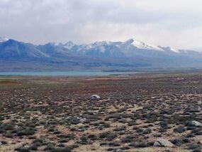
 الطرف الغربي لبحيرة زاركول، حيث يبدأ نهر پامير مساره. | |
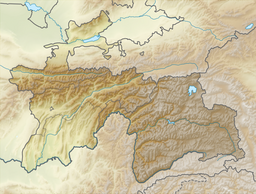
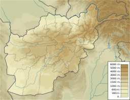
| الموقع | جبال پامير، هندوكوش |
| الاحداثيات | 37°27′N 73°42′E / 37.450°N 73.700°E |
| التصريفات الرئيسية | Pamir River |
| بلدان الحوض | أفغانستان وطاجيكستان |
| مساحة السطح | 38.9 كم² |
| ارتفاع السطح | 4,130 m (13,550 ft) |

| |
| الاسم الرسمي | Zorkul Lake |
| التوصيف | 18 July 2001 |
| الرقم المرجعي | 1086[1] |
زاركول (Zorkul ؛ Dari: زارکول؛ Pashto: زارکول؛ بالطاجيكية: Зоркӯл) هي بحيرة في جبال پامير التي تجري بطول الحدود بين مديرية واخان في ولاية بدخشان في أفغانستان وولاية بدخشان الجبلية الذاتية في طاجيكستان. وهي جزء من كلٍ من منتزه واخان الوطني في أفغانستان و المنتزه الوطني الطاجيكي.
الجغرافيا
Lake Zorkul extends east to west for about 25 km (16 mi). The حدود أفغانستان-طاجيكستان runs along the lake from east to west, turning south towards Concord Peak (5,469 m (17,943 ft)), about 15 km (9.3 mi) south of the lake. The lake's northern part lies in Gorno-Badakhshan where it is protected as part of the Zorkul Nature Reserve. Out of the lake, towards the west, flows the Pamir River, tracing the Afghan–Tajik border. وهي لذلك منبع لنهر جيحون. ويمتد پامير الكبير إلى جنوب البحيرة.[3][4]
التاريخ
تقع البحيرة على طريق الحرير. It was referred to as "Great Dragon Pool" (Chinese: 大龍池) في السجلات التاريخية الصينية.[5]
The territory was conquered by Ahmad Shah Durrani in 1750 and became part of the Durrani Empire. The lake and river were established in 1895 as the new frontier between the Russian Empire and the Emirate of Afghanistan. A general treaty of friendship was signed between the two powers, agreeing that the lake area would be a nature reserve, and that neither empires will post national or international military forces within a certain distance of the frontier, nor establish settled communities in the area.[6]
Although there is a probable reference to the lake in Marco Polo's account,[7] the first European known to have visited the lake was the British naval officer John Wood in 1838.[8] Sir-i-kol became known to the British as Lake Victoria, after the British queen, although Wood declined to name it so.[9] It was also known as "Lake Victoria in the Pamirs" to distinguish it from the much larger Lake Victoria in Africa.[10][11]
انظر أيضاً
المراجع
- ^ "Zorkul Lake". مصلحة معلومات مواقع رامسار. Retrieved 25 April 2018.
- ^ "Lake Victoria, Great Pamir, May 2nd, 1874"
- ^ Diment, Alex; Hotham, Paul; Mallon, David (January 2012). "First biodiversity survey of Zorkul reserve, Pamir Mountains, Tajikistan". Oryx (in الإنجليزية). 46 (1): 13. doi:10.1017/S0030605311002146. ISSN 1365-3008.
- ^ Annieandpaddy (2016-08-10). "Pamirs 2: Murghab to Khargush via Zorkul Lake". COMPLETE TANDEMONIUM (in الإنجليزية). Retrieved 2020-07-24.
- ^ 孙燕 (2013-09-05). ""世界屋顶"的中国痕迹 –". 中国民族宗教网 (mzb.com.cn) (in الصينية). Retrieved 2017-02-02.
这个"大龙池",学界已经基本形成共识,就是塔吉克斯坦境内的佐库里湖(Zorkul)
- ^ Shahrani, M. Nazif. (1979) The Kirghiz and Wakhi of Afghanistan: Adaptation to Closed Frontiers and War University of Washington Press, Seattle, ISBN 0-295-95669-0; 1st paperback edition with new preface and epilogue (2002), ISBN 0-295-98262-4 p.37
- ^ The Travels of Marco Polo, Book 1, Chapter 32: "Of the Great River of Badahshan; and the Plain of Pamier" (...you find a great lake between two mountains, and out of it a fine river running through a plain). Retrieved on 6 May 2009
- ^ Keay, J. (1983) When Men and Mountains Meet ISBN 0-7126-0196-1 Chapter 9
- ^ H.C. Rawlinson, "Monograph of the Oxus", Journal of the Royal Geographical Society of London, Vol. 42 (1872), pp. 482–513. Retrieved from JSTOR on 6 May 2009
- ^ "Zorkul State Reserve". UNESCO World Heritage Centre (in الإنجليزية). Retrieved 2020-07-24.
- ^ "BirdLife Data Zone". datazone.birdlife.org. Retrieved 2020-07-24.
- Pages using gadget WikiMiniAtlas
- CS1 الصينية-language sources (zh)
- Short description matches Wikidata
- Coordinates on Wikidata
- Wikipedia infobox body of water articles needing maintenance
- Articles containing Dari-language text
- Pages using Lang-xx templates
- Articles containing Pashto-language text
- Articles containing طاجيكية-language text
- Articles with hatnote templates targeting a nonexistent page
- Articles containing traditional Chinese-language text
- بحيرات أفغانستان
- بحيرات تركمانستان
- حدود أفغانستان-طاجيكستان
- بحيرات دولية في آسيا
- تضاريس ولاية بدخشان
- واخان
- ولاية بدخشان الجبلية الذاتية
- مواقع رامسار في طاجيكستان
- صفحات مع الخرائط


