خليج همبولت
| خليج همبولت Humboldt Bay | |
|---|---|
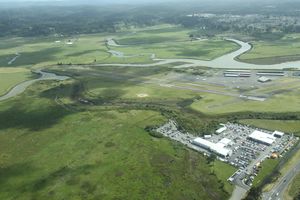
 منظر جوي لخليج همبولت ومدينة يوريكا | |
| الموقع | مقاطعة همبولت، الساحل الشمالي، كاليفورنيا |
| الإحداثيات | 40°45′13.53″N 124°12′54.73″W / 40.7537583°N 124.2152028°W |
| منابع النهر | Elk River; Jacoby, Freshwater, and Salmon Creeks. |
| منابع المحيط/البحر | المحيط الهادي |
| بلدان الحوض | الولايات المتحدة |
| أقصى طول | 14 ميل (23 km) |
| أقصى عرض | 4.5 ميل (7 km) |
| مساحة السطح | 13 ميل مربع (34 km2)/25.5 ميل مربع (66 km2) (min/max tide) (17,000 acres) |
| متوسط العمق | 11 أقدام (3.4 m) |
| أقصى عمق | 40 أقدام (12 m) (بالتكريك) |
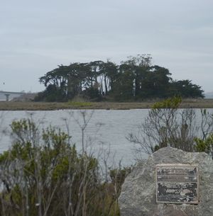
| الجزر | الجزيرة الهندية، جزيرة وودلي، جزيرة دابي |
| التجمعات السكنية | يوريكا، أركاتا |
| المراجع | [1] |
| الاسم الرسمي | Humboldt Harbor Historical District[2] |
| الرقم المرجعي | 882 |
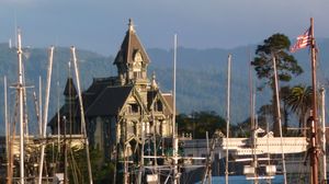
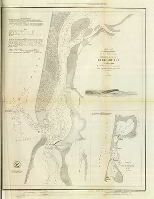
خليج همبولت Humboldt Bay هو خليج طبيعي[3] ولاگون ساحلي متعدد الأحواض تفصلها ألسنة رملية[4] ويقع في الساحل الشمالي الوعر لكاليفورنيا، يقع بالكامل ضمن مقاطعة همبولت، بالولايات المتحدة. وهو أكبر مسطح مائي محمي على الساحل الغربي بين خليج سان فرانسسكو و پيوجت، اللسان البحري، ثاني أكبر أكبر خليج محاط به في كاليفورنيا،[5] and the largest port between San Francisco and Coos Bay, Oregon.[4] The largest city adjoining the bay is Eureka, the regional center and county seat of Humboldt County, followed by the town of Arcata. These primary cities, together with adjoining unincorporated communities and several small towns, comprise a Humboldt Bay Area total population of nearly 80,000 people. This comprises nearly 60% of the population of Humboldt County.[6] The bay is home to more than 100 plant species, 300 invertebrate species, 100 fish species, and 200 bird species.[7] In addition, the bay and its complex system of marshes and grasses support hundreds of thousands of migrating and local shore birds.[8] Commercially, this second-largest estuary in California is the site of the largest oyster production operations on the West Coast, producing more than half of all oysters farmed in California.[9]
ميناء خليج همبولت (ويشار إليه أيضاً بإسم "ميناء يوريكا") هو deep water port with harbor facilities, including large industrial docks at Fairhaven, Samoa, and Fields Landing, designed to serve cargo and other vessels. Several marinas also located in Greater Eureka have the capacity to serve hundreds of small to mid-size boats and pleasure craft.[10] Since the 1850s, the bay was used extensively to export logs and forest products as part of the historic West coast lumber trade. There is now infrequent shipping of this product.[10]
الجغرافيا
التجمعات السكنية المطلة على الخليج


About 80,000 people reside on the shore of the bay in at least 20 named settlements on the coastal plain around the bay estuary. Most of these are unincorporated suburbs of the City of Eureka.
Settlements located on or near the bay, listed clockwise from the north side of the bay entrance:
- Fairhaven
- Samoa
- Manila
- Arcata
- Sunny Brae
- Bayside (includes Hidden Valley, which is surrounded by Indianola)
- Eureka
- Fields Landing
- Hookton
- Loleta
- Table Bluff
روافد ومستنقعات الخليج

Streams and sloughs that enter into Humboldt Bay are listed north to south, clockwise, with tributaries entering nearest the bay listed first. The primary streams of major watershed areas east of the bay (draining a combined area of 288 ميل مربع (746 km2))[11] are in bold.[12][13]
- Mad River Slough
- Liscom Slough
- Janes Creek (enters the bay as McDaniels Slough)
- Jolly Giant Creek (enters the bay as Butcher Slough)
- Campbell Creek (partially channeled to Gannon Slough)
- Fickle Hill Creek
- Gannon Slough
- Grotzman Creek
- Beith Creek
- Little Jacoby Creek
- Jacoby Creek
- Washington Gulch Creek
- Rocky Gulch Creek
- Eureka Slough
- Fay Slough
- Cochran Creek
- Freshwater Creek
- Little Freshwater Creek
- Ryan Slough
- Ryan Creek
- First Slough
- Second Slough
- Third Slough
- Fay Slough
- Clarke Slough
- Elk River
- Swain Slough
- Martin Slough
- Swain Slough
- Willow Brook/White Slough
- Salmon Creek
- Deering Creek
- Little Salmon Creek
- Hookton Slough
انظر أيضاً
- California State Route 255 – only bay crossing and sole access to the Woodley Island Marina.
- Humboldt Harbor Light
- Table Bluff Light
الهامش
- ^ Shellfish Growing Area Classification for Humboldt Bay Technical Report # 06-11 (PDF). California Department of Health Services. March 2006. p. 87. Archived from the original (PDF) on 14 September 2012. Retrieved 13 December 2013.
- ^ قالب:Cite ohp
- ^ "Humboldt Bay Management Plan Executive Summary" (PDF). Humboldt Bay Harbor Recreation and Conservation District. May 2007. Archived from the original (PDF) on 24 February 2012. Retrieved 13 December 2012.
- ^ أ ب Costa, Steven L.; Karen A. Glatzel (September 2002). "Coastal Inlets Research Program: Humboldt Bay, California Entrance Channel, Report 1: Data Review" (PDF). U.S. Army Corps of Engineers. Retrieved 13 December 2012.
- ^ Schlosser, Susan; Annie Eicher (2012). Humboldt Bay and Eel River Estuary Benthic Habitat Project (PDF). University of California San Diego: California Sea Grant College Program Publication No. T -075. p. 246. Archived from the original (PDF) on 2 April 2015. Retrieved 13 December 2009.
- ^ "Draft Transit Dev Plan Humboldt County Systems". PMC/HDR. December 2011. Retrieved 23 August 2013.
- ^ "Humboldt Bay Sea Level Rise Adaptation Plan" (PDF). California Coastal Commission. 2012. Retrieved August 23, 2013.
- ^ "WHSRN Humboldt Bay Complex". Western Hemisphere Shorebird Reserve Network . 2009. Retrieved August 23, 2013.
{{cite web}}: CS1 maint: extra punctuation (link) - ^ Pomeroy, Caroline; Cynthia J. Thomson; Melissa M. Stevens (August 2010). California's North Coast Fishing Communities Historical Perspective and Recent Trends: Eureka Fishing Community Profile (PDF). National Oceans and Atmospheres Administration California Sea Grant Program. p. 79. Retrieved 9 December 2012.
- ^ أ ب Hills, Cody (6 December 2012). "Backyard of Boats". North Coast Journal, Eureka, California. Retrieved 6 January 2013.
- ^ "Humboldt Bay: Physical Geography". Nature and Science. Friends of the Dunes. Archived from the original on 30 November 2012. Retrieved 14 December 2012.
- ^ "KRIS Humboldt Bay". Klamath Resource Information System. Retrieved 14 December 2012.
- ^ "Wetlands, Streams, Riparian Areas, and Watershed Areas" (PDF). Humboldt Bay Harbor Draft Management Plan. Humboldt Bay Harbor District. April 2006. Retrieved 14 December 2012.[dead link]
وصلات خارجية
- Pages using gadget WikiMiniAtlas
- Articles with dead external links from April 2017
- Short description is different from Wikidata
- Coordinates on Wikidata
- Bays of California
- Lagoons of California
- Eureka, California
- Ports and harbors of California
- Bodies of water of Humboldt County, California
- Lagoons of Humboldt County, California
