جريمسڤوتن
| جريمسڤوتن Grímsvötn | |
|---|---|
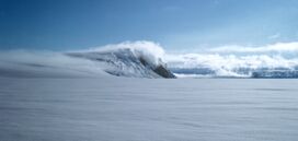
 Grímsvötn and the Vatnajökull glacier, Iceland, July 1972 | |
| أعلى نقطة | |
| الارتفاع | 1,725 m (5,659 ft) [1] |
| الإدراج | قائمة براكين أيسلندا |
| الجغرافيا | |
| الجيولوجيا | |
| نوع الجبل | volcanic caldera |
| آخر ثوران | 22 مايو 2011 |
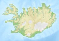
بحيرات جريمسڤوتن الجليدية الفرعية Grímsvötn، (النطق الآيسلندي: ['krimsvœʰtn̥];[2] vötn = "waters", singular: [vatn] Error: {{Lang}}: text has italic markup (help)) وبركان يحمل نفس الاسم في جنوب شرق أيسلندا. وتوجد في مرتفعات أيسلندا في الجانب الشمالي الغربي من غطاء إيافيالايوكل الجليدي. تقع البحيرات على 64°25′N 17°20′W / 64.417°N 17.333°W، وترتفع 1725 متر.
. . . . . . . . . . . . . . . . . . . . . . . . . . . . . . . . . . . . . . . . . . . . . . . . . . . . . . . . . . . . . . . . . . . . . . . . . . . . . . . . . . . . . . . . . . . . . . . . . . . . . . . . . . . . . . . . . . . . . . . . . . . . . . . . . . . . . . . . . . . . . . . . . . . . . . . . . . . . . . . . . . . . . . . .
Jökulhlaup
ثوران 1998 و2004
الفيضان الجليدي 2010
ثوران 2011
On 21 May 2011 at 19:25 UTC, an eruption began, with 12 km (7 mi) high plumes accompanied by multiple earthquakes.[3][4][5] The ash cloud from the eruption rose to 20 km (12 mi), and is so far 10 times larger than the 2004 eruption, and the strongest in Grímsvötn for 100 years.[6]
During 22 May the ash plume fell to around 10 km altitude, rising occasionally to 15 km.[7]
On 23 May, the eruption was releasing about 2000 tons of ash per second, totalling 120 million tons in the first 48 hours.[8] The 2011 eruption of Grímsvötn thus qualified as 4 (VEI4) on the Volcanic Explosivity Index (VEI), releasing more ash in the first 48 hours than Eyjafjallajökull released during its entire 2010 eruption.[9]
On 24 May poor weather prevented visual observation of the eruption plume, but it had an estimated height of below 5 km, implying that the eruption is significantly weaker than on previous days.[10]
تعطل حركة الطيران
اكتشاف البكتريا في البحيرات الجليدية الفرعية
انظر أيضا
- النشاط البركاني في أيسلندا
- قائمة براكين أيسلندا
- جغرافيا أيسلندا
- الأنهار الجليدية في أيسلندا
- Glacial lake outburst flood
- Iceland plume
- Iceland hotspot
- بحيرات أيسلندا
- قائةم جزر أيسلندا
- خط زمني لثورات براكين العالم
- صفائح تكتونية
المصادر
- ^ "Grímsvötn". Global Volcanism Program. Smithsonian Institution. Retrieved 2006-08-15.
{{cite web}}: Cite has empty unknown parameter:|accessyear=(help) - ^ "How to pronounce /grímsvötn/". youtube.com. Retrieved 2011-05-23.
- ^ خطأ استشهاد: وسم
<ref>غير صحيح؛ لا نص تم توفيره للمراجع المسماةHelgason - ^ خطأ استشهاد: وسم
<ref>غير صحيح؛ لا نص تم توفيره للمراجع المسماةaljazeera - ^ خطأ استشهاد: وسم
<ref>غير صحيح؛ لا نص تم توفيره للمراجع المسماةicenews - ^ "Largest Volcanic Eruption in Grímsvötn in 100 Years". Daily News. Iceland Review Online. 2011-05-22. Retrieved 2011-05-22.
- ^ "Ash plume and lightning". Icelandic Met Office. 2011-05-22. Retrieved 2011-05-23.
- ^ http://www.ruv.is/frett/ekkert-akvedid-um-folksflutninga
- ^ http://www.jonfr.com/volcano/?p=969#comments
- ^ "Update on volcanic activity in Grímsvötn". Icelandic Met Office. 2011-05-24. Retrieved 2011-05-24.
وصلات خارجية
- Update on Grímsvötn Activity - from the Icelandic Met Office and University of Iceland (updated at least daily)
- Current seismology around Grímsvötn – Earthquakes in last 48 hours
- Webcam by Míla, Iceland (exact location unknown)
- Webcam at Jökulsárlón, south of the volcano, by Míla, Iceland
- Grímsvötn statement from Eurocontrol European Air Traffic Control (updated frequently)
- Grímsvötn volcanic ash advisory from regional Volcanic Ash Advisory Centre, London (updated every 6 hours)
- Grímsvötn updates from NATS - UK air traffic control plus the Eastern part of the North Atlantic
- Live air traffic and ash cloud position
- BBC news report of the 23 May 2011 eruption
- Report on the start of the Grímsvötn eruption from the Icelandic Met Office
- "Grímsvötn". Global Volcanism Program. Smithsonian Institution.
{{cite web}}: Cite has empty unknown parameter:|accessyear=(help) - Formation and emptying of glacier lakes
- Photo report of the November 2004 eruption
- Independent news report of the 2004 eruption
- Grimsvötn eruption – frequently asked questions
- Pages using infobox mountain with unknown parameters
- Pages using infobox mountain with deprecated parameters
- Lang and lang-xx template errors
- Pages using gadget WikiMiniAtlas
- بحيرات أيسلندا
- براكين نشطة
- أراضي مرتفعة في أيسلندا
- Subglacial volcanoes
- براكين أيسلندا
- VEI-6 volcanoes
- Subglacial lakes
- منطقة براكين شرق أيسلندا
