تناگرا
Tanagra
Τανάγρα | |
|---|---|
 | |
| الإحداثيات: 38°19′N 23°32′E / 38.317°N 23.533°E | |
| البلد | |
| المنطقة الادارية | وسط اليونان |
| الوحدة المحلية | بيوتيا |
| المساحة | |
| • البلدية | 461٫02 كم² (178�00 ميل²) |
| • الوحدة البلدية | 122٫53 كم² (47٫31 ميل²) |
| المنسوب | 214 m (702 ft) |
| التعداد (2011)[1] | |
| • البلدية | 19٬432 |
| • كثافة البلدية | 42/km2 (110/sq mi) |
| • الوحدة البلدية | 3٬827 |
| • كثافة الوحدة البلدية | 31/km2 (81/sq mi) |
| Community | |
| • التعداد | 1٬117 (2011) |
| • المساحة (كم²) | 27.814 |
| منطقة التوقيت | UTC+2 (EET) |
| • الصيف (التوقيت الصيفي) | UTC+3 (EEST) |
| Postal code | 322 00, 320 09 |
| مفتاح الهاتف | 22620 |
| Vehicle registration | ΒΙ |
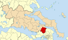
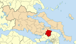
Tanagra (باليونانية: Τανάγρα) is a town and a municipality north of Athens in Boeotia, Greece. The seat of the municipality is the town Schimatari.[2] It is not far from Thebes, and it was noted in antiquity for the figurines named after it. The Tanagra figurines were a mass-produced, mold-cast and fired type of Greek terracotta figurines produced from the later fourth century BC, primarily in Tanagra.
. . . . . . . . . . . . . . . . . . . . . . . . . . . . . . . . . . . . . . . . . . . . . . . . . . . . . . . . . . . . . . . . . . . . . . . . . . . . . . . . . . . . . . . . . . . . . . . . . . . . . . . . . . . . . . . . . . . . . . . . . . . . . . . . . . . . . . . . . . . . . . . . . . . . . . . . . . . . . . . . . . . . . . . .
الحكم
The municipality Tanagra was formed at the 2011 local government reform by the merger of the following 4 former municipalities, that became municipal units:[2]
- Dervenochoria
- Oinofyta
- Schimatari
- Tanagra
التاريخ
القديم
Anciently, Tanagra (باليونانية قديمة: Τάναγρα), sometimes written Tanagraea, was a town of ancient Boeotia, situated upon the left bank of the Asopus, in a fertile plain, at the distance of 130 stadia from Oropus and 200 from Plataeae.[3] Several ancient writers identified Tanagra with the Homeric Graea;[4] but others supposed them to be distinct places, and Aristotle regarded Oropus as the ancient Graea.[5][6][7] Pausanias mentions in Tanagra's location the ancient city of Graea, eponymous of the Graikoi, a Boeotian tribe whose name gave rise to the Latin Graecus "Greek". Homer, while reciting the Boeotian forces in the Iliad's Catalogue of Ships, provides the first known reference to the Boeotian city of Graea.[8]
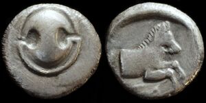
Tanagra was also called Poemandria or Poimandria (Ποιμανδρία), and its territory Poemandris, from the fertile meadows which surrounded the city, or after its founder Poimandros, who took part in the Trojan campaign.[5][6] The most ancient inhabitants of Tanagra are said to have been the Gephyraei, who came from Phoenicia with Cadmus, and from thence emigrated to Athens.[9][6] From its vicinity to Attica the territory of Tanagra was the scene of more than one battle. In 457 BC the Lacedaemonians on their return from an expedition to Doris, took up a position at Tanagra, near the borders of Attica, with the view of assisting the oligarchical party at Athens to overthrow the democracy. The Athenians, with a thousand Argeians and some Thessalian horse, crossed Mount Parnes and advanced, against the Lacedaemonians. In the First Battle of Tanagra, both sides fought with great bravery; but the Lacedaemonians gained the victory, chiefly through the treacherous desertion of the Thessalians in the very heat of the engagement.[10][11] At the beginning of the following year(456 BC), and only sixty-two days after their defeat at Tanagra, the Athenians under Myronides again invaded Boeotia, and gained at Oenophyta, in the territory of Tanagra, a brilliant and decisive victory over the Boeotian League, which made them masters of the whole country (see Battle of Oenophyta). The walls of Tanagra were now razed to the ground.[12][13] The Second Battle of Tanagra was fought in 426 BC. the Athenians made an incursion into the territory of Tanagra, and on their return defeated the Tanagraeans and Boeotians.[14]
Dicaearchus, who visited Tanagra in the time of Cassander, says that the city stood on a rugged and lofty height, and had a white chalky appearance. The houses are adorned with handsome porticoes and encaustic paintings. The surrounding country does not grow much corn, but produces the best wine in Boeotia. Dicaearchus adds that the inhabitants are wealthy but frugal, being for the most part landholders, not manufacturers; and he praises them for their justice, good faith, and hospitality.[15] In the time of Augustus, Tanagra and Thespiae were the two most prosperous cities in Boeotia.[16] Tanagra is called by Pliny the Elder a free state;[17] it is mentioned by Ptolemy;[18] and it continued to flourish in the sixth century.[19]
Its public buildings are described at some length by Pausanias.[20] The principal temple was that of Dionysus, which contained a celebrated statue of Parian marble, by Calamis, and a remarkable Triton. Near it were temples of Themis, Aphrodite and Apollo, and two of Hermes, in one of which he was worshipped as Criophorus, and in the other as Promachus. Near the latter was the theatre, and probably at no great distance the gymnasium, which contained a picture of Corinna, who was a native of Tanagra. There was also a monument of this poet in a conspicuous part of the city. Pausanias remarks as a peculiarity in Tanagra, that all their sacred buildings were placed by themselves, apart from the houses of the town.[21] He likewise notices that Tanagra was famous for its breed of fighting-cocks,[22] a circumstance which is mentioned by other writers.[23] Tanagra possessed a considerable territory; and Strabo mentions four villages belonging to it, Eleon or Heleon, Harma, Mycalessus, and Pharae.[24][17]
الحديث
In the early 2000s, a military plane which was on a training flight crashed on the runway during bad weather. There were no survivors.
On Sunday 18 September 2005, the Archangelos air show, the largest ever organized in Greece, took place in Tanagra. It attracted a crowd of more than 200,000.
الجغرافيا
The municipality has an area of 461.023 km2, the municipal unit 122.527 km2, the community 27.814 km2.[25] Tanagra is located SE of Thiva and Arma, SW of Schimatari and NW of Agios Thomas. Farmlands surround the rest of Tanagra, and the Asopus River along with the Parnitha mountains to the south.
السكان
| Year | Settlement | Municipal unit | Municipality |
|---|---|---|---|
| 1981 | 1,097 | – | – |
| 1991 | 847 | – | – |
| 2001 | 871 | 4,134 | – |
| 2011 | 1,117 | 3,827 | 19,432 |
Arvanites settled in Tanagra in the Middle Ages, but today they only make up a linguistic minority.
الاقتصاد
Since 1956, the 114th Combat Wing of the Hellenic Air Force has been based in Tanagra Air Base. The base is one of Greece's largest military airports and its runway is about 3 km in length.[بحاجة لمصدر]
In the area it is located also the Hellenic Aerospace Industry.
النقل
Tanagra can be accessed by GR-1 in the north and by a provincial road linking Thiva (Thebes) in the west.
Tanagra is served by two interchanges, a partial southbound exit, a northbound entrance to the northwest and an almost-full to the east, serving access to highways 44 and 77 to the island of Euboea. Its service road lies to the south and is linked with the southeast bypass and to the military base.
انظر أيضاً
. . . . . . . . . . . . . . . . . . . . . . . . . . . . . . . . . . . . . . . . . . . . . . . . . . . . . . . . . . . . . . . . . . . . . . . . . . . . . . . . . . . . . . . . . . . . . . . . . . . . . . . . . . . . . . . . . . . . . . . . . . . . . . . . . . . . . . . . . . . . . . . . . . . . . . . . . . . . . . . . . . . . . . . .
المراجع
- ^ أ ب "Απογραφή Πληθυσμού - Κατοικιών 2011. ΜΟΝΙΜΟΣ Πληθυσμός" (in اليونانية). Hellenic Statistical Authority.
- ^ أ ب "ΦΕΚ A 87/2010, Kallikratis reform law text" (in اليونانية). Government Gazette.
- ^ Dicaearch. Stat. Gr. pp. 12, 14, ed. Hudson
- ^ Lycophr. 644.
- ^ أ ب قالب:Cite Stephanus
- ^ أ ب ت اسطرابون. جيوگرافيكا. Vol. ix. p.404. أرقام الصفحات هي تلك الموجودة في طبعة آيزاك كاسوبون.
- ^ قالب:Cite Pausanias
- ^ Homer, "Iliad", II, 498
- ^ قالب:Cite Herodotus
- ^ توكيديدس. تاريخ الحرب الپلوپونيزية. Vol. 1.107, 108.
- ^ قالب:Cite Diodorus
- ^ توكيديدس. تاريخ الحرب الپلوپونيزية. Vol. 1.108.
- ^ قالب:Cite Diodorus
- ^ توكيديدس. تاريخ الحرب الپلوپونيزية. Vol. 3.91.
- ^ Dicaearchus, De Statu Graec. p. 12.
- ^ اسطرابون. جيوگرافيكا. Vol. ix. p.403. أرقام الصفحات هي تلك الموجودة في طبعة آيزاك كاسوبون.
- ^ أ ب قالب:Cite Pliny
- ^ قالب:Cite Ptolemy
- ^ قالب:Cite Hierocles
- ^ قالب:Cite Pausanias, et seq.
- ^ قالب:Cite Pausanias
- ^ قالب:Cite Pausanias
- ^ Varr. de Re Rust. 3.9.6; Hesych. sub voce Κολοίφρυξ; Suda, s. v. Ταναγραῖοι ἀλεκτορίσκοι.
- ^ اسطرابون. جيوگرافيكا. Vol. ix. p.405. أرقام الصفحات هي تلك الموجودة في طبعة آيزاك كاسوبون.
- ^ "Population & housing census 2001 (incl. area and average elevation)" (PDF) (in اليونانية). National Statistical Service of Greece.
![]() This article incorporates text from a publication now in the public domain: Smith, William, ed. (1854–1857). "Tanagra". Dictionary of Greek and Roman Geography. London: John Murray.
This article incorporates text from a publication now in the public domain: Smith, William, ed. (1854–1857). "Tanagra". Dictionary of Greek and Roman Geography. London: John Murray.
وصلات خارجية
 Media related to Tanagra at Wikimedia Commons
- Pages using gadget WikiMiniAtlas
- CS1 اليونانية-language sources (el)
- Articles with hatnote templates targeting a nonexistent page
- Short description is different from Wikidata
- Coordinates on Wikidata
- Articles containing Greek-language text
- Articles containing Ancient Greek (to 1453)-language text
- Articles with unsourced statements from March 2013
- Wikipedia articles incorporating a citation from the DGRG without Wikisource reference
- Wikipedia articles incorporating text from the DGRG
- بلديات وسط اليونان
- أماكن مأهولة في بيوتيا
- Boeotian city-states
- أماكن مأهولة في بيوتيا القديمة


