تشورنومورسك
تشورنومورسك
Чорноморськ Chornomorsk | |
|---|---|
مدينة | |
 Myru Avenue - one of the main streets of the city | |
| الإحداثيات: 46°18′06.0″N 30°39′25.0″E / 46.301667°N 30.656944°E | |
| البلد | |
| أبلاست | قالب:Country data Odesa Oblast |
| رايون | رايون أوديسا |
| المساحة | |
| • الإجمالي | 25 كم² (10 ميل²) |
| المنسوب | 29 m (95 ft) |
| التعداد (2022)[1] | |
| • الإجمالي | 57٬983 |
| منطقة التوقيت | UTC+2 (EET) |
| • الصيف (التوقيت الصيفي) | UTC+3 (EEST) |
| Postal code | 68000—68090 |
| مفتاح الهاتف | +380 4868 |
| Climate | Cfb |
| الموقع الإلكتروني | cmr.gov.ua |
تشورنومورسك (أوكرانية: Чорномо́рськ، تـُنطق [t͡ʃornoˈmɔrsʲk]؛ إنگليزية: Chornomorsk)، وكانت تُدعى سابقاً إليتشيڤسك (أوكرانية: Іллічі́вськ؛ Illichivsk ؛ تـُكتب Illichivs'k), هي مدينة في رايون أوديسا، في أبلاست أوديسا في جنوب غرب أوكرانيا، وتعتمد على ميناء تشورنومورسك. وتضم إدارة Chornomorsk urban hromada, one of the hromadas of Ukraine.[2] The city is located around the Sukhyi Estuary. Its population was given as 57,983 (2022 estimate).[1]
Originally, the city was established as a satellite town of أوديسا.
. . . . . . . . . . . . . . . . . . . . . . . . . . . . . . . . . . . . . . . . . . . . . . . . . . . . . . . . . . . . . . . . . . . . . . . . . . . . . . . . . . . . . . . . . . . . . . . . . . . . . . . . . . . . . . . . . . . . . . . . . . . . . . . . . . . . . . . . . . . . . . . . . . . . . . . . . . . . . . . . . . . . . . . .
الجغرافيا
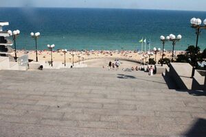
Chornomorsk is situated on the coast of the Black Sea, 12 miles (20 km) جنوباً من أوديسا.
التاريخ
This section requires expansion. (May 2013) |
Before the construction of a port with a city, the region was the site of a number of unorganized farmsteads and hamlets (khutir) that were collectively known as Buhovi khutory (أوكرانية: Бугові Хутори) that were located on agricultural lots of a local landowner Andriy Buhovyi. After establishing of the Soviet regime and "nationalization" and collectivization of the area, in 1927 the settlement was renamed into Illichivskyi Khutir.
In 1952 a port was established, and its surrounding territory was urbanized and converted into a city of Illichivsk. The city was designed to become a new home for the Black Sea Shipping Company (then the largest passenger and commercial vessel operator in the world). Originally a builder's trailer village, Chornomorsk has expanded to become Ukraine's most prosperous town by income per capita. Residents are mostly employed by the port (one of the largest ports of Europe) and the maritime industry. Residents of Odesa have recently begun relocating to lower-cost but higher-income Chornomorsk.
On 15 May 2015 President of Ukraine Petro Poroshenko signed a bill into law which began a six months period for the removal of communist monuments and the mandatory renaming of settlements with names related to Communism.[3] On 12 November 2015, the city council decided to rename the city to Chornomorsk (after the Black Sea coast upon which the city is found). The decision was confirmed by the Verkhovna Rada (the Ukrainian parliament) on 4 February 2016.[4] The city's former name, Illichivsk, was an homage to Vladimir Ilyich Lenin, the founder of the Soviet Union.
Until 18 July 2020, Chornomorsk was incorporated as a city of oblast significance and the center of Illichivsk Municipality. The municipality was abolished in July 2020 as part of the administrative reform of Ukraine, which reduced the number of raions of Odesa Oblast to seven. The area of Illichivsk Municipality was merged into Odesa Raion.[5][6]
السكان
According to the 2001 Ukrainian Census:
| Ethnicity | Proportion |
| Ukrainians | 66.5% |
| Russians | 28.5% |
| Bulgarians | 1% |
| Moldovans, Belarusians, Romanians, and other | 4% |
الاقتصاد
خدمة عبارات القطارات إلى بلغاريا
Chornomorsk was connected by freight train ferry line (426 km) to Varna in Bulgaria in 1978. Four train ferries two Soviet and two Bulgarian ones, named "Hero of Odesa", "Hero of Sevastopol" and "Hero of Schipka", "Hero of Pleven" which could take in three decks a total of 108 two bogie (four axle) Soviet freight cars. In the first ten-year period (1978–1988), these train ferries had transported 1,000,000 freight cars between Illichivsk and Varna. This train ferry service took 17 hours in both directions. The Bulgarians built break of gauge apparatus at Varna which made it possible to change bogies of 24 freight cars in one hour thirty minutes.
الصناعات
Chornomorsk's economy is largely oriented to the sea. The biggest employer is the Port of Chornomorsk. The headquarters and manufacturing facilities of "Antarctica" (Ukraine's largest fishing company) are located in the city, and other major maritime shipping companies have also chosen to open their offices there.
The city also has a freight railway station. The port is on one of the freight routes of China's proposed Eurasian Land Bridge (part of the "New Silk Road"), which would see an eastern link to China via ferry to Georgia, Azerbaijan and across the Caspian Sea, and a western link by train to western Europe.[7]
العلاقات الدولية
البلدات التوأم – المدن الشقيقة
Chornomorsk is twinned with:
 Narva, Estonia
 Beyoğlu, Istanbul, Turkey
 Maardu, Estonia
 Qaradağ raion, Baku, Azerbaijan
 Tczew, Poland
 Poti, Georgia
المراجع
- ^ أ ب Чисельність наявного населення України на 1 січня 2022 [Number of Present Population of Ukraine, as of January 1, 2022] (PDF) (in الأوكرانية and الإنجليزية). Kyiv: State Statistics Service of Ukraine. Archived (PDF) from the original on 4 July 2022.
- ^ "Черноморская громада" (in الروسية). Портал об'єднаних громад України.
- ^ Poroshenko signed the laws about decomunization. Ukrayinska Pravda. 15 May 2015
Poroshenko signs laws on denouncing Communist, Nazi regimes, Interfax-Ukraine. 15 May 20
Goodbye, Lenin: Ukraine moves to ban communist symbols, BBC News (14 April 2015) - ^ "Decommunisation continues: Rada renames several towns and villages". UNIAN. 4 February 2016.
"Rada de-communized Artemivsk as well as over a hundred cities and villages" (in الأوكرانية). Pravda.com.ua. 4 February 2016. Retrieved 4 February 2016. - ^ "Про утворення та ліквідацію районів. Постанова Верховної Ради України № 807-ІХ" [About the formation and liquidation of districts. Resolution of the Verkhovna Rada of Ukraine No. 807-IX]. Голос України (in الأوكرانية). 2020-07-18. Retrieved 2020-10-03.
- ^ "Нові райони: карти + склад" [New areas: maps + warehouse] (in Ukrainian). Міністерство розвитку громад та територій України. July 17, 2020.
{{cite web}}: CS1 maint: unrecognized language (link) - ^ Dyussembekova, Zhazira (21 January 2016). "Silk Road Renewed With Launch of New Commercial Transit Route". The Astana Times.
وصلات خارجية
 Media related to تشورنومورسك at Wikimedia Commons
- CS1 uses الأوكرانية-language script (uk)
- CS1 الأوكرانية-language sources (uk)
- CS1 الروسية-language sources (ru)
- Short description is different from Wikidata
- Articles with hatnote templates targeting a nonexistent page
- Pages using gadget WikiMiniAtlas
- Articles containing أوكرانية-language text
- Pages using Lang-xx templates
- Articles containing إنگليزية-language text
- Articles to be expanded from May 2013
- All articles to be expanded
- Chornomorsk
- Cities in Odesa Oblast
- Populated places established in the Ukrainian Soviet Socialist Republic
- Port cities and towns in Ukraine
- Port cities of the Black Sea
- Former Soviet toponymy in Ukraine
- Cities in Odesa Raion


